|
|

|
|
North DownBarrow / Cairn Cemetery
|
||||||||||||||||||||||||
|
|
|
Images (click to view fullsize) |
|
Photographs: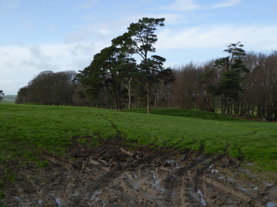
 Maps / Plans / Diagrams:
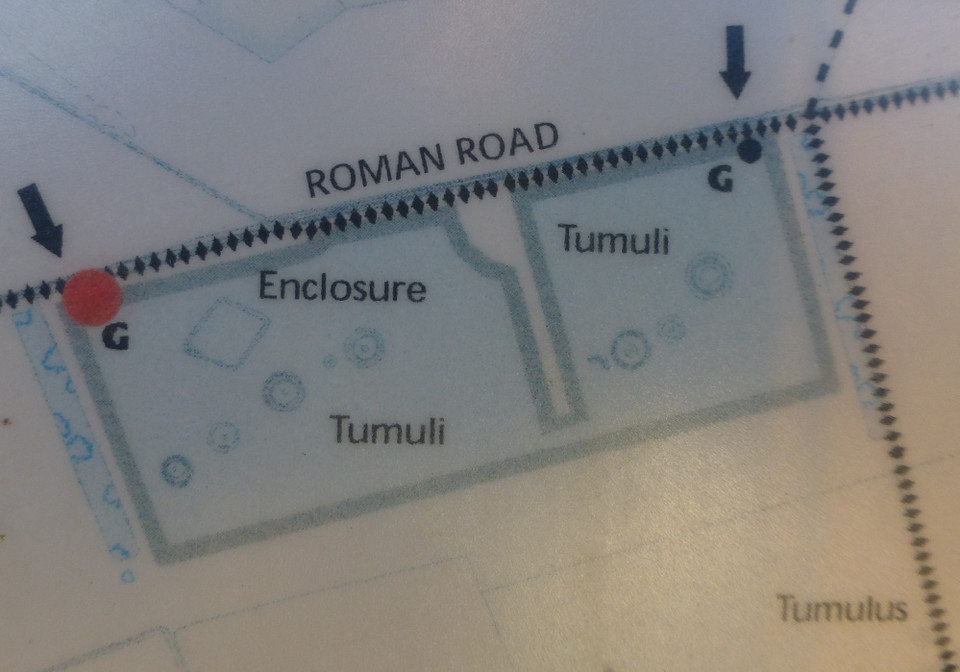
|
Fieldnotes |
|
|
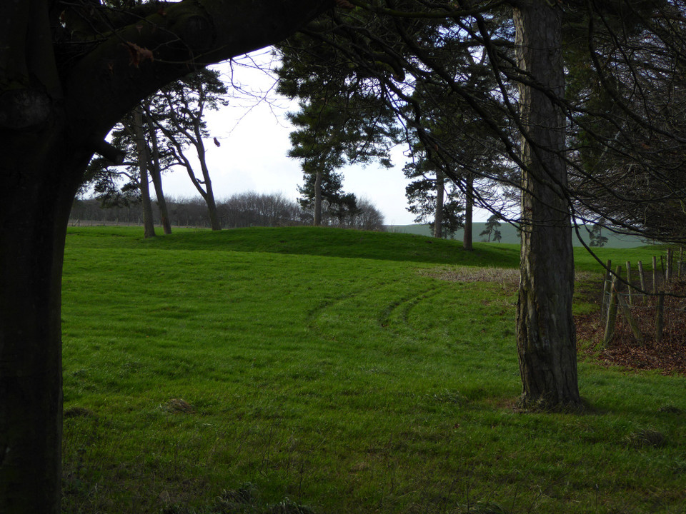
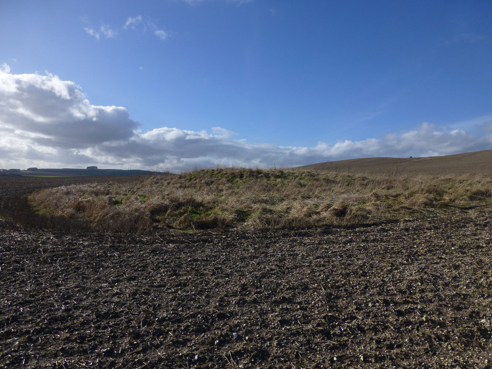
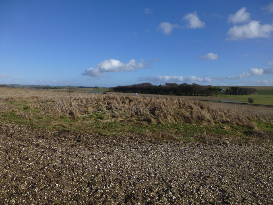
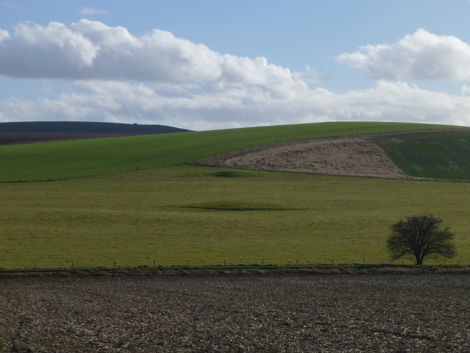
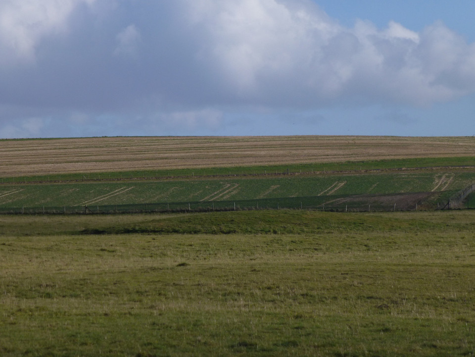
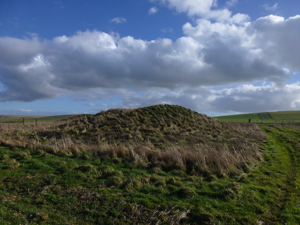
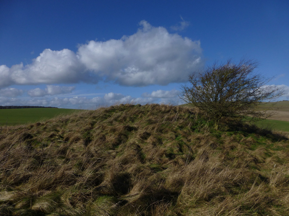
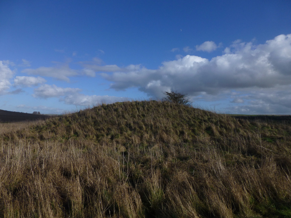
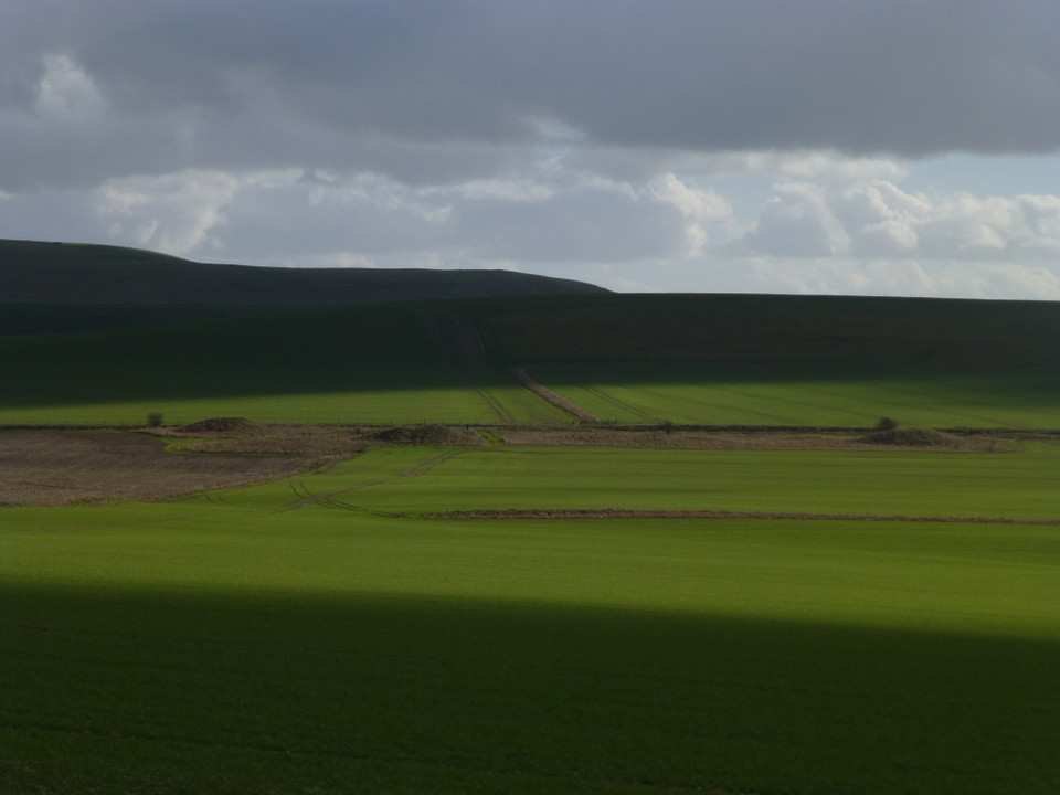
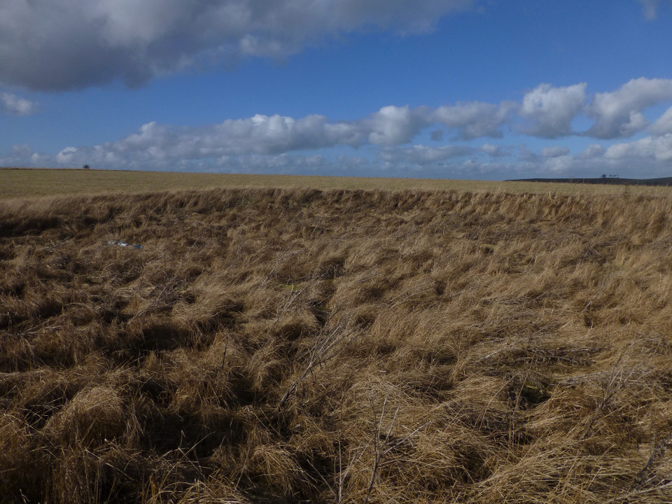
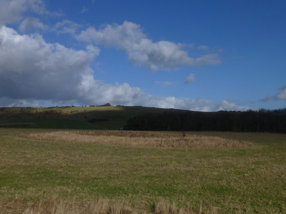
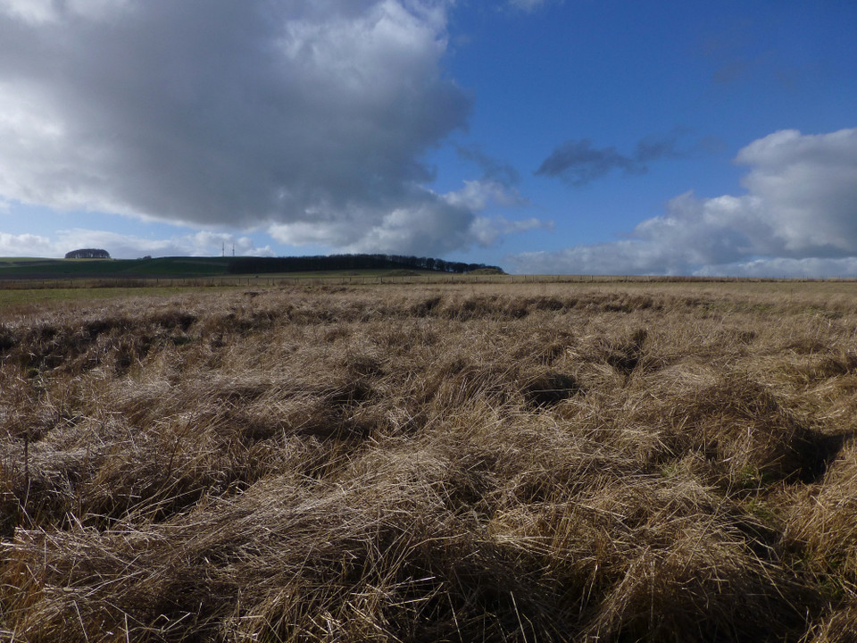
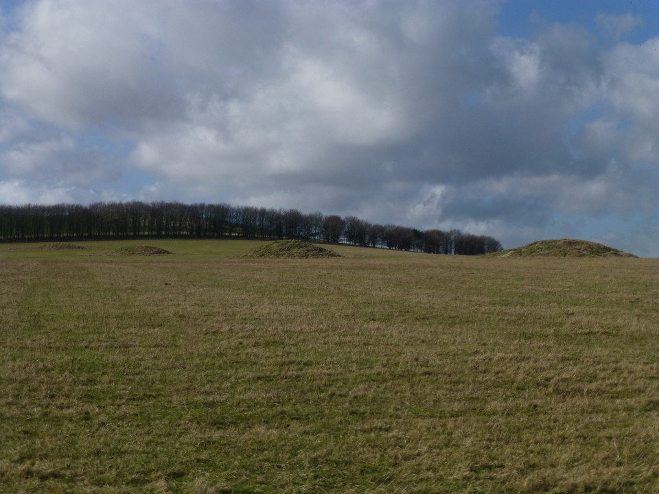
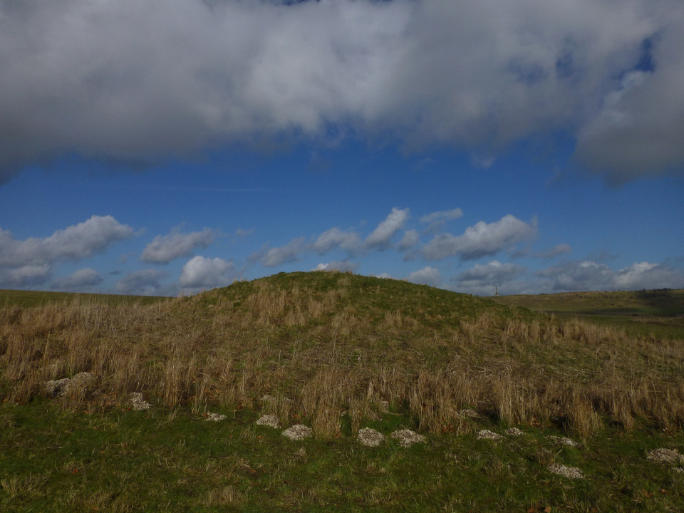
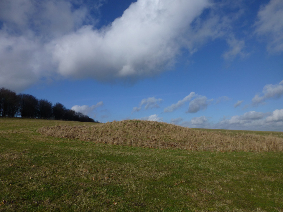
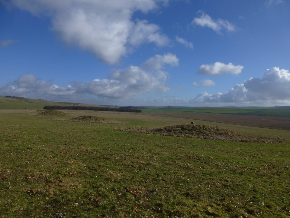
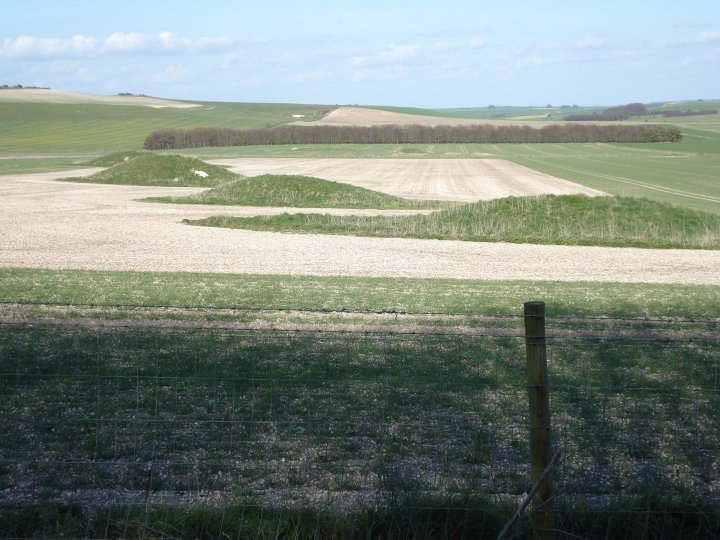
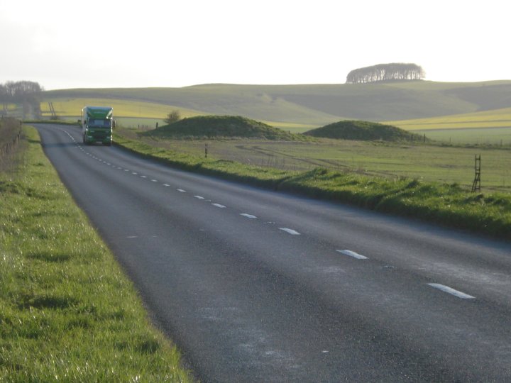
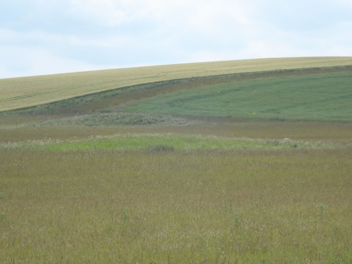
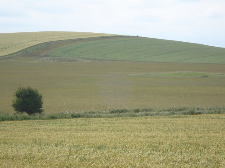
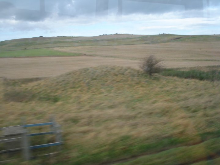
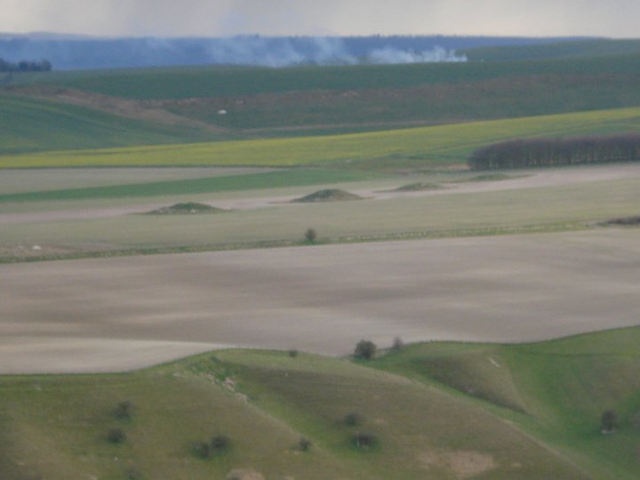
This site covers a large area with the busy A361 Beckhampton to Devizes road running through the middle. Sections of this road may well be pre-historic and if you follow lay-lines through long barrow orientations, the pre-historic mind set would suggest this to be a major route into Avebury. Dividing the area up into walkable sections, the most convenient place to park is at SU 05894 67518, marked on the O.S. map as Three Barrows. Although not an official parking place, (the official one being a mile or so further east towards Beckhampton), this spot would allow you to walk and view the cluster of barrows around the original Long Barrow. This field is usually pasture and the barrows can be viewed up close without damage to a crop. Bare in mind this is not public access land. The barrows in this cluster have been excavated by different people over the course of hundreds of years with the result leaving them much reduced in height and shape. The same is true of the barrows on the opposite side of the A361 to the north, which stand out as islands in a sea of corn. The barrows to the west of Three Barrows are easier to view due to the byways that run across the area. Following the byway that joins the A361 at Three Barrows north, turn right when you meet the Wessex Ridgeway trail and walk up to the plantation strip. On the left are the remains of a ploughed out Bowl barrow, Bishops Cannings 16. In 1951, a large sarsen was removed from this barrow when it was ploughed up. This may indicate that the barrow was built over the top of an earlier site, which was the case of Hemp Knoll Barrow, on the other side of the A361. Once you reach the point where the Wessex Ridgeway trail meets the Roman Road, SU 04829 68005, turn left and follow the old Roman Road up in the direction of Morgan’s Hill. The barrows here are very impressive and well preserved but alas we know nothing of their contents. They were thought to have been dug into by Hoare and possibly later antiquarians but no firm records exist. By now your mind will be on your car and the contents. When I travel around this area I usually do so on a bike and don't have to worry about parking or re-tracing my steps. You will find that the fields have large unploughed headlands and you can easily make your way towards Baltic farm and the byway back to Three Barrows. An alternative parking place would be the Small Grain Picnic area, next to the North Wilts Golf Club SU 01949 67148. Although a safer place to park, the walk down to North Down is much longer but covers many more sites. If you decide to explore this side of the hill, check out Furze Knoll which is an unexcavated flint mine. On the North of this area is Ranscombe Bottom, a natural fold in the chalk and the source of the River Marden. This would have been a very sacred site to the ancients and a source of pure water for both them and their cattle. Worth viewing but not listed on TMA. |
 Posted by Chance
17th August 2013ce |
Folklore |
|
|
Adding on to the post below, I found this note of Burl's....... About three-quarters of a mile WSW of the Beekhampton roundabout on the south side of the road where the outline of the Roman road crosses the A4 there is an inconspicuous stone. It marks the place of a former gibbet. Around 1837 the Royal Mail coach was held up by a gang of highwaymen and the driver. Henry Castles, murdered. The robbers made off towards Beckhampton but meeting a drunken labourer, Walter Leader, they stunned him and dumped him and a pistol alongside the wrecked coach and dead driver. Conclusions were quickly reached and Leader was condemned to death. On a misty December morning he was taken to the gallows where the crime had been committed and hanged. Minutes later a horseman arrived with a reprieve. One of the highwaymen had confessed. Leader was taken down and buried beneath a lonely tree nearby. Burl, A., Prehistoric Avebury. Second Edition, New Haven and London, Yale University Press, 1979 Page 58 Maybe the ghost of Walter Leader has a thing about traffic. |
Posted by Chance 7th December 2007ce Edited 7th December 2007ce |
Katy Jordan describes her spooky experiences on the Beckhampton to Devizes road in her book 'The Haunted Landscape':At one time I used to travel this road quite often at night, and after passing the Beckhampton roundabout I would usually start to feel uneasy, as if there was something in the car behind me, and I would find myself looking in the mirror to check. This feeling of uneasiness would not lift until I crossed Wansdyke, and for some reason I always associated it with the round barrows in the area. Quite recently, and without knowing of my experience here, my friend Alison Borthwick told me that she often hears people calling to each other on just this section of road. |
 Posted by Rhiannon
24th August 2004ce Edited 24th August 2004ce |
Miscellaneous |
|
|
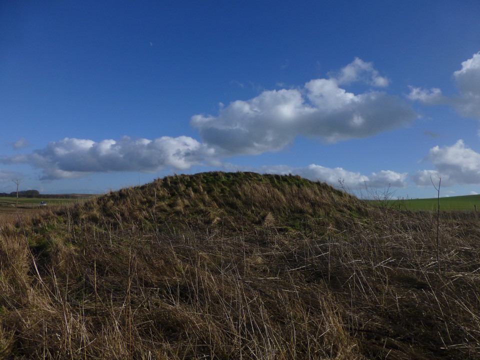
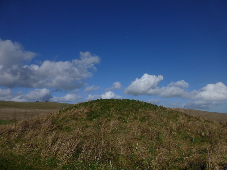
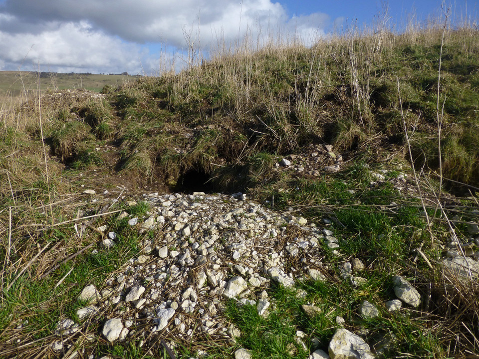
Hemp Knoll Barrow Monument No. 215555 Details of Barrow on Pastscape Bronze Age bowl barrow, Grinsell's Bishops Cannings 81. Excavated in 1965, the mound had been constructed over a group of 5 Neolithic pits containing flint implements, pottery, antler and animal bone. The primary burial comprised an inhumation with pottery, wristguard and beaker. There were traces of some kind of wooden structure associated with the grave, presumably a coffin. The presence of an ox skull and four feet suggests that the interment had been covered by an ox-hide. A single secondary cremation was contained in an inverted food vessel. The round barrow is visible as an earthwork mound on aerial photographs but has been ploughed level and the outer ditch of the mound, and a possible central pit are visible as cropmarks on more recent aerial photographs. (SU 0686 6733) Tumulus (NR) (1) A bowl barrow south-west of Beckhampton Firs, Bishop's Cannings 81, was totaly excavated in 1965 by Mrs M E Robertson-Mackay on behalf of the Ministry of Works. The excavation revealed that the barrow, 56 ft in overall diameter, with an irregular ditch 3 ft wide by approx 2 ft deep, had been constructed over a Neolithic occupation site consisting of five roughly circular pits. Finds from the pits included flint scrapers, piercer, hammer stones and flakes, Windmill Hill pottery, antler tines and animal bones. The primary grave of the barrow, which seemingly had been covered by an indeterminate structure, at least partially constructed of wood, contained a male inhumation, with wrist-guard, toggle and bell beaker. An unaccompanied satellite inhumation of a child lay near the primary burial. A single secondary burial consisted of a cremation in an inverted food vessel. An irregular length of disconnected barrow ditch 23 ft long had been dug outside the barrow on the east side. (2-3) SU 0685 6733: The soilmark of the barrow ditch 19.0m diameter, in ploughland, is all that remains. Resurveyed at 1:2500, utilizing OS APs. (4) Final publication of the excavation (5). A radiocarbon date of 2630 +/- 80 bc was obtained from animal bone from one of the Neolithic pits. The indeterminate structure containing the primary inhumation is interpreted as having been a wooden coffin. In the grave fill but outside the coffin was the complete head and four feet of an ox. (See SU 06 NE 120 for note on ditch terminal encountered north of the barrow during excavation). (5) The Bronze Age round barrow described by the previous authorities is visible as an earthwork mound, and after being ploughed level, the outer ditch of the mound, and a possible central pit are visible as cropmarks and these have been mapped from aerial photographs. The barrow appears to be 20m in diameter and is situated at the grid reference stated by aithority 1. It is possible the central pit represents a burial pit or is the result of the excavations described above. The barrow, as authority 5 suggests appears to have acted as a possible marker for a ditched boundary (described in SU 06 NE 120). (6) |
Posted by Chance 17th August 2013ce |
|
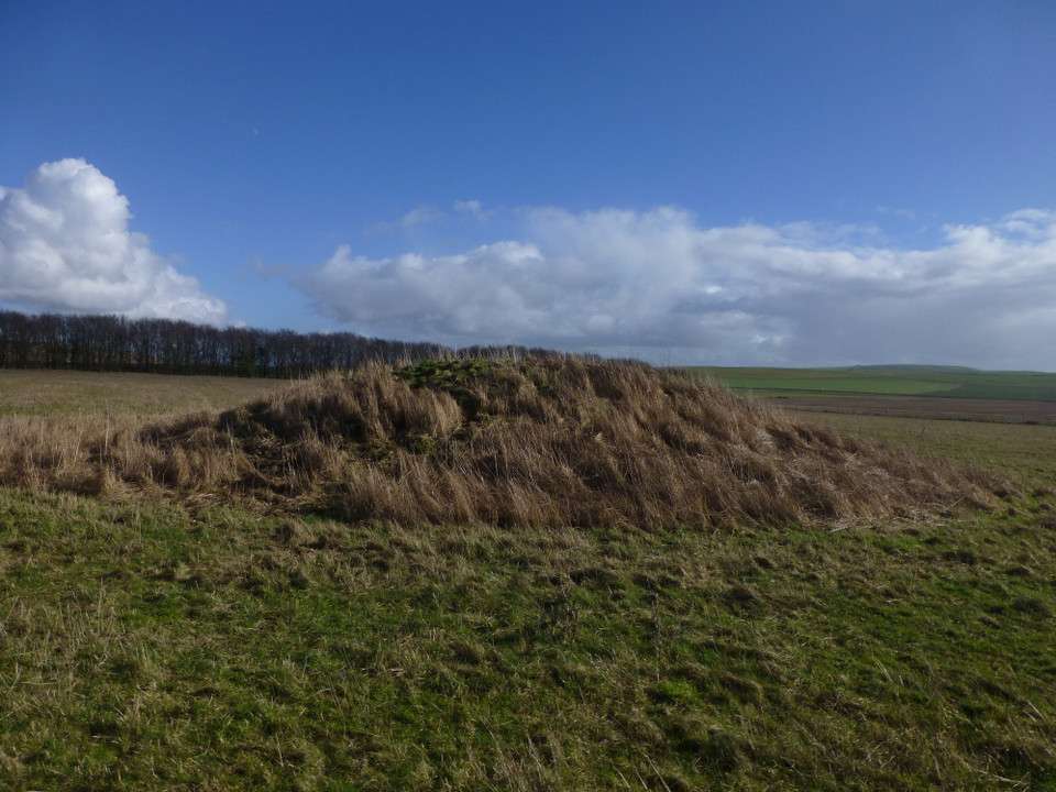
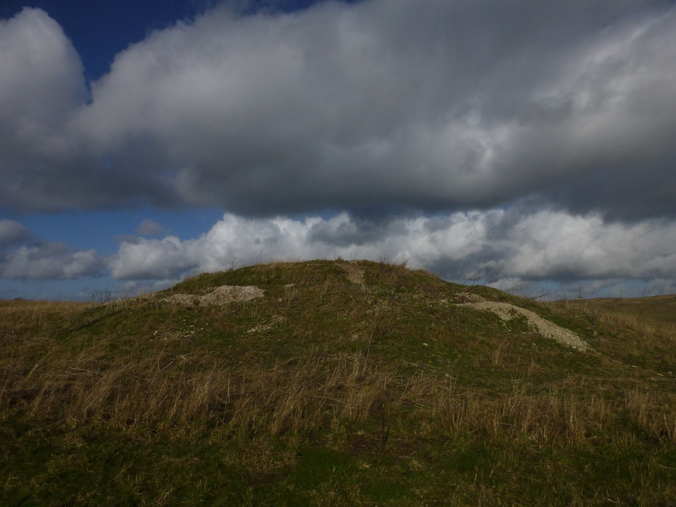
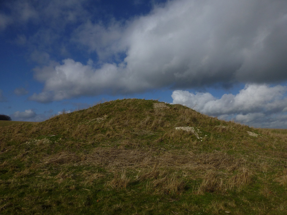
Beckhampton Firs Long Barrow Monument No. 215662 Details of Long Barrow on Pastscape A Neolithic long barrow (Grinsell's Bishops Cannings 76) with a Bronze Age round barrow over its east end, located west of Beckhampton Firs. Excavated by Thurnam in the mid-19th century, apparently without result. Completely excavated by Smith in 1964. Neolithic pottery, animal bones and an antler pick were found. The antler pick was radiocarbon dated to 2307 +- 90 bc. The mound itself featured a framework of fencing comprising an axial line of stake holes with off-set "bays", each then infilled and revetted. No human bone was found associated with the the long barrow. Subsequent to excavation, the long barrow remains as a mound, though inevitably much disturbed in appearance. Scheduled. (SU 06666773) Long Barrow (NR) (1) West of Beckhampton Firs - Bishop's Cannings 76 : long barrow (see plan). Probably excavated by Thurnam (3) without result during 1855-67. Total excavation of the mound, which remained to a height of 3 ft, by Smith on behalf of the Ministry of Public Building and Works in 1964 revealed it to be unchambered, and no burials were discovered. A few sherds of Neolithic pottery were found in the mound and animal bones including the skulls of three oxen were found both in and under the mound. A round barrow with ditch was later superimposed on its eastern end. This has been almost totally destroyed, but sherds of a Collared Urn from the adjacent plough soil were most probably derived from it(4). Finds from the barrow are in Devizes Museum. (2-6) SU 06656773. The long barrow, now up to 0.7m in height above 0.2m deep side ditches, is apparently much disturbed and cannot be readily reconciled with Smith's plan, where the orientation seems to be in error. The mound, 66.0m long NE-SW by 50.0m, has a slightly raised circular portion at its NE end, probably the remains of the round barrow identified by Smith, and side ditches 0.2m deep. Resurveyed at 1:2500. (7) Final publication of Smith's excavation occurred in 1979 (8). The long barrow mound consisted of a framework of fencing - an axial line of stake holes with offsets at right angles and lateral lines closing off the bays thus formed. These bays were then infilled, the whole being revetted mostly with what the excavator describes as chalk gravel. An antler pick from the burial surface produced radiacarbon dates of 2307 +/- 90 bc. No human bone was found associated with the long barrow. The round barrow constructed over its eastern end would appear to be of Early Bronze Age date. (8) Additional references. (9-10) The Neolithic long barrow,dsecribed by the previous authorities, has been mapped from air photographs. (11-12) |
Posted by Chance 17th August 2013ce Edited 17th August 2013ce |
|
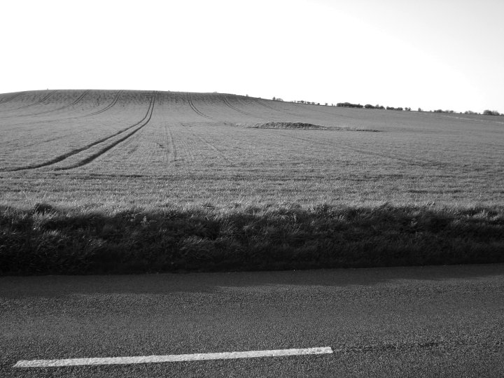
'Drive by' - 27.8.12 I spotted nine of the Barrows making up the cemetery whilst driving north along the very busy A361. Four were on the brow of the hill, one south of a copse of trees and four in a line right next to the road. Time was against us and parking is difficult on this stretch of road so I settled for a view from afar. To be honest, the four Barrows closest to the road are very easily seen and gives as good a view as you are likely to get. I hope to visit the Barrows on top of the hill on a future visit but will approach from the other side of the hill - via Cherhill and Oldbury Hillfort. |
Posted by CARL 31st August 2012ce |
|
When dashing along the road between Devizes and Avebury you will no doubt notice the wealth of barrows in the fields around you. About 24 of them (some now obvious, some ploughed out) made up the North Down cemetery. The oldest barrow was a Neolithic long barrow (now only 20cm higher than the surrounding field, according to the EH smr) – it was excavated in 1964 and three ox skulls were discovered inside, along with the wattle frame used in its construction. (Three ox skulls were similarly found within nearby Beckhampton longbarrow). The ground underneath showed that the area had been used for agriculture and 'funerary activities' before the barrow was built. The barrow was 40m long and orientated NE-SW (perhaps in reference to the midwinter sunrise?). A bowl barrow was built in the Bronze Age close to the longbarrow, and around this focus were built the many other round barrows of the cemetery, probably over a considerable period of time. The cemetery is classic "DAD will you look at the ROAD" territory, so be careful because other drivers seem to use this straight stretch as a racetrack. |
Posted by Rhiannon 18th August 2004ce Edited 18th August 2004ce |
Links |
|
English Heritage ViewfinderSome of the barrows on North Down. |
Posted by Rhiannon 10th November 2004ce |