|
|

|
|
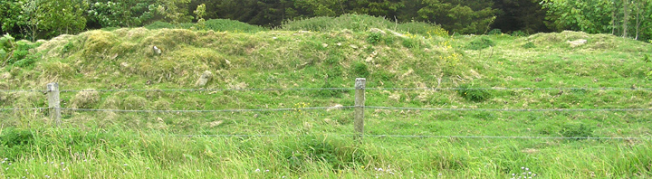
Round HoweBroch (Destroyed)
|
||||||||||||||||||||||||
|
|
|
Images (click to view fullsize) |
|
|
Fieldnotes |
|
|
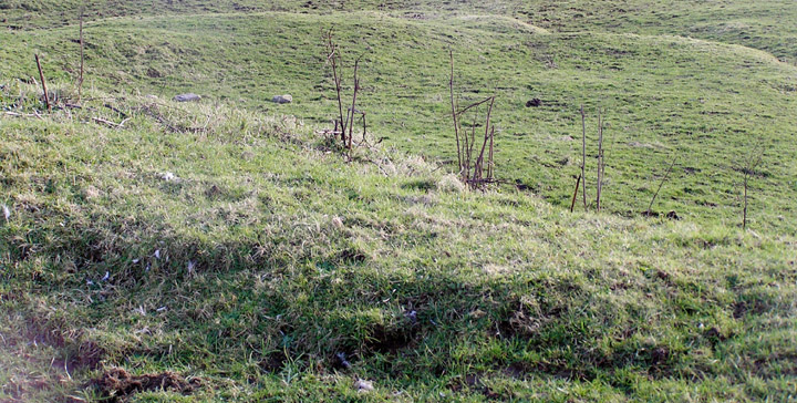
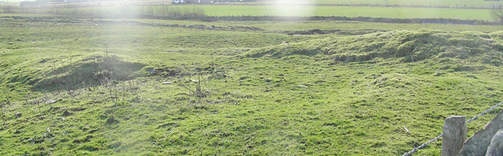
Visited 8.6.12 There is little left of this Broch which is now no more than a 1 metre high mangled mound covered in rough grass. We parked on the verge and I hopped over the fence for a quick inspection. Other than several stones sticking out of the grass there is little else to report. If you didn’t know it was here you would easily drive right past without as much as a look. Not really worth stopping for. |
Posted by CARL 16th July 2012ce |
|
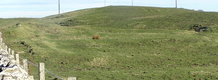
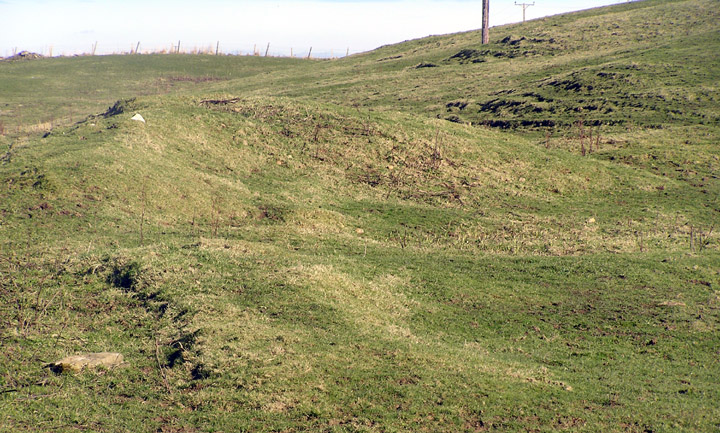
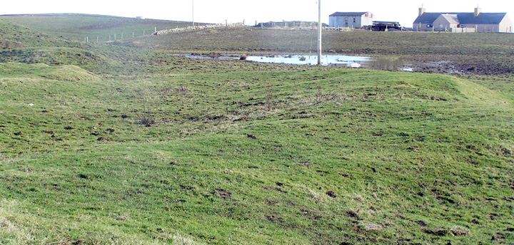
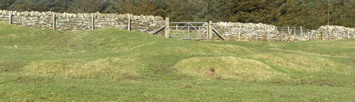
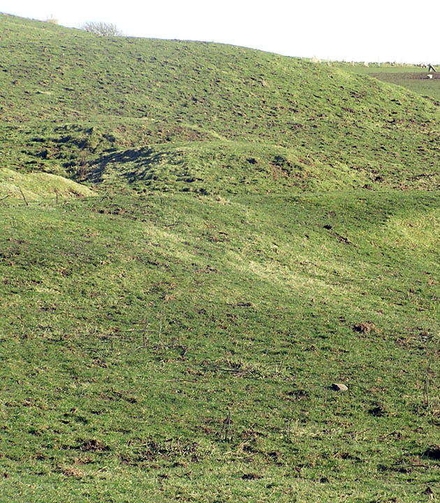
The site lies either side of the road going down to Mine Howe. Part of it lies by the plantation and looks fairly intact, but as everything is hidden under huge grass tussocks it is unrevealing, and only one trench was placed here. Might have done better to strip just the turf back over the whole area this side of the road. There is a long straight looking bank maybe a metre high, roughly parallel to the road, and then a further bank or banks behind this 'pushing' the plantation back in a curve. If this is the 'embankment' then the gap between the end of the arms should be towards the far end of what you see. In the plantation behind is a remaining section of natural burn. Before you reach the main body of the site a wide water channel goes under the road. On the Langskaill side the far bank the part by the road incorporating larger stones seems to have excessive height for the present usage, and might have been associated with Round Howe or be re-used stones from it. This RH side of the road is where the owners dug in 1946. Over the mid-19th century drystane wall from the roadside the workers left a cut alongside the wall. Perhaps one could still find part of the entrance to the broch (or that in the mound) close by this cut. Climbed a fieldgate onto the site. The start of the 'arms' should be about the lower right region as you look at it - on my last visit the land between here and the channel was water-logged. Trench remains complicate the viewing and the "Mine Howe location map" shows earthworks over an 150m wide area (unfortunately the geophysics has no scale in the Mine Howe publication). Away from the mound what looks like an inner bank is re-deposited material and the rise to the north is natural. You can still see the level area between mound and enclosure easily. There are several stumpy earthwork sections at the Round Howe end of Lang Howe which may properly belong to this site. |
13th March 2007ce Edited 26th June 2007ce |
|
Walking to the Mine Howe area I suddenly had this idea of the place as a bath-house of the soul, with analogy to frigidarium and tepidarium and plunge pool in mind. Looking from the last dyke wall Round Howe (a landscaped natural knoll) runs almost imperceptibly up into Long Howe. Mine Howe is hidden from view and from the top of the latter would have been yer actual revelation. It would be nice to have authoritative relative dating for the three sites - perhaps we think of affairs revolving on Mine Howe when it could have been an afterthought rather (explaining the possibility of objects from Round Howe being taken wholesale to Mine Howe at some stage). Last night, afterwards, I tried again to find out why the present county archaeologist referred to the site as a "pseudo-broch". Found a relevant clipping from "The Orcadian" of September 12th 2002. Nick Card talks of its being "meant to be a broch site" but that in the excavation "what we found...quite bizarre...a mound..surrounded by quite a large ditch...and outside of the ditch..an encircling bank". Sounds more like a barrow or henge (similarity with Ring of Bookan??). Regarding the paucity of finds he speculated that the many finds from Mine Howe were deposited there after being removed from here. As later Bronze Age pottery turned up at Round Howe could it be regarded as being more in the nature of the capturing of a shrine than a plain transference of sanctity to the later site ? |
14th April 2004ce Edited 30th August 2006ce |
Miscellaneous |
|
| In 1862 Petrie dug this tumulus (RCAHMS NMRS record no. HY50NW 8) and found the low (2' to 2' 6") remains of a broch measuring 19' 8" internally, with walls varying from 8-10' across containing two 1'11'-2' wide (one had a short 3' entrance at right angle) by 2' high passages in them. There was a wallface surrounding the broch at 2' distance and the whole stood on a 90' diameter mound. Both had entrance gaps ~ENE but slightly offset. All this stood within two banked arms with a western gap of 15' and a large obstruction blocking the east end (total enclesd area 225' by 175' according to Hedges, banks 24' by 2'6" high). Between broch and embankment varied from 66-78' With its surrounding banked enclosure the nearest parallel is between here and Dingishowe where the Campston/Venikelday site is a broch with ring-ditch on current thinking. There are passages on Petrie's plans but no guard cells, which means either it survived to the base of the 2nd level as Hedges thought or only remained to the bare minimum below where they would have been. Shortly before 1880 the modern road passed through the site, though locals spoke yet of passages beneath the road. The 1946 excavation on the Langskaill side found a "tomb with burnt bones" without saying if it came from the broch or the mound it stood on, but would have said if this were a cist, so what was it - The Howe had a Neolithic grave turned into a souterrain. From the extensive geophysics even outside of the enclosure the site seems extensive and probably multi-period, and the (2.8 by 0.7m) LBA flat-bottomed ditch dug at the mound's base this century reminds me that antiquarians thought Campston to be a henge on account of its similarity to the Ring of Bookan. Easiest to call it a broch really! |
13th March 2007ce Edited 26th June 2007ce |