|
|

|
|
Long HoweCairn(s)
|
||||||||||||||||||||||||
|
|
|
News |
|
Nut confirms Mesolithic contextThe hazelnut was found in a layer beneath the Bronze Age burial mound at Longhowe during excavations earlier this year. The charred shell has been dated to 6820-6660 BC, and its discovery pushes back the known settlement of Orkney by 3,000 years... continues... |
3rd November 2007ce Edited 3rd November 2007ce |
|
Mesolithic Excavation Starts Today Radio Orkney reports that a great number of Mesolithic tools have come to light, though presently this is thought to represent a refurbishment workshop rather than a factory per se. They urgently require volunteers to sieve the whole of the spoil heap for microliths missed by the main thrust of the excavation |
21st June 2007ce Edited 3rd July 2007ce |
Images (click to view fullsize) |
|

|
Fieldnotes |
|
|
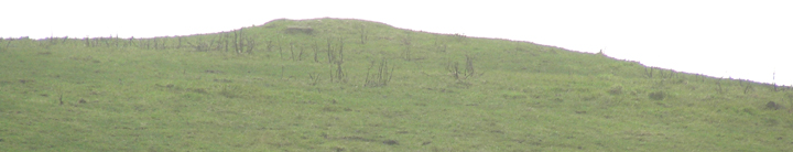
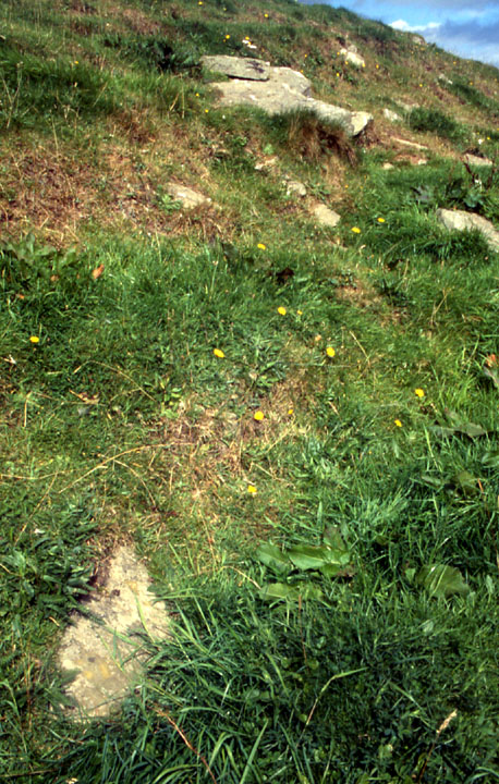
After a promising start the expected Mesolithic windfall was a no show, the present hypothesis being that work on the barrow removed most of this previous material. My visit to the excavation left me distinctly underwhelmed. First impression is that a mushroom-cap shaped rise has been revealed that consisted of a layer of small to medium sized flat stones sitting on top of soil (as distinct from embedded in an earth matrix). In the eastern quadrant they have dug through this. Just in front of what seems to be the very decomposed inclined top of a rocky outcrop (reminding me of the geophys lines at the other end of Long Howe) is a 4-6' line of stones that looks to be at least one course of non-drystone walling. Apart from a couple more stones after a small gap it is isolated, doesn't seem to be going anyplace or connecting up with anything else presently visible [so no mortuary enclosure then ;-) ]. Perhaps something later trashed this and the postulated Mesolithic material? Walking around to the NW side of the dig (facing the road to Twinness) I saw an irregular shallow narrow trench that I take to be where they looked for a continuation of the previously found stakeholes or else the originals. |
29th June 2007ce Edited 29th June 2007ce |
|
On the tour of Mine Howe the archaeologist said a lithic specialist had identified the flint chipping as being of Mesolithic manufacture. Though these are obviously re-used they can be read as evidence of a nearby settlement of this date. I wonder how old the relict dunes/shorelines (HY522071) are on the coast towards the Point of the Liddle, and Sandy Howes (HY498067) is a very faint possibility - but I'm probably speaking out of my backside ;-) Or perhaps it should call to mind the stone working site hard by the Unstan tomb. No pit was found underneath but some kind of slot emerged instead. The holes could perhaps be from a Mesolithic bivouac but could equally well be connected to the kerbed cairn. Unfortunately this trench was just being closed whilst the tour took place and was newly covered by earth when our party reached it. If you want to know where the cist is when the dig is done simply find the block of stone bordered by two incised lines in the roadside wall and look straight across. |
26th August 2004ce Edited 26th June 2007ce |
|
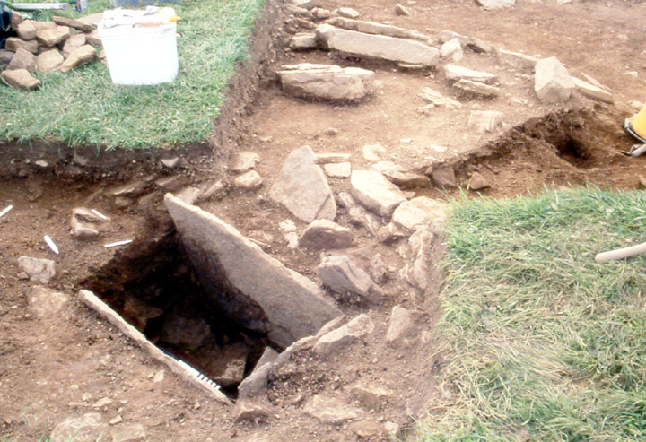
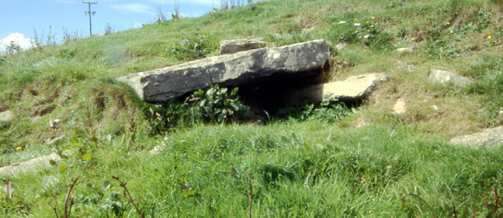
Went to Mine Howe for the open day and was delighted to hear they were also excavating a Bronze Age cist on Long Howe. Though the general area has possibly suffered damage from livestock it is a little beauty, 50x20 by 50cm deep, atop the barrow at the end nearest Round Howe. I imagine this to be the known cist mentioned in the NMRS. There is a small area excavated around it and a bigger area downslope, mostly to the left of the cist, in which are exposed several (what for the moment I'd call) flags contiguous in a circular manner. The young lady said they found flint chippings on the cover slab and on the inside, but nowhere else in the vicinity. No human remains have been found as yet, though as the bottom is a bit smashed up they believe these could be in a pit further down still. What marks the cist out as unusual is that there is no back slab. I was minded on the Nev Hill round cairn. However on re-reading Davidson and Henshall I find that there it was the back slab to a chamber which was absent and an arc of drystone walling thereabouts apparently continues as part of a semicircular rear wall. Most of the exposed stones are unseen from the road as they are at the back, so I was glad of a chance to finally see them. I don't know aboot kerbed but it certainly feels a little 'terraced' and the lines of stonework, if we may deign to call them that, seem to bear this out. The stones become more obvious as you near the Mine Howe end. In 2005 terracing on the geophysics proved to be from medieval farming. At HY51010599 they are especially big and present a structured appearance. Two stones are one above another at an obtuse angle, though not fully overlapping, and visible of the top one on the left is 1.8x0.9x0.2m and of the lower one 1.5x0.2x0.2m. There is a space of about half a metre beneath them but no void to be seen, only comparatively smaller stones. To the right of this 'overhang' are yet more stones, though I could not tell whether these were in connection with or seperate or perhaps more of that 'terracing'. P.S. 2005; Though Nick Card said these are more likely to do with the boulder clay there are attached to Long Howe stories of subterranean chambers, so we'll probably never know for certain. |
22nd August 2004ce Edited 26th June 2007ce |
Miscellaneous |
|
|
Work started again last week [volunteers needed for on-site sieving this week and next - see News]. Went round yesterday and there was a JCB on top of the mound. A strip has been exposed behind where they [re-]excavated the cist last year and I could see levels being taken and limited digging apparently underway. Having heard Radio Orkney this morning the reason for hesitancy is obvious, finding microliths being even more labour intensive than normal tool finding [alas volunteering is forbidden me]. My own betting for a settlement is still the relict beach at the bottom of the road. P.S. there is no Mine Howe season this year, but it is open for visitors and there is a small shop / interpretation centre on site. |
21st June 2007ce Edited 21st June 2007ce |
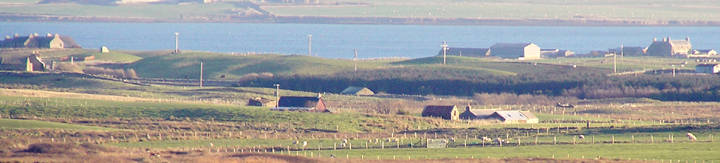
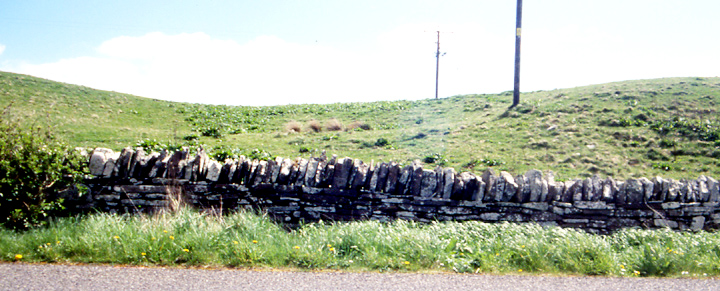
| RCAHMS NMRS record HY50NW 61 is probably a kerbed bowl barrow and the main body is 7.7x7.1m. Mine Howe being surrounded by water the only dry entrance was from Long Howe, though Mine Howe has to date only shown Iron Age structures. |
3rd March 2004ce Edited 22nd August 2004ce |