|
|

|
|
Anglezarke Moor Group
|
|
|
|
Sites in this group:
|
3 posts
Anglezarke Misc 10 Cup and Ring Marks / Rock Art |
9 posts
Anglezarke Misc 4 Cairn(s) |
4 posts
Anglezarke Misc 5 Chambered Cairn |
|
1 post
Anglezarke Misc 6 Chambered Cairn |
1 post
Anglezarke Misc 7 Round Barrow(s) |
8 posts
Anglezarke Misc 9 Ancient Village / Settlement / Misc. Earthwork |
|
7 posts
Anglezarke Moor Standing Stone Standing Stone / Menhir |
20 posts
Black Coppice Chambered Cairn Chambered Cairn |
3 posts
Black Hill Upper 1 Cairn(s) |
|
3 posts
Devil's Ditch Ancient Village / Settlement / Misc. Earthwork |
7 posts
Jepson's Gate Cairn Cairn(s) |
55 posts
Pikestones Chambered Cairn |
|
11 posts
Pikestones Cairn Kerbed Cairn |
23 posts
Round Loaf Artificial Mound |
2 posts
Rushy Brow Mesolithic site |
|
2 posts
Stronstrey Bank Cairns Cairn(s) |
10 posts
Stronstrey Bank Stone Standing Stone / Menhir |
Sites of disputed antiquity:
|
4 posts
Anglezarke Misc 1 Carving |
1 post
Anglezarke Misc 11 Sacred Well |
2 posts
Anglezarke Misc 3 Carving |
Fieldnotes |
|
|
This is a tough area to walk as there are few footpaths, certainly between the sites mentioned here. So wear some stout boots. Wherever you look there are possibilities of past human settlement, my imagination ran riot. Top place though Dave 3rd March 2004 |
 Posted by daveyravey
4th March 2004ce |
Miscellaneous |
|
|
Can there be a significance that Round Loaf and Pikestones are aligned perfectly along a line between the top of Great Hill and the view point over Anglezark reservoir? The line runs exactly north east - south west. The distance between Round Loaf and the top of Great Hill is exactly the same as that between the view point and Pikestones. Refering back to the standing stone on Stonstrey bank and the triangles: Assuming that Pikestones marks the bottom left point and Round Loaf marks the top point, this same distance marks precisely where the smaller triangle sits along that line, away from Pikestones. I would really appreciate any input. This area must have been a very sacred place to our ancesters. I hope that we can unravel some of it's secrets. |
Posted by parker 4th May 2005ce Edited 4th May 2005ce |
|
I've just come across the following documentation. I think it may be the latest published survey and excavation report covering the Anglezarke area. The Proceedings of the Prehistoric Society No 61, 1996 pp 133 – 166 "Seeing the Sites : Survey and Excavation on the Anglezarke Uplands, Lancashire" By Christine Howard Davis With contributions by M. Bain, H. Bamford, B. Barnes, R. H. Leech & J. Quartermaine |
7th March 2004ce |
| ArchSearch shows a Jepson's Gate Cairn at SD6217 threatened by erosion , possibly Bronze Age . |
21st February 2004ce |
|
The Anglezarke Moor Group has been created to collect together previously known sites and more importantly, new features that are appearing out of the eroding covering of peat. The perimeter of this area have been defined using where possible landscape and are :- West - Stronstrey Bank escarpment. East - A675 (as it runs along the "valley" bottom between Turton & Anglezarke Moors) South - The road from Belmont to Rivington village (as it runs at the base of Rivington Moor escarpment) North - Dean Black Brook. (Separating Anglezarke from Wheelton Moor) Over time it may be decided that some of these should not be considered in "isolation" but may be linked to other sites in the surrounding area. As features are rediscovered they probably won't appear on any maps and so may not be named. In cases like this I suggest they are named Anglezarke Misc 1, 2 etc until a proper naming convention is found. |
21st February 2004ce |
Links |
|
A brief history of AnglezarkeA brief history of Anglezarke including a defination of the place name. |
24th February 2004ce |
Chorley and District Historical and Archaeological SocietyA new web site, looking at archaeological site around Chorley. The chairman has had an interest in the prehistoric sites on Anglezarke moor for most of his life. |
24th February 2004ce Edited 24th February 2004ce |
Latest posts for Anglezarke Moor Group |
Showing 1-10 of 176 posts. Most recent first | Next 10 
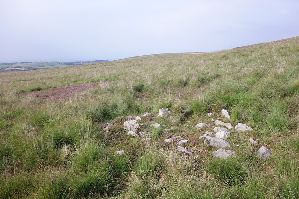
Black Hill Upper 1 (Cairn(s)) — Fieldnotes |
|
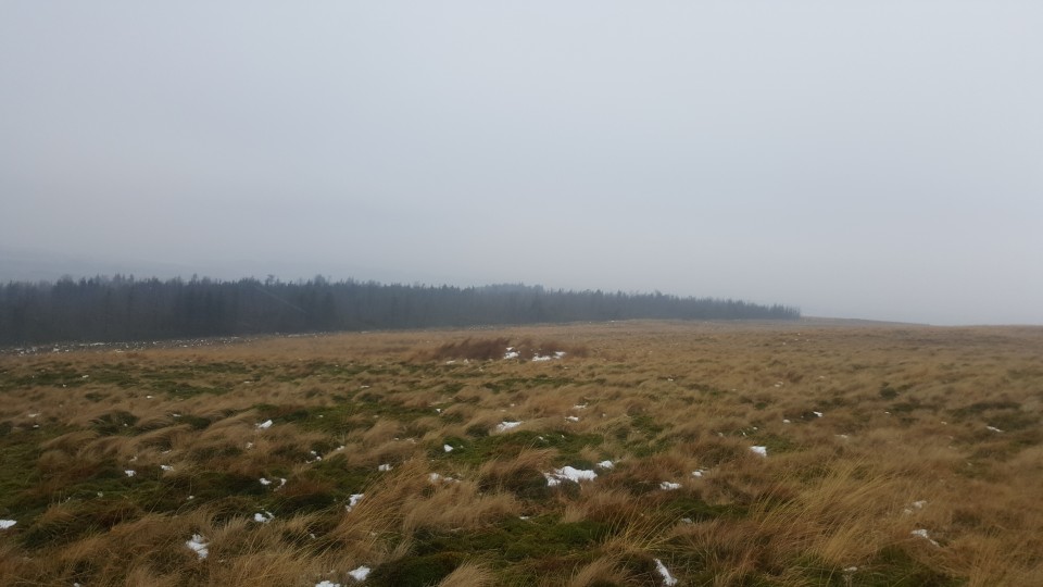
[visited 19/5/23] The hard slog but on a cloudless day with only skylarks and peewits for company, 101% worth it. That old top to bottom feeling of peace as I sunk down to eat my sandwiches. One of several small cairns poking out about the edges of the peat up here, ever more suggestive of a large cairn field under the blanked bog on the flat bits all the way to the top of hurst hill. This is a small site buried in the archaeological survey and well worth the effort if you like small mounds of stones. There is just a hint of a kerb, a few earthfast stones coquettish peaking up on the edges. Access is difficult across peat bog from any direction. I came from the great hill to hordern stoops footpath and its quite boggy. I left via Round loaf and across moor to lead mines clough. Quite boggy that way too! |
 Posted by juamei
31st May 2023ce |
Black Hill Upper 1 (Cairn(s)) — Images (click to view fullsize) |
|
Posted by juamei 30th May 2023ce |
Black Hill Upper 1 (Cairn(s)) — Miscellaneous |
|
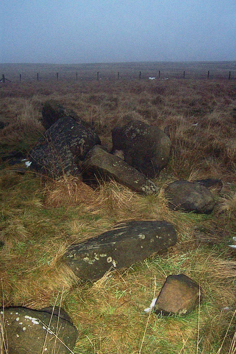
Site 16 in the Anglezarke and Rivington Moors - Archaeological Survey 1986. "This is a relatively well defined cairn in an area of peat erosion. It comprises small to medium field stones, some of which are earthfast. There is a possible kerb. It is in the vicinity of the PRN 4064 flake working area. Size: length 1.7m width 1.7m height 0" |
Posted by juamei 30th May 2023ce |
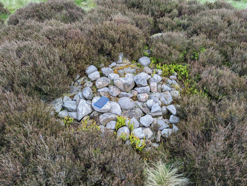
Pikestones Cairn (Kerbed Cairn) — Images |
|
Posted by juamei 7th March 2018ce |
Pikestones Cairn (Kerbed Cairn) — Fieldnotes |
|
[visited 4/3/18] Out on a hike up Hurst hill, I remembered on my way back I'd never actually found this cairn despite walking within 100m of it many times. So, with the aid of the images on here and some rough guesstimation I found this really good condition small cairn. Turns out I was always the other side of a slight rise and even when I'd climbed it I was looking for a circular bank not a mound, should have checked the images earlier! This is a really good condition cairn, seemingly untouched by robbers, antiquarians or farmers. The mound is poking out of the peat and has a clearly defined kerb about a metre or so up enclosing a 2-3 metre space. I wonder if there is a second kerb under the peat defining the bottom of the cairn, I poked about a bit but couldn't see anything obvious. Looking at the previous pictures on here I think the peat may have denuded a bit over the last 15 years or so. The views are really good and before the trees went up you would have had a great view of pikestones and round loaf, this mound lying between the two. Also a lovely vista all the way round the eastern end of anglezarke, winter hill and then onto the lancashire plains out to the sea. Access is good for Anglezarke, however it will probably be boggy underfoot depending on the time of year. You'll need to cross a couple of stiles and the cairn is just off a footpath. |
Posted by juamei 7th March 2018ce |
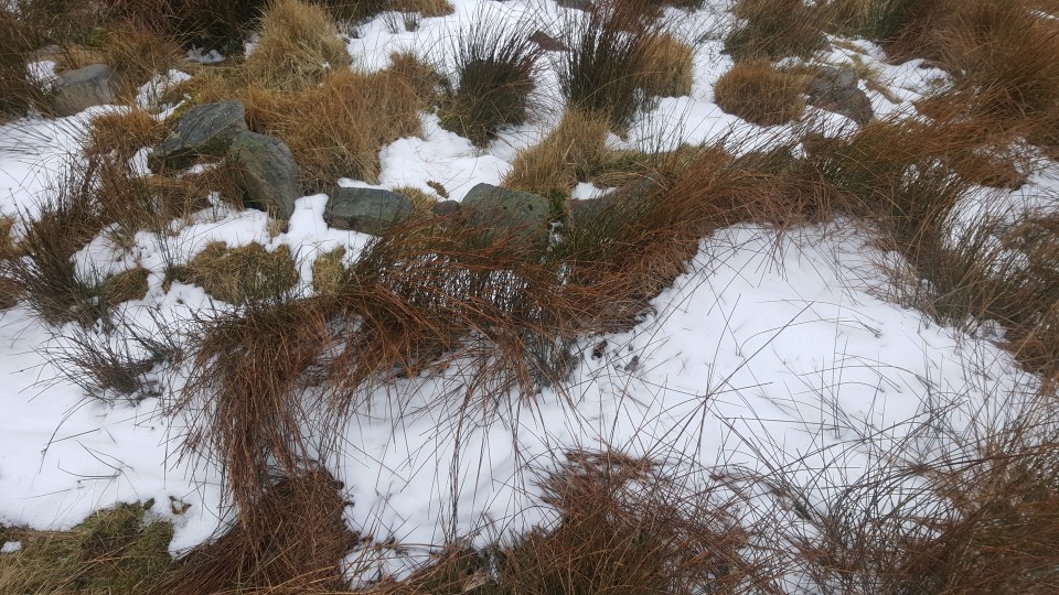
Stronstrey Bank Cairns (Cairn(s)) — Images |
|
Posted by LivingRocks 2nd September 2015ce |
Stronstrey Bank Cairns (Cairn(s)) — Fieldnotes |
| 2 Cairns & a Mesolithic scatter site are listed very close together in The Anglezarke survey report & also by Pastscape, so having worked out where the sites should be I headed off on the short walk from Moor Lane. The first of the cairns is quite easily found, but the second is more problematic, I think I found it but it’s buried deep in the Anglezarke tufty grass & a winter trip when the vegetation is at its lowest is needed to confirm it. |
Posted by LivingRocks 2nd September 2015ce |
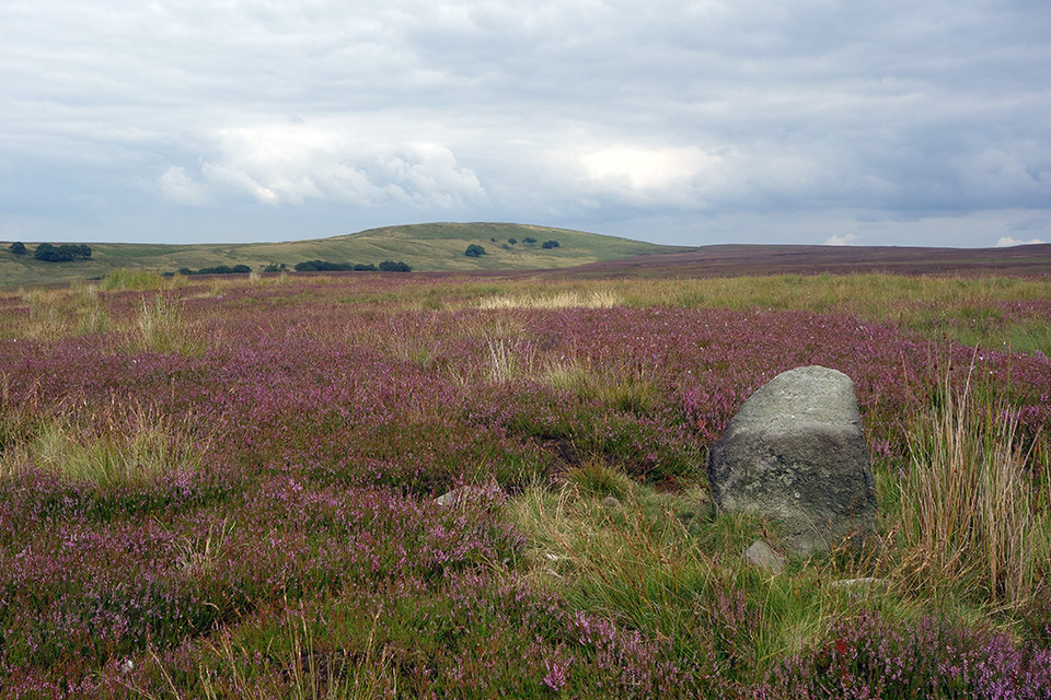
Anglezarke Moor Standing Stone (Standing Stone / Menhir) — Images |
|
Posted by LivingRocks 23rd August 2015ce |
Showing 1-10 of 176 posts. Most recent first | Next 10