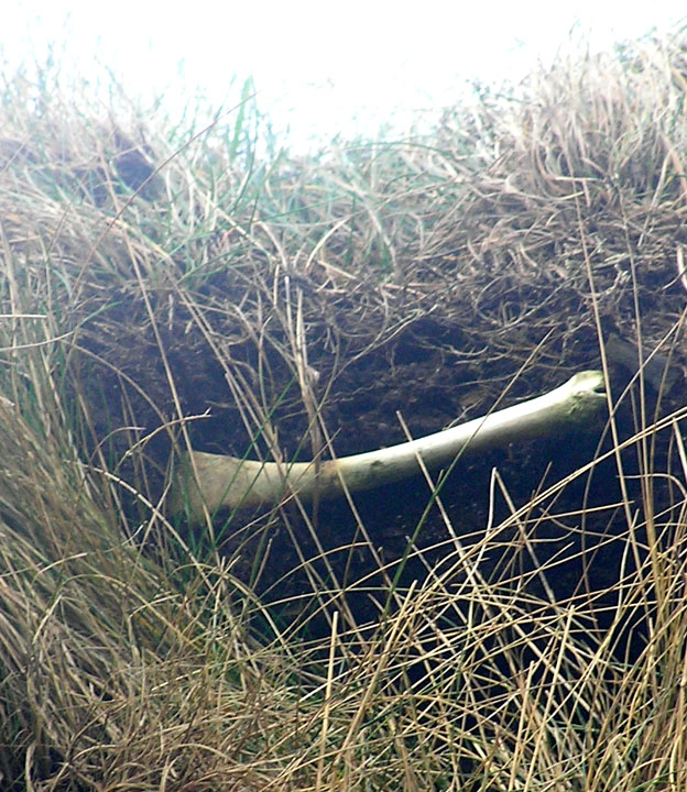
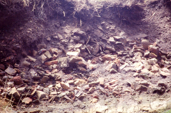
After years of waiting a storm has finally brought down from the cliif edge on the opposite side of the burn to the broch village a few sods containing the midden-y material. Definitely not pot of any kind. The coloured rock appears to be the same kind of burnt stone as I saw last week at the Loch of Tankerness. No doubt the next high enough tide will remove the material from the bottom of the cliff.
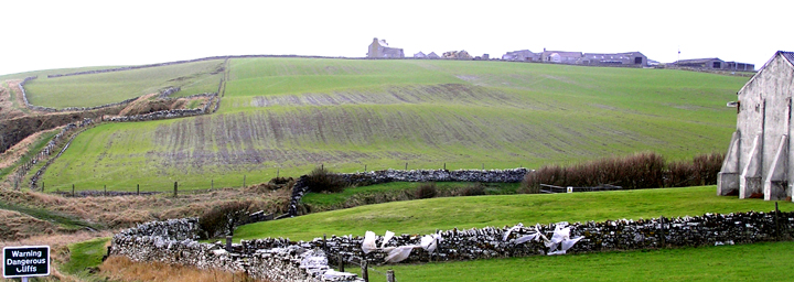
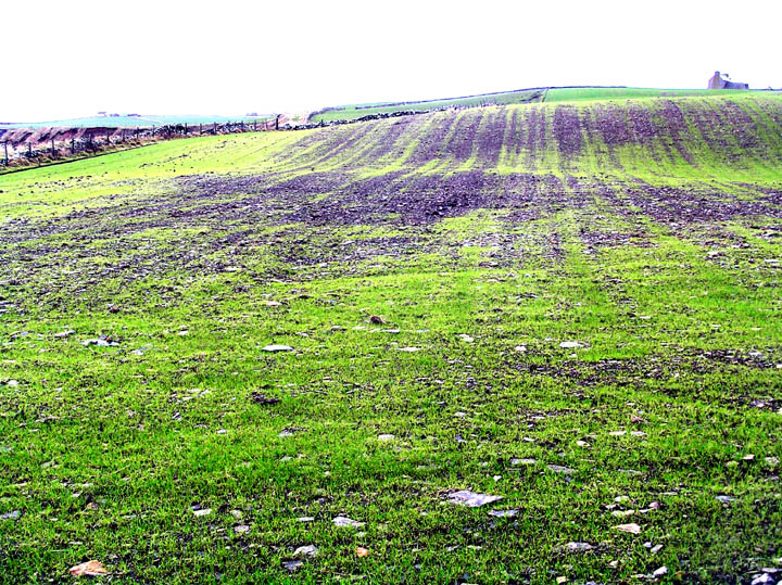
When I walked the coastal path by the distillery in February, the field between it and Lingro had been newly ploughed and seeded. As I result soilmarks and exposed stone plainly showed where the broch and settlement had been. On the flat section you could furthermore see the contrast between the area where the broch tower had been and that of the outworks, all picked out in stone scatter besides. Stone scatter was seen on the rise above and again on the rise above that, but walking further along I noticed when alongside these that the stones in the higher rise were a magnitude larger than those in the lower scatter so perhaps not to be associated with the broch. These two sets end where there is a long natural rectangular bite of a cliff, the fieldwall following the three sides.
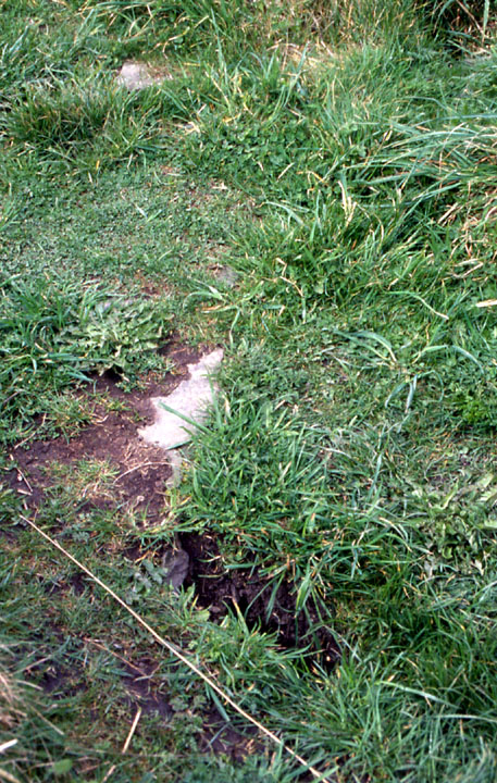
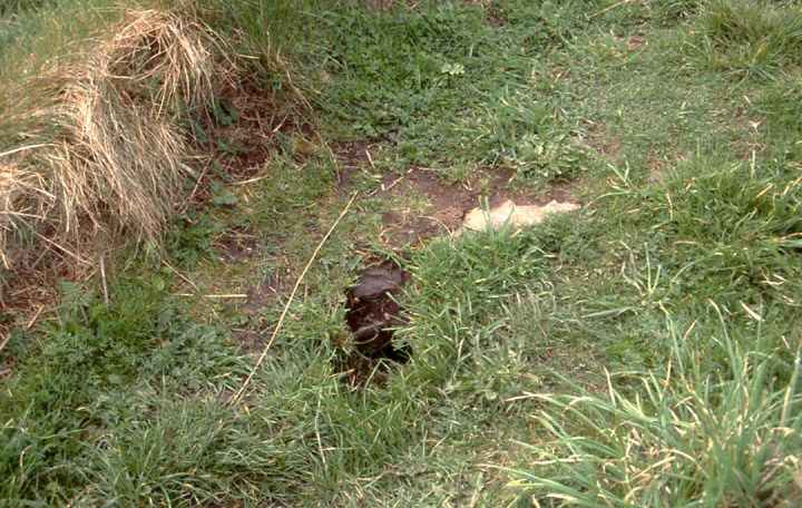
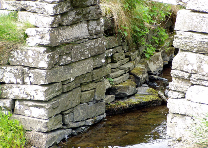
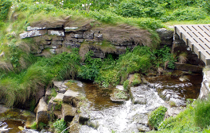
A few years back I noticed stones projecting from the modern ground surface by the NE end about a metre from the wall (i.e. closer to the cliff), mostly darker than those of the fieldwall, that appeared to be the remains of a previous wall. This is much reduced but a higher level than the presumably submerged wall foundation. Since the footpath has been renovated several further stretches of this wall/feature have been exposed. On one by the northern side (HY43370871) 6-12" high I now found a ~4x1.2m collection of stones far bigger than those making up either wall - ranging from 23-29½ by 16-23" by 3-10" - and definitely not from either, clean of lichen as well. Not sure whether I missed these before or the path renovation has disclosed them, but they are certainly not there naturally and were once presumably structural.
Coming back I noticed in the top of the modern wall further down (HY43420872) what could be a pivot stone. It measures 15x5½x5" and the circular depresssion is 1¼ across and 1" deep, which is too small for a main broch door.
Having finally found a plan of the Broch of Lingro it is obvious that the line of stones outwith the present drystane wall falls within its compass, you can see where the broch structures respect the cliff edge here. Obviously these 'lines' precede the wall but what is their relationship with the broch itself, both spatially and temporally? I think it probably went all the way to the Scapa Distillery outlet as there is at least one more such stone along the path closer to there. Perhaps some of the burnside walls relate to it?
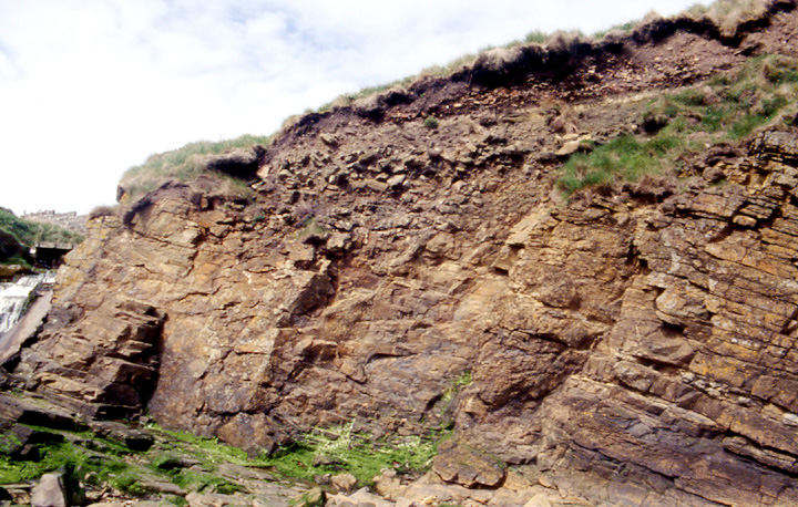
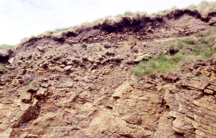
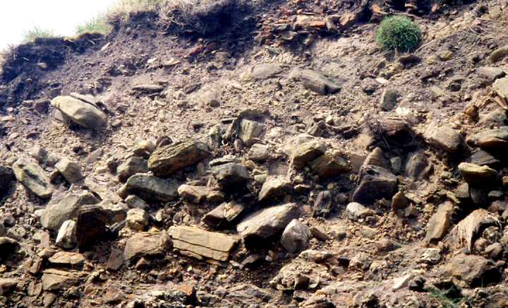
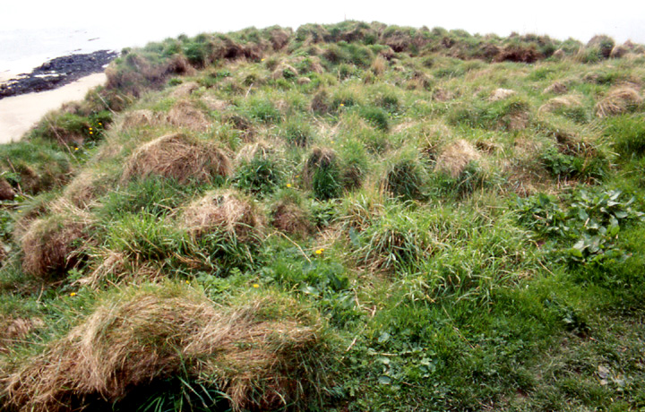
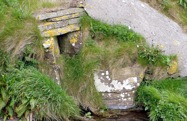
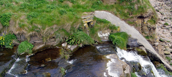
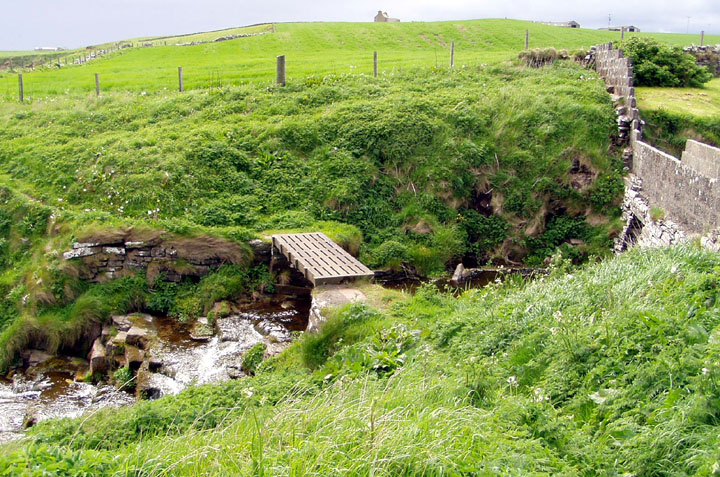
This used to be in the field to the left of Scapa Distillery. The broch tower itself was levelled in 1981, along with the immediately surrounding area, but points of interest still remain - as do unexcavated settlement mounds from there back to the main road at least. The most visible evidence of the broch lies either side of the stream outlet as it reaches the shore and cascades down (see photos).
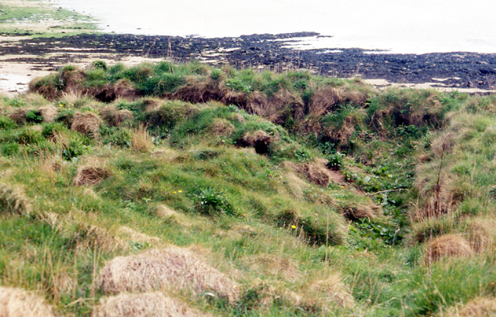
As you go up the cliff path to here you will notice a feature, 14m across and taking in an area out to the cliff edge 11m at furthest point, that itself looks like the remains of a broch or somesuch; a place where the cliff goes out and there is a ditch 1.8x1m like a sector of a circle, and within its arc a flat area 6x4.8m. As I can only see earth and sod and it isn't shown on CANMAP we may perhaps safely call it a simulacrum? The LH edge of the arc goes 6m straight to the cliff edge. HY436088
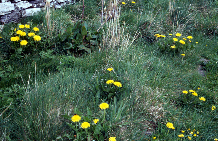
If you pass over the bridge and up the other side you will need to watch your step the rest of the way - a teenager fell from near here just recently in damp conditions. There is another curious feature just past here inside where the lichen-covered wall turns for a few metres before resume its coastline track. At the point where it first turns (HY434087) there is a short line of regular-shaped stones darker than the wall, level with the path and over which you narrowly pass. Then up between where the wall turns again and its next juncture (HY433087) similar lines of like nature can be made out. Being on the coastline side of the decaying cliff face I assume that this predates the present wall. If this feature were angled away from coast I would have no doubt it represents the walls of a structure, but unless it is very ancient I am at a loss as to what it can be ( why no lichen on the stones for starters !). P.S. Going back today I noticed to the landward side of the 'simulacrum' a very small ditch I could walk in parallel to the present drystane wall about the same distance from it as these stones so wonder if it is the same feature this side of the burn also, whatever it is.
Down on the coast one can see more evidence of settlement at the top of the cliff face on the stream outlet's immediate right, though I wasn't convinced until I saw it today in the light of recent visits to other brochs. Above where the cliff's stone ends 3.9m up is a layer of what looks like cultivated soil and a thin line going straight across, very reminiscent of the broch bases at Ingshowe and Berstane. There are the odd few stones to be made out in this ?matrix. But it is the next layer, that under the grass, that has finally convinced me now that I have made it out clearly. This is a layer several inches thick made up of nothing but angular fragmented small stones (and possibly man-made material as though there are red rocks on the Scapa shore there are none up the cliff-face this side of the bay except here) several inches deep. Unless my eyes decieve me this is most likely to be a destruction layer. The total area is 8.7m long and something under 3m deep. HY435088
Nothing remains now of the Broch itself as this was bulldozed in 1981. It was along the cliffpath to the left of the Scapa Distillery. The mounds that can still be seen represent the outbuildings. These may have stretched as far as the Orphir road on a bend in which you can sit on part of the mound still. This reminds me of the one opposite the Standing Stones Hotel on the main Kirkwall-Stromness road. It could also have been associated with the Broch of Warbuster whose remains used to be at Tofts Farm.
Until sometime between 1860 and 1882 the King's Mill of Scapa occupied a small part of the present Scapa Distillery site, which I take for evidence of continuity and is likely to explain at least some of the features that we saw downstream.
During the 1870 dig they also excavated a chambered tomb (?HY43240863) south of Lingrow house (HY431086), though the sparse details could possibly refer to an earth house.
In the last few years before Scerrabrae was excavated John Fraser in Vol.2 of the Proceedings of the Society of Orkney Antiquaries wroteof it "the labyrinth-like walls of the structures to a small extent resemble the maze of walled enclosures at Lingro Broch".