|
|

|
|
LochviewStanding Stones
|
|
|
|
Images (click to view fullsize) |
|


|
Fieldnotes |
|
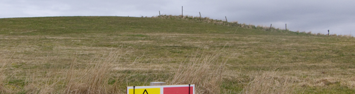
| This year they investigated strong circular features shown by geophysics and thought to be revetments [IIRC] for a Wideford-like tomb under the mound, but abandoned this for the time being when their excavation failed to turn up anything substantial. I'm sure if they had followed the common practice of checking a previous antiquarian excavation or the area adjacent they would have had better results. Instead they were (mis)led to an area away on the periphery with less-well defined arcs. At least they seem to have found the edge of the tomb or whatever. However, being perverse, I found twa other things uncovered intriguing. Into/onto the slumped stone mass there is a small sub-circular structure not having the appearance of a chamber - hopefully this is not the planti-creugh shown near the mound on early diagrams, but if not what ? A few feet from this is a depression with some stone tumble - immediately uphill of these two features in the section is an area ?robbed of stone. If it were me I would want to go back and see if either of these two items represents post-monumental activity. |
8th August 2013ce |
|
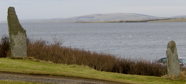
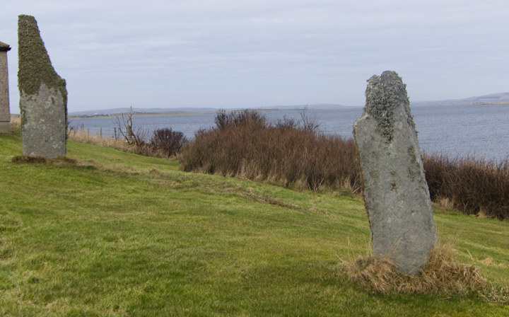
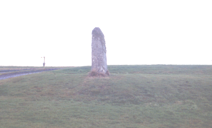
Visited 13th August 2012 I've always looked at these stones on past visits to Orkney and wondered if they were once part of a great processional avenue between Stenness and Brodgar, and always marvelled at how fantastic it would be to have such a pair of stones in your front garden. The fact that they were so close to someone's house had always deterred me previously from approaching them too closely, instead contenting myself from taking pictures from the roadside. However whilst on a tour of the Ness of Brodgar excavations we were told by our guide that the house had been bought and gifted to the excavation by a mysterious benefactor! Since it was now occupied only by archaelogists on a tea break I took the opportunity after the tour to get up close and personal with the stones. They seem to both align with Stennes as well as obviously being adjacent with the other structures being uncovered on the Ness, and it will be fascinating to see whether any further evidence of additional stones once having been present comes to light in the future, apparantly long term plans will be for the house to eventually be removed from the site to open up the landscape and allow additional excavations to take place on the site the house occupies (all depandant on securing the continuation of funding for the dig of course) It's great to be able to pay an unhurried visit to the stones in the heart of this amazing area of rich prehistoric remains, and keep your eye out for Corncrakes, the RSPB have been developing some Corncrake friendly environments along the Ness to encourage an increase in the birds numbers, we didn't see any today but we had spotted a small group of them a couple of days previously early in the morning as we were heading out to get the ferry to Hoy. |
15th September 2012ce |
|
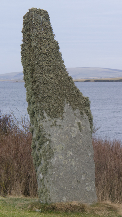
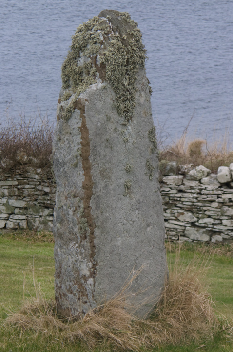
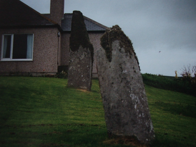
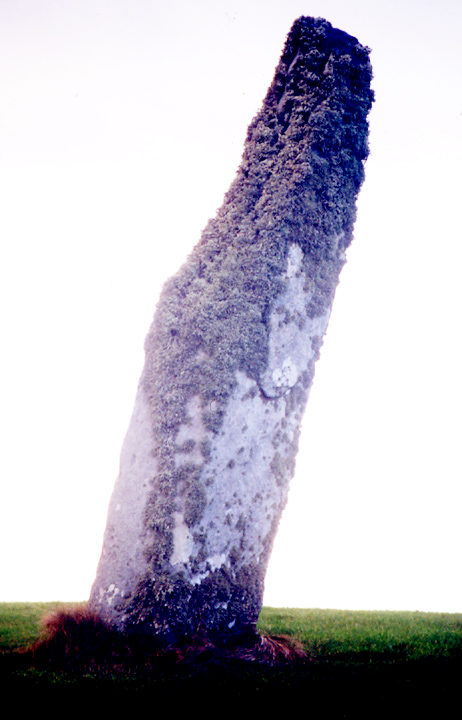
Visited 4.6.12 The B9055 can be a busy old road and this could make seeing these stones difficult if travelling by car. I waited until the evening when all was quiet and we were able to pull up next to the house. What a great feature to have in your garden! One stone is approximately 1.5 metres high and the other 3 metres high. The tops of the stones are covered in ‘hairy’ lichen – the most I have seen on a stone so far. |
Posted by CARL 9th July 2012ce |
| The trial excavation here for the Ness of Brodgar dig has uncovered another 'great wall' and it is interesting to note that this is at right angles to the standing stone pair, 'pointing' across the gap (centrally ?) |
26th August 2009ce |
|
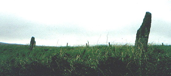
Like the barnhouse stone, these two are best seen by visiting Brogar from the Stones of Stenness sans automobile. You could see them from the road, but it would be a case of 'blink and you miss'em' or even mistake the gateposts up the road for them. Be wary though, for the road is not wide, and the cars come down fast. |
 Posted by Hob
22nd June 2004ce |
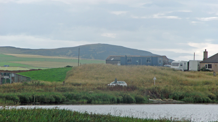
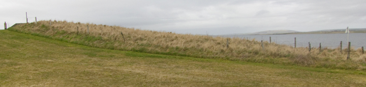
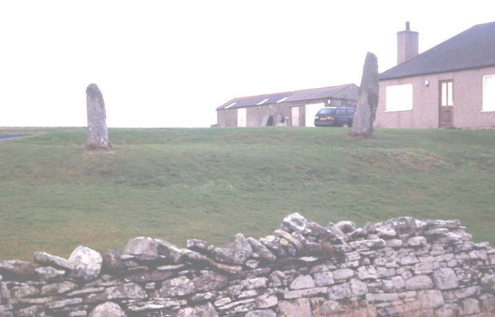
| This pair of standing stones (the 3rd pair known to have existed in this region, the only still complete pair there) should perhaps have an alternative name of Bridgend rather than Brodgar Farm as this appears to be the name of the associated cottage . It does seem passing strange though that Brodgar Cottage has a similar arrangement , with stones embedded in a small hillock parallel to the road and on the 'downhill' side of a cottage at right angles to the road. But at the farm the stones are 'only' a pair of strangely isolated gateposts . The very slight mound (before you reach the standing stones) in the area appears by geophysics to be a probable broch , there is nothing to be seen there apart from the hill itself and a big scoop showing excavation . |
23rd January 2004ce Edited 24th January 2004ce |
Miscellaneous |
|
|
In order to enlarge a field by the Bridge of Brodgar a large amount of a tumulus had to be removed as it impinged upon the corner. The labourers had cut a section 3-4' deep and thrown the earth removed up onto the mound. Amongst the discard they found what is described as a sinker. Description of 'sinker' is an incised water-worn sandstone 7 1/2 inches long, a tapered oblong with a groove around the side. One side quartered to contain sadly degraded images, other decorated with two fishes and a probable seal. Yep, it's that stone. No wonder this site had been ascribed to a [Pictish] broch. Some years before an arrow-head and a scraper, both of flint, had been found in the mound. (P.S.A.S. XXII [1887-8] article by James Noble). The mound appears to have been dug even earlier as Thomas' map of 1851 has some detail of the structure [not apparent on reproductions] including an entrance passage along the side facing the road. Cut was made near back of tumulus. Now I have had a photocopy fom the library and using an Agfa lupe my passage runs along the N side of the east lobe of a kidney shape occupying the S side of the ?top. Opposite the west lobe is a circle and then a curve runs arond the remaining [north-eastern quadrant], possibly joining the outside line of the 'kidney'. |
20th April 2010ce Edited 25th April 2010ce |
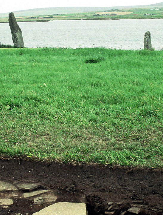
| The chambered tomb mound can be seen on 2 photos in "Current Archaeology" April 2010 article on Ness of Brodgar : p.12 behind house, p.15 behind Lochview stones [if these were part of an avenue between the stone circles it would have to be fairly sinuous to go around the mound] |
13th March 2010ce Edited 13th March 2010ce |
| I have now determined that the chambered mound (HY31SW 20 at HY30391280) is the same as the Kokna-cumming "burnt mound" (RCAMS 1946 Inventory 899, HY31SW 28). |
2nd September 2007ce |
| Until the end of the month there are guided tours of the present Ness of Brodgar dig. Went on one today and learnt that the Lochview mound is a tomb with revetments that has suffered from the whole area being levelled off in 19thC agricultural improvements. A test pit previously found scalloped and decorated Grooved Ware. Also pitchstone from Arran (found in the current excavation too, which is uncovering evidence for another chambered tomb, perhaps two). |
17th August 2006ce |
| As we now have chambered tombs at the Ness of Brodgar and the Point Of Onston perhaps the Girnaness site, lying between them near the Standing Stones Hotel, should be re-assessed. Unfortunately this enigmatic multi-period site is rather fragmentary and mostly underwater. |
24th February 2006ce |
| An apparent series of rings forming the Brodgar Farm cairn had been read in support of this being a broch. But as a result of assessing the later and clearer Ness of Brodgar Settlement geophysics results Nick Card is strongly inclined to see these as more indicative of a chambered tomb, probably of the Maes Howe type. This then explains the lack of broch buildings or secondary broch settlement. |
24th April 2005ce |
|
Excavations this past fortnight show that the Lochview settlement mound represents a series of Neolithic settlements probably covering 2.5 hectares. Towards its western outskirts geophysics may be showing us a chambered cairn. Geophysics also shows up a 'wall corner' (one of whose sides follows the modern road for about 10m) and apparent paving was revealed by a thin trench across it. Source "The Orcadian" of June 17th. http://www.orkneyjar.com/archaeology/brodgardig.htm |
18th June 2004ce Edited 18th June 2004ce |