|
|

|
|
WasdaleCrannog
|
||||||||||||||||||||||||
|
|
|
Images (click to view fullsize) |
|
|
Fieldnotes |
|
|
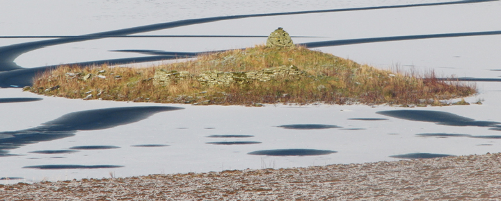
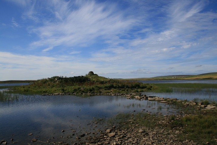
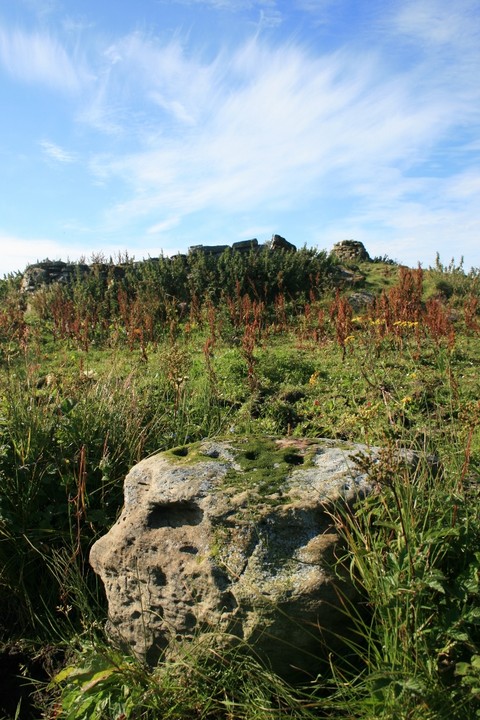
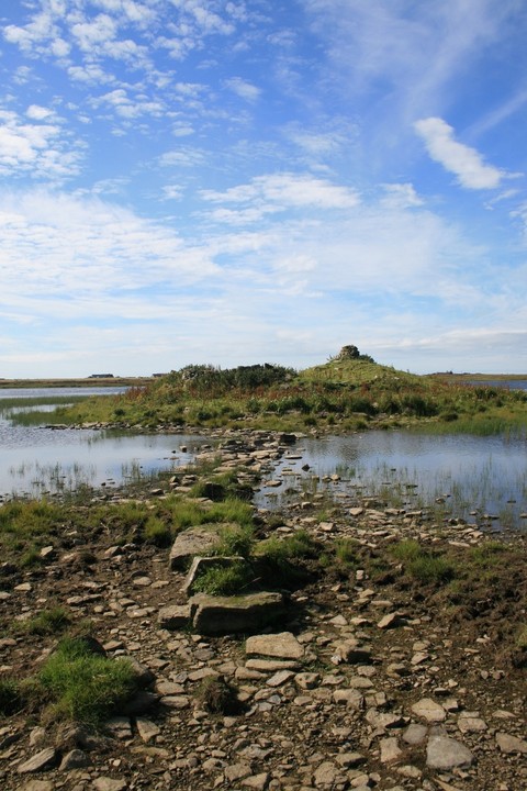
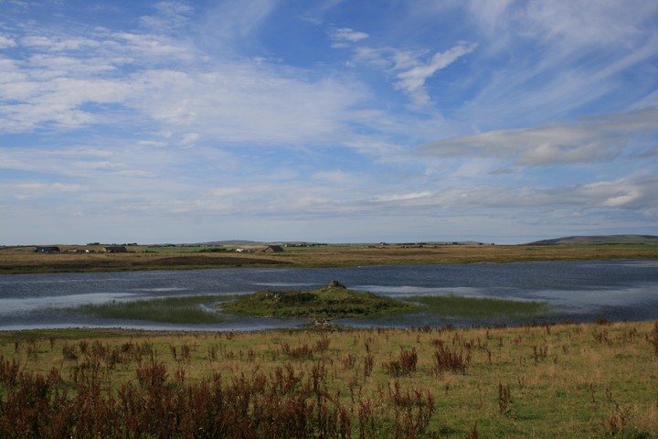
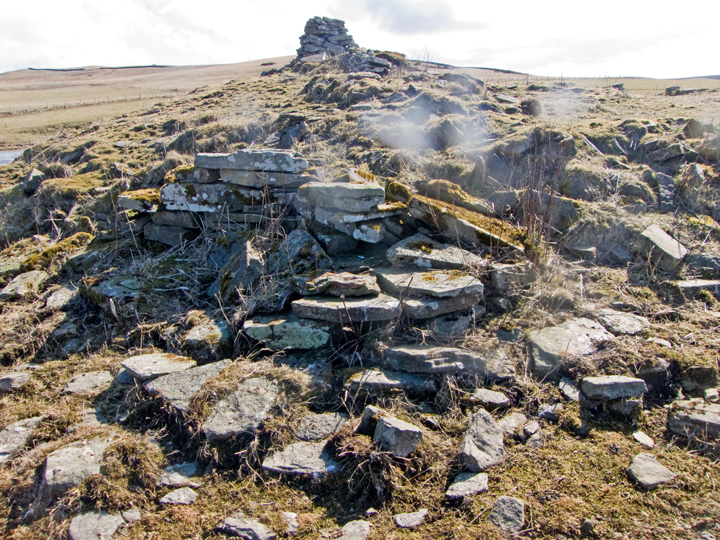
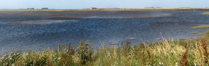
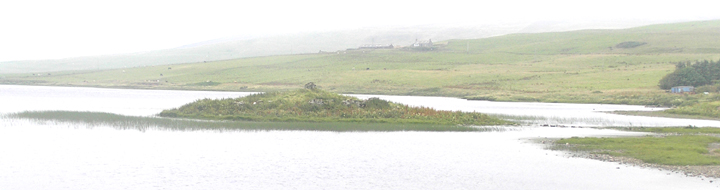
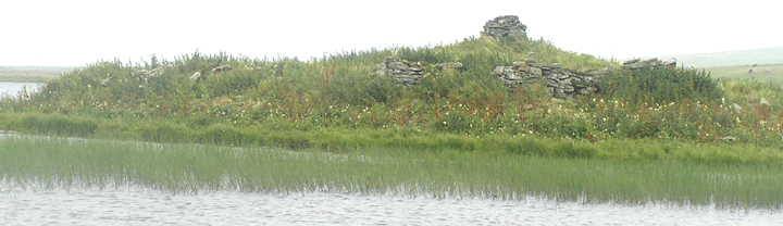
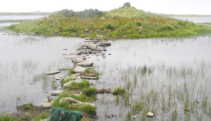
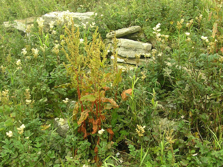
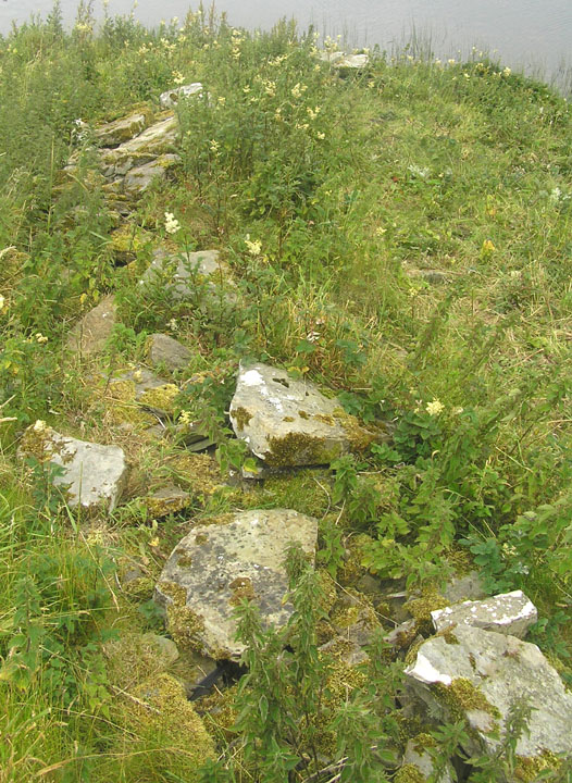
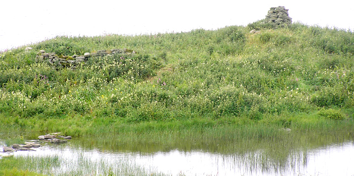
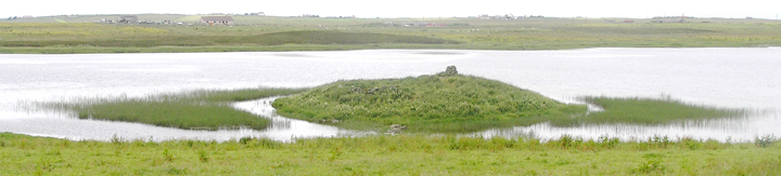
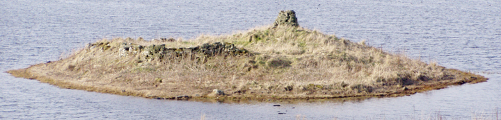
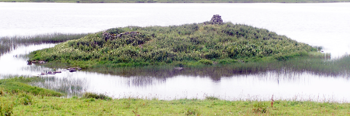
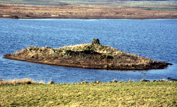
Visited 14th August 2013 There are plenty of marked parking bays at the edge of Finstown, just before you leave the village on the way to Stromness, and we left the car here to walk on to Wasdale. A gate gives access into a field next to road, across which a short walk takes you into Binscarth Wood. It’s still lovely and sunny this afternoon, but soon we enter the wood and the warmth of the day is muted by the cool green shade of the verdant canopy above us. We stick to the old drover’s path, as the other tracks through the trees are still muddy, despite the small amount of rain recently. The excited voices of kids playing on the homemade rope swings over the burn provide an accompaniment, and the walk through mature woodland seems jarring after the paucity of trees on the rest of Mainland, but it’s good to be back amongst the thickets, arboreal withdrawal symptoms being one of the few downsides of spending some time on Orkney. Despite being a veritable forest in Orcadian terms it only take a few minutes for us to be back in the sunlight as we leave the wood behind, and as the path forks a small signpost indicates we bear left to follow the footpath (the right fork will take you up towards Binscarth House). Soon the Wasdale lochan is visible, and in it the tantalising mound, its modern cairn a peedie tower surrounded by the remains of the much older lower courses of stonework. The water levels in the loch are low, making crossing the stepping stones easy, and soon we are on the island. Although the undergrowth chokes some of the lower stones there is plenty to see. The curve of an exterior wall reminds me of the construction of the walls at the Borwick broch, other stonework looks altogether more jumbled as if built on later, along with some worked stones, and a jumble of rocks just above the level of the water on the north-western side of the islet, that looks like it might have once been a rough pier or landing stage. Canmore lists an intriguing record for this site, encompassing a chapel, enclosure, ancient mound and possible dun, and as you poke about the site you can almost feel the different layers of history, like the skin on an onion, which permeate this little islet. I soon find an intriguing block of stone near to the island end of the causeway, it is pocked with four ‘cupmarks’ in a line. The depressions are too linear to be natural, but too crude to be modern workings, and I wonder just how old they really are, and whether the stone was scavenged from one of the nearby cairns on the hills overlooking the loch? We spend some time here, Ellen sketching whilst I write my fieldnotes, just taking in the landscape and atmosphere. The sunny day brings out the best of the colours, the water a coruscating blue around us, reeds flanking the islet a viridian green, with the softer pastels of the surrounding moorland below the azure sky, a perfect place to sit and ponder, and another of Orkney’s ‘off the beaten track wonders’ |
10th September 2013ce |
| With the lochan low went over causeway yesterday, seemed even more exposed than last time I managed to do this. To call it a causeway is to over-egg the pudding as it is more a line of stepping stones (warning -halfway across you have to jump onto the edge of a slab to get between stones). Saturday I had the feeling that the stones could be re-used from the original prehistoric structure on the islet, perhaps when the kirk was founded. Looking back along the mound's northern side from the far end there is a kind of stepping to the turf - one of the two contenders for causing this is a broch of course |
7th April 2013ce |
|
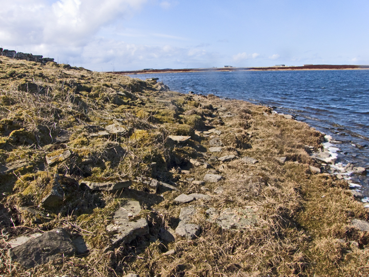
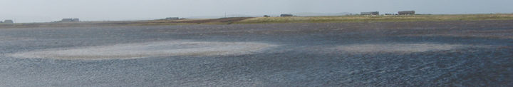
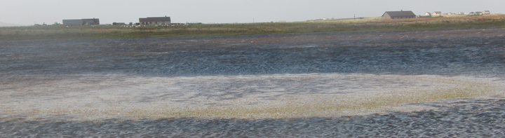
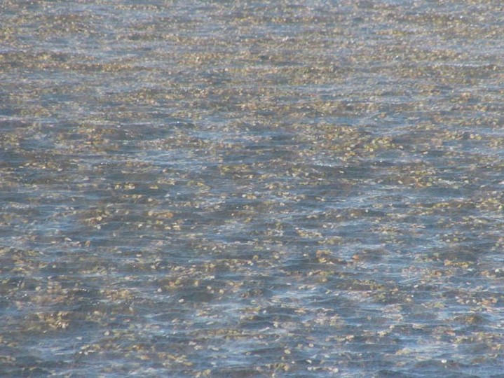
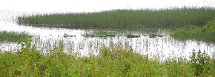
September 7th about one o'clock. Coming down Wasdale road from N. Past the traditional graveyard side [marked by a hut] the loch opens out and the bright overhead sun picks out figures in the loch, two (?conjoined) circles of dissimilar sizes on the side near the road and a long ?ellipse towards the other side and a little further north. First impression is that the gale is whipping waves that flush underlying vegeatation up to reflect underlying archaeology. But the camera later reveals that the plnts are actually a myriad small stones. Also the circles have a clear central space, so annular rings I suggest. An archaeo tells me thay in Skye exceptional conditions can bring crannogs into view. Alternately these have been mooted as fish traps of unknown age. I have always thought that there should be a Neolithic settlement below Howe Harper, as with the Cuween and Wideford Hill Cairns. Just remembered that in a field S/SW of the loch thre is what could well be a dry version of the lochbed sites, after a prolonged period of rain it is marked by a shallow pool. |
9th September 2010ce Edited 11th September 2010ce |
|
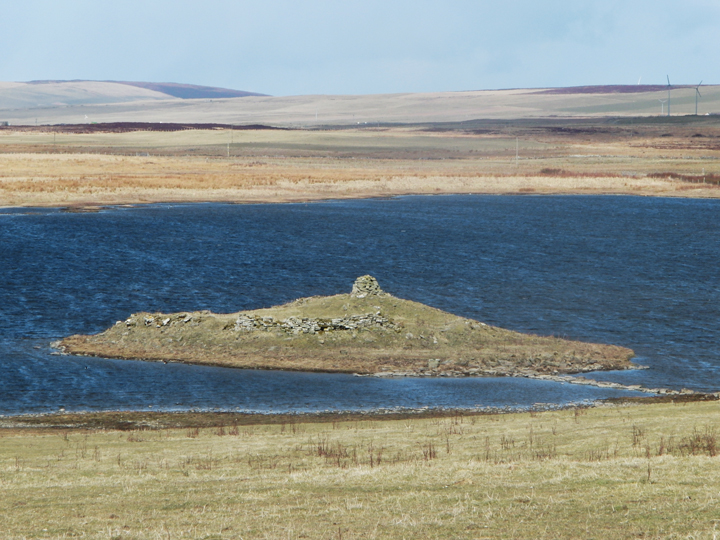
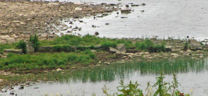
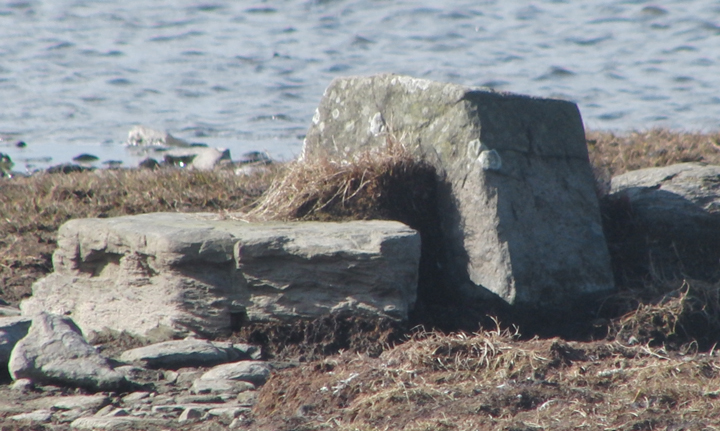
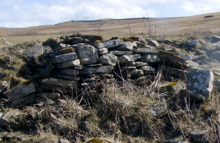
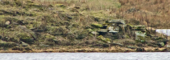
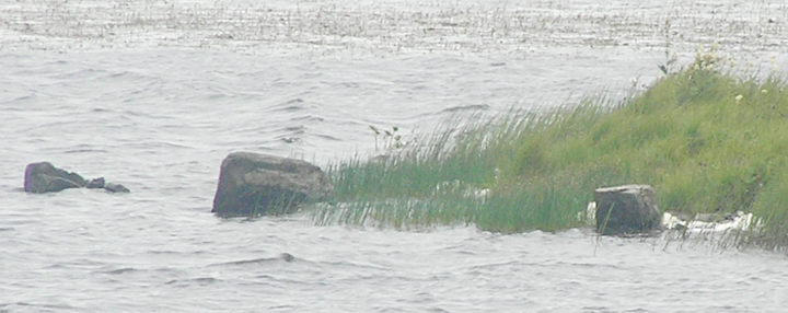
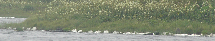
After visiting the Ring of Brodgar dig I made my long way over to the Loch of Wasdale. Couldn't quite get across to "Counrtrywoman"s other island (HY34221517) what I shall call Wasdale 2, as I wasn't sure whether the fence I saw kept the kie out. My first sight of the edgeset stones, offshore by the wooden hut, didn't look to show any regular pattern. Carrying further along this old road brought more of them to light, ones projecting less above the water, and indicated a fairly regular spacing. Despite the fact that I saw my first ones in front of that hut they could well be more further up the shoreline as there was too much 'foam' there to make anything out. I should point out, for what it's worth that there do appear to be one or more edgeset stones on the shoreline opposite the site i.e. below the road. In Orkney one or two orthostats (or facing pairs) tend to be called 'sailors graves', and more than that is a 'graveyard', but to my eyes it is most unlikely that there has been any actual burial ground here. Coming on to the now permanent island there is a greater depth of the causeway showing. Indeed it is passable now. But you will still need some care over the stepping stones in a few sections - rest the foot and then push off, test firmity on the centre of stones where these don't have an obvious incline. There is nothing to add about the large stones fronting the mound. Walking around the islet it certainly seems basically artificial, even if the stonework surrounding the mound isn't yer megalithic broch style it is definitely circular and the base survives for two or more courses. This earlier site makes its presence most felt at the sides and back of the mound, where the width is least, leading me to think that the Iron Age [? Bronze Age if a crannog first] structure occupied a site more at the northern end of the islet. Behind the mound at the back what looks to be a broch age chamber still stands about a metre high (nettles prevented close inspection. On top of the mound at the back, atop a smaller mound, is the conical modern cairn. From this an older wall runs down to the chamber, to all intents and purposes a radial [not that I'm suggesting a wheelhouse for this site]. I tried unsuccessfully to find the cist in the hind part of the mound, but towards the back, to the side of the moundlet, there is a cuboid arrangement of stones covering one long one (there being an overhang my photos may not show this). There are the lower courses of one (? two) presumably early/middle mediaeval structures to one side of the later entrance. It struck me that the later folk hoicked out the front of the earlier structure and brought it 'forward' to form their own more rectilnear site. As the causeway is some distance in front of the main earlier stuff does it really go with it ? Despite the present state of the whole islet it could once have supported a more megalithic (broch age) set of walls - there are some great stonking stones used below the farm as a shoreline field boundary or summat that might be originally monumental. With the present lower shoreline after taking my leave I was able to circle my subject and take shots not takeable close to. If you do this be aware your foot could get sucked in on muddier parts of the shore and by the marsh/heath edges of the field. Even had some close up shots of a pair of skuas - do not disturb. Only when climbing up onto the field did I see the kie in another corner of the field, so I moo-ved on. |
26th July 2008ce |
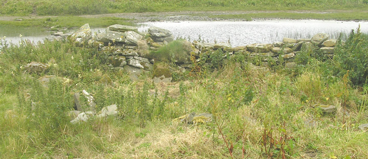
| The waters of the lochan being lower than on any of my previous visits there were several areas of ground just about breaking the surface and I could see the tops of at least one side of the short causeway to the artificial islet (though later I see a poor photograph in an hardbacked thesis shewing its entirety laid bare in a drought year). Mostly what you are aware of is the 'modern' cairn atop this creation. Like the Holm of Groundwater on the Loch of Kirbister in Orphir used to there are the traces of a wall round it at the (winter) water-level. Here, though, there is a causeway from the southern tip behind which are the remains of a massive stone rampart. Of the suspects it does sound more like a dun than a broch or any kind of roundhouse. |
4th August 2005ce |
|
Cribbing here : most of what you see is mediaeval around a modern cairn but at the west side are broch-like stones and a resemblance has been noted to 'causewayed island duns' in the Outer Hebrides . A crannog by any other name ? I have come across several sites like this but usually with causeway still obvious all the time . On a map they resemble spores attached to the shoreline , you might not even notice the ?indicative causeway if it were over a certain size and you were simply walking the shoreline rather than striking out or looking from a vantage point . This is a complicated multi-period site whose use has changed several times , so I would refer you to NMRS record HY31SW 8 on RCAHMS for further proposed history (traditionally the site of a chapel but a recent two-volume tome on early Christian sites in the Northern Isles etc. found no evidence, finding a broch origin more in accord with what's there). |
19th January 2004ce Edited 10th July 2005ce |
Miscellaneous |
|
| In 1985 Orkney's county archaeologist Raymond Lamb compared Wasdale to the pre/proto-broch gatehouse forts of Clickhimin and Huxter (Whalsay) in Shetland because the 'apron' where causeway meets islet resembles their 'landing stages' |
7th June 2011ce |
|
In the Proceedings of the Orkney Antiquarian Society the chapel site on the east side of the loch is described as evidently used by man because of the rich grass covering it, which sounds more like the north loch site. He too says that there are no signs of the kirk, apart from a few earthfast slabs. Is it possible that Dryden's plan does not have N at the top in the modern manner. This would certainly explain why he shows a 45' neck connecting it to the shore but no causeway. Except Dryden's sketch is certainly not Wasdale 2 |
29th July 2008ce Edited 29th July 2008ce |
| Having crossed over to this at a very low water level "Countrywoman" ["The Orcadian" Aug 15th 1985] recalls that traditionally a graveyard to go with the 'chapel' lay on an island at the opposite side of the loch, and recollects wading across once to find an artificial/modified island with edgeset stones at the lochward side - an area at the northern end of the loch (at HY34221517) has gone through the same vicissitudes as this site, being shown as an island on the 1882 O.S. but now a circular promontory presently [and much larger than Dryden's islet]. |
22nd July 2008ce Edited 22nd July 2008ce |
|
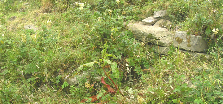
Dryden's 1871 plan and sketches of the Loch of Wasdale prove useful. The plan is quite detailed for the island and shows a short cist (1'11" x 1'7" x 1'6" deep) at the right back of this as seen from the causeway but within the encircling wall. This site looks more like a dun than a promontory fort, and more like that than a broch. At the time the water level lay 7'6" below the highest point of the island, and as a consequence it is shown connected to land by a neck 45' across. Perhaps this explains why he does not appear to show the present causeway. Orkney Room archive GB241/D21/4/1/16 (prob. duplicated in Shetland archives Petrie papers). Though it has plenty of measurements and shows the contours of level changes, the only constructions it shows are the planticru to the left as you come onto the mound and the short cist (which I failed to identify) in the top right corner. |
18th August 2005ce Edited 29th July 2008ce |