Approx east of enclosure...... inner rampart
Image credit: Robert Gladstone
Approx east of enclosure...... inner rampart

Approx northern arc...... from inner rampart.

Highlighting the substantial nature of the defences... amongst other things.


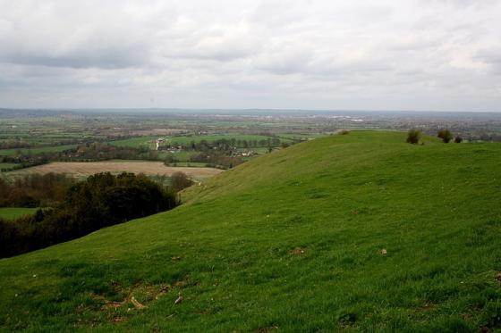
North-east......


Eastern arc, with substantial inner rampart to left......


Approx north-east (I think) ......
Cholesbury Camp is another fine Buckinghamshire Iron Age enclosure... technically a ‘plateau fort’, as opposed to ‘hillfort’... which has unfortunately been damaged by the building of a malignant church and village hall in the southern quadrant. Happily, however, the malevolent atmosphere I found at the similarly defaced, and not too distant, West Wycombe Hill is absent here. Quite the contrary, the surviving three quarters of the ancient ramparts being a joy to behold this bright morning, sunlight interacting with the fine beech trees to send a myriad shadows snaking across the ditch which separates the mainly bi-vallate defences (there would appear to be an additional bank and ditch to west and south-east, if I not mistaken?).... not to mention everywhere else, for that matter. Nice. Yeah, although the initial south-eastern arc is heavy overgrown with vegetation, the remainder of the enceinte is as aesthetically pleasing to the eye today as perhaps it is possible for any ancient fortification to be? Or to have a right to be.
The constantly changing light, and therefore colour, has my artistic consciousness – such as it is – reeling as I try to capture something of the wonder laid out before me upon the digital SLR for posterity. However as I try to do so, the archetypal ‘Tim, Nice-But-Dim’ – walking with his children, as one does – stops and eyes me curiously. Suspiciously, even... ‘what are you photographing?’ he enquires. To his credit, and before I can deliver a devastatingly acerbic ‘Morrissey-esque’ retort, he answers his own question. ‘Ah, the hillfort. I see. Jolly good’. Lucky he did so, actually, since I doubt if the aforementioned former Smiths front man would have approved of my rather feeble prospective witticism. Such is the positive vibe at Cholesbury today that everything is right with the world for a while. Can’t even think of a sarcastic comment to defend myself with...
The ‘fort is easily located within the environs of the chocolate box village. Simply head for the Village Hall – making sure you keep an eye out for the many cyclists who flock to the area at weekends (or so it would appear) – and advance up the church driveway situated to its left, from where paths access the ramparts. The interior of the enclosure is now the site of equestrian activity. But I can deal with that. Hey, I can deal with any thing at Cholesbury.
Cholesbury Hill fort.
Situated in the village of Cholesbury on the north side, a late iron age plateau fort exists.Termed a plateau fort as it lies on level ground.
Known locally as the Danes camp.
Excavated in 1932 by Mr Day kimble, He surmised that the main occupation is dated to the 2nd and 1st Centuries BC.
The site was in use prior to that in the earlier Iron age as a more cruder hand made pottery was found.
Pottery evidence suggests the site continued into the Roman period as some samian was found in some of the hearths.
The excavations cut into the banks and ditches in several places and a trench was cut across the middle of the interior to determine any occupation.
The defences:
The main defences of this oval fort contains 11 acres.
Three quarters of the defences are intact but has been destroyed nearest the village.
The destroyed defences that were filled -in can still be detected in the gardens of the grange and the priory.
In most places where the bank is complete it rises 13 feet above the bottom of the ditch in a ‘V’shape.
The opposite bank being almost of equal height.
The bank and ditch was constucted in the Glacis fashion, meaning that the steepness of the bank was deemed sufficient defence.
A second bank and ditch was under construction but never was completed.
This second defence which is inferior circles approximatly half of the primary defence.
Duel defences have been thought to be a defence against sling warfare which came into fashion late in the Iron age.
The gate:
No definable gate remains today, it is presumed to be at the entance to the church which sits inside the defences of the fort(St Lawrence).
There are gaps in the banks but none are defined as a gate..
The interior:
Two ponds exist within the fort. One of ponds nearest the church is known as holy pond and is said to never dry up, presumed to fed by a spring.
Seven hearths were found when Day Kimble cut a trench across the interior.
Some of the hearthes contained pottery suggesting cooking fires.
A portion of the hearthes contained Iron slag (Fayalite magnetite) with hard baked clay earth.
It is presumed that some of the hearths were smelting hearths. These smelting hearths tended to be near the revetment or the back of the defences.
The cooking hearths concentrated nearer the centre of the fort.
Of the finds in the Alylesbury museum. A piece of Nieder mendig lava was found which was thought to be a piece of a quern stone.
A near complete cooking pot was found next to one of the hearths..
The interior of the fort was under the plough until the last war then reverted to pasture so no features exist above ground.
Mr Day kimble suggested that the site was in existance prior to new race or tribe taking over.
Crude handmade pottery dating to the earlier Iron age was supaseded by a superior wheel thrown pottery. This is the time the defences went up.
The defences could have been put up to defend an important resourse.
Iron smelting.. The immediate area has a vast resourse of limestone which is the flux ingriedient in Iron production.
The site is likend to an industrial site in the production of Iron artifacts.
Other sites in the area are associated with the production of Iron.
Brays wood moated site close by has evidence of iron smelting..
Some names exist in the region that hint of a wider iron smelting industry.
Ashley green, cindery wood, kings ash and ashridge are all very close to Cholsbury
A tree covered Ironage hillfort, it has 2 banks, with a ditch in between, and another bank and ditch to the SE and W
The fortifications enclose Cholesbury Church
From the website which Kammer links to below:
..a somewhat spooky story I unearthed about Cholesbury Camp a while back. Ever heard of the ‘Screaming Pigs of Cholesbury’? Well the story is told of strange ‘unearthly noises’ emanating from Camp and the reluctance of even the most fearless of the men of the village to enter the Hillfort after dusk. So if anyone fancying a stroll as darkness falls is welcome to test out this theory let me know what happens!
An excellent page about Cholesbury Camp, including a detailed description of the site, details about access, a drawing of the defenses and a plan of the site.