The Modern Antiquarian
Log in
|
Register
Home
Latest Posts
Forums
Maps
Help
Browse Sites
News
Blog
Contributors
The Books
Select
-
Belgium
Denmark
Eire
France
Germany
Greece
Italy
The Netherlands
Norway
Portugal
Republic of Malta
Spain
Sweden
Switzerland
United Kingdom
England
Southern England
Devon
Blackdown Rings
Hillfort
Blackdown Rings (Hillfort) on The Modern Antiquarian, the UK & Ireland's most popular megalithic community website. 1 image, 1 fieldnote, plus information on many more ancient sites nearby and across the UK & Ireland.
Image © Gill
Nearest Town:
East Allington (5km SE)
OS Ref (GB):
SX719521 /
Sheet: 202
Latitude:
50° 21' 15.17" N
Longitude:
3° 48' 3.33" W
Added by
daveyravey
Images (1)
Fieldnotes (1)
0 discussions
Start a topic
Show |
Hide
Web searches for Blackdown Rings
Flickr
Google
Google Images
MAGIC
The Megalithic Portal
Bing
Stone Pages
Streetmap.co.uk
Wikipedia
Show map
(inline Google Map)
- Sites within 20 km -
-
Stanborough Camp (5.31km E) (1 post)
Ritson Barrows (5.51km ENE) (1 post)
Halwell Camp (6.57km ENE) (1 post)
Cantrell Stone Row (7.95km WNW) (5 posts)
Western Beacon (8.42km WNW) (22 posts)
Cuckoo Ball (8.47km WNW) (12 posts)
Butterdon Hill Chambered Tomb (8.69km WNW) (7 posts)
Butterdon Hill cairn circle (9.17km WNW) (6 posts)
Butterdon Hill cairns (9.17km WNW) (23 posts)
Addicombe (9.33km WNW) (0 posts)
Aish Ridge (9.53km NW) (4 posts)
Butterdon Hill (north) cairn (9.59km WNW) (4 posts)
Weatherdon Hill (9.67km WNW) (3 posts)
Brent Hill (9.71km NNW) (1 post)
Spurrell's Cross Stone Row (9.8km WNW) (8 posts)
Glaze Meet (10.02km WNW) (4 posts)
Butterdon stone row (10.15km WNW) (19 posts)
Butter Brook Ford (10.24km WNW) (6 posts)
Glasscombe Ball (10.34km WNW) (5 posts)
Glasscombe Ball North (10.37km WNW) (1 post)
Glasscombe Corner (10.44km WNW) (13 posts)
Corringdon Ball Long Barrow (10.54km NW) (16 posts)
Corringdon Ball Stone Row (10.65km NW) (16 posts)
Piles Hill longstone (10.76km WNW) (14 posts)
Harford Moor (10.95km WNW) (17 posts)
Piles Hill cairns (10.98km WNW) (10 posts)
Piles Hill stone row (11.32km WNW) (3 posts)
Burford Down cairn and cist (11.42km WNW) (9 posts)
Burford Down (11.43km WNW) (23 posts)
Sharp Tor (11.88km WNW) (6 posts)
Stalldown South-East (12.22km WNW) (10 posts)
Three Barrows (12.3km WNW) (10 posts)
Woodbury (Dartmouth) (12.57km E) (1 post)
Rider's Rings (12.86km NW) (0 posts)
Hillson's House (13km WNW) (8 posts)
Stalldown Stone Row Cairn S (13.03km WNW) (6 posts)
Harbourne Head (13.09km NNW) (6 posts)
Harbourne Head cairns (13.27km NNW) (3 posts)
Stalldown Stone Row (13.38km WNW) (49 posts)
Bolt Tail (13.41km SSW) (1 post)
Stalldown Stone Row Cairn NE (13.45km WNW) (7 posts)
Stalldown cairn circle (13.46km WNW) (5 posts)
Stalldown Stone Row Cairn NW (13.52km WNW) (7 posts)
Stalldown Cairns (13.64km WNW) (7 posts)
Gripper's Hill (13.79km NW) (15 posts)
Harrowthorn Plantation North (13.84km WNW) (2 posts)
Brockhill Foot West (13.93km NW) (10 posts)
Eastern White Barrow (14.06km NW) (1 post)
Brockhill Ford West (14.09km NW) (2 posts)
Coombebrook North East (14.13km WNW) (2 posts)
Brockhill Enclosed Settlements (14.22km NW) (1 post)
Dean Moor (14.35km NW) (9 posts)
Blatchford Bottom settlements (14.43km WNW) (3 posts)
Dendles Waste (14.82km WNW) (2 posts)
Western White Barrow (14.83km NW) (4 posts)
Stall Moor Stone Circle (14.87km WNW) (30 posts)
Biller's Pound (14.95km NW) (3 posts)
Snowdon (15.07km NW) (7 posts)
Ranny Brook (15.14km WNW) (4 posts)
Hook Lake (15.19km WNW) (4 posts)
Hook Lake (15.21km NW) (5 posts)
Buckland Ford Cairn Circle (15.22km NW) (10 posts)
Erme Plains (15.23km WNW) (1 post)
Huntingdon Warren Settlement (15.25km NW) (2 posts)
Stall Moor Cairn (15.29km WNW) (7 posts)
Heap of Sinners (15.84km NW) (14 posts)
Penn Beacon South (15.84km WNW) (3 posts)
Erme Pound (15.86km NW) (5 posts)
Pupers Hill (15.89km NW) (15 posts)
Penn Beacon (16.11km WNW) (2 posts)
Hembury Castle (16.4km N) (26 posts)
Cholwich Town (destroyed) (16.8km WNW) (2 posts)
Shell Top (16.87km WNW) (3 posts)
Beacon Hill (16.94km NE) (1 post)
Mardle Valley (17.08km NW) (2 posts)
Tory Brookhead (17.42km WNW) (7 posts)
Tory Brookhead (17.47km WNW) (0 posts)
Stall Moor Stone Row (17.73km NW) (14 posts)
Grim's Grave (17.83km WNW) (14 posts)
Spanish Lake (18.15km WNW) (1 post)
Willings Walls Reave (18.29km WNW) (2 posts)
Langcombe Brook / Deadman's Bottom (18.45km WNW) (36 posts)
Trowlesworthy Warren (18.48km WNW) (32 posts)
Trowlesworthy Stone Row East (18.49km WNW) (23 posts)
Hen Tor North / Shavercombe Brook (18.57km WNW) (8 posts)
Trowlesworthy Stone Row West (18.63km WNW) (27 posts)
Emmets Post (18.69km WNW) (2 posts)
Ryder's Hill (18.76km NW) (3 posts)
Little Trowlesworthy Tor (18.81km WNW) (2 posts)
Trowlesworthy (18.81km WNW) (0 posts)
Collard Tor (18.83km W) (12 posts)
Great Gnat's Head (18.83km WNW) (4 posts)
Willings Walls Warren cist (18.91km WNW) (2 posts)
Calveslake Tor (18.95km WNW) (3 posts)
Boringdon Camp (18.98km W) (12 posts)
Denbury Hillfort round barrows (19.03km NNE) (6 posts)
Plym Steps (19.15km WNW) (10 posts)
Denbury (19.16km NNE) (9 posts)
Plym Steps Round Cairn (19.16km WNW) (5 posts)
Ditsworthy Cairn Circle (19.19km WNW) (2 posts)
Trowlesworthy Warren (19.39km WNW) (2 posts)
Saddlesborough summit cairns (19.45km WNW) (4 posts)
Higher Hartor Tor (19.47km WNW) (4 posts)
Holne Moor Triple Row (19.48km NNW) (2 posts)
Saddlesborough (19.5km WNW) (0 posts)
Willings Wall Warren (19.54km WNW) (3 posts)
Drizzlecombe Megalithic Complex (19.61km WNW) (131 posts)
Saddlesborough settlement (19.64km WNW) (10 posts)
Legis Tor Cist (19.7km WNW) (6 posts)
Holne Moor (19.71km NW) (3 posts)
Skir Hill (19.78km NW) (1 post)
Ditsworthy Warren (19.89km WNW) (8 posts)
Aller Brook (19.91km NNW) (2 posts)
West Saddlesborough Hut Circles (19.94km W) (11 posts)
West Saddlesborough Stone Row & Cairn Circle (19.94km W) (21 posts)
Shaugh Moor (19.94km W) (1 post)
- Add -
-
Add news
Add an image
Add fieldnotes
Add folklore
Add miscellaneous
Add a link
-
Add a site
Add a nearby facility
Add an alternative name/spelling
Images
(click to view fullsize)
Add an image
Fieldnotes
Add fieldnotes
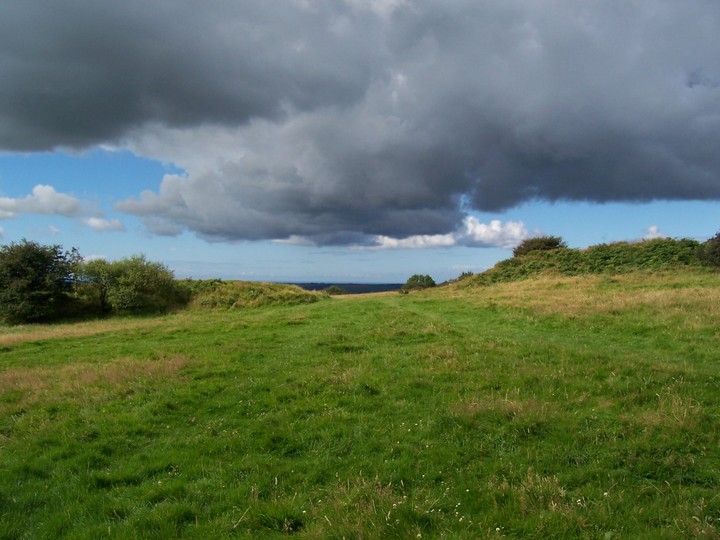
A large Iron Age embanked enclosure with Norman Motte and Bailey. Impressive banks and views all around. There is a small car park and plaque and the site is well sign-posted.
Comments (0)
|
Add a comment
|
Permalink
Posted by
daveyravey
4th January 2004ce

 Posted by daveyravey