The Modern Antiquarian
Log in
|
Register
Home
Latest Posts
Forums
Maps
Help
Browse Sites
News
Blog
Contributors
The Books
Select
-
Belgium
Denmark
Eire
France
Germany
Greece
Italy
The Netherlands
Norway
Portugal
Republic of Malta
Spain
Sweden
Switzerland
United Kingdom
England
Southern England
Suffolk
Black Ditches South
Dyke
Black Ditches South (Dyke) on The Modern Antiquarian, the UK & Ireland's most popular megalithic community website. 1 image, plus information on many more ancient sites nearby and across the UK & Ireland.
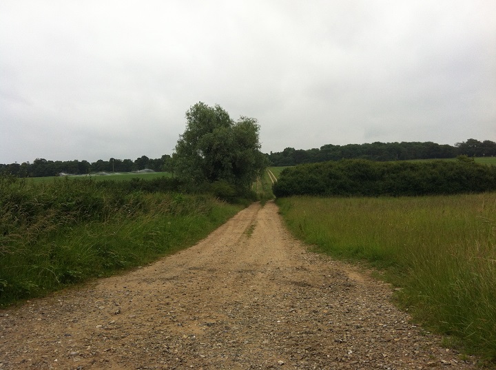
Image © ruskus
Nearest Town:
Bury St Edmunds (9km ESE)
OS Ref (GB):
TL774686 /
Sheet: 155
Latitude:
52° 17' 11.04" N
Longitude:
0° 36' 4.35" E
Images (1)
0 discussions
Start a topic
Show |
Hide
Web searches for Black Ditches South
Flickr
Google
Google Images
MAGIC
The Megalithic Portal
Bing
Stone Pages
Streetmap.co.uk
Wikipedia
Show map
(inline Google Map)
- Sites within 20 km -
-
Black Ditches North (3.59km NNW) (0 posts)
Icklingham (3.9km NNW) (1 post)
King's Forest Barrow (5.37km NE) (2 posts)
Three Hills (6.39km NW) (1 post)
Hill of Health (6.74km ENE) (4 posts)
Howe Hill (7.78km WSW) (3 posts)
How Hill (7.83km NNW) (3 posts)
Traveller's Hill (8.9km NE) (1 post)
Chippenham Barrow Cemetery (10.2km WSW) (2 posts)
Seven Hills (Rymer) (10.22km ENE) (1 post)
Troston Mount (13.34km ENE) (3 posts)
Mill House Barrow (13.92km NE) (1 post)
Honington Barrows (14.04km ENE) (1 post)
Moor Farm Barrow (15.96km W) (1 post)
Tutt Hill (16.62km NE) (1 post)
Thetford Castle (17.39km NE) (30 posts)
Seven Hills Barrows (18.2km NE) (3 posts)
Seven Hills (Rushford) (18.34km NE) (0 posts)
Partridge Hall Long Barrow (19.52km WSW) (1 post)
Pepper Hill (19.62km N) (5 posts)
- Add -
-
Add news
Add an image
Add fieldnotes
Add folklore
Add miscellaneous
Add a link
-
Add a site
Add a nearby facility
Add an alternative name/spelling
Images
(click to view fullsize)
Add an image
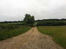 Image © ruskus