The Modern Antiquarian
Log in
|
Register
Home
Latest Posts
Forums
Maps
Help
Browse Sites
News
Blog
Contributors
The Books
Select
-
Belgium
Denmark
Eire
France
Germany
Greece
Italy
The Netherlands
Norway
Portugal
Republic of Malta
Spain
Sweden
Switzerland
United Kingdom
England
Northern England
Cumbria
Bleaberry Haws
Torver High Common Dyke
Dyke
Torver High Common Dyke (Dyke) on The Modern Antiquarian, the UK & Ireland's most popular megalithic community website. 1 image, plus information on many more ancient sites nearby and across the UK & Ireland.
Image © Chris Bickerton
Nearest Town:
Ambleside (15km NE)
OS Ref (GB):
SD264946 /
Sheets: 96, 97
Latitude:
54° 20' 28.96" N
Longitude:
3° 7' 56.03" W
Images (1)
0 discussions
Start a topic
Show |
Hide
Web searches for Torver High Common Dyke
Flickr
Google
Google Images
MAGIC
The Megalithic Portal
Bing
Stone Pages
Streetmap.co.uk
Wikipedia
Show map
(inline Google Map)
- Sites within 20 km -
-
Bleaberry Haws (0km N) (15 posts)
Bleaberry Haws Summit Cairn (0.23km ENE) (4 posts)
Bleaberry Haws Cairn (0.45km NNE) (11 posts)
Bleaberry Haws Ringcairn (0.5km NE) (7 posts)
Banniside (3.1km NE) (15 posts)
Lead Pike (4.02km NW) (3 posts)
White Borran (5.5km SSE) (0 posts)
Giant's Grave (6.72km S) (20 posts)
Cairn to SW of Hardknott Castle (8.17km WNW) (2 posts)
Wrynose Pass Stone (8.89km N) (5 posts)
Great Burney (8.94km SSE) (12 posts)
Rusland (8.98km ESE) (8 posts)
Castle Howe, Little Langdale (9.28km NNE) (3 posts)
Ash House (10.23km SW) (15 posts)
The Beacon (10.51km SSE) (8 posts)
Great Langdale (11.2km N) (20 posts)
Sunkenkirk (11.27km SW) (162 posts)
Kirkby Moor (11.66km S) (5 posts)
Brat's Hill (11.89km WNW) (32 posts)
The Kirk (11.95km S) (7 posts)
White Moss (12.03km WNW) (55 posts)
Copt Howe (12.24km NNE) (72 posts)
Elterwater Common (12.26km NE) (1 post)
Boat Howe (12.27km WNW) (14 posts)
Mickleden Beck (12.28km NNW) (9 posts)
Low Longrigg (12.29km WNW) (20 posts)
Loft Crag (12.56km N) (5 posts)
Langdale Axe Factory (12.62km N) (54 posts)
Thorn Crag (12.67km N) (3 posts)
Harrison Stickle (12.71km N) (4 posts)
Whitrow Beck (12.97km WSW) (6 posts)
Barnscar (13.21km W) (19 posts)
Maiden Castle (Wastwater) (13.41km WNW) (5 posts)
Grasmere (15.11km NNE) (12 posts)
Black Combe (15.66km SW) (12 posts)
Glaramara Stone Axe Factories (15.97km NNW) (1 post)
Glaramara (Northern) Stone Axe Factory (16.07km NNW) (4 posts)
Eller Barrow (17.18km SSE) (1 post)
Lacra (17.4km SW) (12 posts)
Lacra Stone Row (17.41km SW) (0 posts)
Lacra D (17.49km SW) (14 posts)
Lacra A (17.54km SW) (10 posts)
Lacra E (17.55km SW) (3 posts)
Hall Foss (17.56km WSW) (1 post)
Lacra Stone Avenue (17.63km SW) (7 posts)
Lacra C (17.78km SW) (7 posts)
Lacra B (17.85km SW) (22 posts)
Dunmail Raise (18.2km NNE) (13 posts)
High Hugill Settlement (18.35km ENE) (3 posts)
Giant's Grave (18.48km SW) (66 posts)
Seatallan (18.58km WNW) (5 posts)
Kirkstones (18.81km WSW) (0 posts)
Annaside (18.88km WSW) (1 post)
Hird Wood Circle (18.89km NE) (17 posts)
Skelmore Heads Longbarrow (19.2km SSE) (12 posts)
Toad Stone (19.34km ESE) (3 posts)
Great Urswick Fort (19.5km SSE) (14 posts)
The Kirkstone (19.61km NE) (13 posts)
Middle Barrow (19.69km S) (9 posts)
- Facilities within 20 km -
-
Scarr Head Farm (Camping Site: 1.9 km ENE)
The Church House Inn (Pub: 2.1 km E)
Sun Hotel (Hotel: 4.7 km NE)
Ruskin Museum (Museum: 4.9 km NE)
Hollins Farm Campsite (Camping Site: 10.8 km WNW)
Great Langdale Campsit... (Camping Site: 11.4 km N)
The Old Dungeon Ghyll ... (Hotel: 11.7 km N)
Wainwrights Inn (Pub: 12.1 km NNE)
Queens Hotel (Hotel: 14.9 km NE)
Unicorn Inn (Hotel: 15 km NE)
The Armitt Gallery, Mu... (Museum: 15.1 km NE)
Wasdale Head National ... (Camping Site: 15.3 km NW)
Travellers Rest (Hotel: 16 km NNE)
Wasdale Head Inn (Hotel: 16.1 km NW)
Watermill Inn (Hotel: 18.6 km ENE)
- Add -
-
Add news
Add an image
Add fieldnotes
Add folklore
Add miscellaneous
Add a link
-
Add a site
Add a nearby facility
Add an alternative name/spelling
Images
(click to view fullsize)
Add an image
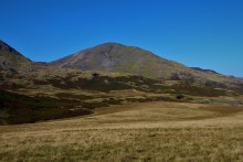 Image © Chris Bickerton

