|
|

|
|
Uley Bury CampHillfort
|
||||||||||||||||||||||||
|
|
|
News |
|
Fort Awarded Lottery MoneyThis 2,500-year-old Iron Age fort is to be reclaimed from nature, thanks to a share of a £1.4 million 'Caring for the Cotswolds' lottery award. Scheme leader is Jenny Phelps, from the Cotswold Area of Outstanding Natural Beauty Project says: "It will be a national example... continues... |
 Posted by Rhiannon
19th August 2004ce Edited 19th August 2004ce |
Images (click to view fullsize) |
|
Photographs: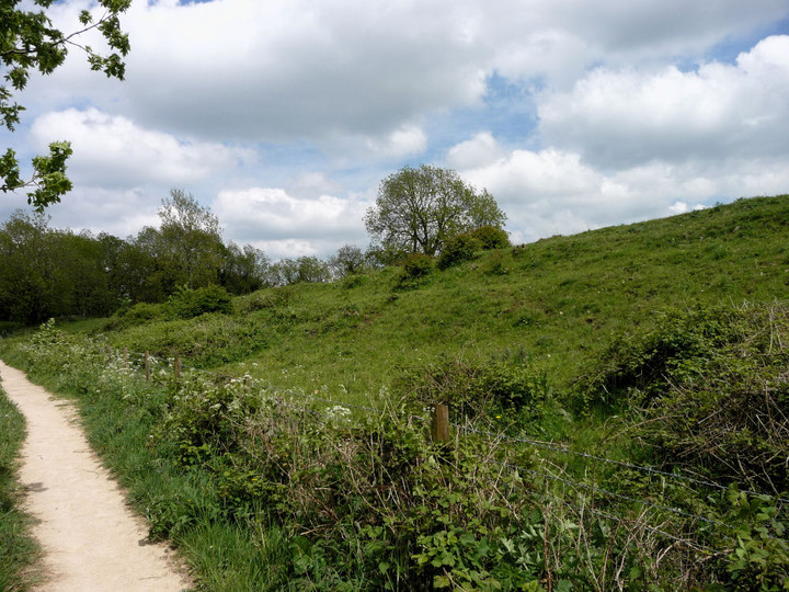
 Maps / Plans / Diagrams:
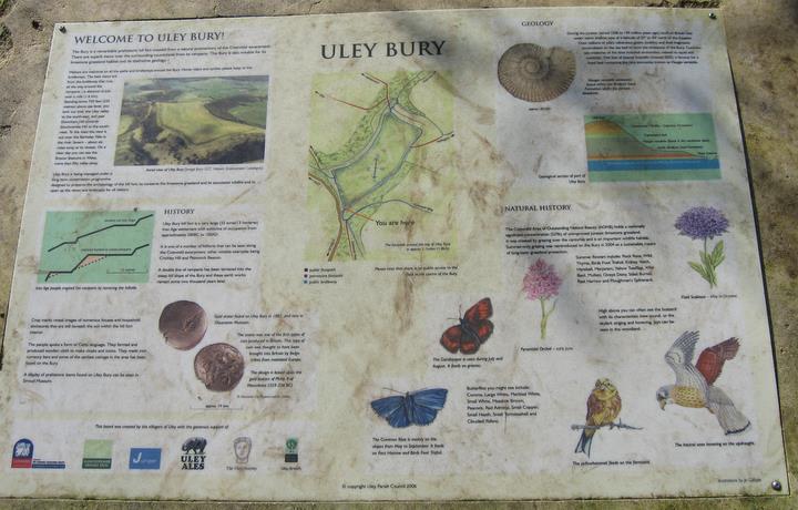 Artistic / Interpretive:
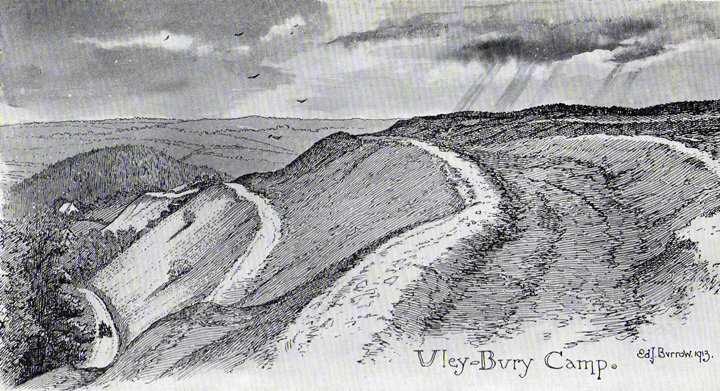
|
Fieldnotes |
|
|
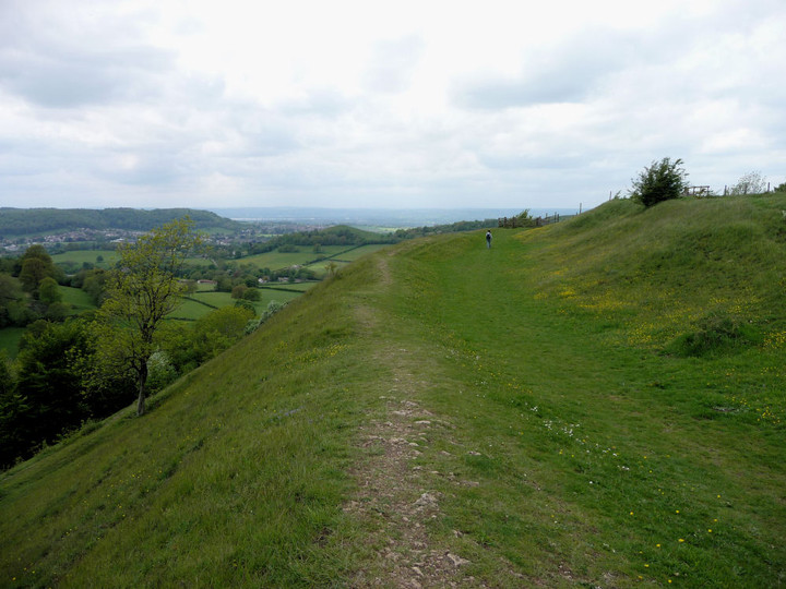
Visited 28.12.11 Last time I came here Dafydd was a baby sat in the car. Now the baby sitting in the car was Sophie. Who would have thought? On this cold but bright winter's afternoon there were plenty of walkers about. As I made my way up to the Hillfort a group of ramblers were coming the other way. The cold wind was fairly biting. This time I walked right around the Hillfort which took longer than I was expecting – about 45 minutes (sorry Karen!). The Hillfort is certainly a big one and the views are simply stunning. I was thinking that this area would be great for a school trip to teach children a bit about their ancestors. The children could walk around the Hillfort (discussing how it would have originally looked etc) then stop off at Hetty Pegler's Tump before having lunch / run around etc at the Coakley point viewpoint parking area and of course having a look at Nympsfield Long Barrow. What a great day out! They could then do projects on what they had seen / prehistoric life. Any school teachers reading this?!! |
Posted by CARL 5th January 2012ce |
|
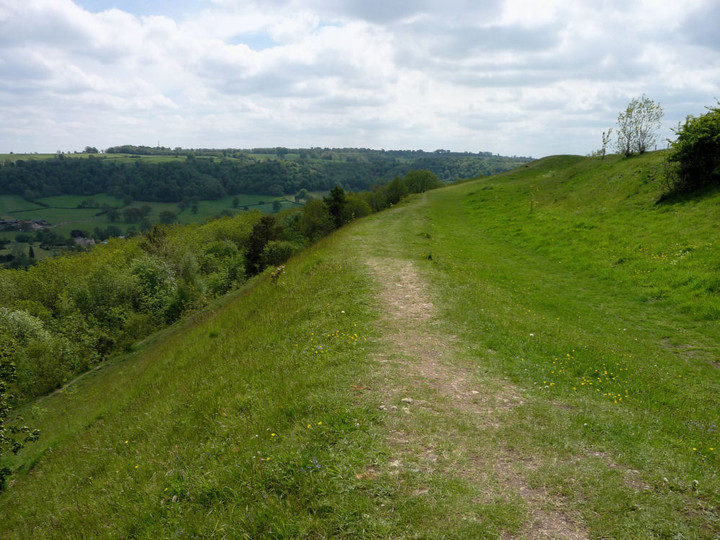
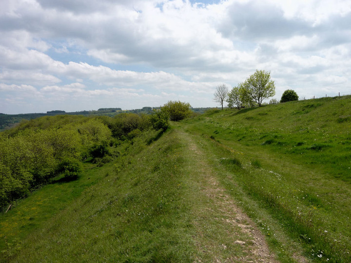
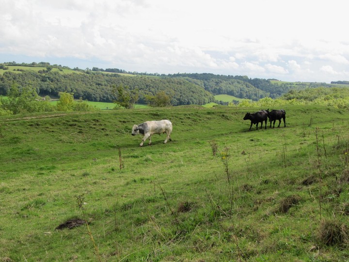
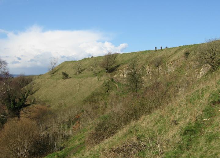
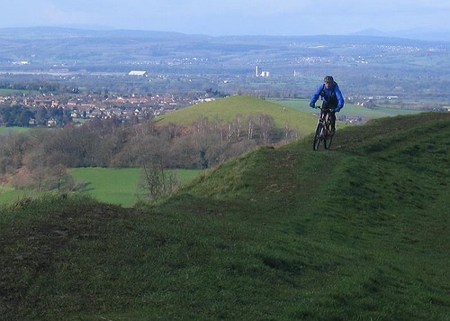
This must be one of the largest hill-forts I've yet seen; we walked here along the Cotswold Way from Nympsfield long barrow. Gorgeous walk on an up/down path with the steep wooded slopes of the Cotswold escarpment to our right; to our left, evidence of past quarry work had resulted in some impressive cave-like clefts in the rock face. We had lunch sitting on the high rampart of Uley Bury overlooking the landscape to the south. A chunky white bull appeared between the ramparts, strolling purposefully along leading a small herd of young cows behind him - heading no doubt for the water trough near the entrance to the hill-fort. We walked around the ramparts only to find a larger herd of young cows congregated by the gate we needed to walk through. As we then noticed the white bull heading back in our direction we climbed onto the top of the hillfort (which is a massive open field) making our way diagonally back towards the water trough. From here another lovely wooded walk along to Hetty Pegler's Tump. Splendid! |
 Posted by tjj
7th September 2010ce Edited 7th September 2010ce |
| A very easy site to visit with lovely views. When I visited a hot air balloon was drifting silently overhead and we gave the people in the basket a wave! There were lots of walkers about. I went to the wrong hill first (bit further down the road) but didn't realise until I had battled my way through the trees and reached the top! On the plus side I did see two roe deer which more than made the effort worthwhile. I really like this part of the world. |
Posted by CARL 17th June 2010ce |
|
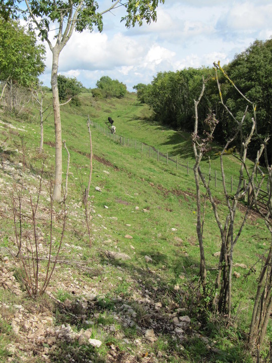
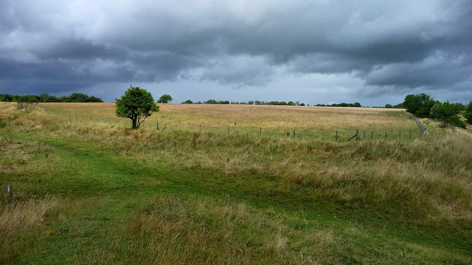
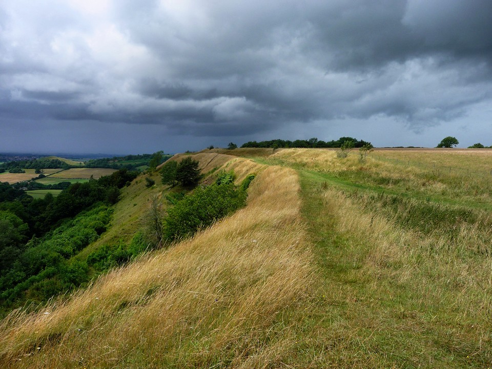
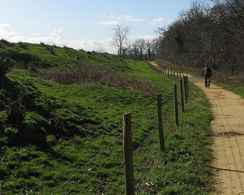
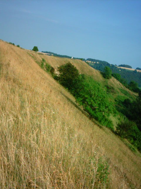
Visited 19.7.09, walking from Cam & Dursley station, via a climb up Peaked Down. Sadly the weather was terrible, with heavy showers being the order of the day. As reported previously, the interior of the fort is clear of vegetation and is being grazed by cattle (NB: the interior of the fort is not open to the public, but can be seen easily from the footpath that runs around the whole of the fort at the level of the rampart). The fort makes good use of an unusually rectangular promontory, with steep slopes on three of the four sides. After leaving here I had intended a visit to Hetty Pegler's Tump, but mistakenly took the Cotswold Way to avoid the busy main road - mistakenly as I hadn't realised that the long barrow is not accessible from the footpath. |
 Posted by thesweetcheat
14th August 2009ce Edited 7th September 2010ce |
|
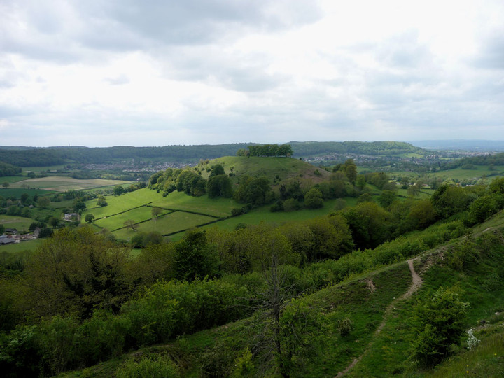
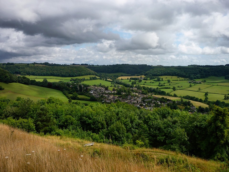
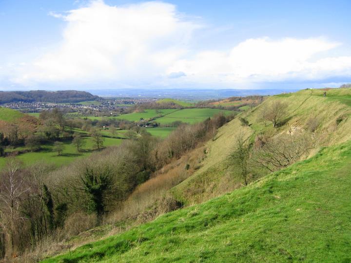
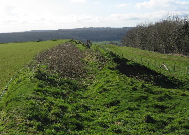
16th Jan 2005 Can confirm Rhianon's news that they are working to reclaim Uley Bury from nature. They're making a bit of a mess of it but I am sure things will improve. Great views down to the Severn and across into Wales, so this would have been an easy place to defend. The walk around the fort is about a mile in length, most of it being in the ditch, apart from the far west end. |
19th January 2005ce Edited 25th January 2005ce |
|
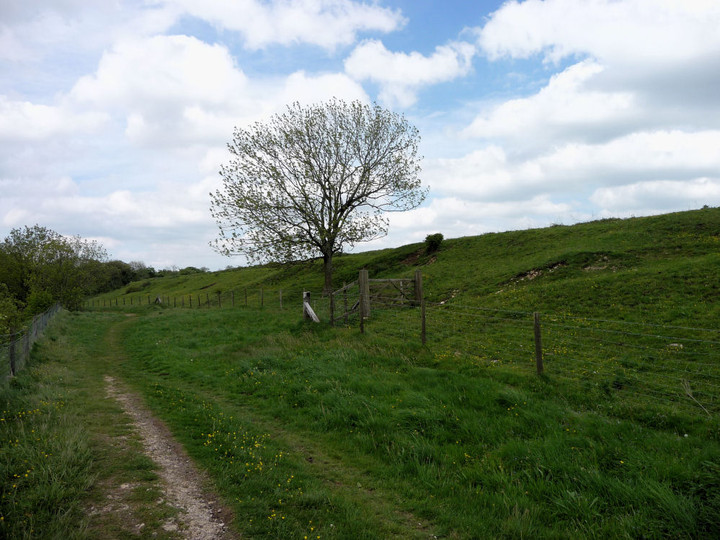
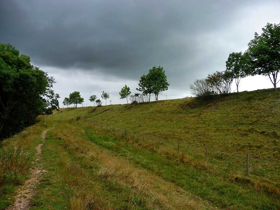
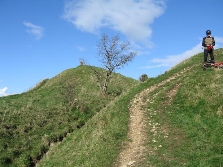
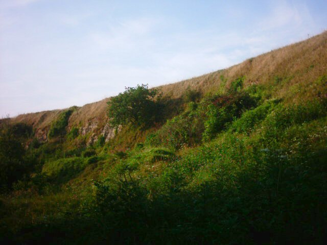
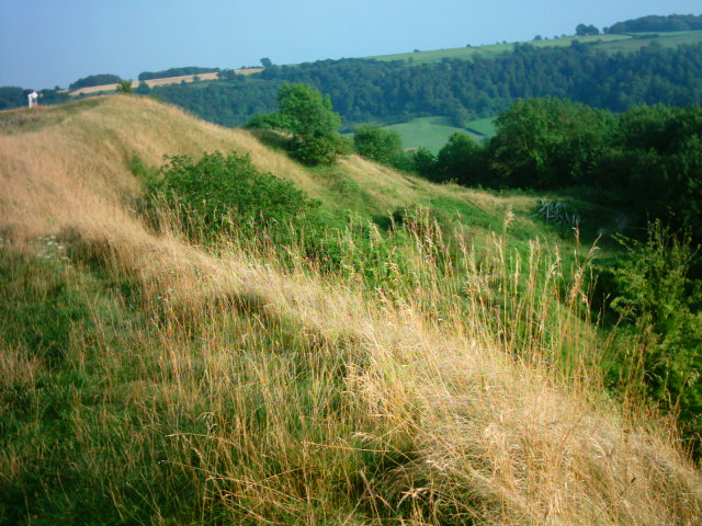
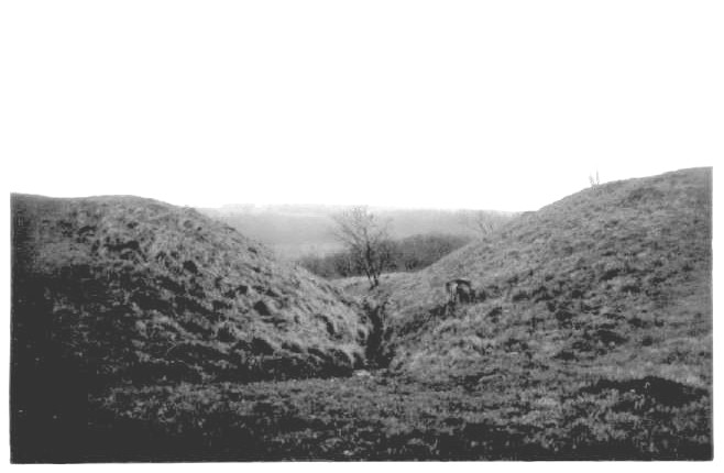
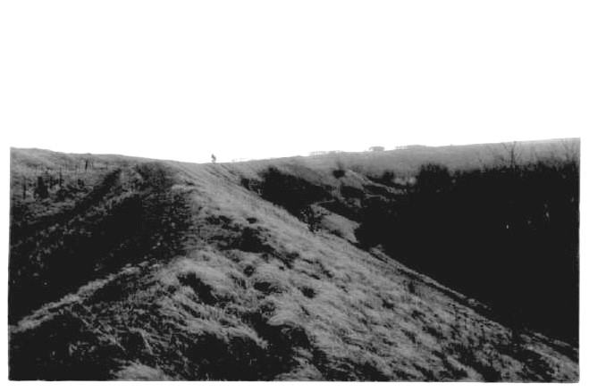
Uley Bury Hill fort 1-Aug-2004 We entered Uley Bury Hill fort from approx ST782981. There is a bridle path here which is basically a narrow gully that leads up to the top of the hill. Due to the fact that there appears to be a gateway into the fort at or near the top of this gulley, then I assume the gully to have been made as a passageway to the fort rather than natural, which would probably make it unique. At the bottom of the gully there is medium sized dressed stones that shore up the earth banks but whether they are original work, I don't know, but they do remind me of the small visible wall found at South Cadbury Camp. As one travels up the gulley there are small irregular stones that appear as stone walling and these may be original work? As one reaches the top of this passageway/gully, you are greeted by a huge steep natural defence to the camp proper. You should note that there is a path between two artificial mounds that was probably once the gateway into the camp. The camp itself is about 30 acres in size and although it's fenced off you can still walk around the perimeter and take in the fabulous views. To the Northwest one can see Cam long down and the isolated Peaked down, which has Arthurian connections. On the Southside of Cam long down and on the top there appears to be earth defences. |
Posted by vulcan 2nd August 2004ce Edited 2nd August 2004ce |
|
Uley Bury Hill Fort - 27.12.2003 There is a makeshift, muddy (unmarked) layby for about 7 cars at ST787993, towards the top of the hill that leads North West from Uley. If you park here (or walk to it from the Cotswold Way) walk past the large metal gate and the plateau of Uley Bury is about 70 metres onwards, up the muddy track. You can walk all around the top of the hill, and other paths often run down off the hill so you can explore them as well. When walking around the top it seems to be often what would have been the last line of defence, but it's rarely much of a ditch now. Most of the defence otherwise seems to be the naturally tough escarpment of the hill. This is very steep in places, although on the north West and South sides I was surprised to see small extra ditches and ramparts visible on the hill. The south east corner is interesting, with a clear entrance built here. The walk around the hill is pretty pleasant (even in the biting rain!) because it has stunning views, especially to the West, across Gloucestershire and Wales. It's like being on the top of the world. |
 Posted by pure joy
3rd January 2004ce |
Folklore |
|
Uley Bury Camp.-- This famous fortress, according to old village tradition, was known as the "maiden" hill; it being said that it was never taken by besiegers. [..] So steep is the hill, that it is hard to think it could be captured by a hostile attack, unless it were taken unawares at the entrance in the narrow neck which unites it with high lands to the east.From Gloucestershire Notes and Queries v5 (1891-4). Elsewhere on the Internet people like to claim the name 'maiden' comes from some alleged Celtic words for 'great hill'. But whether that's any more or less likely I don't know. Maybe the latter is / was a less embarrassing explanation. |
Posted by Rhiannon 5th January 2012ce Edited 5th January 2012ce |
Links |
|
ADSNearby West Hill (between Uley Bury and Hetty Peglar's Tump) was the site of an Iron Age shrine, and after it, a Roman temple. It's even possible that there was a Neolithic monument beneath these. You can download EH's Archaeological Monograph about the excavations of "The Uley Shrines" by Woodward and Leach (1993) from the ADS website. |
Posted by Rhiannon 12th December 2014ce |