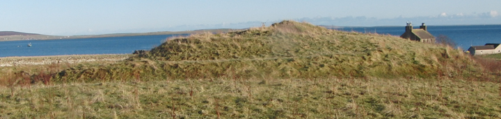
You can’t miss it when heading down to Tingwall to catch the ferry over to Rousay.
The Broch is right next to the road but the other side of a barbed wire fence.
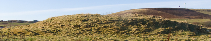
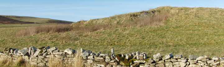
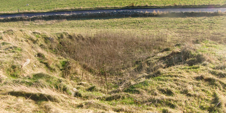
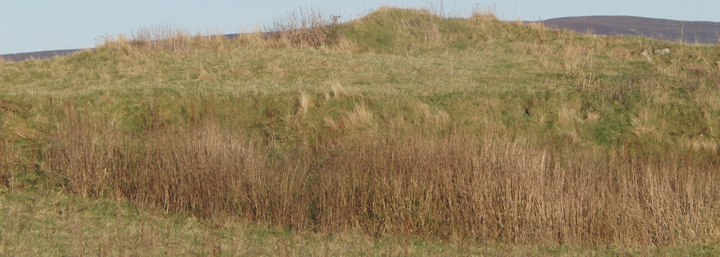
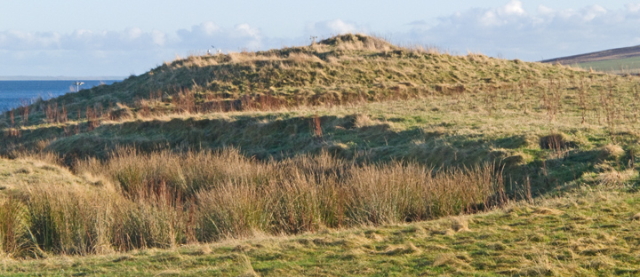
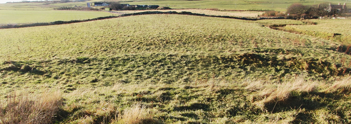
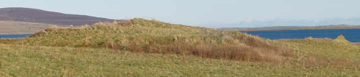
The Broch is now a very large mound (approx 4 metres high x 50 metres long)
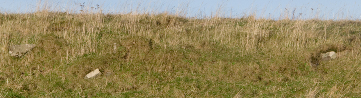
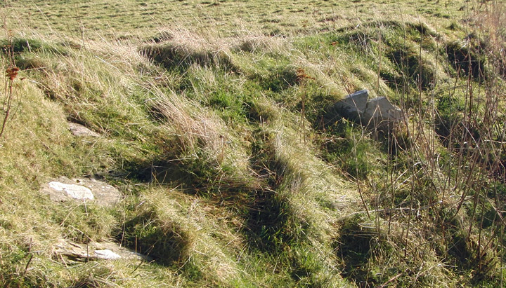
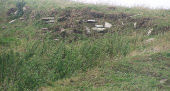
There are lots of stones sticking out of the grass.
The Tingwall mound is in the form of a figure-of-eight or else two mounds of disparate sizes have been joined together, the larger and more mutilated at the west end and the smaller at the east by the farm. Using the 1st O.S. to look at the brochs from Dishero to Burgar you find the broch depicted as not quite circular except for the east end of this mound where its circle is a geometric circle. Which seemed strange. Then I had reason to ponder whether the sluice behind had been made using stones from the broch and the light went on - the sluice makes the burn behind a millstream and so this is a strong candidate for being a mill mound. Which isn't to say that it had no prior use [unless the mound had been constructed specifically for the mill]. The early map isn't as detailed as that for Dishero, showing a bank occupying the inside of the west circle's western half and orthostats on the south periphery (seven shown).
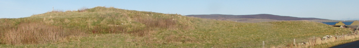
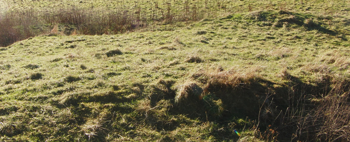
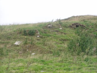
On a modern-day aerial view [192.com IIRC] this is generally confirmed, with little appearing at the east quadrant and the stones part of the plant-covered ditch obscuring it from a roadside view. The view from above shows the large irregular pit seen roadside as coming from the south edge of the circle, a little right of centre, up to the broch tower marks with a small circle where it contacts. There are several pits inside the broch tower area. These are probably from antiquarian investigations. To my mind these would post-date the 1880 survey or more detail would be shown on the 1st O.S. (like Dishero). The photo shows a circular ditch on the west side and inside this the broch tower wall in the W-N quadrant with what appears to be an out-turning at the north end, perhaps a gateway or the east side of an external cell. I imagine the ditch to be is connected to the substantial rampart fragment referred to in the NMRS. Virtually nothing can be seen at the east side of the broch circle over or from there to the mill-mound.
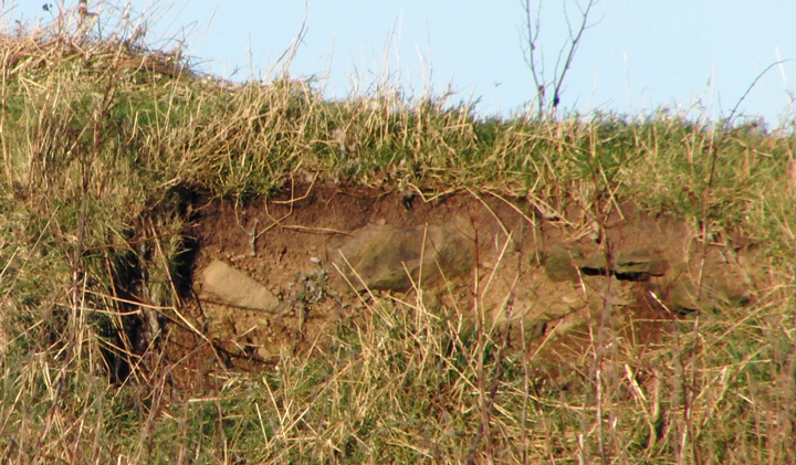
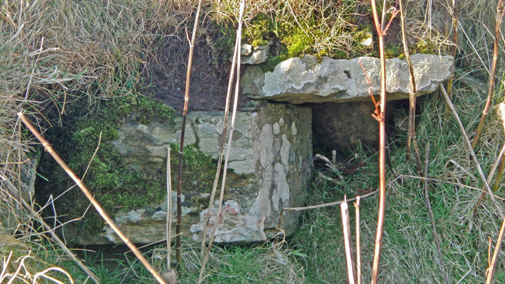
All of the foregoing I learned after this particular visit. Coming from the harbour I first came to the eastern end. Looked across this end from the east it is the south side that has been touched by man, at the base on the left what appears to be a low bank across this end, then an apparently manufactured curve to the top and an equally low rise or foundation from whose north side the mound slopes gradually down seemingly naturally. To the right of the 'foundation' you can see the top of the broch in the distance. Along the side facing the road a few stones of different sizes are exposed, though truth to tell if they have a pattern it is a line rather than a curve. Even in winter the gouge of a ditch cutting in front of the west end and up into this end of the mound like a stairway to heaven is heavily fringed with dock. Exposed in the cut above are a mix of small thin slabs and blocks. All are still where placed by man, but only in one spot are you priveleged to see a tiny section of plain to see walling. This horizontal block with a slab coming onto it I had previously believed to be part of a small passage entrance but later close inspection reveals a vertical surface behind and below the slab, probably one block and part of another - it feels different from the rest and I would like to think this is the outer face of the broch tower wall.
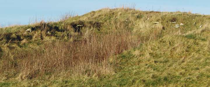
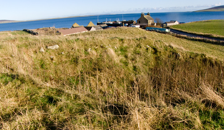
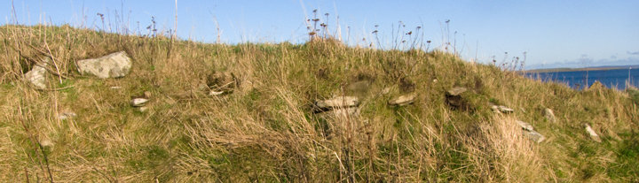
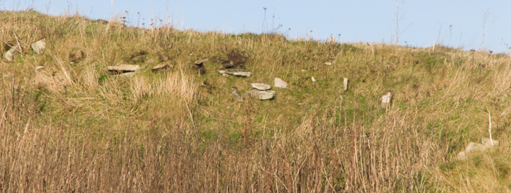
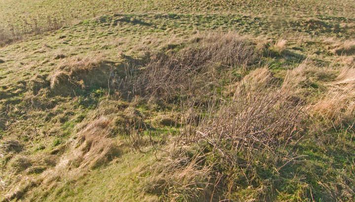
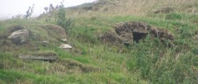
Up at the crossroads the west end presents the multiple levels now familiar from Dishero. After entering the field I am about halfway to the mound when to my surprise I see a deep ditch cut into the ground by this end just beyond a sharp bend in the burn, and the broch sits on the other side. Up on the mound the bank/s on this end are easier to see. From the top it is more obvious how regular the east end is and there may be another bank between. Spot another interesting thing to my left as I look past a pit to the mound (or top of the mound)'s edge, a broad but very shallow concave curve and what might be slight bumps at either end. Could this be an entranceway ? And if so to the broch or something else ?? I was also surprised by how far back the big 'hole' at the south side was from the central broch tump. Beneath the plants at the bottom are some larger stones/slabs. Not sure if these are in situ or whether part of flooring if so. On the west side are fewer stones but there is that 'wall'. On the east side there is more of a continuity though after several metres it does broaden out suddenly, might be another chamber or whatever. Further down near the lip of the 'hole' on this side is something definitely different, a saw-edged orthostat (just visible from the road with magnification) with its face towards me. More like a tomb than broch - though it is considered that this is not a 'greenfield site', however the arrow is considered to run forward to Viking times rather from the IA back. Lastly I walked over the the other end down a shallow slope, still above ground level, then up more steeply. Nothing to add to my first observation about the seaward end.
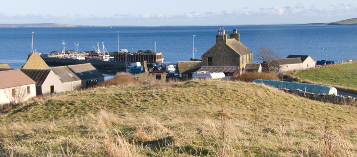
A long minor road leads you to the Broch of Gurness on the headland . On this stretch of coast , facing Rousay of the fabulous tombs , are the remains of many brochs . But this is the only one viewable up close as a scenic site for visitors . Further down the road to Finstown lies the Tingwall road , and if you go down to the pier to catch a boat to Rousay just before you reach farm in front of the pier , on the left of the road lies Thing-Voll Broch . This is a lovely multi-period site , much excavated ; not just the broch alone but many houses and extensive turfed ditches
HY 4011 2286. RCAHMS NMRS No. HY42SW 3.
As you go to the pier for Rousay this site lies on the left-hand side of the road just before the farm that overlooks the pier. Tingwall or Thing-voll was almost certainly a broch (another example of a broch associated with a thing is Dingy's Howe Broch [Dingieshowe] at the isthmus between Upper Sanday and Deerness) but the mound is much mutilated. Close to the top of the mound is what looks like a megalithic entrance but I am suspicious of its antiquity as I can find no reference to this. It has certainly been much extended since the 'Broch Age'. This site still repays the use of even the simplest form of magnification to 'bring it out'.
Orkney Name Book gives two Thing Volls, one a circular structure 5 chains SW of Tingwall farmhouse and another "similar" 250 links from this and SW of Tingwall..