|
|

|
|
Robin Hood's Butts (Shropshire)Barrow / Cairn Cemetery
|
||||||||||||||||||||||||
|
|
|
Images (click to view fullsize) |
|
|
Fieldnotes |
|
|
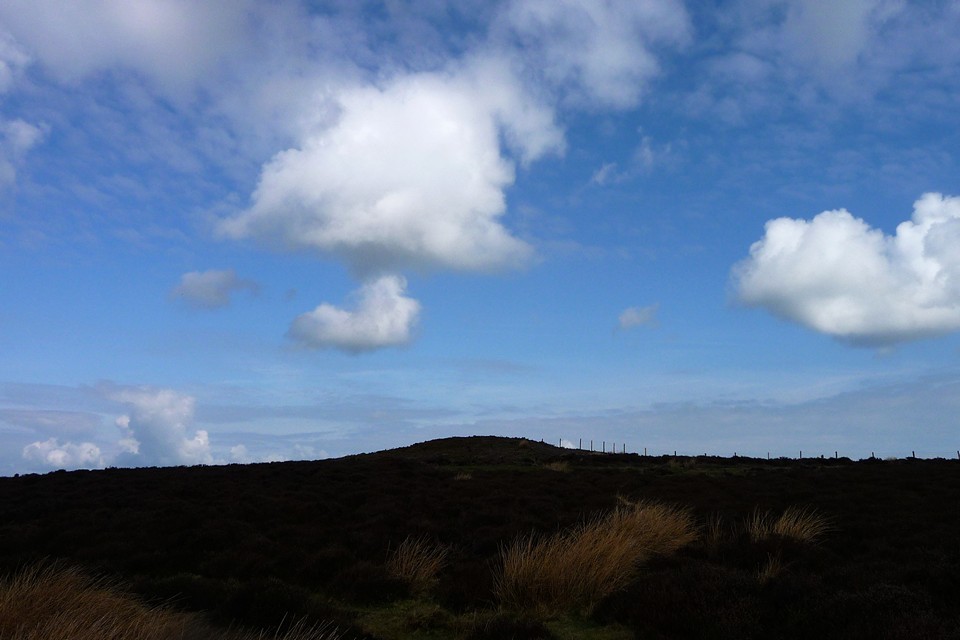
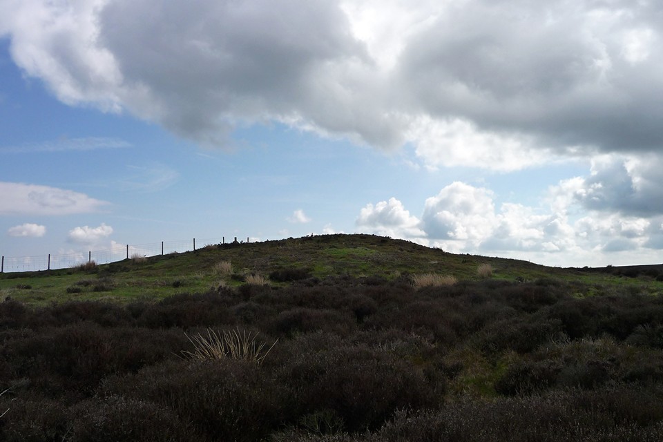
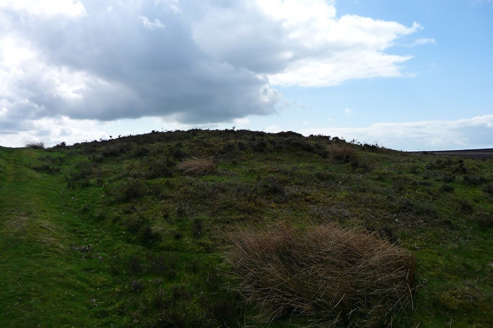
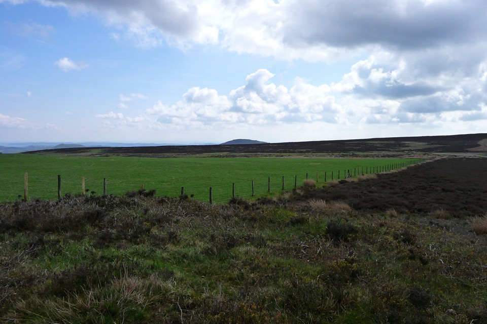
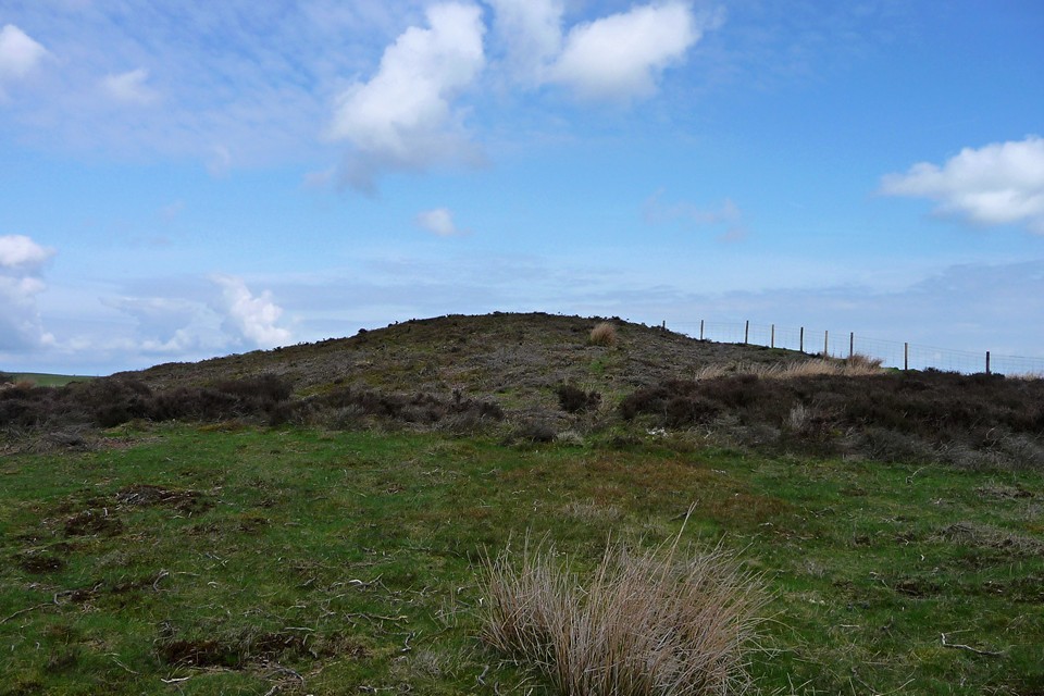
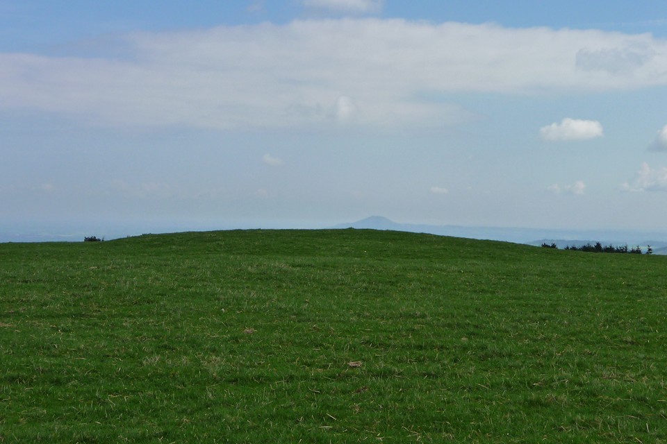
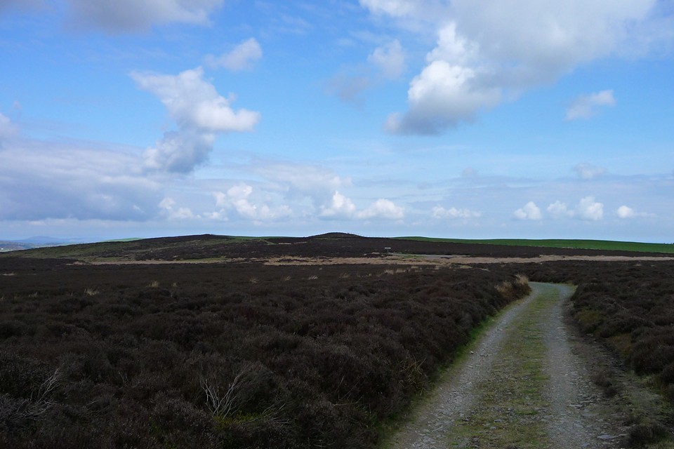
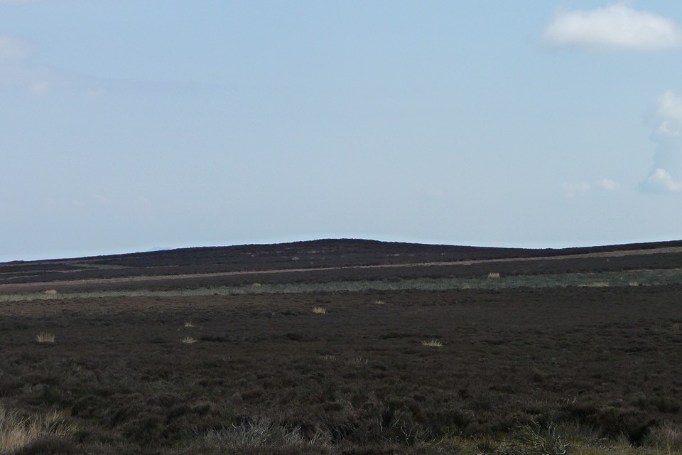
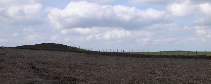
Visited 16.4.2011. After a trip into Shropshire last week, to visit Mitchell's Fold and its surroundings, another sunny Saturday draws me back to the area for a further mooch. The Long Mynd is indelibly marked upon me, due to a sledging incident up on these hills aged 14 that left me with stitches in the back of my head (and a permanent scar!). I'll try to be a bit more careful this time... Access to the area couldn't be easier, as Church Stretton has a train station on the Cardiff - Manchester main line. There is however the small matter of the uphill walk from there. The Long Mynd is a broad ridge a couple of miles across, but bordered on every side by steeply sloping hills which have to be dealt with from any approach. Worth pausing to look north eastwards from the town too, at the even more steeply sided Caer Caradoc Hill, with its premier league hillfort looming over the town. It is one of a long row of hills that culminates at the northern end at The Wrekin, also topped with a hillfort and the origin of Midlands expression "to go round the Wrekin" (meaning to go the long way round to get somewhere, or take a long time to get to the point). Which is appropriate enough in these fieldnotes, don't you think? Anyway, my approach for today's trip is an easy enough one, via Church Stretton golf club. A path runs up into the hills from behind the club-house and provides excellent views of Caer Caradoc and the Lawley for most of its route. Beware flying golf balls though (often the path is unsighted from the tees). As the path gets up past the 300m mark, the neat IA ringwork of Bodbury Ring can be admired as well. Eventually the path leaves the grassy slopes of the golf course at the bottom of Haddon Hill. From here the terrain changes to the heather that cloaks the Long Mynd and which will provide the surface for most of the remainder of the walk. The southeasternmost barrow of the group stands prominent on one of Haddon Hill's summits. It's a low mound, covered in heather, with no obvious path to it other than to wade through the heather. I decide to give it a miss (bit poor for the first barrow of the day, I know) - I think a winter visit would be needed to make it a worthwhile trek. Instead I carry on until the path hits the minor Woolstaston - Ratlinghope Road, where it meets the Shropshire Way long distance path and the possibly prehistoric Port Way. From here the main object of my visit is clearly visible. Perched on a natural hilltop at 470m, the two central barrows - known as Robin Hood's Butts, he was a well-travelled chap - are an obvious landmark. The larger barrow, the SW, is a massive mound 35m across and 4m high. Even though its edge has been cut through by an embanked field boundary, this is a really impressive monument. Standing on its top, there are really decent views to be had - the top of Caer Caradoc can be seen to the southeast, the long ridge of the Stiperstones and nearby Corndon Hill are the major landmarks to the WNW. The barrow has a slightly "stepped" appearance, as if a smaller mound has been built on to the top of the large one. The second barrow lies across the fence to the NE, in private land. It's a much smaller effort, ploughed right down and not much to see, although it still stands out against the skyline even in its reduced state. Along the fence line to the northwest, there is another mound visible at a corner of the fence. Stupidly, I didn't go and investigate (nothing is shown on the OS 1/25000), but a look at Pastscape on my return home reveals that there is indeed another barrow here. I also skip the northwestermost barrow of the group, which seems to have disappeared in the smothering heather. All in all, this is a decent group of monuments in a lovely location. From here I head off SW along the Port Way to see some of the Long Mynd's other barrows. |
 Posted by thesweetcheat
20th April 2011ce Edited 20th April 2011ce |
| Robin Hood's Butts consist of two fairly small tumuli situated on the 1600 foot high plateau of the Long Mynd that covers a very large area to the west of Church Stretton. The two barrows themselves are fairly unremarkable for the South Shropshire area, though they are probably the best two examples of the bronze age tumuli that litter the entire area of the Long Mynd and to my knowledge they are the only two tumuli in such close proximity to one another in the area, though I admit I've not seen them all. There are at least a dozen tumuli on the Long Mynd, all of similar proportions and condition as well as Bodbury Ring - a Bronze age enclosure/hillfort, The Port Way - a Bronze age track and a handfull of dyke type earthworks. |
Posted by 2 jags 16th November 2003ce |
Miscellaneous |
|
|
A group of four barrows, spread over a mile, are shown on the OS 1/25000. A fifth possible barrow has been mapped by the Marches Uplands project. The central two are the ones known as Robin Hood's Butts. Info from Pastscape: NW barrow (SO 42409672) A heather-covered round barrow upon a gentle E-facing slope, is 20.0m in diameter and has a height of 1.3m. There are no visible remains of a ditch. The mound is disturbed at the centre. Henley Nap barrow (SO42799686) - not on OS map A heather-covered round barrow, situated at SO 42799686, on the summitof a local rise of ground upon the top of the Lond Myd at about 1480 feet above OD. The barrow measures 14.0M in diameter, and stands 1.2m in height. A post-and-wire fince upon a parish boundary bank crosses the north-eastperimeter, beyond which the barrow protrudes into arable land, where it has been reduced by ploughing. Robin Hood's Butts barrows SO 4302 9655. Bowl barrow and section of boundary bank on Duckley Nap, 500m east of Wildmoor Pool. The overall appearance is of a smaller upper mound 18.5m in diameter surmounting a flat topped lower mound 35.5m in diameter, standing to a height of 4.2m. It is classified as a stepped bowl barrow and is a good example of this unusual class of round barrow. The north-eastern edge of the lower mound is crossed by a field boundary bank of stone and earth construction which appears to be of considerable age. The section where it crosses the barrow is included in the scheduling. The surrounding ditch has become infilled but survives as a buried feature some 2.5m wide. SO 4306 9661. Bowl barrow, 540m east of Wildmoor Pool. The surrounding ditch has become largely infilled but can be traced as a slight earthwork 4m wide and 0.3m deep around the north-east side of the mound. SE barrow (SO43379618) A heather-covered round barrow, upon the top of a ridge 22.0m in diameter and 1.1m in height. No visible remains of a ditch. Large central excavation crater, 7.0m in diameter. Bowl barrow 500m south-east of Duckley Nap. The surrounding ditch has become infilled but survives as a buried feature some 2m wide. |
Posted by thesweetcheat 17th April 2011ce |