The Modern Antiquarian
Log in
|
Register
Home
Latest Posts
Forums
Maps
Help
Browse Sites
News
Blog
Contributors
The Books
Select
-
Belgium
Denmark
Eire
France
Germany
Greece
Italy
The Netherlands
Norway
Portugal
Republic of Malta
Spain
Sweden
Switzerland
United Kingdom
England
Northern England
Leicestershire
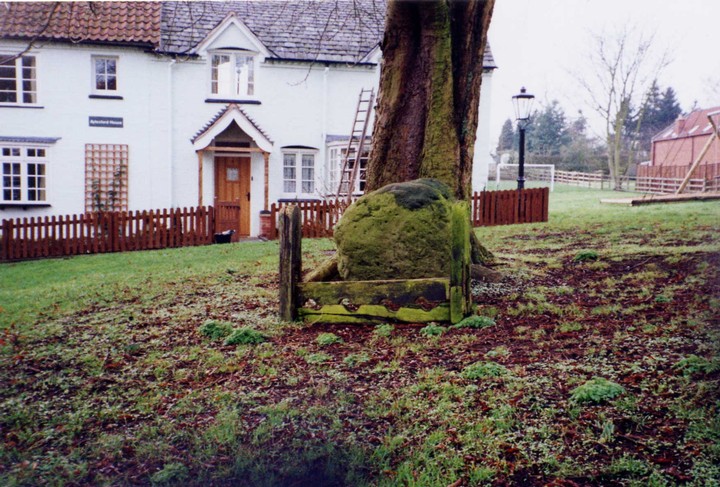
Grimr's Stones
Standing Stone / Menhir
Grimr's Stones (Standing Stone / Menhir) on The Modern Antiquarian, the UK & Ireland's most popular megalithic community website. 1 image, plus information on many more ancient sites nearby and across the UK & Ireland.
Image © fleckers
This site is of disputed antiquity. If you have any information that could help clarify this site's authenticity, please post below or
leave a post in the forum
.
Nearest Town:
Melton Mowbray (7km ESE)
OS Ref (GB):
SK685218 /
Sheet: 129
Latitude:
52° 47' 20.44" N
Longitude:
0° 59' 2.85" W
Images (1)
0 discussions
Start a topic
Show |
Hide
Web searches for Grimr's Stones
Flickr
Google
Google Images
MAGIC
The Megalithic Portal
Bing
Stone Pages
Streetmap.co.uk
Wikipedia
Show map
(inline Google Map)
- Sites within 20 km -
-
Piper Hole Farm Barrow (9.05km ENE) (1 post)
The Moody Bush Stone (11.37km SSW) (1 post)
Cossington Barrows (11.92km SW) (3 posts)
Burrough Hill (12.46km ESE) (19 posts)
Syston Barrow (Round Hill) (13.12km SW) (1 post)
Temple Grange Rothley (13.34km SW) (3 posts)
Wanlip (13.83km SW) (2 posts)
Birstall enclosure settlement (14.61km SW) (1 post)
Windmill Hill (14.77km ENE) (2 posts)
The Humber Stone (16.02km SSW) (23 posts)
Hanging Stone (17.44km WSW) (1 post)
Bingham (18.56km N) (1 post)
King Lud's Entrenchments (18.66km ENE) (2 posts)
Beacon Hill (18.79km WSW) (8 posts)
St. John's or Little John's Stone (destroyed) (18.94km SW) (4 posts)
Bradgate Stone & Ring (19.01km WSW) (3 posts)
Saltby Barrows (19.08km ENE) (1 post)
The Billesdon Stone (19.36km SSE) (1 post)
Robin-a-Tiptoe Hill (19.65km SE) (2 posts)
- Add -
-
Add news
Add an image
Add fieldnotes
Add folklore
Add miscellaneous
Add a link
-
Add a site
Add a nearby facility
Add an alternative name/spelling
Images
(click to view fullsize)
Add an image