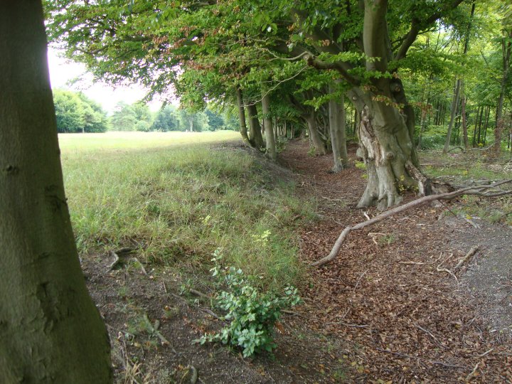
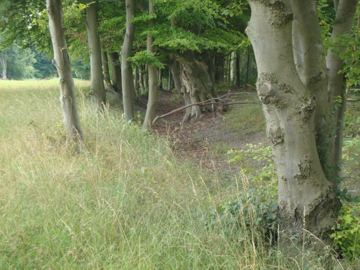
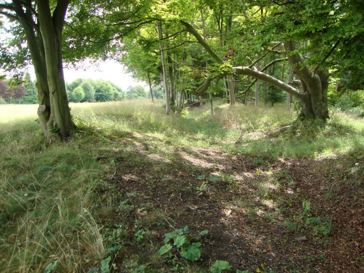
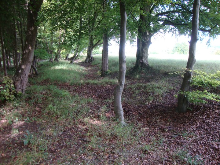
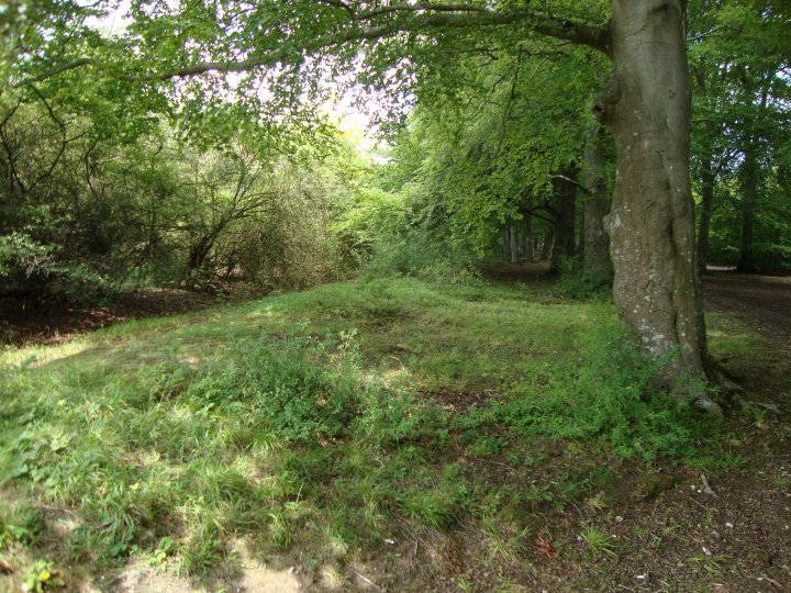
An example of a Bronze Age boundary ditch still marking the border between two counties, Hants and Wilts. More obvious to the SW where Bokerley Dyke and the Grim's Ditch serve the same purpose. What is more startling about this area is the disparity between the concentration of ancient sites either side of the dividing line. To the W. a huge number of tumuli and earthworks, to the E. none at all! The landscape is of similar form and there is no large physical barrier such as a river to provide a logical boundary. A line drawn between two tribes of dissimilar wealth?
The line of the Devil's Ditch and the county boundary runs pretty straight towards Park House (still a hotel, on the old line of the A303), which sounds like where Park Gate must have been, and presumably the stone. So it makes you wonder if this huge stone did have some significance. I can't see it marked on a map so not sure quite where it was - it's hard to tell which direction the 'narrow lane' was heading (possibly NW back along the boundary but who knows). Now the area is carved up with roads so I fear it won't be there any longer. But it sounds impressively big.
The county boundary at Clarendon Hill, about a mile west of North Tidworth, turns towards the south along an old landmark called the "Devil's Ditch," on the western side of Beacon Hill, down to Park House. The burial mounds called barrows abound in the direction of Ambresbury; and no wonder, for we are approaching what was once the fashionable burying-ground of eminent Ancient Britons.
[...] At Park Gate, on the county boundary, on the road between Andover and Amesbury, there is, or was, in a field abutting on a narrow lane leading from the roadside inn, a flat stone, of large dimensions, 11ft. long, 12ft. in breadth, and 5ft. in thickness. One of the many traditions about Stonehenge is that the great Sarsens came from Andover, and this Park Gate stone, in order to help the tradition, is quoted as having been on its way thither but abandoned.
From 'Notes on the Border of Wilts and Hants' by the Rev. Canon J.E. Jackson, in WANHM v21, 1883.
[SU 20934855 - SU 21714725] Devil's Ditch [O.E.] [Twice] [SU 21714725 - SU 23234355] Devil's Ditch [O.E.] (Course of) [Three times]. (1)
Additional courses: SU 22404850 to SU 22254819 (SU 24 NW 146) and SU 21774877 to SU 22414893 (SU 24 NW 145) [at which latter point the two earthworks intersect and pass into the county of Wiltshire.] (2)
A bivallate linear earthwork of LBA ranch boundary type (see SU 24 SE 13) extending for some 7700.0m. from Tidworth Barracks southwards to the River Bourne near Cholderton. The county boundary between Wiltshire and Hampshire follows it all the way except for a short stretch near Tidworth. Published 1/2500 revised. (3)
The Devil's Ditch was investigated as part of the Wessex Linear Ditches project where it formed the eastern boundary of the Northern and Southern Core Territories. Excavations took place at SU 21104831 (LDP 052), SU 21564491 (LDP 090) and SU 21724599 (LPD 094). The ditch at LDP 052 and LPD 090 was found to be V-shaped c. 3.7m - 4.9m wide, and up to 1.75m deep terminating in a steep-sided basal slot. The ditch was originally flat-bottomed but had been remodelled and the original silts cleaned out. A cattle skull recovered from secondary ditch deposits was used to provide a Radio-carbon determination (OxA-3046). This was used to date events which were noted elsewhere in the ditch complex (SU 25 SW 166), a discrete cultural horizon which appears to be connected with the re-use of the ditch system during the Middle Iron Age. These excavations also recovered Roman Pottery from the top of the ditch. Roman and Late Bronze Age pottery was also recovered by field walking along the southern section of the ditch. (4) The Devil's Ditch was investigated by RCHME field staff as part of Salisbury Plain Training Area Project. Further details can be found within the project archive. The linear earthwork bounds the Tidworth golf course on the SW for its entire length, skirting and partially destroying two round barrows as it does so. Where it crosses Dunch Hill it is 5m wide and 1m deep with a corresponding bank on its N side, except where it descends the slope of Dunch Hill. A second linear ditch, c5m wide and 1m deep, with a corresponding bank on its N side, abuts and may even cut into the `Devils Ditch'. This runs to the NE for a distance of 100m following the line of the earlier fields. On reaching the summit of the hill it turns ENE and is clearly aligned on a group of round barrows some 350m W of the golf course perimeter. Surveyed at 1:2500. (5)

 Posted by jimit
 Posted by Rhiannon
 Posted by Chance