|
|

|
|
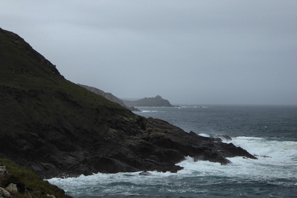
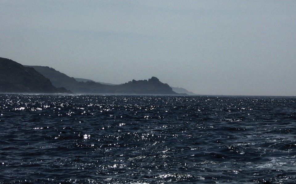
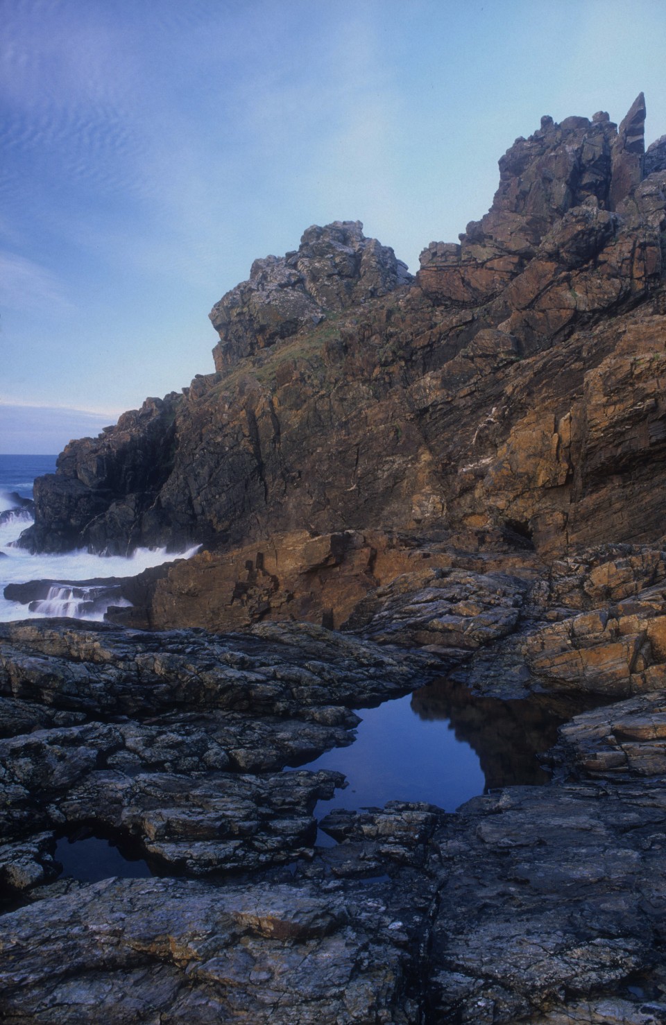
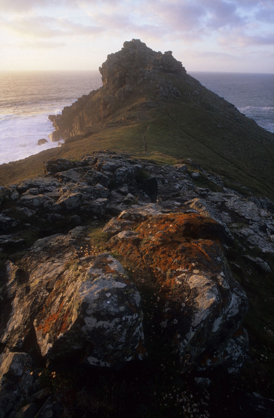
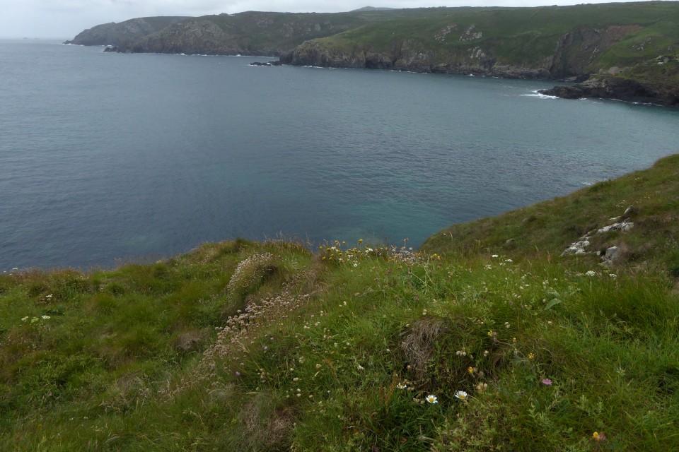
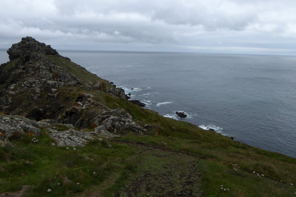
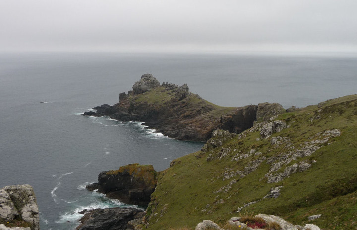
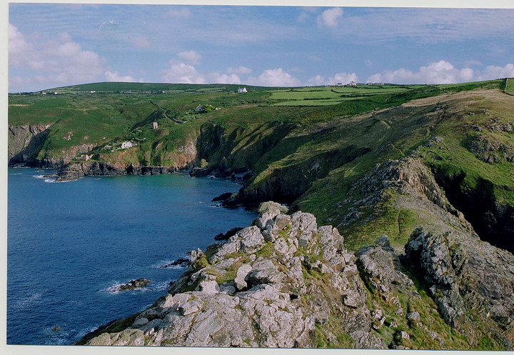
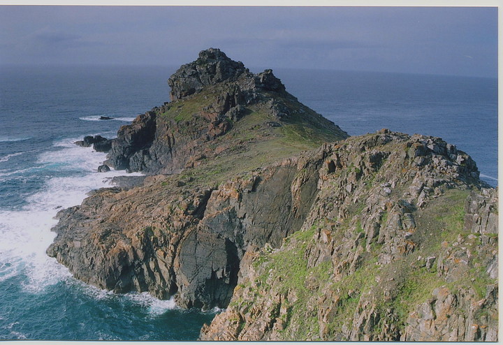
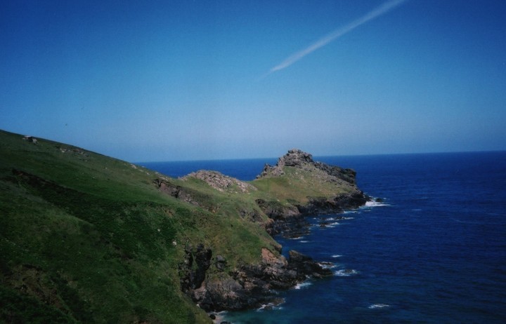
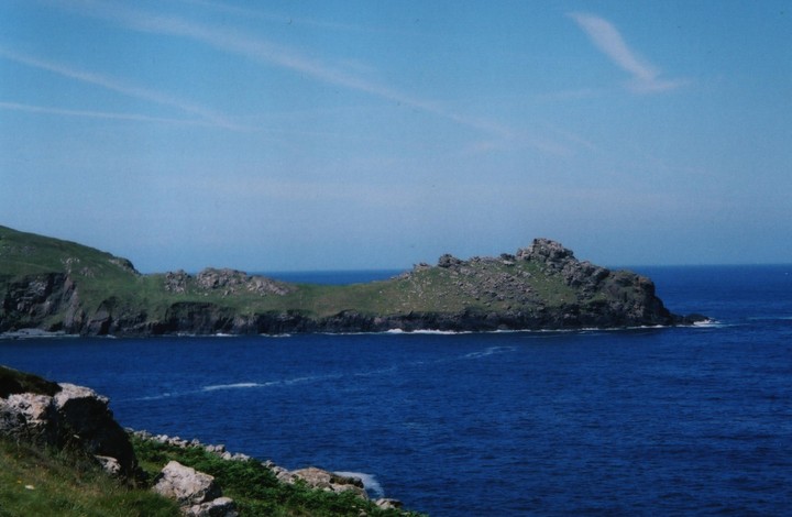
Gurnard's HeadCliff Fort
|
||||||||||||||||||||||||
|
|
|
Images (click to view fullsize) |
|
Photographs: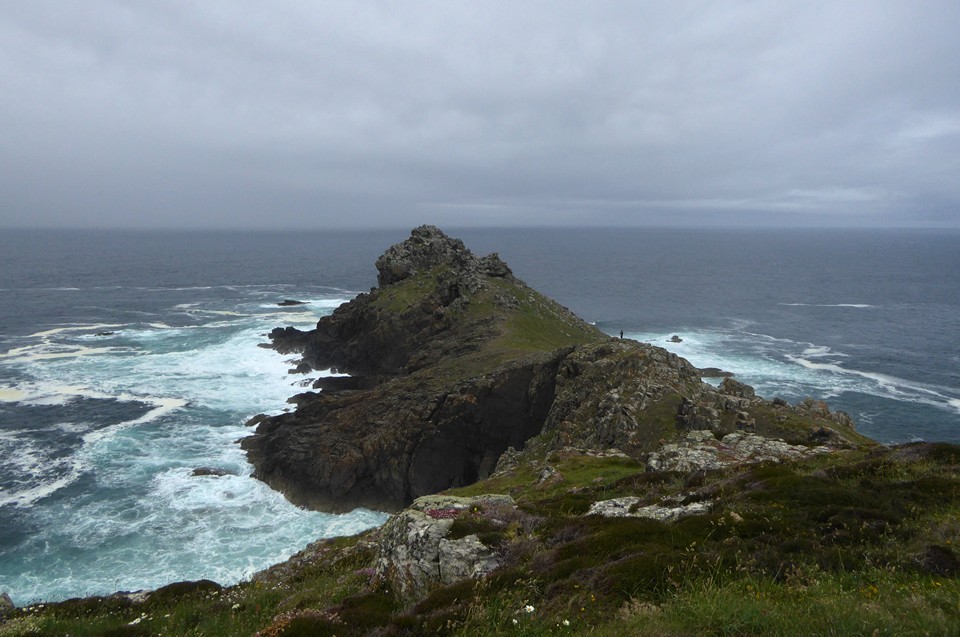
 Artistic / Interpretive:
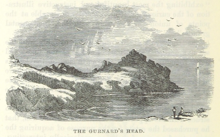
|
Fieldnotes |
|
|
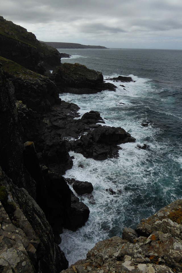
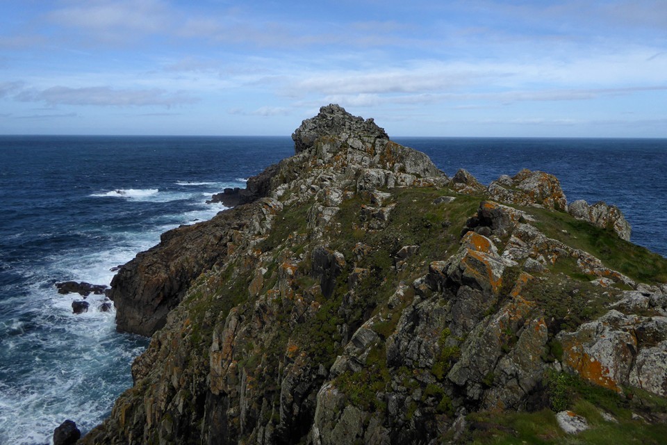
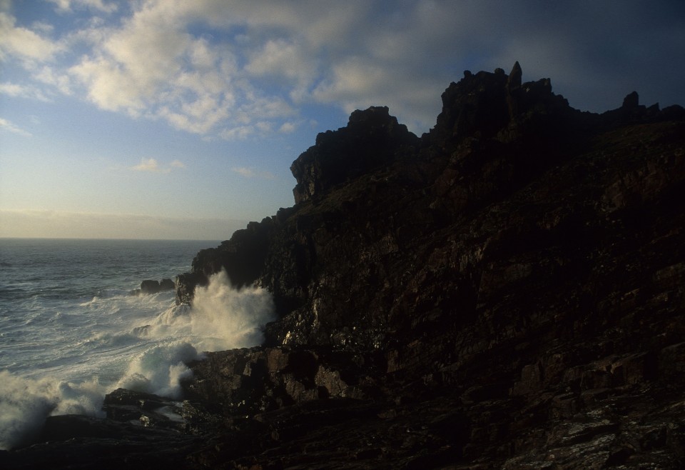
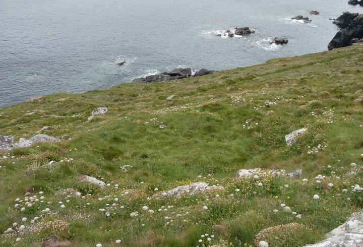
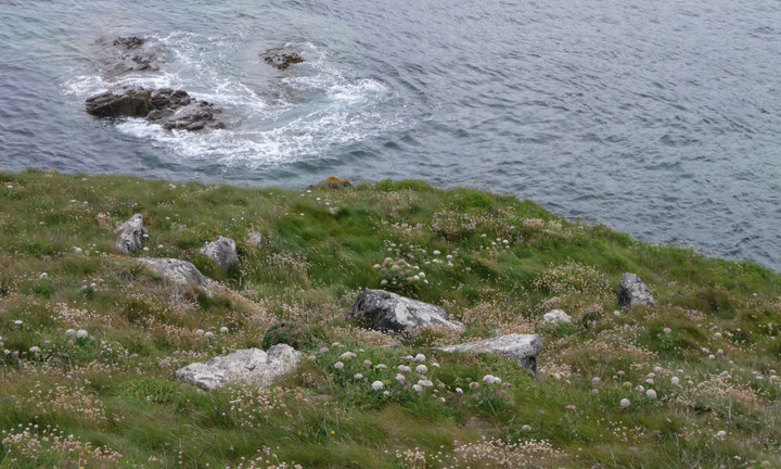
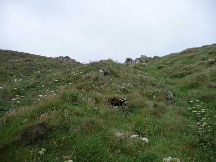
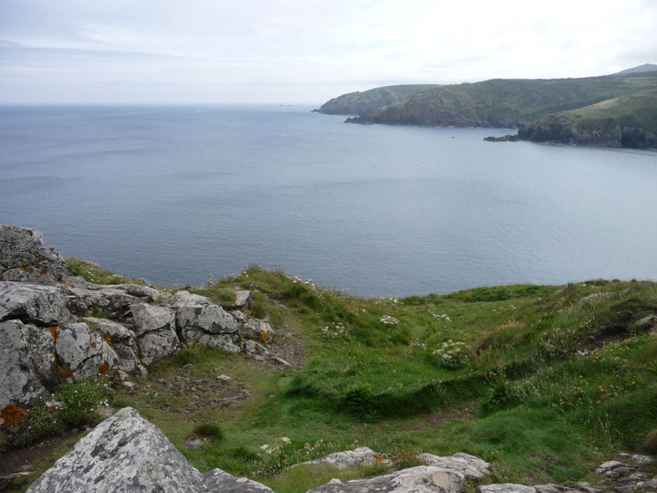
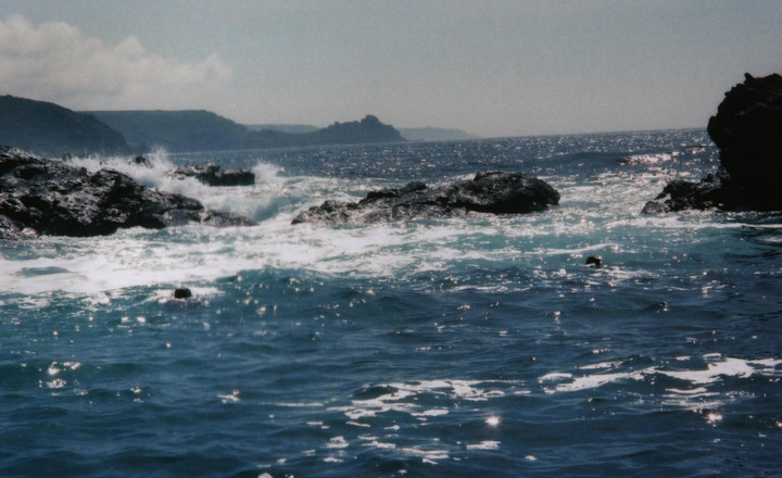
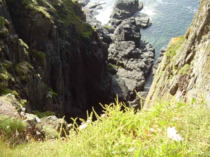
I think it's taken me this long since our visit to Cornwall yet again, to properly absorb this place. It haunts me. If I'd followed my instincts over the years id have walked the dragons back long before now..only ever viewing it from a car driving past. Viewing it on tma i knew I'd wasted a lot of time. It was a glorious September day. We walked from the pub. The gently sloping field down to a monster of a place. It is truly monumental. On one side of the cliff roaring raging sea & the other side calm rolling waves. We alternated between being blasted with delicious sea spray & an absolute wind blasting roar to calm white topped rollling waves with seals playing in the swell all in the span of a few metres. Truly amazing. Looking up & down the ridges of this place it appeared to me as a dragons back. I saw what I presumed was a concoction of arranged stones on the way & then thought how could this be a place to inhabit for any time. But sitting & drifting away under the shelter of the uppermost rocks, choosing wether or not to be blasted or becalmed depending on which side of the outcrop i chose was astonishing to me. I know this is presumably a defensive hill fort but this place sent me into a trance with its absolute beauty. It was a particularly balmy day; I'd still tackle it when slippy but be very careful, those spines could be vicious:) |
Posted by carol27 15th November 2017ce Edited 15th November 2017ce |
|
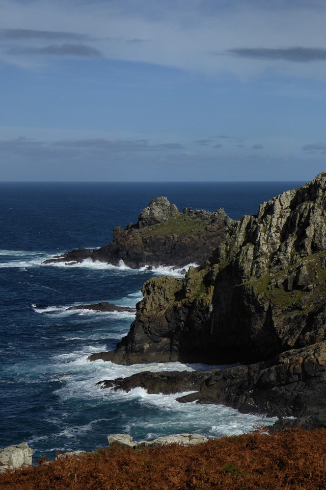
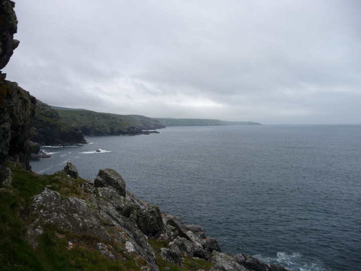
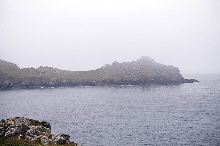
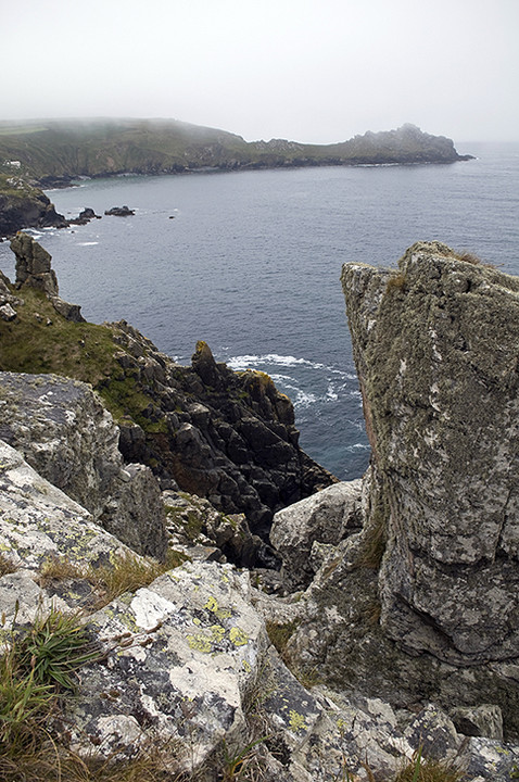
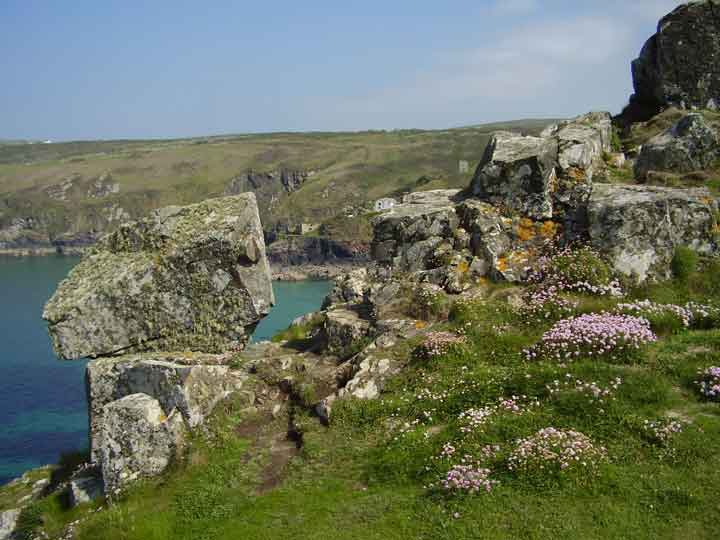
Wow........ an exquisite site. The fact that I couldn't make out much of the promontory defences didn't matter. To be here.... and taste and smell the salt air after a day seeking megaliths inland is everything. Not sure that I could actually envisage people living on here, but then - of course - they were much harder than us 21st Century softies, weren't they? Then again, perhaps this was just a place of refuge to run to when the look-outs gave warning? The Cornish coast is something really special and on a day like today when the sun shines and the sea reflects the blue sky, is there a better place to be than here? Right on! |
 Posted by GLADMAN
15th June 2009ce Edited 3rd December 2017ce |
|
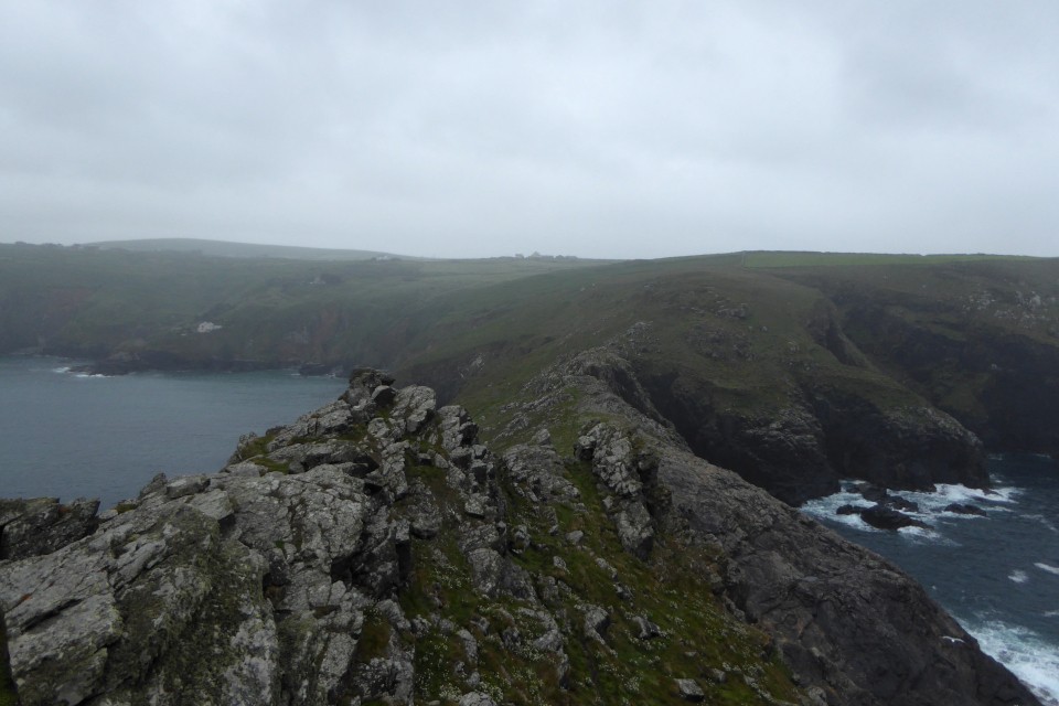
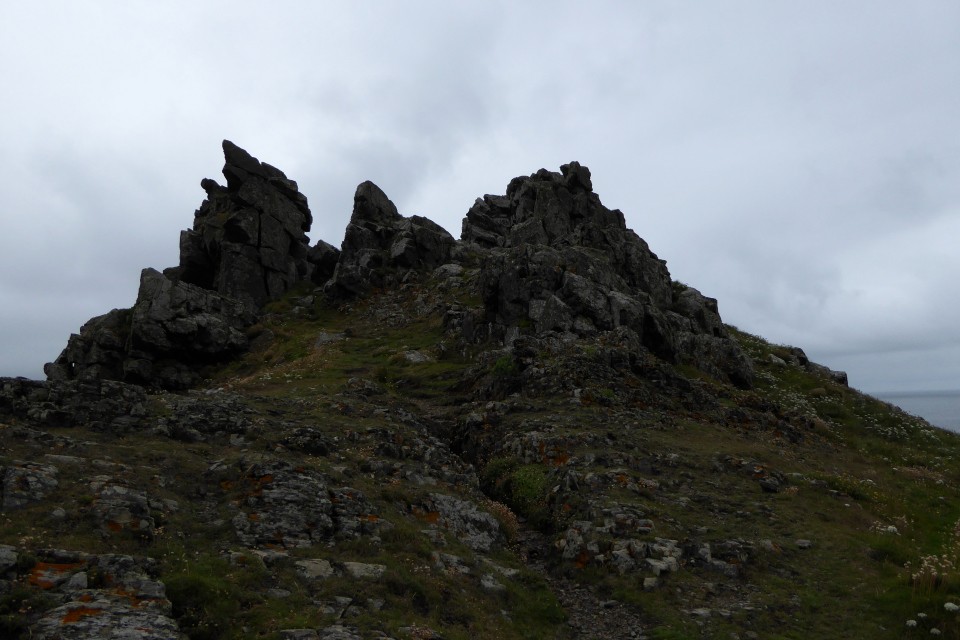
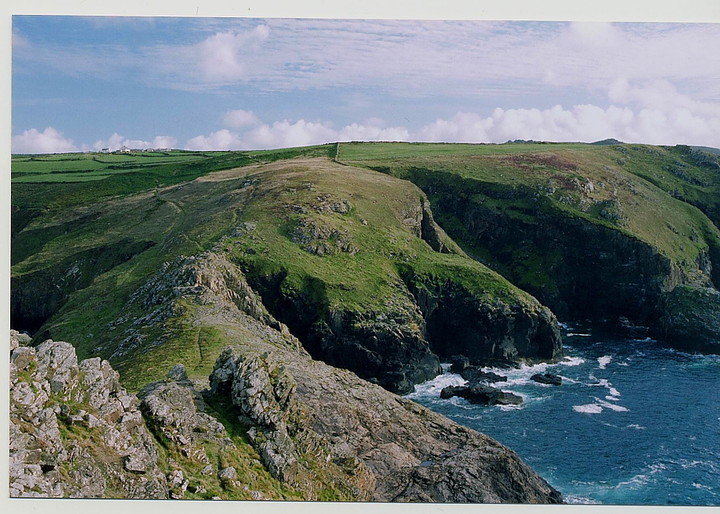
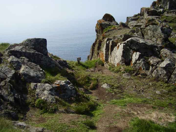
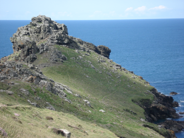
This is a stunning place for the views alone on a beautiful sunny day in June, I'm not sure how I would feel about being here in a howling gale in mid winter though. The perfect place to defend, the cliffs either side of the narrowest point are at least 100 feet in height. It's a bit hard to see but there are the remains of walls and at least one entrance. It's name in the Cornish language is Ynyal which means desolate. |
 Posted by formicaant
16th June 2007ce Edited 16th June 2007ce |
|
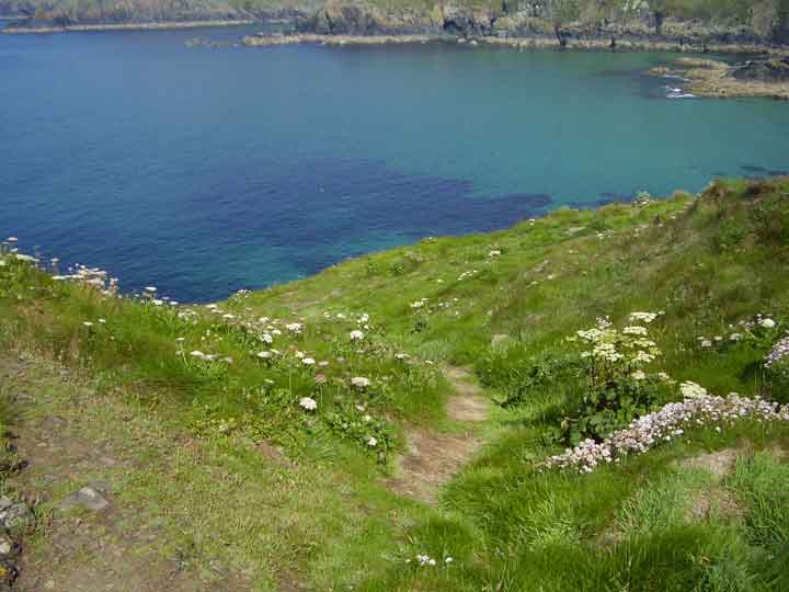
Wait for low tide and walk round the headland itself for an adventure. Sit at the sea's edge and lose yourself to the mermaids... wonderful place to meditate. Also any dowsers would love the 'hotspot' that occurs alongside the pathway towards the headland. Take the right hand path at the fork... very over powering! Get yer copper rods out! Not that youll need them mind ;) |
25th December 2003ce Edited 25th December 2003ce |
Miscellaneous |
|
|
With the weather forecasters telling us that the whole country was to be in the grip of an Ice Age by mid week I headed for subtropical St Ives. My partner had a two day conference to go to so I thought I would join her and get in some walking at the same time. Tuesday 27th Jan 2004 Drove out of St Ives a couple of miles to the hamlet of Towednack. In the porch of the church on the right is a recumbent stone that according to Ian Cooke's guide to the Tinners Way came from Crete in 2000-1500BC.{{1,2,22}} Left the church and took the footpath heading west to Beagletodn. Just after the house a gate on the right (padlocked) has to be climbed over so a track can be followed. You will find in these two walks that I have not stuck to legal paths but made my own way over what is essentilly wild moorland. This is possible in mid January as the bracken has died down but even so I would reccomend wearing waterproof trousers and taking a stick. The track twists its way amongst boulders and water features untill you come to a gate near the Pump House featured on the OS map. Go through the gate and turn right. You will soon find yourself walking up between two walls (not for the last time that you will be following ancient trackways). At the top of this track you come to another gate, once the other side of it it is time to head out over the moors towards Sperris Quoit. {{3,4,5}}Known as one of the most elusive sites in Cornwall I battled my way through the bracken and gorse in a north westerly direction untill I saw the pile of rocks on the skyline. Don't be mistaken by Sperris Croft, a smaller pile but nethertheless named on the OS map. Reaching the rock piles you will get great views over to the coast and also of Zennor Hill. The quoit lays just to the south of the rocks and can be distinguished by one triangular upright. Even from here it is not easy to reach and requires some scrambling amongst the stones. Keep an eye out for the ancient stone wall that runs off to the SEast, did they use stones from the quoit in its construction? Leaving the rocks walk towards the ruined mine building. Wheal Sperris was a small mine started in the early 1800's, all around this area are open shafts, water channels and various holes in the ground. If you do leave the path, beware, it's pretty uneven ground. Zennor Quoit looms on the horizon to the SWest and the path is easy to follow. {{6,7}}Once there I was undecided as to which way to go next, down to Zennor and the Tinners Arms, or onto other sites. The fact that I could see Mulfra Quoit on the horizon weighted my decision and I decided to head south along the old trackway before turning west to the Bishop's Head and Foot boundry marker. This involved trudging through along muddy paths but the sense of space and the fact that the sun was shining made up for it. On the left hand side of the road beside Kerrowe Cottage is a stone with a nice carving on it, I don't believe it tobe very old and judging by the "standing stones" opposit possibly a residents artwork. Follow the tarmaced track to the road then carry on ahead to the "main" road. Cross the road and find the path that leads up over the northern saddle of Mulfra Hill. Yet again I decided to head out cross open moor and took myself off up the side of the hill. A couple of times I thought I had stuimbled across an unknown stone circle lying hidden in the gorse but decided my imagination was playing tricks. There is so much rock up there and at times you can trace a large arc between them, but never mind. Eventually I picked up a path and found the quoit.{{10,9}} I could not have asked for a better view, the Lizard stood out clear as a bell, St Michael's Mount sat below me and the sun caught the roofs of Newlyn giving them a silver coating. Time for a cup of coffee and a rest. I suddenly realised time was getting on and I was far from the car. A footpath supposedly runs east from here down to the road but somewhere along the way I lost it and just plunged down the hillside dwarfed by boulders before reaching a forest of Rhododendrons. I had thought of visiting the Tyre Menhir but time was getting on so I headed to Tyre Farm and turned left along another muddy footpath. Reaching a large Badger holt the path carries on cross a field to a gate beside a small pond (puddle!). In the next field a new fence has been eracted and the route of the path is not clear. However what is marked on the OS map as a round wall around a shaft interested me, is it just a round wall or is it a hillfort?{{11}} I climbed over the new fence at the far end of the field having decided there was no way through the hedge and skirted the pond before finding a rusty gate hidden in the undergrowth. It was impossible to open so I climbed over, disturbing a fox in the process. Turn left along the valley and you soon come back out onto the Kerrowe track, turn right. THe simple way back from here is to follow the bridleway around the south side of Amalveor Downs to Embla Vean then by road to Towednack. I chose a slightly longer route heading more to the south but this did not include any sites of TMA interest except for a couple of tumuli sat overgrown in fields. The walk took me about 5 hours including stops and it's not just a trudge between quoits it's a walk that offers lots more, space, views, and if like me you don't meet anyone all day, solitude. 28th January 2004 Started day 2 at the carpark beside the engine houses of Carn Galver mine (on the B3306). It was here that my love affair with Penwith began. On a blustery day in Feb 1987 a friend gave me my introduction to rock climbing, if you want to get close to this landscape try hanging on to it by your fingers whilst the waves crash 200ft below you. Today I head away from the sea, up the footpath/stream that runs along the west side of Carn Galver.{{12,13}} I have been up amongst the rocks before so today I carry on to the crest of the hill untill I come to a crossroads of paths. Turning right brings me to the field in which the Maen Scryfa stands.{{14}} Sadly the sun is right behind the stone so reading the inscription is not easy and photgraphing it impossible. I am struck by the contrast between lush green fields, stone walls and barren moorland. The dead bracken has turned much of the landscape a dull brown colour, only turning gold when the sun hits it at the right angle. From the maen Scryffa it is a short walk to the men-an-tol, all is good there and after a short rest I carry on in the direction of Greenburrow Engine House (commonly known as Ding Dong). Just after passing the little stream I noticed a pile of boulders on the right hand side. Amongst these and just beside the path is a square pit. Gorse and hawthorn grow out of it and it is full of water. I plunged my stick it and found it had a bottom, not far down. Like the "Hillfort" yesterday could this be an undiscovered cairn? or is it a mining relic, I will do some research and see what i can find out. Ding Dong reached and explored (I wont bore you with mining details) I headed back towards Boskedndan circle.{{15,16}} The footpath is thin and runs through gorse and bracken but by following the wall I found my way to a cairn on the south end of the ridge. This lays buried amongst gorse, but with most of the other bracken etc dead it was possible to make out the stones that form the cairn. The ridge runs north towards Carn Galvers mighty south peak and the stone circle is soon reached. It is rather a wet area in winter and a couple of times I was glad of my stick and high sides of my boots. I missed the standing stone but did explore the tumuli at the north end of the ridge before charging out across the moor to Little Galver, the rocky luump to the east. This was hard going! I wouldn't reccomend it but I had decided I wanted to visit the quoit at Bosporthennis. After a lot of hard work I reahed the walls that surround the quoit. Wow! this is a stoney landscape but imagine how many stones were used to build these walls? Up to 4ft thick inplaces and about 5ft tall we marvel at what it took to build the monuments but think how much work went into building these. And how old are they? who knows, some say the field patterns down here date back to the bronze age.{17,18,19,20}} Having visited the quoit I head back to the road down another vague footpath before following the road back to the car. Looks like I am in time for a pint and a bowl of fish soup at the Gurnards Head{{21}}. This post appears as part of the weblog entry The Quoits of Penwith
|
31st January 2004ce |
|
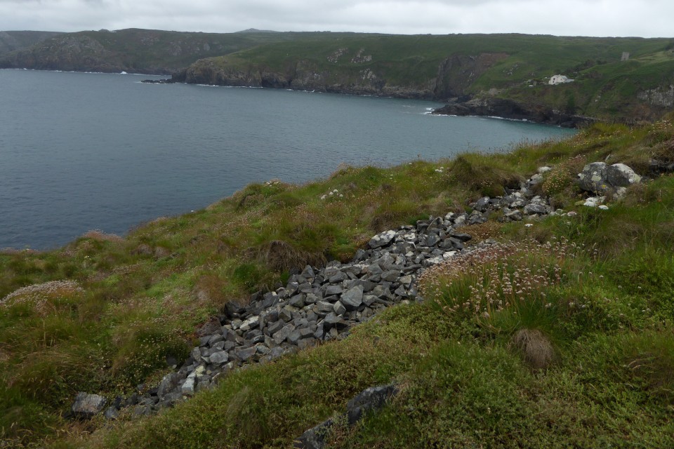
Mentioned by Craig Weatherhill, in "Cornovia: Ancient Sites of Cornwall & Scilly" (Cornwall Books - 1985, revised 1997 & 2000) - "Two dilapidated stone ramparts 60m long, with outer ditches, cross the high, narrow neck of this rugged headland, defending an area of 3 ha. The inner bank, 3.0m thick, reaches a height of 1.8m; the outer rampart is now no more than 1.2m high. The two halves of each rampart are slightly out of alignment, forming staggered entries that are now difficult to see. 10m south of these defences is a short length of ditch above the eastern cliff, apparently an unfinished outer defence. Excavation in 1939 showed that the back of the inner rampart had been fashioned into three steps, providing a stance for slingers, as in some Breton cliff castles. Within the ramparts, on the lower eastern side of the headland, are sixteen round houses averaging 6.0m in diameter. They and the ramparts are second century BC." Just off the coastal footpath, on National Trust openland. |
 Posted by pure joy
2nd November 2003ce |