|
|

|
|
Scutchamer KnobArtificial Mound
|
|
|
|
News |
|
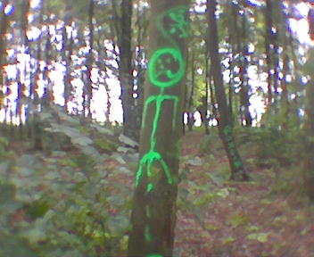
Vandals at the KnobScutchamer's Knob, has always been a a glowing belisha beacon on the beautiful Berkshire downs for rave parties and illicit camping trips - especially during the early '90's. Largely helped by its ease of accessability but yet fairly remote location... continues... |
Posted by Shining_Moon 8th July 2004ce |
Images (click to view fullsize) |
|
Photographs: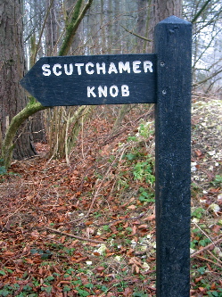
 Artistic / Interpretive:
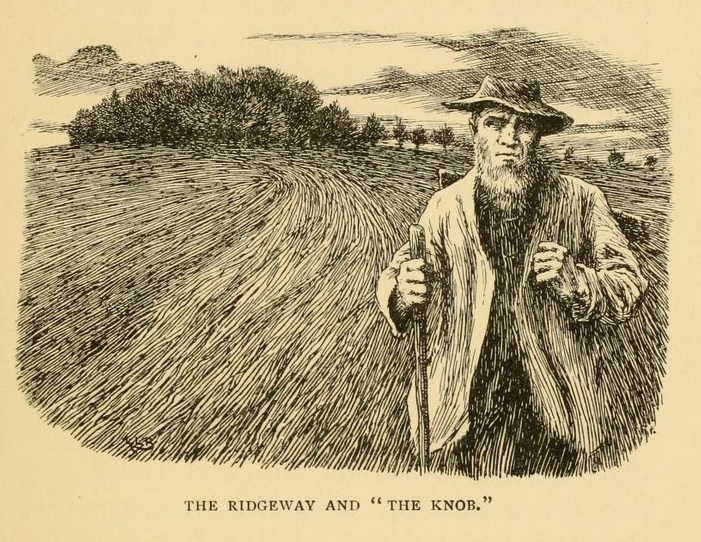
|
Fieldnotes |
|
|
I have a special place in my heart for scutchamer.. I join the ridgeway at east ilsley where it crosses the A34, so this is the first antiquity I reach. Only another 45 or so miles to Avebury!! It's definitely a mysterious place, the first time I did the ridgeway there was a gigantic bonfire burning there. Shame about the rubbish though and as for those trees.. too many knobs at scutchamer I reckon!! |
Posted by HopHead 20th January 2008ce |
| Just visited the 'Knob' this spring (2005) and have seen new changes. There is now a fence around the base of the knob and there has been some clearing of the scrub and trees on top. Guess I kind of liked it better before! |
26th April 2005ce |
|
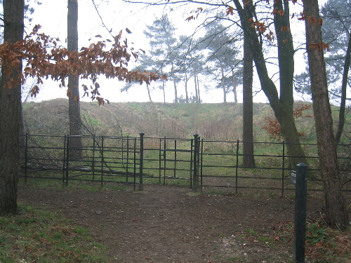
This is one of the saddest sites I have visited. Hidden in a small wooded area is the Knob, which I believe used to be a small artificial hill/chamber. This has collapsed in the middle and one edge has been worn away to leave a horseshoe shapped mound. Sickeningly the remains of Scutchamer Knob have been used by off road motorcyclists for scrambling and the area is littered with plastic bags and bottles. |
13th April 2004ce Edited 16th December 2006ce |
|
Just a quickie, I visit this place often and it is in a break of trees on the Ridgeway path. It is much worn down and used by trials bikes and mountain bikes for practice (shame!). There is a fair amount of rubbish at this site from campers who don't pick up the litter (shame again!). The original shape has long gone and as the centre has collapsed, it resembles more of a dougnut with a hole in one side, than a conical mound (which it once was). All traces of the ditch which once must of surrounded it are also gone. It is still quite a height (20 feet or so tall) and offers a good view out on one side. Try to imagine the original construct and the fact that the trees would not have been there. It sits atop the crest of a hill and would have offered an excellent view of the surrounding countryside. It is a very large mound, and although it resembles a large barrow (or a mini silbury hill depending on your presuasion), I have found no evdience to support its prehistoric antiquity. All references to Scutchamer Knob are in the early Anglo-Saxon period (400-600 AD). A pleasant and historically important site (see the folklore), but also a very busy one as the Ridgeway is well used (especially at weekends) and adjacent to the site. |
4th November 2003ce Edited 4th November 2003ce |
Folklore |
|
For the most part, this venerable way is deserted save for an occasional shepherd or a solitary farm labourer returning home from work. Silent and lonely, it pursues its course over height and into hollow: now stretching away in a generous curve sharply defined by a bank on either side, now scarcely to be distinguished from the surounding turf.From Travels Round Our Village by Eleanor G Hayden (1902). |
 Posted by Rhiannon
8th May 2014ce Edited 8th May 2014ce |
There is a remarkable tradition amongst the peasantry, who state that this fosse*, from one end to the other, was dug by the Devil in a single night, and that retiring to the summit of the downs he there scraped his spade, the mould from which formed the well-known barrow, Cuckhamsley Hill! Others narrate that it is a furrow made by the Devil, who traversed these downs with his plough!*ie the Devil's Dyke or Grim's Ditch. From 'The history and antiquities of the hundred of Compton, Berks' by John Snare, 1844. |
Posted by Rhiannon 14th July 2010ce Edited 14th July 2010ce |
|
extract from 'Berkshire' by Ian Yarrow 'There are various ways of spelling this name, of which Cwichelmeslaew, the burial-place of Cwichelm, is the most difficult to spell and pronounce. Scutchamer is believed by some to be a corruption of Scotchman's Knob, while others see in it a reference to Captain Scutchamer, a gentlemen killed in the Civil Wars. The "Knob" in its grove may have been a barrow, but nothing has been found inside it that will settle the matter, though some Iron Age pottery discovered in the surrounding ditch may indicate its age. Birinus, the missionary, preached from here in the seventh century, and shire moots sat on it.' |
7th May 2007ce |
|
with the original name of the site being 'Cuckhamsley' (deriving from Cwichelmshlaew), where does the 'Scutch' come from? To Scutch is to separate fibres (i.e. flax) and I assume the same is true of wool. The Berkshire Downs were reknowned for sheep and sheep fairs (east ilsley), and I have read (but can't find it among the library - argh!) a reference to Scutchamers Knob being used as a meeting place for a sheep fair. Given the distance from 'the Knob' to East Ilsley sheep fair, maybe it was a place the shepherds and flocks stayed at, the night before arrival at the fair? --- A 'scotch' can be a tool for 'scutching', although the fact that the site is sometimes referred to as Scotsmans Knob (that's quite an unplesant thought if you're a sassenach) may also be because one of the tracks just before the knob goes north! (i.e. to Scotland). --- Thats quite enough about knobs, i'm off to look at knockers (...no you idiot, there's somebody at the door) |
7th May 2007ce Edited 7th May 2007ce |
Before you write an email signed 'Disgusted of Tunbridge Wells' just remember I only copied this information.- On the edge of the Ridge Way, near West Ilsley, is Scutchamfly Barrow. The hill here is called Scotchman's Nob, also Scratch my Nob. I was told (June, 1901) that a battle was fought there with the Scotch, and that the barrow was the grave of those slain in the battle. An elderly woman told me that her father used to say that the battle was called the Battle of Anna.Scraps of Folklore Collected by John Philipps Emslie, by C. S. Burne, in Folklore, Vol. 26, No. 2. (Jun. 30, 1915), pp. 153-170. |
Posted by Rhiannon 30th September 2006ce |
|
from BERKSHIRE by F G Brabant (1911) This entry is in an old book about Berkshire from 1911. It does mention the 'knob' as being a barrow, but I imagine every lump was termed a barrow in those days. Scutchamore Knob is a remarkable barrow on the ridge of the downs, two and a half miles S. of East Hendred. It stands in the centre of a fine clump of beeches, and a large hole has been dug on its N. side. The name is a corruption of Cwichelm's hlaew (or hill), which has also been altered to Schoomchamfly. Cwichelm was a chieftan or prince in authority under the King of Wessex, and he may well have defended the line of the downs against the advance of the Mercians, as his son Cuthred did, somewhat later. In 871, the Danes, after leaving Reading, are said in the Saxon Chronicle to have 'turned along Ashdown to Cwichelm's hlaew' just before the battle of Ashdown. In 1006 the Danes, after burning Wallingford and Cholsey, turned again to Cwichelm's hlaew, and stayed there out of bravado, because it had often been said that if they came to Cwichelm's hlaew they would never go to the sea. |
4th November 2003ce |
|
Scutchamer Knob was once a 'moot' or 'gemot' place in Anglo-Saxon times. This basically means a 'meeting place' and was used for the local Anglo-Saxon leaders as a sort of 'Berkshire Parliament'. (Originally it was in Berkshire but the boundaries between Berkshire and Oxfordshire changed in the mid 1970's). Local law and justice would have been decided here. The tradition of meeting outdoors to deal with important matters, as opposed to indoors, has its roots in the Germanic (i.e. A-S). It was at this place that criminals would be tried and sentenced (sometimes to death). See 'Kilman knoll' nearby on the OS map as a possible site for the hangings. Originally named 'Cwicchelmeshlaew' (or variaitions on the spelling), the place literally meant 'the law of Cwichelm' and referred to one of the early Wessex Anglo-Saxon sub-kings (a long time before Alfred the Great). This gives a date of use in the early Anglo-Saxon period, early in the 600's AD. The place became symbolic in the later viking invasions and expansion into the area. The Wessex Anglo-Saxons were some of the last to resist the mighty and all-conquering viking invasions. It was sad if the vikings ever reached as far as Scutchamer Knob, then they wouldn't escape alive. This was reached by the vikings and sort of came true. Alfred led the local Saxons to victory against the Danes in the Battle of Ashdown in the year 871 AD somewhere in the local area (there are various places suggested for this site). The invaders were beaten and retreated back to Reading. This was a pivotal point in Anglo-Saxon times as the vikings had never suffered such a defeat on a large scale before. Although Alfred the Great suffered further defeat at the hand of the viking hordes and ended up fleeing to the Somerset marshes later, it showed they could be beaten. Scutchamer Knob has had an important place to play in the history of England. The Anglo-Saxons of the kingdom of Wessex came out stronger than the other A-S kingdoms of England at the time of the viking invasions and went to to form the country we now know as England. Out of Wessex, came England. |
4th November 2003ce Edited 4th November 2003ce |
Miscellaneous |
|
|
Details of site on Pastscape Scutchamer Knob (called Cwichelmeshlaew, in the Anglo Saxon Chronicle) is a large mound ten feet high, constructed of layers of turves, on the Downs just south of the Ridgeway on the boundary of the parishes of East and West Hendred. It is believed to be the site of an Iron Age primary inhumation in a barrow and later secondary Saxon inhumations before use as a beacon. The site was excavated in 1844, which uncovered a range of finds including a stone bead, an iron buckle, horses' teeth and 'large bones' as well as a large oak stake believed to be the remains of a beacon mentioned in 1738. When re-excavated in 1934, the only significant finds were large quantities of Iron Age La Tene I period pottery, all disturbed by earlier excavations. The mound was surrounded by a ditch originally five feet deep, with no berm. The complete absence of La Tene II pottery is believed to indicate that the mound was erected between 300 and 200 B.C. It lies in a small reafforested copse and survives as an earthwork, crescentic in plan, with a deep hollow in the middle and no trace of a ditch. Its situation, high on the chalk downs, is ideal for a beacon. [SU 45658503] Scutchamer Knob [T.I.] Tumulus [G.T.]. (1) Cuckhamsley, Scutchemer or the Scotchman's Knob called Cwichelmeshlaew, in the Anglo Saxon Chronicle (5) is a large mound ten feet high, constructed of layers of turves, on the Downs just south of the Ridgeway on the boundary of the parishes of East and West Hendred. It was excavated in 1844; the finds, scattered all over the site, consisted of a stone bead, an iron buckle, horses' teeth and "large bones", a large oak stake was possibly a beacon post, mentioned in 1738. When re-excavated in 1934, the only significant finds were large quantities of Iron Age A pottery sherds of La Tene I period all disturbed by earlier excavations. The mound was surrounded by a ditch originally five feet deep, with no berm. The complete absence of La Tene II pottery seems to indicate that the mound was erected between 300 and 200 B.C., but its purpose is not clear (2) Scheduled (3). (2-5) Scutchamer Knob lies in a small reafforested copse. The mound is crescentic in plan with a deep hollow in the middle and no trace of a ditch. Its situation, high on the chalk downs, is ideal for a beacon. Surveyed at 1/2500. (6) Probable Iron Age primary inhumation in a barrow, and secondary Saxon inhumation. (7) The secondary burials were found with a bead and bronze buckle and are thought to be Saxon in date. (8) -------------------------------------------------------------------------------- SOURCE TEXT -------------------------------------------------------------------------------- ( 1) Ordnance Survey Map (Scale / Date) OS 6" (Prov) 1960 ( 2) Transactions of the Newbury District Field Club H.J.E. Peake, H.H. Coghlan, C.F.B. Marshall & J.M. Birkbeck 7, 1935 Page(s)93-102 ( 3) Ancient Monuments Boards for England, Scotland and Wales annual reports 1961 Page(s)20 ( 4) Berkshire Archaeological Society The Berkshire archaeological journal 42, 1938 Page(s)110 ( 4a) General reference Anglo Saxon Chronicle. A.D. 1006 ( 5) General reference Peake H. 1931. Archaeology of Berkshire, 164 ( 6) Field Investigators Comments F1 JP 27-AUG-1963 ( 7) by Audrey Meaney 1964 A gazetteer of early Anglo-Saxon burial sites Page(s)45 ( 8) Gazetteer of Early Medieval Sites (unpublished thesis, 2006 by Dr A.K Cherryson)) Page(s)109 |
 Posted by Chance
21st August 2012ce |
|
from 'Berkshire' by Ian Yarrow '...Cwichelmeshlaew, once described as "the boast and glory of our downs", was for long thought to be a burial-place of Cwichelm, a saxon chief, but in 1934 Mr Harold Peake, after a thorough excavation, came to the conclusion that most probably this was not a burial-place at all and had been constructed for some purpose during the early iron age.' (my italics) |
7th May 2007ce |