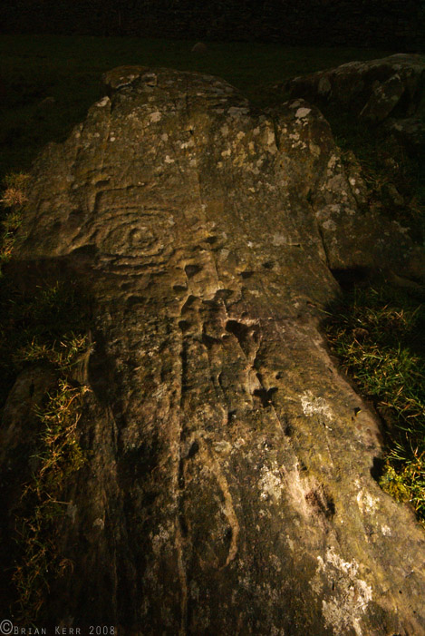
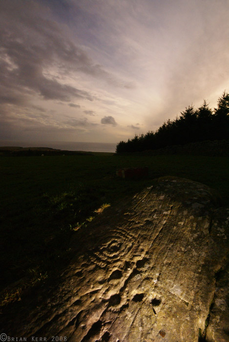
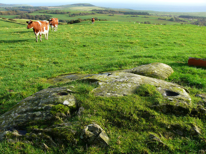
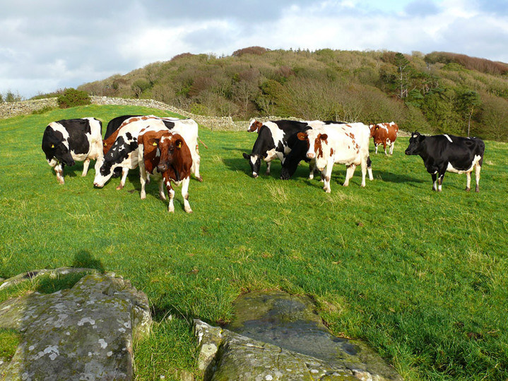
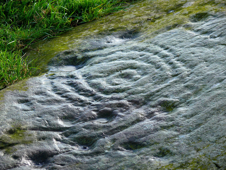
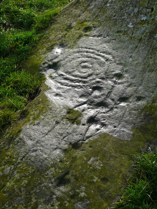
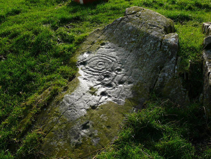
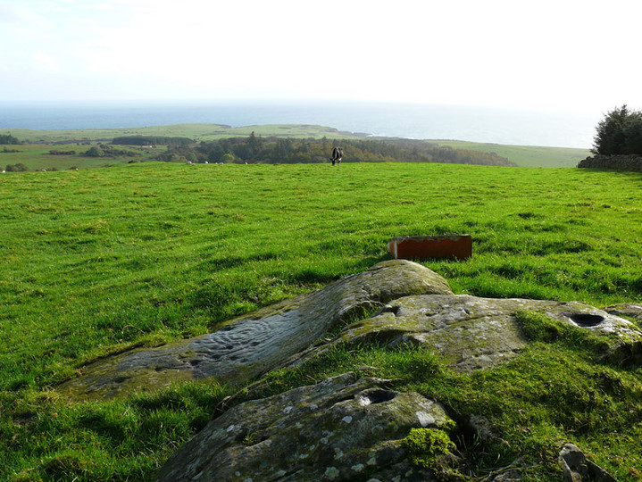
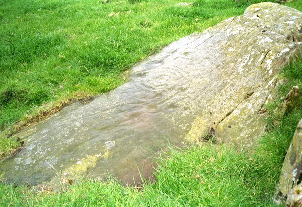
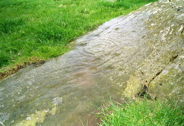
Log in
|
Register
Home
Latest Posts
Forums
Maps
Help
Browse Sites
News
Blog
Contributors
The Books
Select
-
Belgium
Denmark
Eire
France
Greece
Italy
The Netherlands
Norway
Portugal
Republic of Malta
Spain
Sweden
Switzerland
United Kingdom
Scotland
Dumfries and Galloway
Knockshinnie
Cup and Ring Marks / Rock Art
Knockshinnie (Knockshinnie 1a) (Cup and Ring Marks / Rock Art) on The Modern Antiquarian, the UK & Ireland's most popular megalithic community website. 10 images, plus information on many more ancient sites nearby and across the UK & Ireland.
Image © pebblewolf
Also known as:
Knockshinnie 1a
Nearest Town:
Kirkcudbright (6km NNW)
OS Ref (GB):
NX684455 /
Sheets: 83, 84
Latitude:
54° 47' 12.84" N
Longitude:
4° 2' 48.39" W
Added by
rockartuk
Images (10)
0 discussions
Start a topic
Show |
Hide
Web searches for Knockshinnie
Flash Earth
Flickr
Google
Google Images
MAGIC
The Megalithic Portal
Bing
Stone Pages
Streetmap.co.uk
Wikipedia
Show map
(inline Google Map)
- Sites within 20 km -
-
Knockshinnie 2 (0.32km SSW) (8 posts)
Torrs 7 (0.36km WSW) (2 posts)
Torrs 4 (0.42km SW) (7 posts)
Drummore Castle (0.44km ENE) (0 posts)
Torrs 3b (0.5km SW) (1 post)
Torrs 1 & 2 (0.5km WNW) (12 posts)
Drummore (0.56km NE) (3 posts)
Torrs 3 (0.58km WSW) (11 posts)
Torrs (0.58km SSW) (7 posts)
Torrs 10 (0.86km SW) (2 posts)
Balmae 35 (1km SSE) (2 posts)
Dunrod (1.36km ENE) (2 posts)
Blackhill Cottage (1.42km NE) (4 posts)
Grange 1 (1.65km N) (3 posts)
Grange 2 (2km N) (3 posts)
Grange 3 (2.04km N) (11 posts)
Townhead (2.06km NE) (45 posts)
High Grange 2 (2.42km NE) (0 posts)
Milton (2.49km NE) (88 posts)
High Grange 1 (2.56km NE) (13 posts)
Galtway 18 (3.61km NE) (6 posts)
Senwick 1 (3.88km W) (5 posts)
Galtway (3.93km NE) (2 posts)
Clash (3.95km W) (10 posts)
Galtway 7 (4.04km NE) (2 posts)
Senwick 4 (4.11km W) (8 posts)
High Banks (4.21km NE) (39 posts)
Galtway 5 (4.32km NE) (6 posts)
Brighouse Standing Stone (4.38km WSW) (3 posts)
Clauchendolly (4.42km W) (53 posts)
Castlecreavie (5.43km NE) (1 post)
Castlecreavie Dun (5.45km NE) (5 posts)
Castlecreavie (5.45km NE) (15 posts)
Borgue (5.54km W) (6 posts)
Bombie 5 (5.79km NE) (0 posts)
Bombie (5.85km NE) (2 posts)
Bombie 1 (5.87km NE) (5 posts)
Bombie 4 (5.92km NE) (3 posts)
Bombie 3 (5.93km NE) (9 posts)
Bombie 2 (5.94km NE) (18 posts)
Newlaw Hill 2 (5.95km NE) (3 posts)
Newlaw Hill 1 (5.95km NE) (15 posts)
Newlaw Hill 3 (6.03km NE) (18 posts)
Culdoach (7.39km NNE) (21 posts)
Auchenhay (7.57km WNW) (2 posts)
Tongue Croft (8.57km W) (18 posts)
Castle Haven (9.44km W) (5 posts)
Park of Tongland (10.59km N) (7 posts)
Nether Linkens (11.28km NE) (9 posts)
Park of Tongland (11.48km N) (1 post)
Big Airds Hill (13.39km ENE) (0 posts)
Little Airds Hill (13.99km ENE) (0 posts)
Glengap House (14.04km NW) (1 post)
Trusty's Hill (14.14km WNW) (11 posts)
Harper's Hill (14.63km WNW) (10 posts)
Slagnaw (14.64km NNE) (3 posts)
Newton Farm (14.89km W) (3 posts)
Newton Farm (14.97km W) (1 post)
Newton Farm Burial Chamber (14.98km W) (8 posts)
Rutherford's Witnesses (15.04km WNW) (1 post)
Mossyard (15.05km W) (17 posts)
Lagganmullan 10 (15.18km WNW) (3 posts)
Lagganmullan 8 (15.18km WNW) (5 posts)
Lagganmullan 9 (15.18km WNW) (6 posts)
Lagganmullan 1 (15.31km WNW) (0 posts)
Lagganmullan House (15.37km WNW) (2 posts)
Lagganmullan 2 (15.46km WNW) (6 posts)
Lagganmullan 7 (15.57km WNW) (2 posts)
Lagganmullan 7a (15.57km WNW) (5 posts)
Lagganmullan 6 (15.57km WNW) (0 posts)
Lagganmullan 7c (15.57km WNW) (2 posts)
Lagganmullan 7b (15.57km WNW) (3 posts)
Lagganmullan 7d (15.57km WNW) (5 posts)
Lagganmullan 4 (15.62km WNW) (7 posts)
Laggan Farm (15.65km W) (3 posts)
Lagganmullan 3 (15.68km WNW) (4 posts)
Lagganmullan 5 (15.71km WNW) (2 posts)
Upper Newton 3 (16.13km WNW) (4 posts)
Kirkclaugh (16.18km W) (2 posts)
Upper Newton 2 (16.19km WNW) (5 posts)
Upper Newton 1 (16.59km W) (3 posts)
Lodge Of Kelton Farm (16.59km NNE) (9 posts)
Upper Newton 4 (16.67km W) (0 posts)
Kirkclaugh (16.73km W) (1 post)
Whiteside (16.76km WNW) (3 posts)
Bardristane 3 (17.3km W) (3 posts)
Bardristane 4 (17.38km W) (6 posts)
Bardristane 1 (17.52km W) (5 posts)
Barholm 2 (17.88km W) (1 post)
Barholm 3 (17.93km W) (2 posts)
Fir Island and Ash Island (18.17km NNE) (1 post)
Cairnharrow (18.25km WNW) (12 posts)
Cairnharrow (18.39km W) (2 posts)
Torrs Hill (18.48km NNE) (1 post)
Cairnholy (18.54km W) (77 posts)
Cairnholy 01 & 02 (18.54km W) (7 posts)
Kirkdale House (18.55km W) (2 posts)
Barholm 1 (18.55km W) (1 post)
Cairnholy 03 (18.55km W) (0 posts)
Cairnholy 10 (18.94km W) (0 posts)
Kirkmuir 1a & 1b (18.94km W) (1 post)
Kirkmuir 2 (18.94km W) (1 post)
Cairnholy 06 (18.98km W) (1 post)
Kirkmuir 3 (18.99km W) (1 post)
Cairnholy 09 (19km W) (4 posts)
Kirkdale Mains Stone (19.03km W) (1 post)
Cairnholy 04 (19.04km W) (1 post)
Cairnholy 08 (19.09km W) (1 post)
Kirkmuir (19.12km W) (2 posts)
Kirkmuir 4 (19.12km W) (1 post)
Cairnholy 05 (19.14km W) (1 post)
Cairnholy 07 (19.19km W) (0 posts)
Cauldside Burn Cairn (19.3km W) (8 posts)
Cauldside Burn (19.3km W) (11 posts)
Cauldside Burn Stone Setting (19.36km W) (2 posts)
Cambret Moor (19.56km W) (11 posts)
Claughreid (19.66km W) (11 posts)
Ernespie Standing Stones (19.86km NNE) (8 posts)
- Facilities within 20 km -
-
Newton Farm (Camping Site: 15 km WNW)
Cairnholy Old Farmhouse (Bed & Breakfast: 18.8 km WNW)
- Add -
-
Add news
Add an image
Add fieldnotes
Add folklore
Add miscellaneous
Add a link
-
Add a site
Add a nearby facility
Add an alternative name/spelling
Images
(click to view fullsize)
Add an image