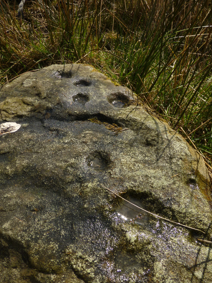
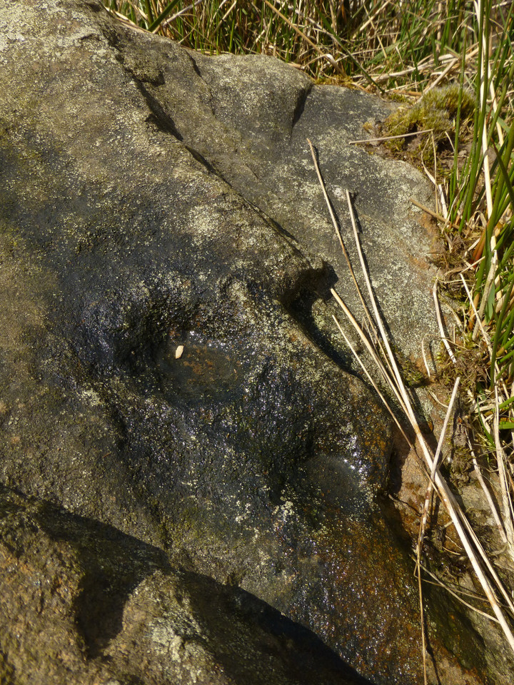
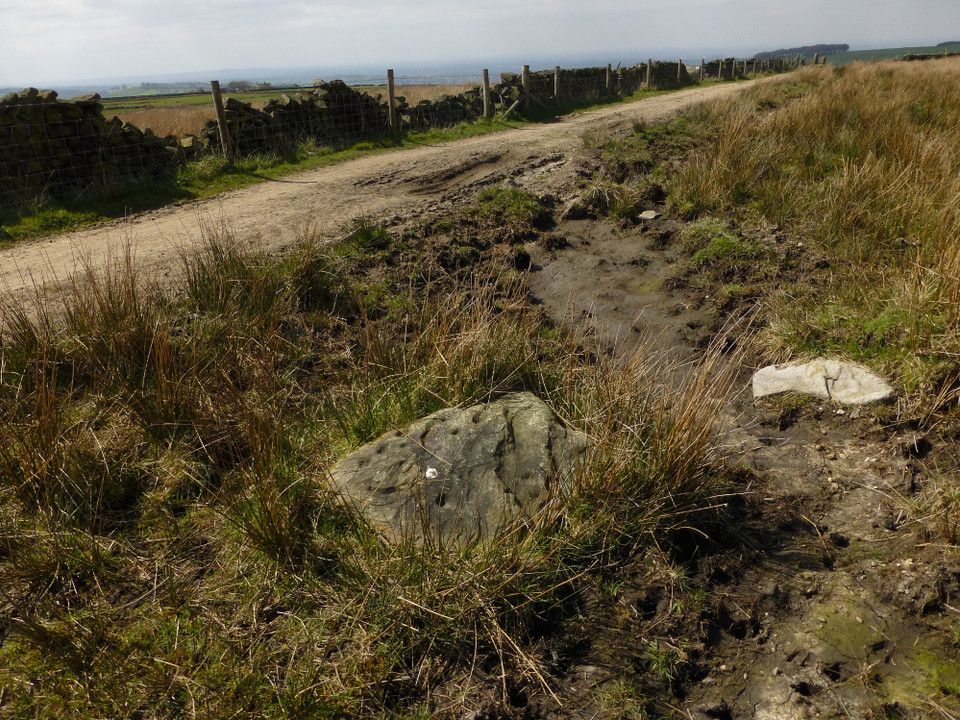
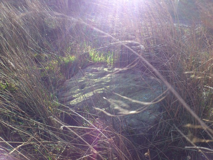
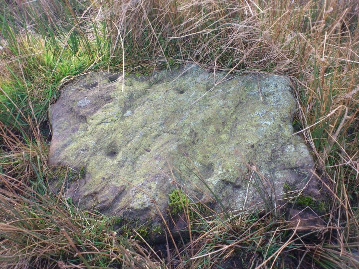
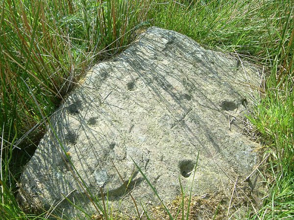
[visited 27/11/2011] Relatively high effort to reward ratio this one, but worth it in my opinion. The stone is located within 5 paces off the bridleway and easy to spot. It is quite small and most of the cups are easy to work out despite being small themselves. Some would probably be classified as microcups if such a classifiaction were made.
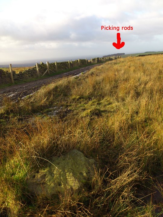
It seems in a weird location, with nothing else within a mile or so apart from the Picking rods, though who knows what else is hidden on this high and barren place. Certainly there are walls which look very old up here (SK007907 ish for example), so I wouldn't be surprised if this plateau was farmed in the Bronze Age. The high grounds containing nearby barrows (Ludworth Intakes & Cown Edge) are visible, though I couldn't make out the barrows.
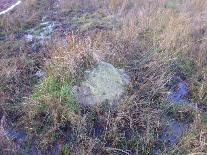
Access was ok, but very muddy and required me to cross 2 stiles. I parked near Pistol farm and headed along the tracks via Far Slack farm to the Bridle path which the stone is just off. A word of warning, I annoyed two "fierce" labradors at Far Slack farm who decided to chase me off their territory. As there was no owner in sight, I legged it to the stile at the bridle path. I'm sure they wouldn't have attacked, but caution seemed prudent. On the way back to the car I took the more direct footpath which was more uneven but quicker.
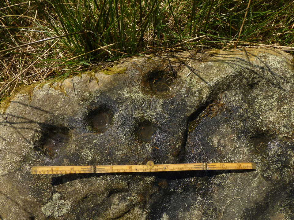
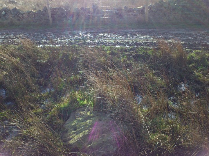
About 80m east of Robin Hood's Pricking Rods is a smallish gritstone slab with 10-11 cup marks on it's upper surface. It lies on the bank of a small spring.
Visible from the cup marked rock is Coombes Tor and legend has it it was here the tribes of the Peak fought the Romans. One of the Chieftans daughters was sacrificed in the hope it would bring them a victory......alas it didn't and the locals were wiped out.
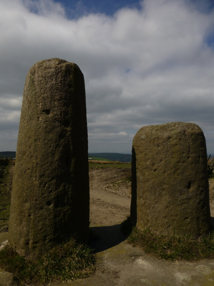
The position of the 'Pricking Rods' is said to mark where the sacrifice took place. As to what the 'Rods' actually are is a bit of a mystery ...they look like they are possibly the remains of 2 wayside crosses stood on top of a large square boulder. Apparently 2 crosses together like this would make them a bit of a rarity......The other explanation for the use of the stones was to aid bending bows whilst being strung.


 Posted by juamei