Visited 24.9.10
Easy site to find and access. Taking the A6108 north towards North Stainley you come to the Lightwater Valley Shopping Village on your left hand side. Park in the large car park and it is a fairly straightforward matter of climbing through the wooden fence and under the barbed wire fence into the field where the camp is.
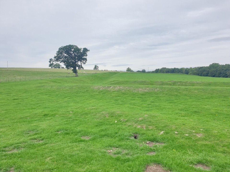
The site itself is in good condition with a bank / ditch going all the way around, about 5ft high from the bottom of the ditch to the top of the bank in some places. It is roughly rectangular in shape and quite large. As with all the sites I visited this week I had the place to myself – not counting the cows of course!
Worth having a look at when in the area as it is easily seen from the road if you don't fancy taking on the barbed wire fence.
This camp has a fascinating possible faulse entrance system. Several hollow ways which approach it from the south converge at Fortress Dyke stream and on the other side diverge again. One of them takes a course straight to the camp, another runs beyond its western side whilst another tow seem to go nowhere - running for 30m or so and then just stopping. Whilst this sort of complex entrance is the same sort of idea as at other Iron Age hillforts, this system is completely different. firstly there are no apparent walls to the hollow ways that approach the camp - it is was a defensive measure they would have had to be lined with wooden fences.
The camp itself is sub rectilinear aproximately 45m by 60m. It has a single bank and ditch which is only apparent on three sides. The fourth side - east appears to have a slight ridge running along it for some of it's length at least. The camp is cut right through by a stream running east west. This may have been an original feature which has now eroded quite a deep path through the camp.
To the north are several other enclosures which have been interpreted as field systems, although one at least is too small, being approx 20m by 7m, and may have been an animal enclosure.