|
|

|
|
Kilmartin Area
|
|
|
|
Sites in this group:
|
3 posts
Achanarnich Cup and Ring Marks / Rock Art |
115 posts
Achnabreck Cup and Ring Marks / Rock Art |
3 posts
Achnabreck Standing Stone / Menhir |
|
10 posts
Achnabreck New 1 Cup and Ring Marks / Rock Art |
1 post
Allt Bealaich Ruaidh Cup and Ring Marks / Rock Art |
2 posts
Anaskeog Cup Marked Stone |
|
1 post
Anaskeog Cairn(s) |
16 posts
Ardifuir Cup and Ring Marks / Rock Art |
20 posts
Auchoish Chambered Cairn |
|
2 posts
Badden Farm Cist |
20 posts
Ballygowan Cup and Ring Marks / Rock Art |
89 posts
3 sites Ballymeanoch |
|
39 posts
Baluachraig Cup and Ring Marks / Rock Art |
15 posts
Baroile Chambered Cairn |
5 posts
Barsloisnoch Lodge Cist |
|
8 posts
Blairbuie 2 Cup and Ring Marks / Rock Art |
Bàrr a'Chuirn
Cairn(s)
|
6 posts
Bruach na Cuirte Cist |
|
54 posts
Cairnbaan Cup and Ring Marks / Rock Art |
22 posts
1 site Carnasserie Stone Row / Alignment |
19 posts
Carn Ban Cairn(s) |
|
13 posts
Carn Bàn Cairn(s) |
4 posts
Carron Standing Stone / Menhir |
23 posts
Clach an t-Sagairt Chambered Cairn |
|
14 posts
1 site Creagantairbh Standing Stone / Menhir |
4 posts
Creagantairbh Beag Standing Stone / Menhir |
11 posts
Creag a' Chapuill Hillfort |
|
5 posts
Crinan Moss Standing Stones |
2 posts
Crubageen Cup and Ring Marks / Rock Art |
70 posts
Dunadd Sacred Hill |
|
3 posts
Dunadd II Standing Stone / Menhir |
3 posts
Dunadd Stone Standing Stone / Menhir |
2 posts
3 sites Dunamuck group |
|
48 posts
Dunchraigaig Cairn Cairn(s) |
15 posts
Dun Chonallaich Hillfort |
4 posts
Dun Dubh Hillfort |
|
10 posts
Dun Na Maraig Hillfort |
12 posts
Dun Toiseach Hillfort |
4 posts
Fincharn Cup Marked Stone |
|
8 posts
Ford Standing Stones |
8 posts
Gariob Cairn(s) |
12 posts
Gartnagreanoch Chambered Cairn |
|
1 site
Glasvaar Cairn(s) |
9 posts
Glenmoine Cup and Ring Marks / Rock Art |
10 posts
4 sites Glennan Standing Stone / Menhir |
|
2 posts
Kilbride Cup and Ring Marks / Rock Art |
26 posts
Kilchoan of Poltalloch Cairn(s) |
3 posts
Kilmartin Cup Marked Stone |
|
37 posts
Kilmichael Glassary Cup and Ring Marks / Rock Art |
1 post
Kilneuair Church Cup and Ring Marks / Rock Art |
51 posts
Kintraw Standing Stone / Menhir |
|
10 posts
Leckuary Standing Stone / Menhir |
1 post
Lochan Druim an Rathaid Cairn(s) |
3 posts
Loch Ederline Crannog |
|
1 post
Loch Michean Cup and Ring Marks / Rock Art |
4 posts
Meall a'Braithain Cup and Ring Marks / Rock Art |
1 post
Nether Largie Cup Marked Stone |
|
4 posts
4 sites Nether Largie Cairn Cemetery Cairn(s) |
Oakfield
Standing Stone / Menhir
|
43 posts
Ormaig Cup and Ring Marks / Rock Art |
|
25 posts
Poltalloch Cup and Ring Marks / Rock Art |
5 posts
Poltalloch Cist Cist |
9 posts
Rhudil cairn Cairn(s) |
|
18 posts
3 sites Ri Cruin & the Great X of Kilmartin |
8 posts
Rowanfield Standing Stone / Menhir |
13 posts
Salachary Stones Standing Stones |
|
6 posts
Slockavullin Cup and Ring Marks / Rock Art |
6 posts
Stane Alane Standing Stone / Menhir |
93 posts
Templewood Stone Circle |
|
3 sites
Tigh a'Charnain Cairn(s) |
28 posts
Torbhlaren Cup and Ring Marks / Rock Art |
3 posts
Torran Standing Stone / Menhir |
|
4 posts
Torran Cup and Ring Marks / Rock Art |
3 posts
Upper Largie Cists Cist |
Upper Rhudil
Chambered Cairn
|
News |
|
|
Kilmartin: The museum showing treasures found on its doorstep Kilmartin Glen - on the road between Lochgilphead and Oban - is a tranquil place, but it hasn't always been so. More info : https://www.bbc.co.uk/news/uk-scotland-glasgow-west-66696653 |
3rd September 2023ce |
Argyll's Kilmartin museum gets lottery boostKilmartin Museum in Argyll is one step closer to a multi-million pound refurbishment. The Heritage Lottery fund has endorsed an application for a £3.1m grant - as well as awarding £400,000 to develop the plans further... continues... |
 Posted by BigSweetie
6th August 2015ce |
Kilmartin Museum project is next for Scots architectsReiach and Hall, one of Scotland's leading contemporary architectural practices, has won the commission to design the £3 million museum housing some of the country's oldest known artefacts... continues... |
 Posted by moss
30th October 2013ce |
|
Kilmartin art event 'Half-Life' - news story News story in today's Herald newspaper has more details about this: http://www.theherald.co.uk/features/features/display.var.1645911.0.0.php |
Posted by VickyD 28th August 2007ce Edited 28th August 2007ce |
|
'Half Life' events from 4-16th September http://www.halflife.org.uk/ Thought provoking archaeological artiness at Kilmartin's Neolithic sites, with NVA http://www.nva.org.uk/ and the National Theatre of Scotland. |
 Posted by Rhiannon
26th August 2007ce |
Kilmartin wins eleventh hour reprieveFrom an article by Stephen Stewart of The Herald - 9th September 2004 One of Scotland's most important museums has been saved from closure by a £100,000 investment package. Frank McAveety, the culture minister, helped broker the deal which will save Kilmartin House Museum in Argyll... continues... |
 Posted by Jane
9th September 2004ce Edited 9th September 2004ce |
University looks back 15,000 yearsby RHIANNION EDWARD of The Scotsman, Monday 5 July 2004 RESEARCHERS are hoping that a computer program will map all of Scotland and give a virtual impression of the landscape as far back as 15,000 years ago... continues... |
Posted by Jane 5th July 2004ce |
Kilmartin House Museum in CrisisKilmartin House Museum is an independent charitable institution established in Scotland in 1994... continues... |
24th May 2004ce Edited 24th May 2004ce |
Mixed Ashes of Man and Animal Give Insight into Bronze AgeFrom The Herald 22 March 2004. A birdwatcher who unearthed the 4000-year-old cremated remains of a young man has given archaeologists fresh insight into the close, superstitious bonds between humans and animals in prehistoric society... continues... |
 Posted by greywether
22nd March 2004ce Edited 25th March 2004ce |
Ancient Scots Link To Stonehenge'Ancient Scots may have enjoyed sophisticated economic, social and cultural links with the builders of one of the world's most mysterious ancient monuments, according to new research... continues... |
Posted by Jane 18th November 2003ce Edited 18th November 2003ce |
3-D modelling of Kilmartin rock artComputer age recreates prehistoric sites in search of answers to carvings mystery From Scotsman... continues... |
Posted by Rhiannon 1st May 2003ce Edited 9th May 2003ce |
Sacred pool ringed by totem poles in Scotland's ritual glenBritish Archaeology news Issue 64, April 2002. An early Bronze Age timber circle containing an inner ring of totem poles set around a deep, sacred pool is thought to have once stood at the head of the Kilmartin Valley in Argyll, site of one of Scotland's richest concentrations of prehistoric ritual monuments... continues... |
Posted by phil 15th May 2002ce |
Images (click to view fullsize) |
|
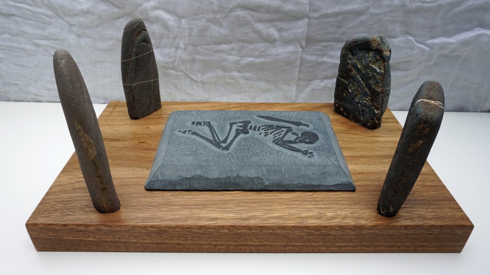
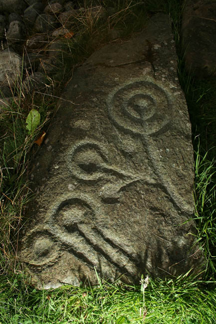
|
Fieldnotes |
|
| I think that one of the best ways to see the tombs and stones at the top end of the valley is to walk past the museum and down to the bottom of the road. Cross the field diagonally and you will find a stile onto a path which takes you to each of the cists and then onto Temple Wood and the great cross. |
 Posted by wee_malky
7th October 2002ce Edited 9th June 2003ce |
Latest posts for Kilmartin Area |
Showing 1-10 of 1,468 posts. Most recent first | Next 10 
Creagantairbh (Standing Stone / Menhir) — Fieldnotes |
|
Right next to the road, just north east from Glennan and its various sites. Fantastic stones, oh for the re-erection of the very tall fallen stone. Plenty cairns nearby, so my feet will visit this area again in the reasonably near future. Visited 07/04/2023. |
24th July 2023ce |
Glennan Cairn 2 (Cairn(s)) — Fieldnotes |
|
A wee jump from the bigger next door cairn will see you land on a cairn that is over 6.5m wide and almost 1m in height. Also like its neighbour there has been some houking to the centre. Hints of a kerb remain. Overlooked by most, but another part of this countryside's jigsaw. Visited 07/04/2023. |
24th July 2023ce |
Glennan (Standing Stone / Menhir) — Fieldnotes |
|
Straight up the track from the road and you'll walk straight into the standing stone. It appears to have been included in a ruined dry stane dyke, which will be very old as well. Superb views for this 2.2m tall stone, plenty sites nearby for the next visit. Visited 07/04/2023. |
24th July 2023ce |
Glennan Cairn (Cup Marked Stone) — Fieldnotes |
|
Slightly to the east of Glennan 1 is a cup marked slab (there appears to be lots of cup marked slabs in the area, another visit required). Nine cup marks can be seen, three are slightly larger. Visited 07/04/2023. |
22nd July 2023ce |
Glennan Cairn 1 (Cairn(s)) — Fieldnotes |
|
Head east on the B840, just north of Kilmartin, and pull in at the second track track heading south. If you can get a reasonable run and can jump the gate, you'll land on the cairn. Surrounded by wonderful scenery and prehistory Cairn 1 sits at over 11m wide being 1.5m tall. It has been houked revealing a probable cup marked cist cover at the centre of the site. Several kerbs remain in place. Next to road, open the gate, no need to jump. Visited 07/04/2023. |
22nd July 2023ce |
Gariob (Cairn(s)) — Fieldnotes |
|
Gariob is a fairly easy cairn to find, just behind the cottage of the same name. I was given permission to park on the track just before the cottage. Follow this track for approximately 100m and jump the dyke into the field to the south. The branches of a tree cover the site. It is a well shaped cairn being 8m wide and 0.7m tall. Sadly the well made cist had been completely covered by fallen branches and damaged by tree roots. These tree roots had also nudged some of the kerbs. If these trees hadn't there, a clear view of Loch Sween would be seen. Still, a nice place on a nice Spring day. Visited 06/04/2023 |
18th July 2023ce |
Rowanfield (Standing Stone / Menhir) — Fieldnotes |
|
A day that started with the superb Galleried Dun at Druim An Duin ended up at the Rowanfield Standing Stone. From Kilmartin I took the A816 south then the B8025, signposted Crinan / Tayvallich. Take the first minor road heading west, then take the first farm track at Fasgadh, just before Mheall Cottage. Plenty room to park at a now defunct quarry. Follow the track uphill until a clearing, the standing stone is straight ahead. It stands at 2.6m high. If the trees weren't there it's a fair chance you could see down into the Kilmartin valley. A nice way to finish the day. Visited 04/04/2023. |
10th July 2023ce |
Ballymeanoch Barrow (Barrow / Cairn Cemetery) — Fieldnotes |
|
To my complete surprise I spied a barrow, almost next to the A816. It must have been huge in its original condition as it still is 30m wide and still has a height of over 1m. As usual, field clearance has been dumped on top. Not much to see, the site is grass covered, I found the site fascinating, so fascinating I jumped the dyke and walked back to Kilmartin to catch up with A & B. I'd forgotten about the henge, I'll visit that in 2024. Yet another part of the jigsaw. Visited 04/04/2023. |
10th July 2023ce |
Ballymeanoch Cairn (Cairn(s)) — Fieldnotes |
|
Next to the stone row is an excellent wee kerb cairn, with some decent kerbs or teeth (as I call them) in the place. Yet again, my thoughts travelled to another place in Scotland, this time to Aberdeenshire, where I live, and the excellent Clune Recumbent Stone Circle. (T also mentioned this as in Temple Wood) The RSC has a decent kerb cairn next door, just like here, it also has a very decent boulder cairn reasonably close, about the same distance to my next stop - the lesser spotted barrow. Visited 04/04/2023. |
10th July 2023ce |
Ballymeanoch — Fieldnotes |
|
I followed the path to the stone row or stone rows, 4 and 2, another excellent site complete with rock art. My thoughts went instantly to the stone rows on Islay and Jura. As with all of the valley's sites there is plenty nearby so a good look round is essential. I looked over the kerb cairn, and to my surprise spied what looked like the flattened remains of a massive cairn or barrow. To the wee kerb cairn first. Visited 04/04/2023 |
10th July 2023ce |
Showing 1-10 of 1,468 posts. Most recent first | Next 10