10 August 2003
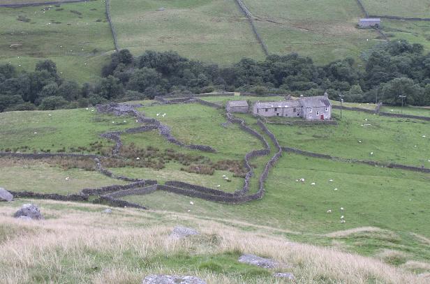
We drove through Reeth up into the bottom of Arkengarthdale and parked around NZ027006, on the verge by the track to Castle Farm. We followed the track down to the river amongst trees (beautiful spot).
Across a bridge, back out into the now blazing sun and up the gentle slope towards the farm buildings.
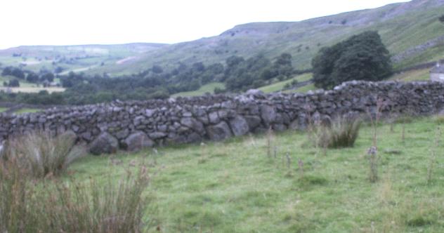
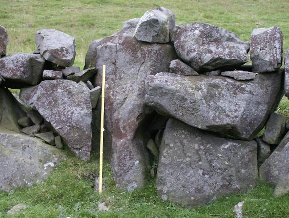
In the fairly small enclosure to the right of the further farm house (Castle Farm itself according to the map), you can immediately see the 'orthostatic' walls of upright stones that the more modern walls seem to have been built onto – if I understand correctly.
Just to the left (north west) of the farm buildings is a stand of trees, on a bank littered with massive rocks, presumably from field clearance.
At the bottom of the bank where you approach it from the path leading along the valley, is a kind of 'kerb wall', possibly related to the orthostatic walls Brigantesnation talks about, or perhaps just a more modern effort to support the bank. We sat in perfect peace for a good few minutes before the walk (mainly uphill!) back to the car.
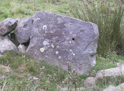
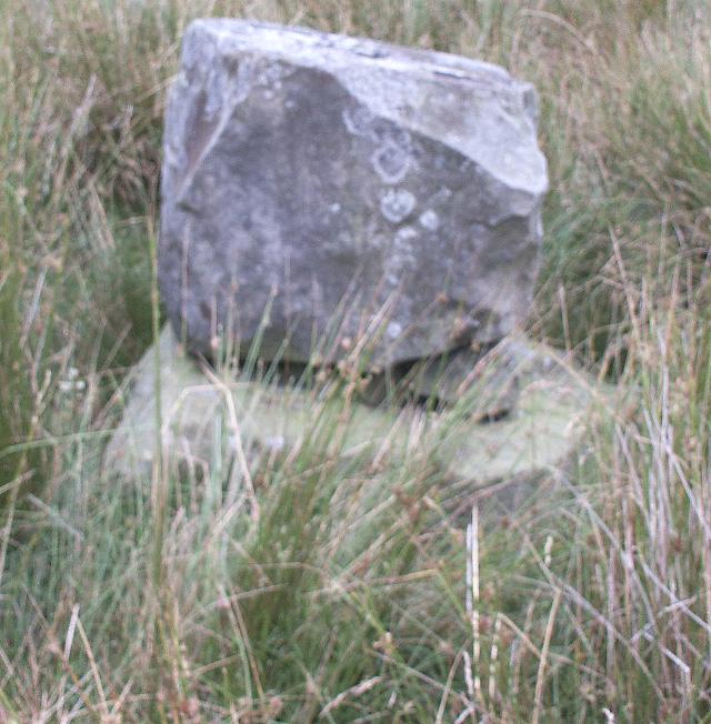
I'm not really sure what this is, other than it's more than what it is currently used for - an animal enclosure. I visited this place on the way to the Gayle mines. There are two places locally called Castle - this place and Castle Knoll, at the top of the escarpment. But no obvious castle. Anyway, this enclosure comprises of a very rough circle of orthostats that have been left in situ and used to create an sheep enclosure. in the centre is a stone on top of a stone. From what I know about the region, these orthostatic walls were created at the very beginning of the clearance of the fields, an a guess I'd say that these were placed here during the late bronze age, as man made the transition to a farmer. However, they could be earlier - very little work has been done on these types of walls so far, although I have come across some partially cleared fields with orthostatic walls, associated to Iron Age type dwelling enclosures quite near to here so I'm pretty certain as to my interpretation.
The enclosure looks like it originally opened to go up the hil and a tight double wall of orthostats creates a narrow causeway which drives up the hill side for some way, then widens out in a similar way to what are known as "banjo enclosures" - creating a bottle neck or funnel into enclosure. These have so far been interprested as for animal use, however, my gut feel is that this was not the primary purpose here. About half way up the hill, just as you enter the mining zone the orthostats disappear. They don't appear to have been taken, they just stop.