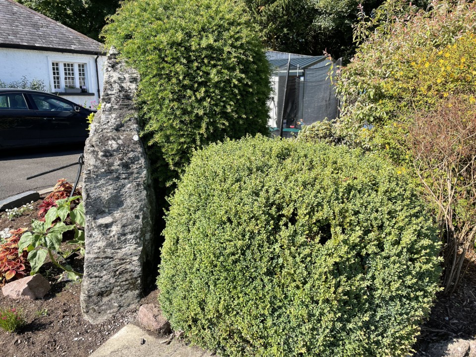
Log in
|
Register
Home
Latest Posts
Forums
Maps
Help
Browse Sites
News
Blog
Contributors
The Books
Select
-
Belgium
Denmark
Eire
France
Greece
Italy
The Netherlands
Norway
Portugal
Republic of Malta
Spain
Sweden
Switzerland
United Kingdom
Northern Ireland
County Antrim
Cushendun Caravan Park
Standing Stone / Menhir
Cushendun Caravan Park (Standing Stone / Menhir) on The Modern Antiquarian, the UK & Ireland's most popular megalithic community website. The site also contains a vast wealth of information on many more ancient sites across the UK & Ireland.
No image available
OS Ref (GB):
D246332 /
Sheet: 5
Latitude:
55° 7' 49.07" N
Longitude:
6° 2' 46.64" W
Added by
FourWinds
0 discussions
Start a topic
Show |
Hide
Web searches for Cushendun Caravan Park
Flash Earth
Flickr
Google
Google Images
Megalithomania
Multimap 1:25000
Stone Pages
Streetmap.co.uk
Wikipedia
Show map
(inline Google Map)
- Sites within 20 km -
-
Ballycleagh (0.28km NE) (3 posts)
Ballyvennaght (4.92km WNW) (4 posts)
Ballyvennaght (5.42km WNW) (9 posts)
Carnanmore (6.25km NW) (1 post)
Glenmakeerin (6.43km W) (2 posts)
West Torr (8.08km NW) (6 posts)
Cloghafadd (10.69km WNW) (8 posts)
Coolanlough (11.13km WNW) (2 posts)
Corvally (11.25km W) (4 posts)
Lough-na-Cranagh (11.59km WNW) (4 posts)
Ballynagloch (12.3km WNW) (6 posts)
Breen (12.37km W) (5 posts)
Knocklayd (13.76km W) (4 posts)
Clough Berragh (15.99km W) (4 posts)
Ballylig (16.16km W) (5 posts)
Tober-bile (16.5km W) (5 posts)
Loughguile (18.18km WSW) (6 posts)
- Add -
-
Add news
Add an image
Add fieldnotes
Add folklore
Add miscellaneous
Add a link
-
Add a site
Add a nearby facility
Add an alternative name/spelling