As I recall, I was left with a choice between visiting this excellent site and the wondrous Dunruchan standing stones last year - a bit like Ron Greenwood having to choose between Peter Shilton and Ray Clemence, you might say? Frankly - in retrospect - I was 'on a winner' either way, just like the former England manager. The bizarre Dunruchan monoliths eventually got the nod... and vindicated the decision by keeping the proverbial clean sheet. And then some. Nevertheless thoughts of Balmuick wouldn't do as they were told and stay conveniently filed away in the subconscious. Oh no. Not with an (apparently) sublime mountain backdrop like that. Nothing for it, then.
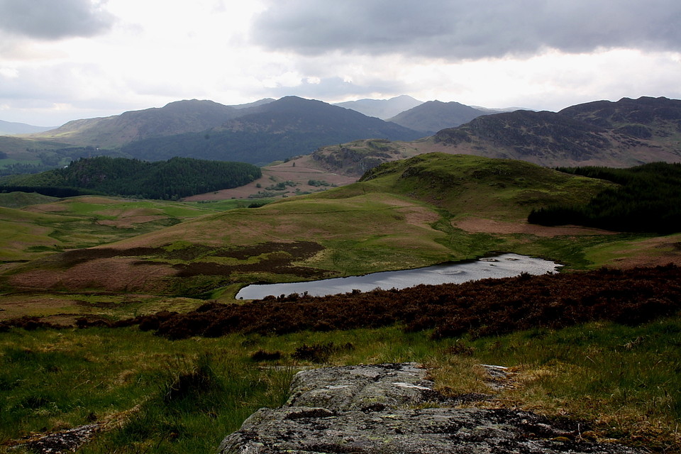
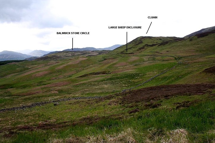
I choose as my starting point the car park below the dam holding back the waters of Loch Turret, Choinneachain Hill rising to the north, crowned by a Bronze Age cairn. Crossing the dam, the track veers south for about a mile before heading west towards distant mountains ... or hills, as the Scots refer to them. Upon clearing forestry, which initially cloaks the landscape below, the expanding views help take the edge off what is actually more of a slog than I had anticipated.... some 6km either way, in fact. To see a virtually destroyed stone circle? Hmm.... perhaps this is not such a good idea after all? The seriously isolated, and consequently somewhat forlorn-looking farmhouse of Braefordie (eventually) appears below, allowing me to fix my position. A little way further on it's time to leave the track (which later peters out to the north-west) and descend over grass and bog, maintaining an westerly direction towards a large, circular sheep enclosure below the craggy hill of Cluain. Balmuick stone circle lies - unseen - upon the low ridge beyond, still to the west, reached by a proper green track which joins another arriving from the south.
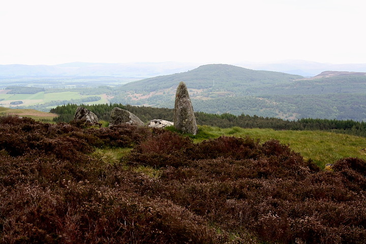
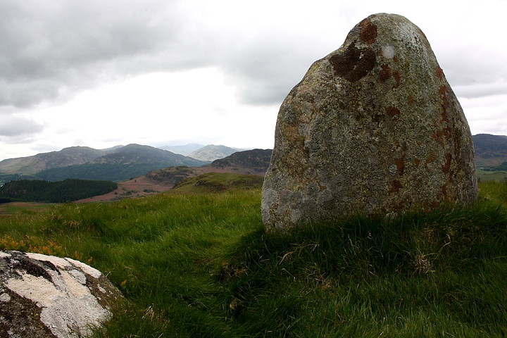
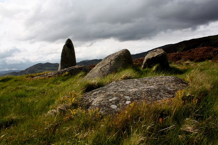
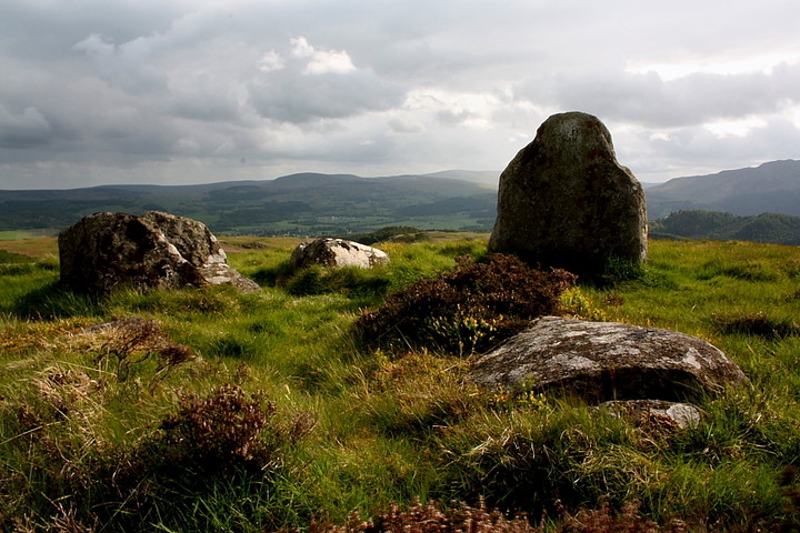
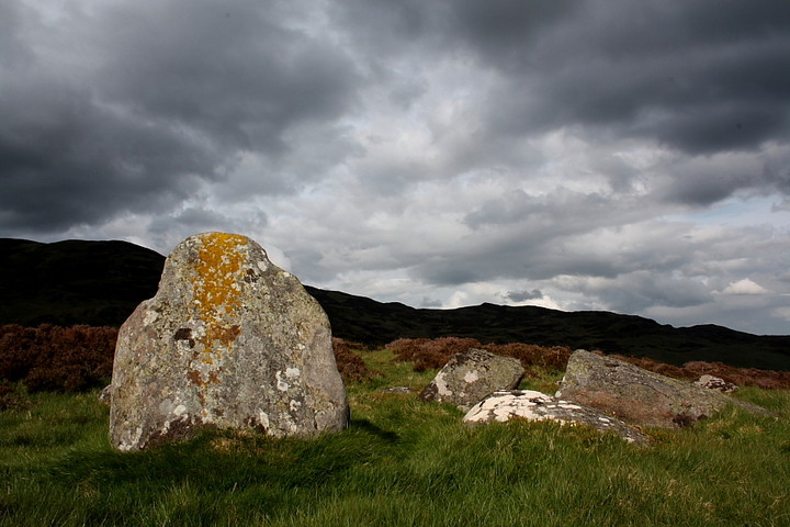
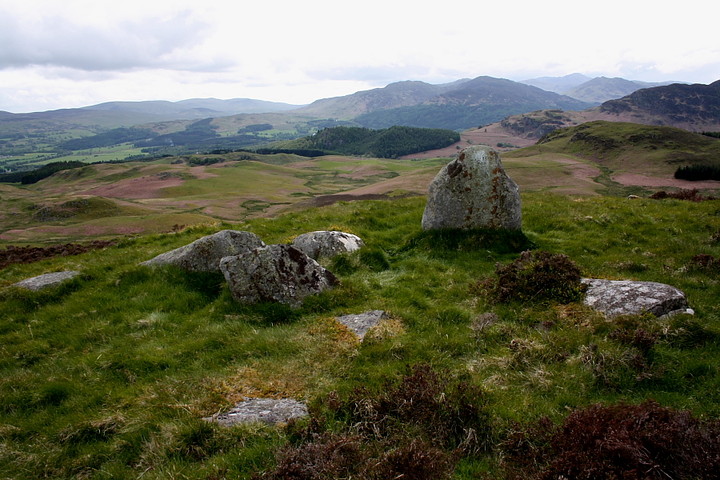
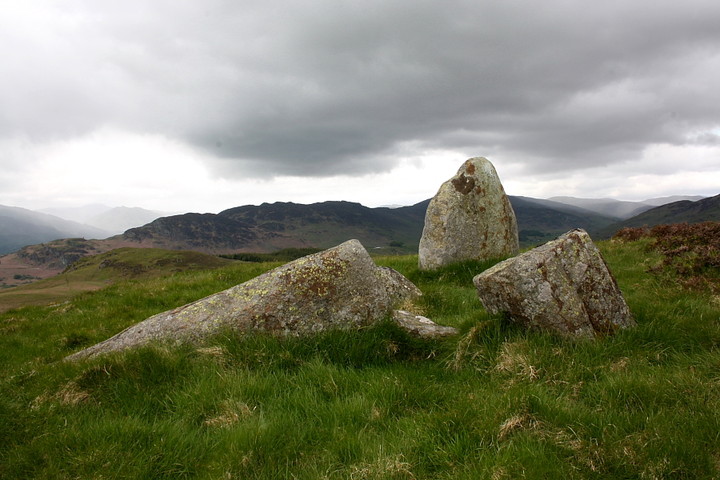
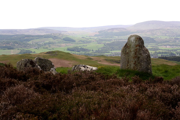
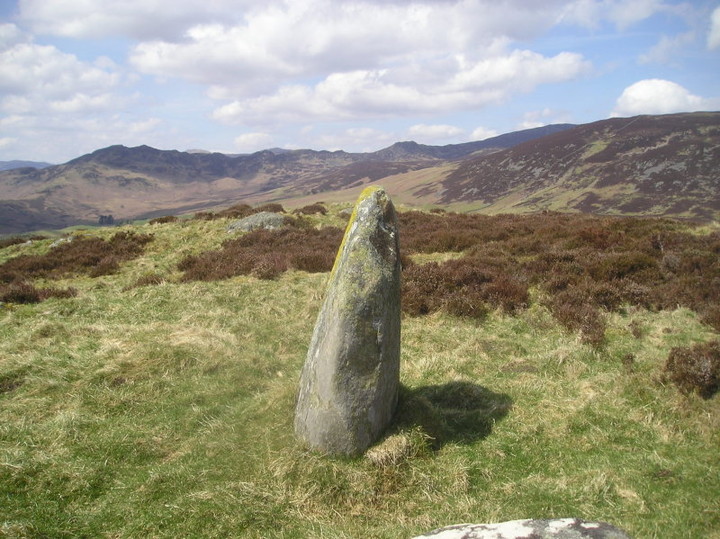
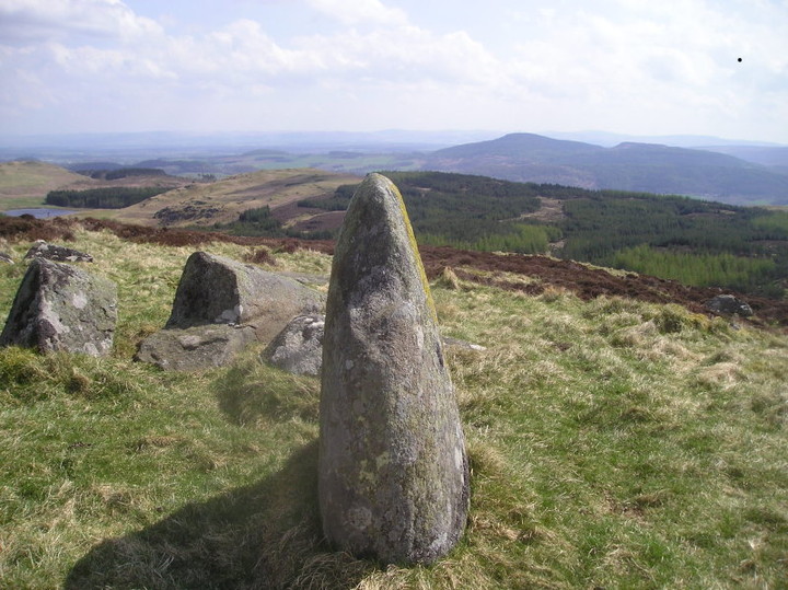
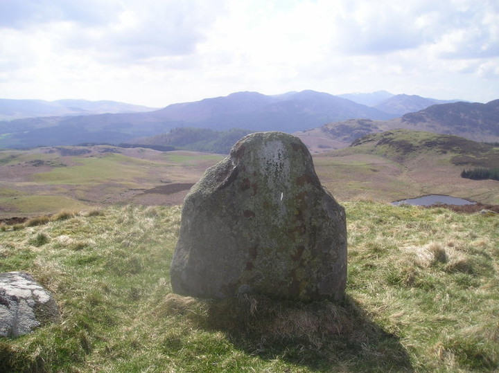
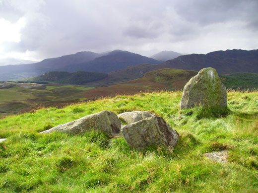
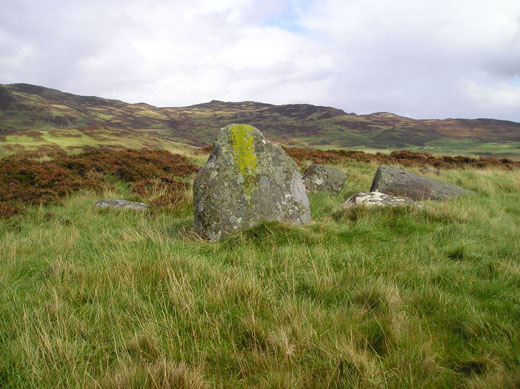
As I clamber through deep heather to the summit a deer decides not to hang around and say 'hello', bounding off into the distance, whilst some bird of prey circles above, keeping a watchful eye upon the intruder. Then, there it is. A single, large stone remains erect beside several other prostrate stones. And that is that. Tiompan's observation that the monument is probably more accurately described as a 'stone setting' is appropriate. However, not to put too fine a point on it, the location simply blows me away! A mountainous backdrop through more or less 360 degrees instantly elevates Balmuick into the company of the finest-sited stone circles I've seen to date, in my opinion even challenging the likes of Ardgroom and Moel Goedog. Awesome, particularly the serrated skyline to north-west, looking across a small loch to the waters of Carroglen and Lurg Burns rushing to join the River Lednock. I sit, buffeted by the wind, and watch the sun vie for supremacy with the dark, brooding sky, neither quite able to deliver the coup de grace. Ha! This circle may not be physically impressive... but, hell, they sure knew where to put it! According to the map two cairns lie within trees below to the west. No can do - at least not this time - since that 6km return awaits me. But it is a small price to pay for an audience with this shattered, yet - for me - magnificent ancient monument.
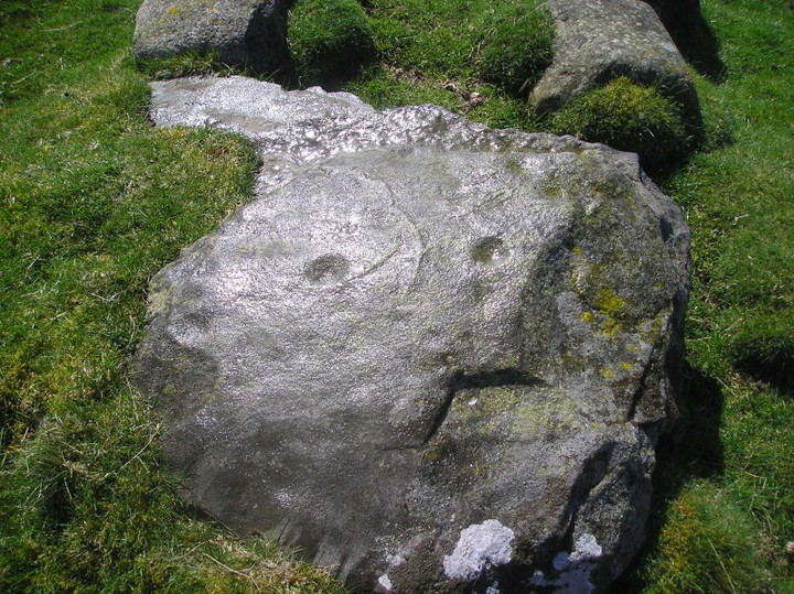
Had a few searches in the past but no rock art was forthcoming in Glen Lednock despite it being a likely area but found three "new " marked rocks a couple of weeks ago . This is the funniest , a bit of simulacra although I doubt if it was intentional . The rocks are within a mile of the "stone circle " stone setting may be more appropriate as one certailny looks like it was erected with a few lying around in a shape even Thom couldn't describe .

 Posted by GLADMAN
 Posted by tiompan
 Posted by BigSweetie
 Posted by rockartuk