|
|

|
|
Dolebury WarrenHillfort
|
||||||||||||||||||||||||
|
|
|
Images (click to view fullsize) |
|

|
Fieldnotes |
|
|
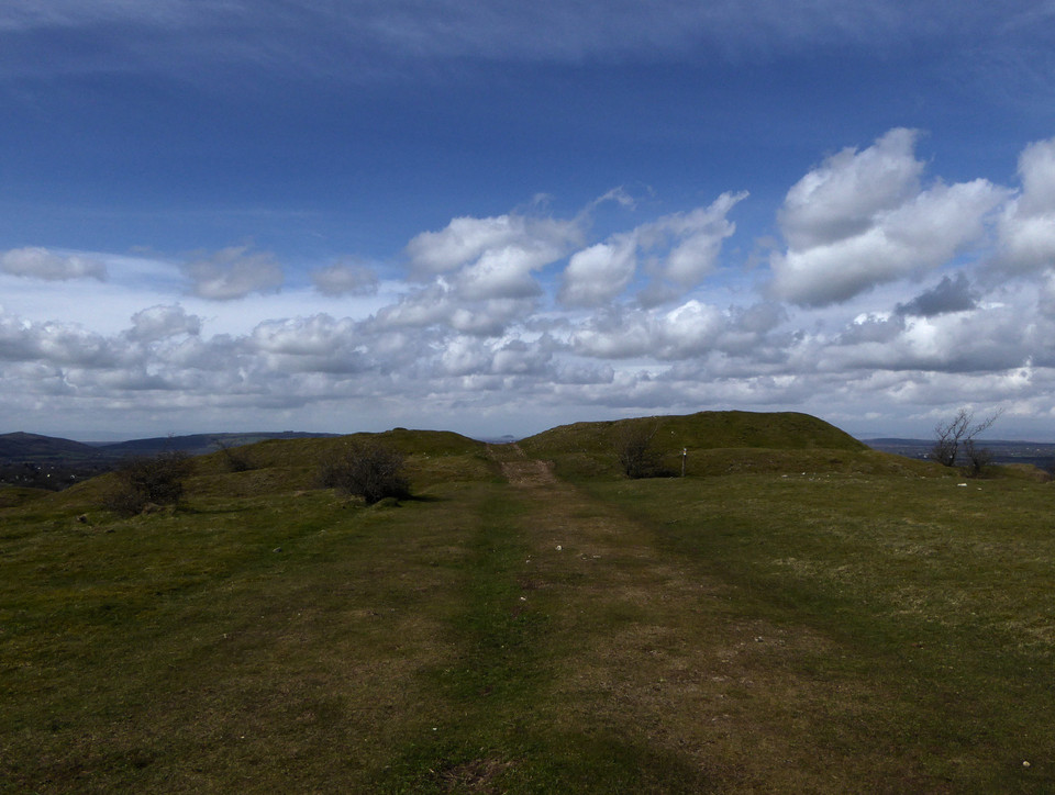
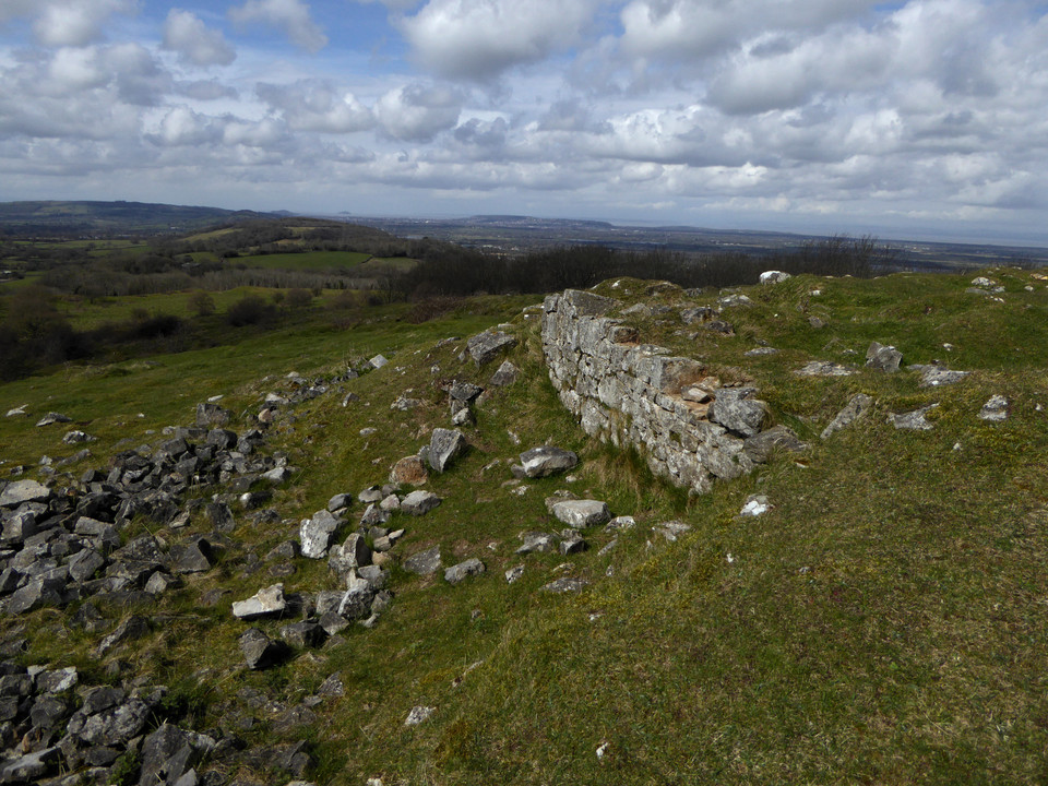
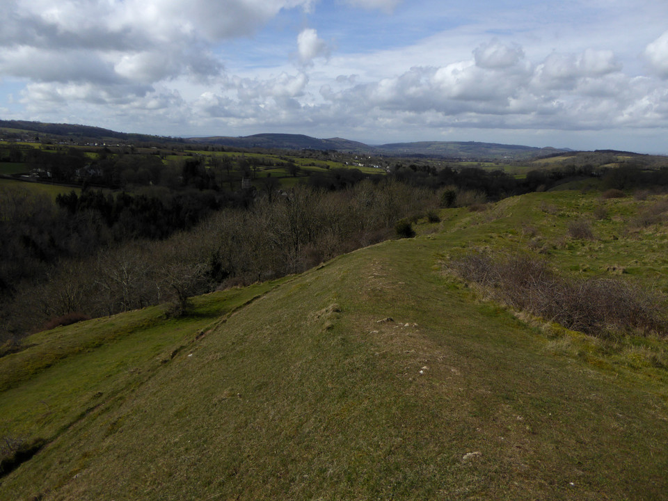
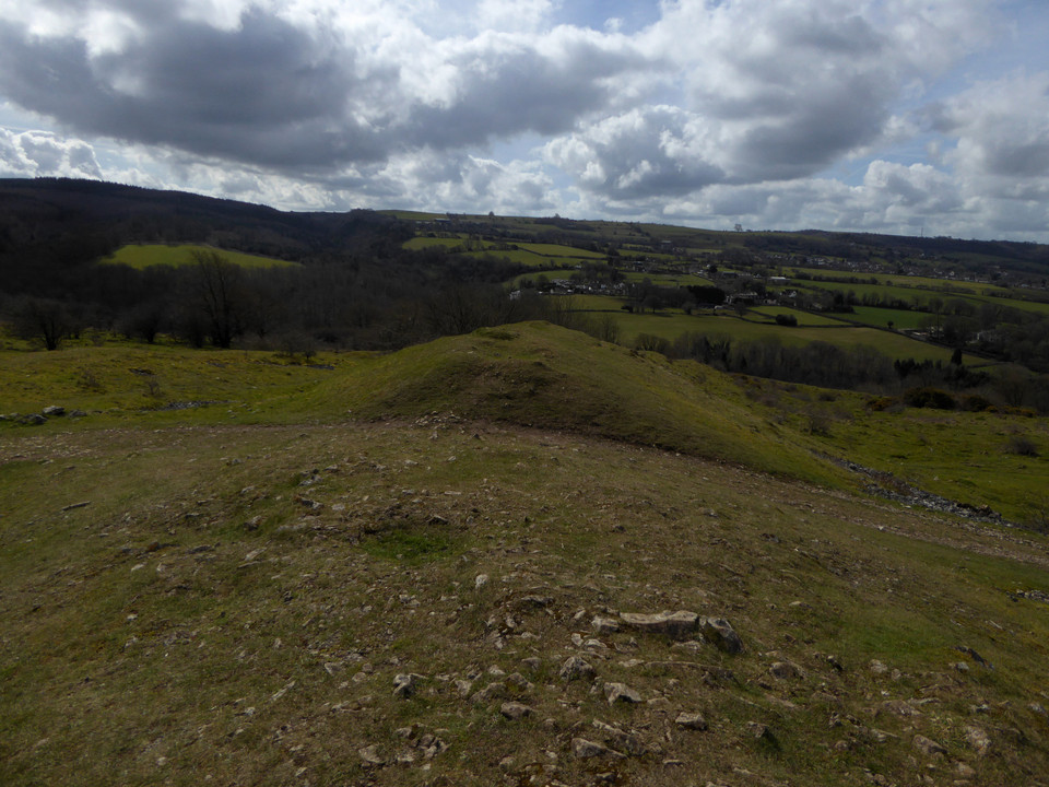
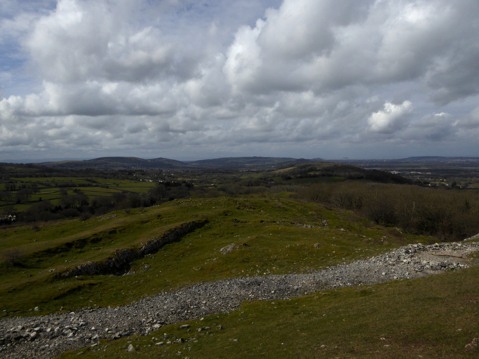
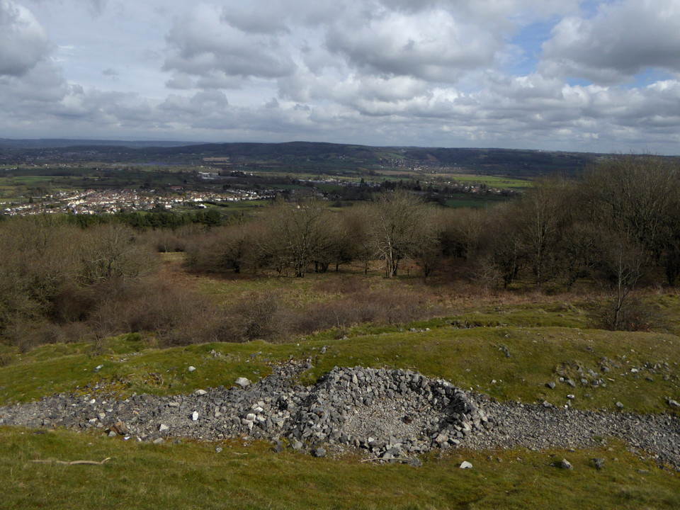
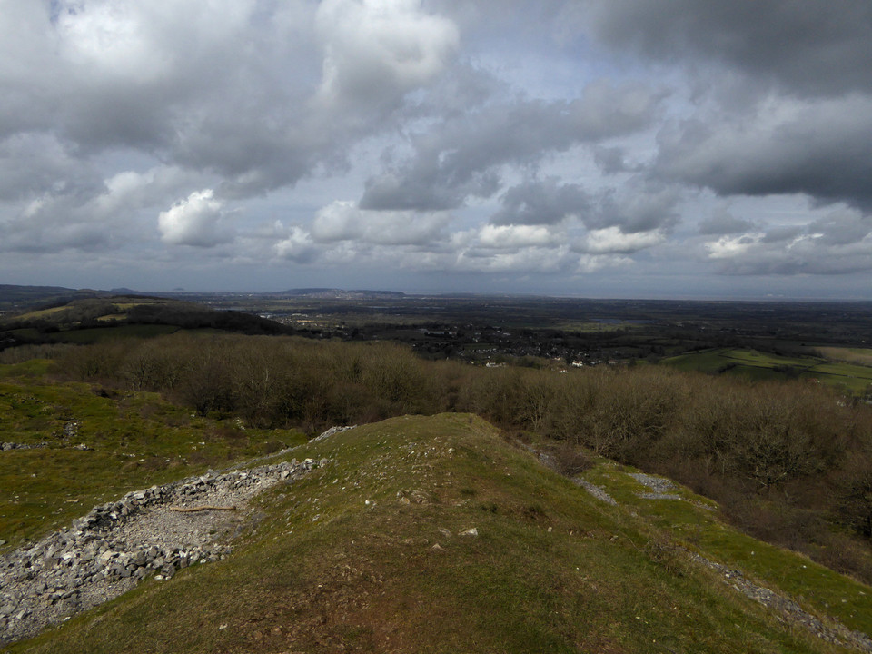
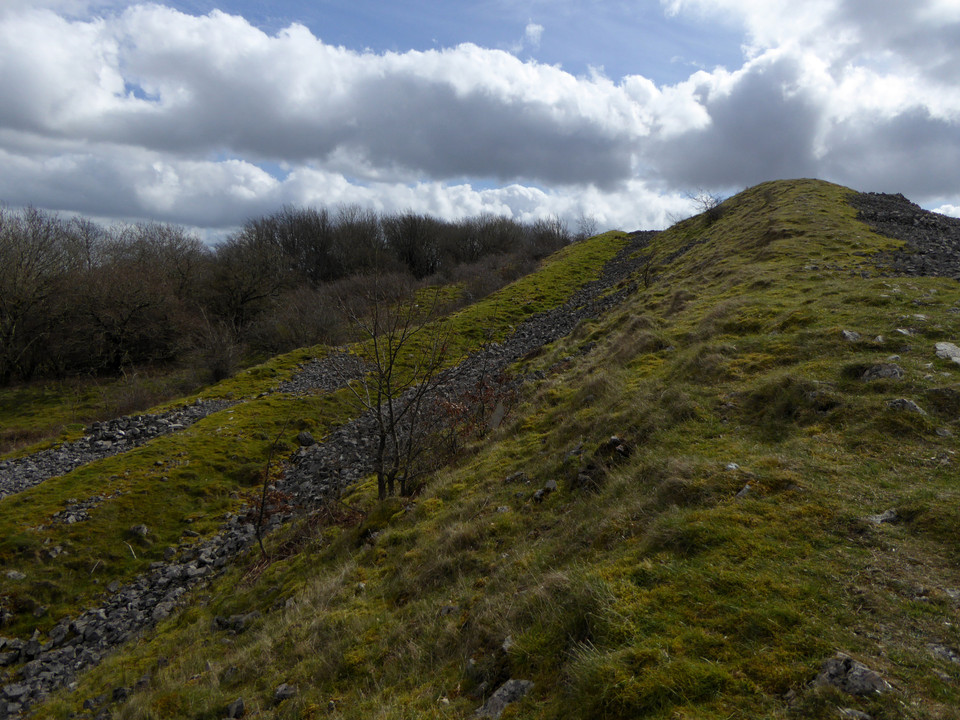
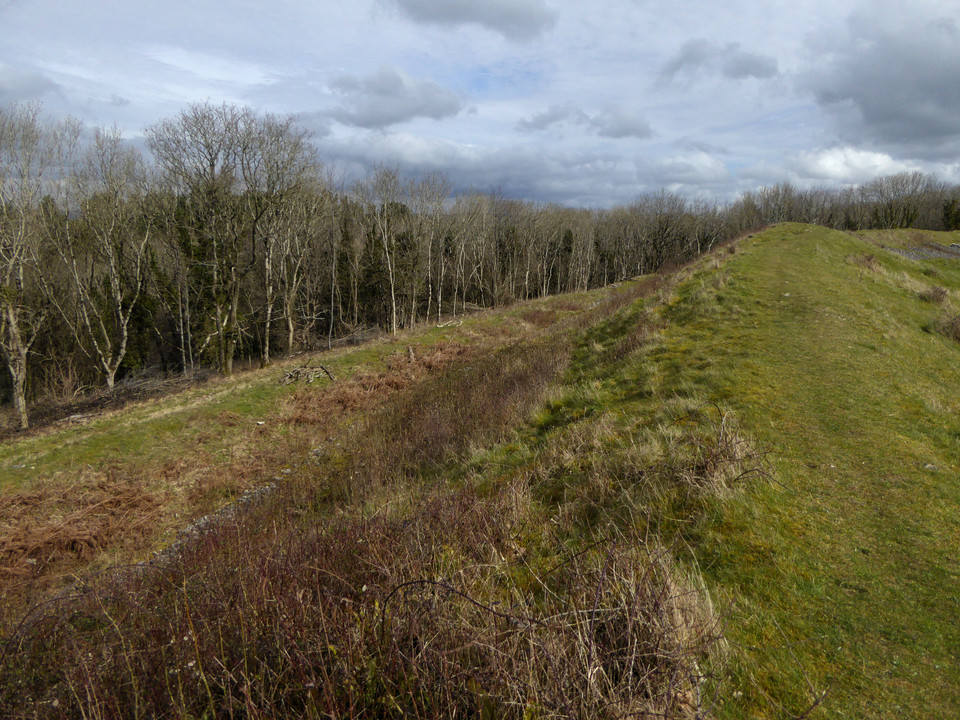
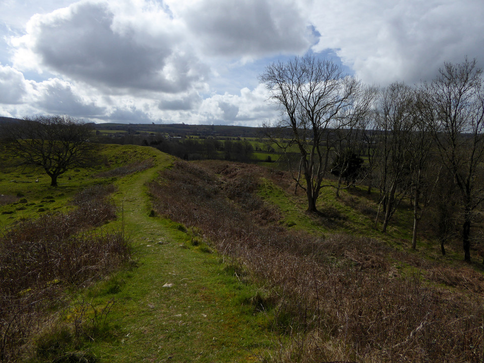
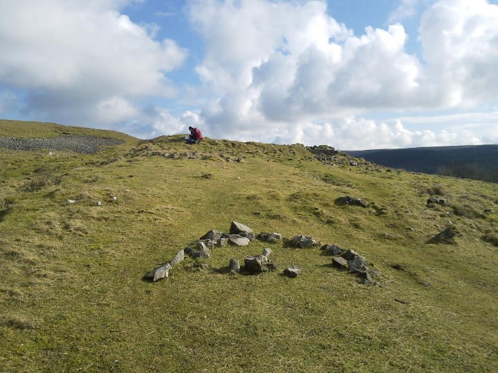
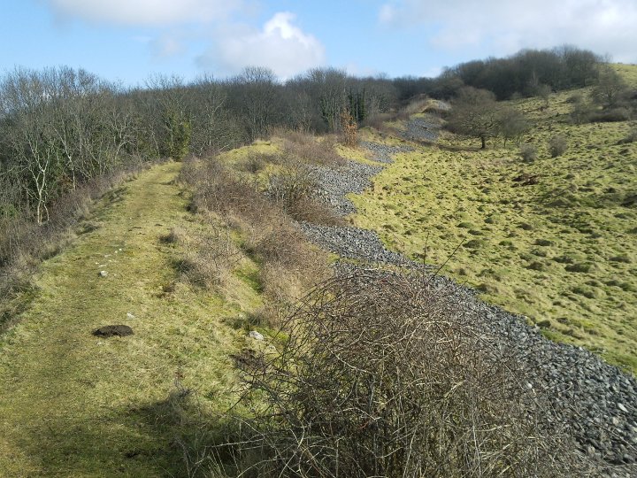
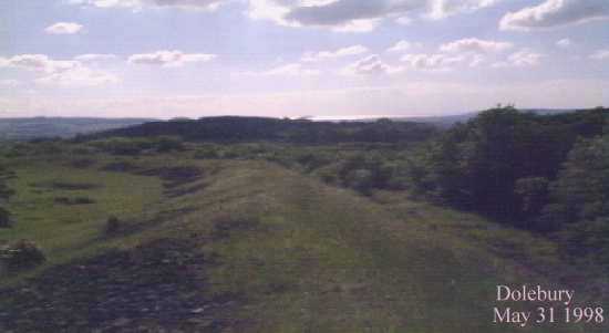
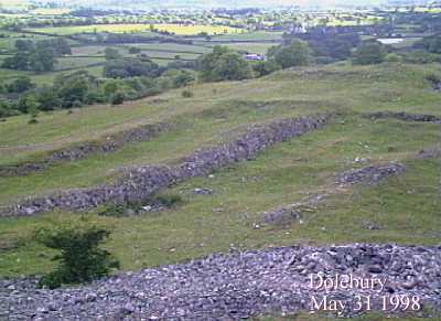
The approach is through woods, climbing fairly sharply although not quite taking the direct route up the scarp. I’m anticipating a slog but in fact the ramparts come into sight pretty quickly – after spending so much time in the Welsh uplands it’s easy to forget that the hills here are not very big, for all that they’re very steep-sided. The sun starts to break through as I reach the western entrance. It’s immediately apparent that this is a first rate hillfort in great preservation. There are two lines of ramparts, the inner one much higher than the outer and built of stone blocks. The western entrance is at the lowest part of the fort, which continues to climb steeply towards the top of the hill a good 30 metres higher than where I’m standing. The banks are inturned and the entrance appears to be an original one. I follow the rampart along its northern side, steadily climbing as it goes. The fetish for building shelters that has damaged so many Bronze Age summit cairns is in evidence here too, with the plentiful stone of the rampart obviously being too difficult to resist messing about. Actually, it’s a pretty windswept place. Although the sun is now out, when it occasionally dips behind ragged cloud there’s a serious chill and I’m quickly reminded that it’s still early in the year to be wandering around a hillfort in a t-shirt. As the rampart climbs, the views open out wonderfully in every direction but east. The Severn is the main event, looking towards Steep Holm and Flat Holm islands that we got familiar with walking the coast path on the opposite side. I also recognise Brean Down and assume the urban sprawl to be Weston-super-Mare. Almost due west a wooded hill with open interior is the neighbouring Banwell Plain hillfort. The ditch between the ramparts is overgrown in places, but there is obviously regular clearance of scrub going on. A couple of dog walkers and a couple of walkers are dotted around the fort, but it’s a big place and there’s no sense of intrusion. Reaching the very top of the fort there’s another entrance facing east, also looking like it’s probably original. The views are now magnificent, right across to South Wales – if the cloud and rain lifted there, I’ve no doubt the Brecon Beacons would be readily visible. To the south the high ridge of the Mendips blocks the view, open moorland that will be my next objective once I leave here. But first there’s the southern circuit and interior. On the south side the rampart is less built-up, but the reasoning is obvious as the ground falls very steeply away to a lovely wooded gorge below. Rowberrow church is visible across the ravine, and in a field beyond there is a sizeable round barrow that just manages to be obscured by trees no matter where I stand on the rampart. I head back up into the fort’s interior, which is heavily scarred and pitted. The fort’s name gives the reason away, as it was the site of a huge artificial rabbit warren in the 17th century. At the highest part of the interior, just inside the eastern entrance, there is a low curving linear feature with a square structure inside. This was apparently the garden wall and footings of the warren-keeper’s house. I wonder what it must have been like to live here, surrounded by rabbits and the ghosts of the original inhabitants. Whatever, it makes a great spot for an early lunch before heading east. A final touch as I leave is the way Steep Holm in the Bristol Channel is framed by the eastern entrance. What a great place this is. I reluctantly turn away, hugely impressed by this great fort with its sweeping views. This post appears as part of the weblog entry Mendip First - 2 April 2016
|
 Posted by thesweetcheat
10th April 2016ce Edited 10th April 2016ce |
|
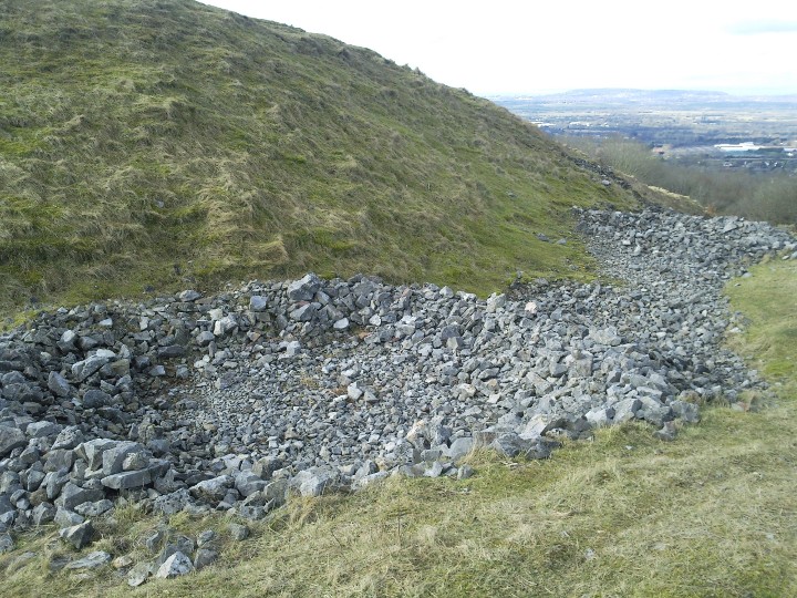
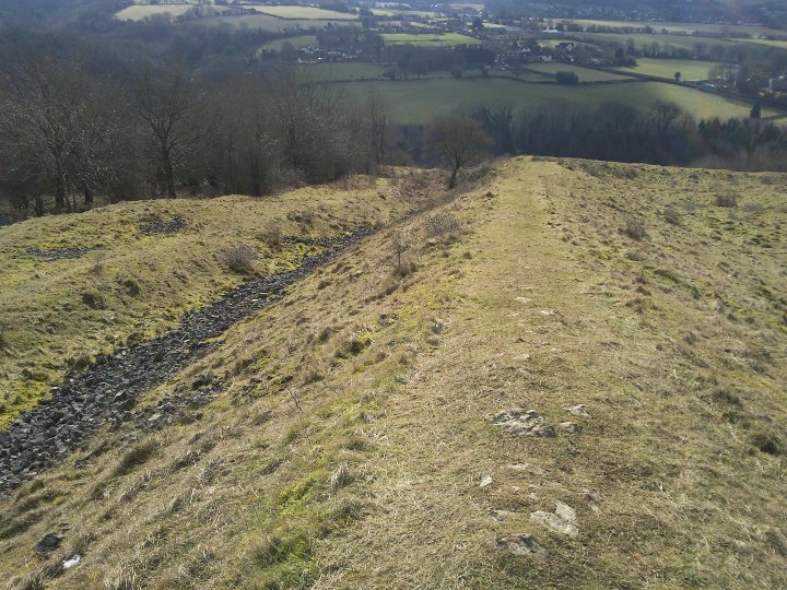
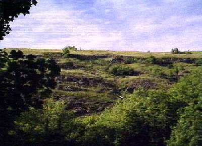
Visited 24.5.14 Directions: From the village of Churchill take the A38 south. After about 1km you will see some houses on your left and a bridleway sign. You can access the Hillfort from here. Alternatively, continue south along the A38 and take the first turning on the left (east). There is a small passing place on this minor road where you can park. A public footpath is signposted which runs along the base of Dolebury Warren. I wasn’t planning on visiting this site but as we were passing the place on the way home and, despite the grey skies, it was still dry, I thought to myself ‘Why not?’ In hindsight what I should have done is approached the hillfort from the bridleway to the west. However, (as I wasn’t planning on a visit) I hadn’t brought my notes with me so approached via the minor road to the south – big mistake! Karen sat in the car while myself, Dafydd and Sophie too the muddy path down through the trees. Sophie complained bitterly about the ‘stink’ of the wild garlic! At the bottom of the valley we crossed a small stream thanks to a wooden bridge and continued along the path. After a bit, in my infinite wisdom, I decided it was time to head uphill to the hillfort. I was hoping to have encountered a path up to the site (not realising that the footpath to the hillfort runs east-west not north-south). We came off the path, through some trees and over a barbed wire fence. We were then confronted by a very steep, very high hillside. I had severe doubts that I would be able to get up there with two children in tow – all three of us in wellies! I took the children by the hand and we very slowly made our way up. It took a long time to get to the top and had I known how difficult it was I would never have attempted coming this way. They certainly knew how to pick a place to build a hillfort! It was with a great deal of relief that all three of us made it to the top without major incident. Once we recovered the first thing to strike you were the all-round views. You could see for miles in all directions – in the distance even Brean Down, Steep Holm and, through the mist, the South Wales coast – home! This is a large hillfort. A herd of cows were happily munching away in the middle of the site. Although we didn’t have time to walk all the way around we did head for the highest point. This is near the eastern entrance where there are multiple banks and ditches some of which are above head height. Near the highest point iare the remains of a stone structure. A short section of walling comprising of a couple of layers was visible. I have no idea of the age of this. Judging by the many outcrops of stones scattered around the site there was clearly no shortage of building material. Before long it was time to head back to the car. It had taken much longer than expected to climb up the hill and Karen was sure to be getting restless. We all managed to get back down the hill without too many problems; except for when Dafydd fell backwards with his legs up in the air – much to Sophie’s amusment. On the way back up the muddy path Sophie fell face down in the mud. It was now Dafydd’s turn to have a laugh! Dolebury Hillfort is well worth the effort of visiting when in the area. E.H. state: The monument includes Dolebury Camp, a large univallate hillfort and associated and later earthworks, on Dolebury Warren, a carboniferous limestone ridge on the edge of the Mendip Hills, overlooking the Somerset Levels. The hillfort has a sloping sub-rectangular interior 487.5m east-west by 200m north-south. The eastern end of the fort is c.60m higher than the west and the interior contains at least four medieval pillow mounds aligned north-south and ranging from 50m to 150m in length and 0.5m high. Surrounding the enclosed area is a single rampart comprising an inner bank c.4m high and c.12m wide. This is bounded by a terrace c.5m wide on the south side of the fort where there is a scarp slope, and elsewhere by an outer ditch c.10m wide and c.1m deep with a counterscarp beyond. The main entrance to the fort is located at the western end. Additional earthworks, immediately beyond the western entrance, may be of later date and include a hollow way linking the entrance with Dolebury Bottom immediately to the west. To the north-east of the hillfort is a series of outworks visible as earthwork banks and depressions. The depressions are likely to represent rakes or quarries. Beyond them is a slight linear bank c.0.3m high and c.1m wide with an accompanying ditch c.1.2m wide and c.0.3m deep which runs north and then west for a total of c.550m. This earthwork is interpreted as an outwork of the hillfort, possibly unfinished, and encloses an area likely to contain evidence for contemporary settlement and land-use. Finds from the site demonstrate an extensive period of occupation, and include Palaeolithic flintwork, Bronze Age pottery, a bronze spearhead and Roman coins and pottery. In the post medieval period a series of pillow mounds were constructed within the fort representing a rabbit warren. It was this that gave Dolebury Warren its name. |
Posted by CARL 29th May 2014ce |
|
[visited 20/2/10] What an amazing hill fort! Its a massive bivallate fort with views stretching all the way to Wales, Exmoor and if someone took the trees out of the way probably Lansdown. With palisades and a clear tree line, this fort would have dominated the upper reaches of Chew valley and the northern Somerset levels. I did my normal trek about the ramparts, clockwise for those keeping count, struggling up to the western entrance. The fort was built sloping down from the highest point on the hill to where the land dropped away on the eastern end. The interior earthwork noise is believed to be mostly from a pre medieval rabbit warren, with possibly some additions during ww2. Presumably the small circles formed from the loose stones near the northern ramparts are probably ww2 picket posts. Access is for those who like hills. The Eastern entrance has still got a reasonable track coming up from the A38. If you are approaching from the west, be prepared for a long muddy walk which out of summertime might be difficult with a pushchair. I trekked up from the A38, parking at a pub down a small lane on the other side of the A road. |
 Posted by juamei
20th February 2010ce Edited 21st February 2010ce |
Folklore |
|
The village of Churchill lies near the great Bridgwater Road, and under the north brow of Doleberry Hill. This fine old rugged eminence has served as a place of encampment for every nation that has ever invaded England. The Britons have built here their wattled huts, and on it, and from hence, have blazed their beacon fires, gleaming over the vale of Glastonbury; and the eagle of the Romans, and the white horse of the Saxons, have alike waved from its summit. The peasants still believe the height haunted, and imagine that vast treasures lie concealed beneath its rocky surface.From 'Cross Country' by Walter Thornbury (1861). |
 Posted by Rhiannon
24th February 2012ce Edited 24th February 2012ce |
|
Ruth Tongue (County Folk Lore v 8) quotes an informant at Ashridge in 1907: "There be a bit of verse as do go: "If Dolbury digged were Of gold should be the share." but nobody hasn't found the treasure yet. And for why? Well, to start up with it don't belong to they, and so they won't never meet up with it. Twill go on sinking down below never mind how deep they do dig. I tell 'ee tis the gold of they Redshanks as used to be seed on Dolbury top. To be sure there's clever book-read gentlemen as tell as they was Danes, and another say twere all on account of their bare legs being red with the wind, but don't mind they. My granny she did tell they were fairies, and all dressed in red, and if so the treasure med be theirs. If they was Danes how do 'ee explain all they little clay pipes as 'ee can find on Dolbury Camp. They did call em 'fairy pipes' old miners did. An' if there be fairy pipes, then there was fairies, and nobody need doubt they was the Redshanks." (taken from 'A dictionary of fairies' by Katherine Briggs) Grinsell records an earlier instance of the couplet, from 1540, when it was recorded by Leland. (Folklore of Prehistoric Sites in Britain) |
Posted by Rhiannon 4th February 2004ce Edited 4th February 2004ce |
Miscellaneous |
|
On the opposite side of the ravine, just above the point where the Bridgwater road is carried along the face of the hill, are traces of another and smaller Camp, called Dinghurst Damp. This has almost been destroyed by quarrying the stone, but sufficient of the rampart remains to show it was another strong position coeval with Dolebury, guarding the pass, or else constructed in after times as an additional security.from the Proceedings of the Bath Field Club, v5 (1885). |
Posted by Rhiannon 16th June 2006ce Edited 16th June 2006ce |
Links |
|
Pastscape page for the hillfort |
Posted by juamei 20th February 2010ce |