|
|

|
|
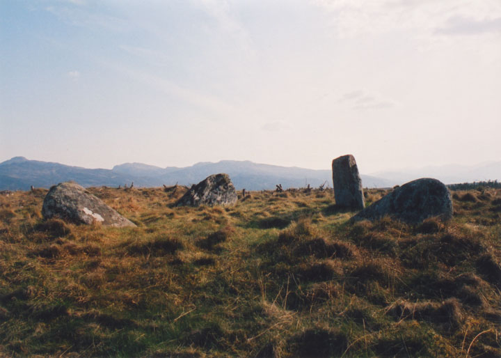
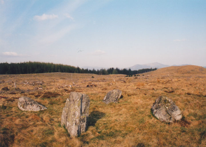
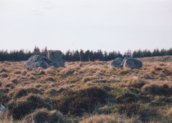
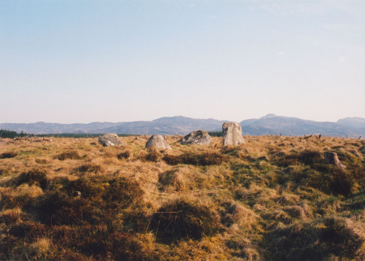
Na CarraigeanStone Circle
|
|
|
|
Images (click to view fullsize) |
|

|
Fieldnotes |
|
|
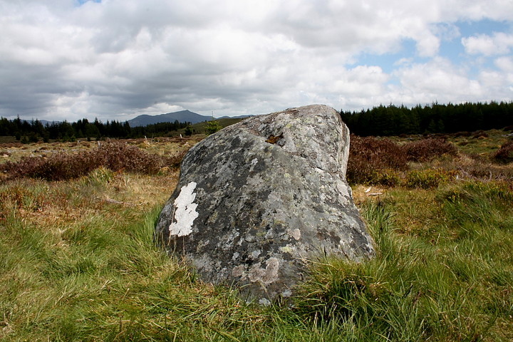
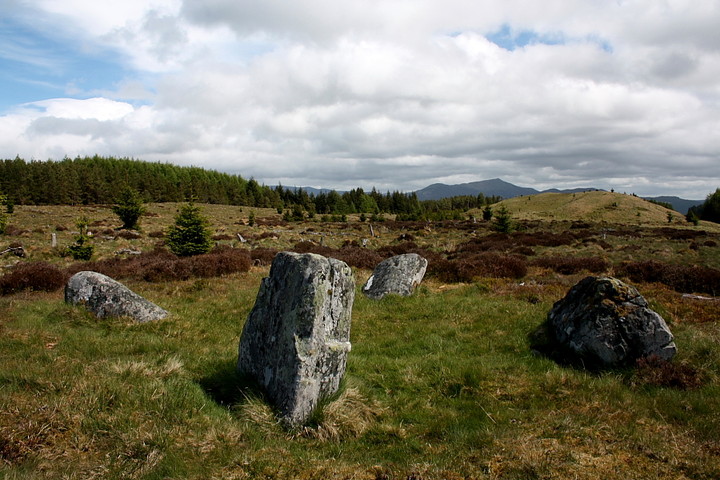
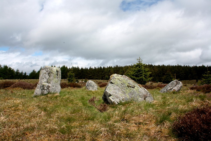
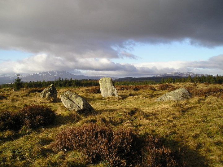
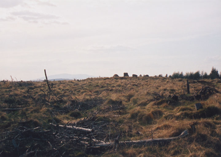
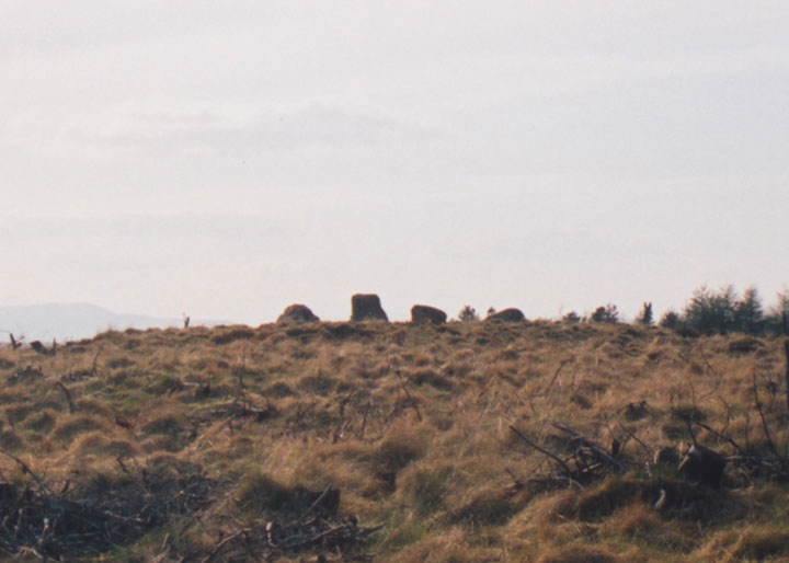
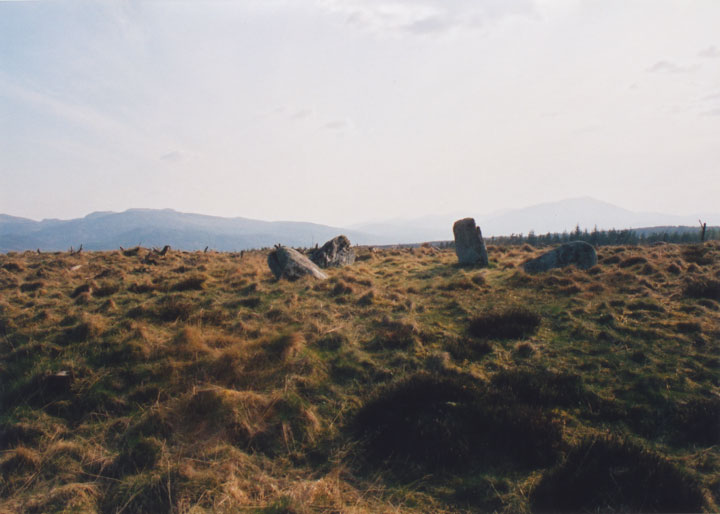
Attempted to visit this fine - very fine - four poster last year.... only to find the Allean Forest 'closed due to forestry operations'. Ha! Be warned. You wouldn't exactly expect a forest to be closed, would you? No matter, since Clachan An Diridh saved the day then and, furthermore, gave me the opportunity to return with a more cunning plan than I had at the time, that of simply blundering through the forest on a compass bearing. Approach via Glen Fincastle! Yeah, that'll work. Surprisingly... it does. Glen Fincastle is reached by a signposted, minor road from the B8019 some way east of The Queen's View (past the hotel and dam, that is). I follow said road through the sleepy valley to the farm house of Chapleton, the occupant readily agreeing to my request to park 'so as not to block the road'. Nice one. Clearly not local, he reckons his girlfriend will be interested to know about the circle. Some guys have all the luck, eh? The road veers to the right, but I carry straight on along a rough - although no doubt still driveable - track heading west past the farm of Drumnagowan, arriving eventually at the cluster of buildings know as 'Edintian'. Here a green track continues westwards to ascend to the forest-line, the retrospective of the glen well worth pausing a moment or so to take in, complete with a peak very reminiscent of my beloved Moel Siabod rising on the skyline. The path veers left, goes a little 'serpentine' for a distance, and then resumes a westward heading. Ignore a sharp, obvious left hand turn some way along and, just before the track begins to descend - having passed high ground to the right - take a relatively obscure green track to the approx north-west (right). The lovely little four poster should appear before you.... as it did for me. Jeez. It's a beauty, in every possible respect, the skyline to the west-south-west(ish) dominated by the seriously enigmatic Schiehallion, the mountain rising above (apparent) Gladman ancestral lands in the vicinity of Loch Rannoch. The circle stones themselves are not that tall - although those familiar with other upland 'circles may well disagree, relatively speaking - but are nevertheless of substantial girth, shall we say? An unusual feature - for me, anyway - is the placement upon a quite significant artificial platform, or mound, even, with traces of possible kerbing visible here and there. However it is the location which 'pushes all the right buttons' for me. You know, I sometimes think I eulogise a little too much about sites such as this? Perhaps. However assuming some monuments were intentionally placed at locations as exquisite as Na Carraigean to achieve a desired 'reverential' - if not awestruck - response in a visitor, who am I to argue when I'm caught 'hook, line and sinker?' It's a fair cop, guv'nor. Yeah, this isolated four poster has me truly 'bang to rights'. Well worth the effort, especially when you can keep 'forestry bashing' to a minimum with an approach from the east, too. Top hang. |
 Posted by GLADMAN
14th June 2011ce Edited 28th June 2015ce |
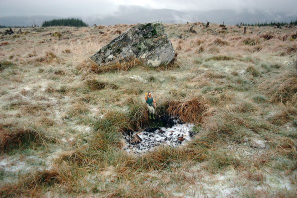
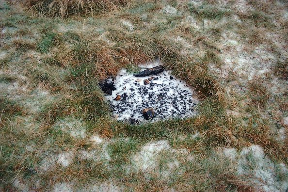
| Revisited Sunday 21st November with BigSweetie, George and ActionMan. Some idiots had been using the central depression (from a previous land-owner's dig) as a fireplace... Fortunately the stones are far enough away from this not to have suffered any apparent damage. Shame though that even as remote a site as this can be damaged. A very cold day, with horizontal sleet, made sure we didn't linger too long. |
 Posted by nickbrand
23rd November 2004ce |
|
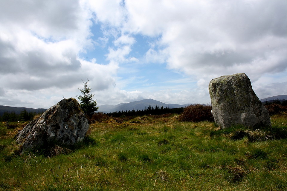
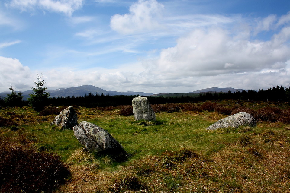
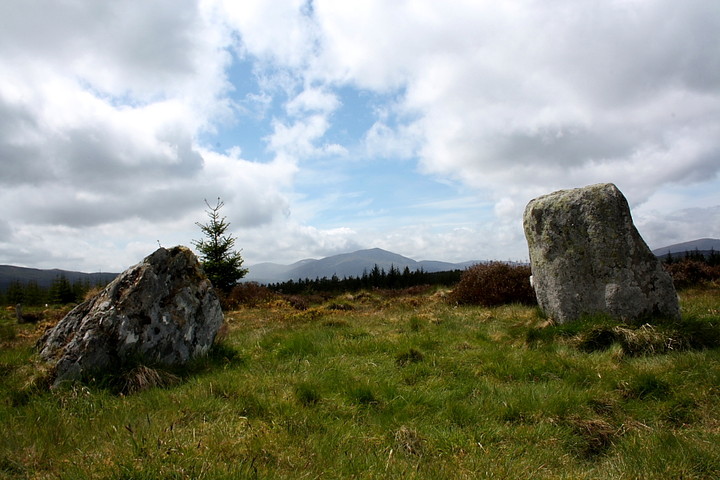
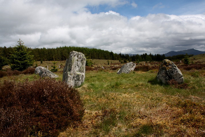
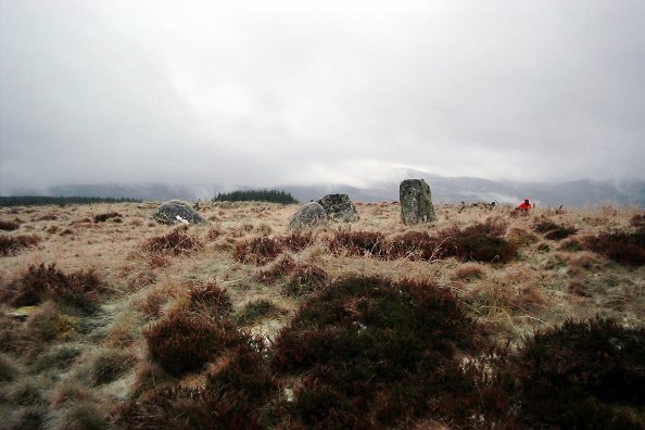
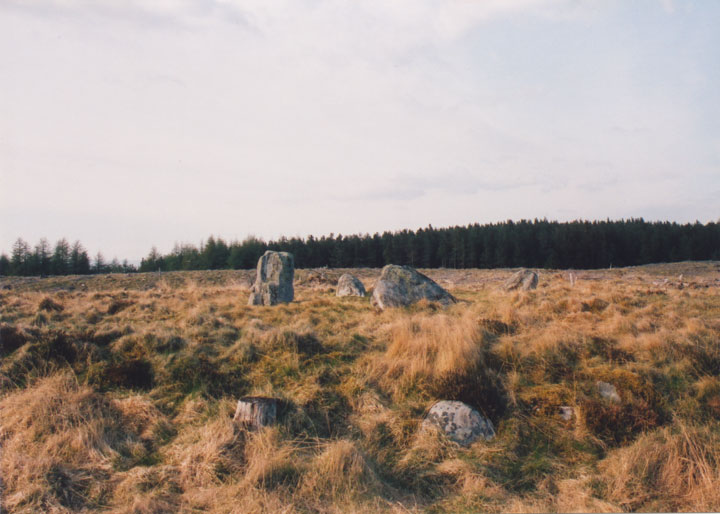
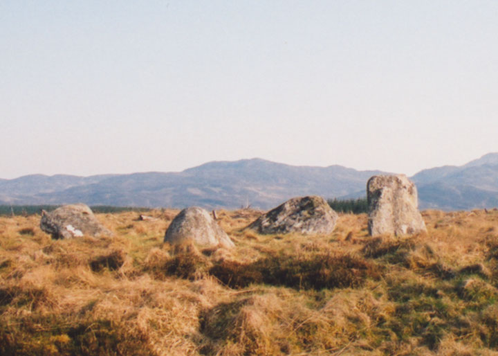
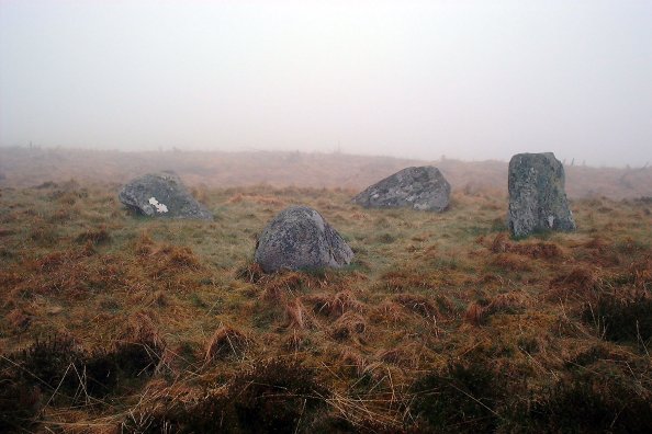
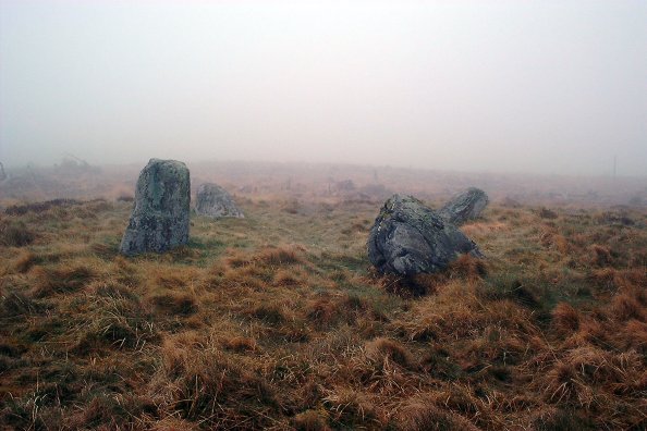
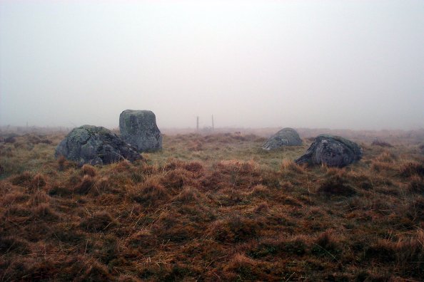
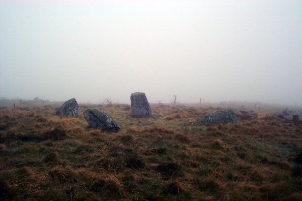
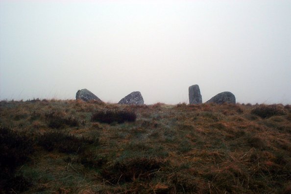
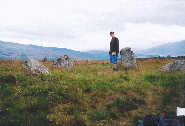
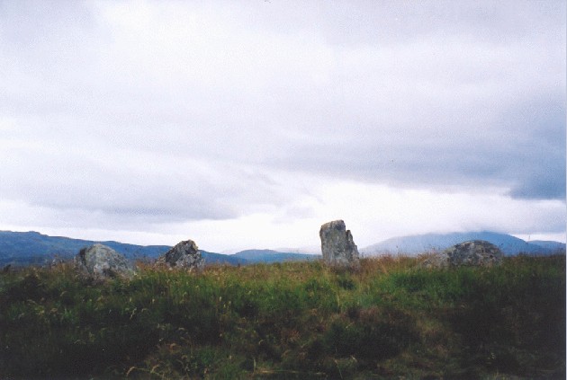
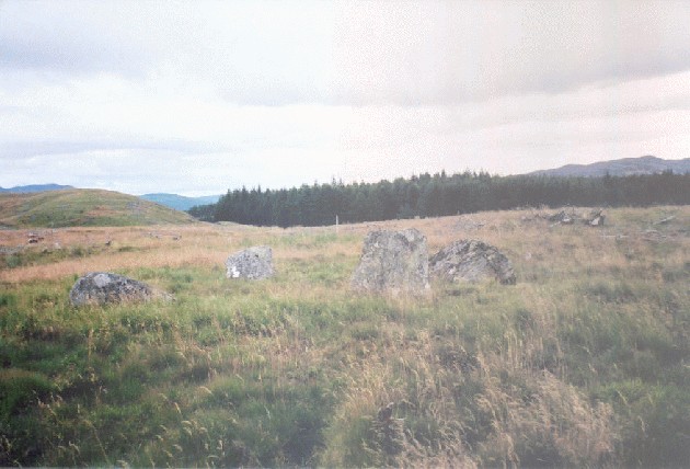
This excellent little four-poster requires a bit of effort, as it's up the top of a wooded hill. Surprisingly, the OS map tracks turned out to be relatively accurate this time, which is a bit of a first... The stones form the corners of a 3m square, graded to the SW, where the largest (1.2m tall) stands. It was a bit misty today, as you will see from the photographs, and I could only make the stones out when I got within around 30m. Pity, as the views are supposed to be pretty spectacular from here. I'll have to wander back on a good day! |
Posted by nickbrand 25th April 2003ce |
|
Friday 26/7/02 A return journey to this fantastically remote four-poster. We have a great walk up through the forest to this site- the views are great, the forest deserted (well- apart from the occasional vehicle marking out the trail for tomorrow’s rally- glad we decided to come up today). At the stones we have a bit of a picnic and now Aed’s walking he sets about exploring the stones for himself, though the bumpy ground ain’t really suited for size 5 baby feet! I leave them to eating and come into the circle. I lean back against one of the stones and it feels like my skull melts into the rock, it buzzes and tingles. When I eventually open my eyes it takes a minute or so for the colours and shapes of the earth and sky to return. |
Posted by Martin 9th August 2002ce Edited 27th July 2003ce |
|
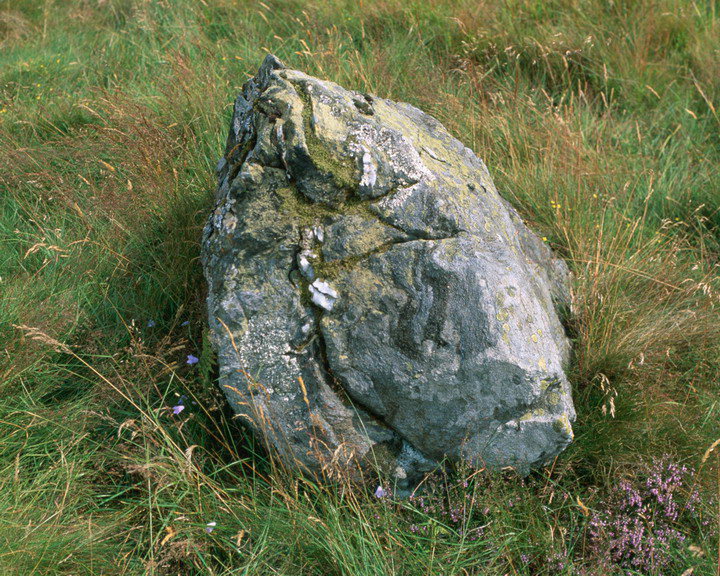
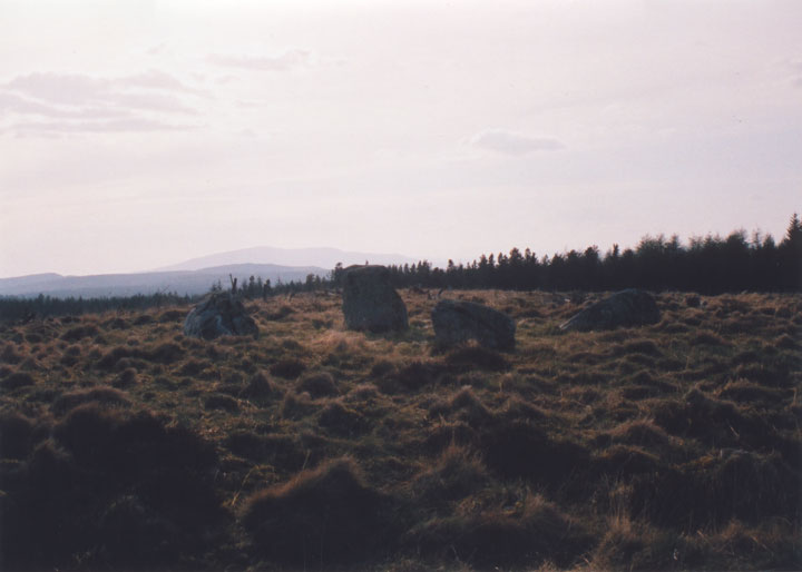
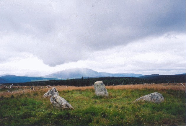
Meall Nan Clachan (AKA Na Carraigean Edintian) Sunday 12/8/01 3:15pm It's taken a trip of almost 4 hours to get here- 1 hour travelling from the Kavan at Bridge of Cally and another 3 hours walk from the car park at Allean. Saying all that we've got Harrydog who has been tracking deer through the forest and Aedan in his heavily-laden off-road buggy, plus we also stopped off for lunch! We'd tried before to get to this stone circle a few years back, but we set off a bit too late on a Winters afternoon and it was starting to get dark whilst we were still on the Allean forest trail so decided to leave it for another day. This is one of the best preserved of the Perthshire four-posters and is in a fantastic setting- I expected the circle to be set in trees, but these have been felled since the last OS survey leaving a great moorland top. There's views over to Schiehallion and Farragon to the south and Ben Vrackie to the east with Beinn a Ghlo just hidden by a line of trees. The stones are four fairly large granite blocks which run in a perfect N/S E/W alignment. The southernmost stone has a beautiful spiralling quartz pattern with rose quartz veins. Up here there's only the sound of very distant dogs barking, flies buzzing past (on the way up here we saw some monster dragonfly- we've seen smaller birds than those), and the occasional squeal of delight from five month old Aedan who is looking at a map of the area with Kat. Another cracking site that's well worth the journey. NB-see the folklore section- I never noticed the hut circle (not on Pathfinder map) or the avenue lined with stones- however, this was probably written before trees were planted here and could have all been lost in the cultivation process. Directions Travelling through Pitlochry to the North stay on the B8019, past a caravan site on the left hand side, then turning next left over the Garry Bridge (still on the B8019) towards Queens View and Tummel Bridge. On past the Queens View visitors centre and just beyond is a sign for Allean Forest walks etc on the right. Turn in here and start walking! I used a combination of maps- Pathfinder 294, a rather good 1:10 000 orienteering map I had bought a few years before from the Queens View visitors centre and the guide to Tay Forest Park (mebbe a bit overboard, but I'm dead sad and love a good map to myself :)). The easiest way to get to the stones (though mebbe not the most direct route) was to follow the red way markers to a junction in the forest track at 862605 (basically the furthest northeast of the waymarked trail). From here we followed the forest track round Meall na h-lolaine (this was built after the OS survey and is only marked on the orienteering map) and had cracking views on the north side of this hill. A pretty indistinct path leaves the main track at 841619 approx NWW across the moor to the circle. Whew! |
Posted by Martin 27th August 2001ce Edited 27th July 2003ce |
Folklore |
|
| One of this site's alternate names is Na Clachan Aoraidh, which means 'the stones of worship'. The site is just to the west of Edintian (another alternate name for the site), a local farm, whose now anglicised name in reality is Aodann an t-Sithein, 'Face of the Fairy Hill'. |
Posted by nickbrand 25th April 2003ce Edited 25th April 2003ce |
|
"Mention must also be made of a Stone Circle by the old path to Loch Tummel. There are four stones, on a magnificent site, and they are named na Clachan Aoraidh, the Stones of Worship. That fairies had their home here is shown by the place-name given to the wooded knoll south-west of the Mains of Fincastle. This is still named an Sithean, the Fairy Hill, and west of it is Edintian, which in reality is Aodann an t-Sithean, Face of the Fairy Hill." From "Highways and Byways in the Central Highlands" by Seton Gordon 1947, page 152. |
Posted by Martin 30th August 2001ce Edited 27th July 2003ce |
|
"At the head of Glenfincastle is the famous stone circle known as "An Carrigean" which was visited on the first of May, and supposed to bring good fortune to those who walked round it. It consists of four stones of no great size, set on a raised earthen platform, which seems at one time to have been causewayed. The circle is probably of Neolithic origin, from the small size of the stones and the veneration in which it was held. An avenue lined with small stones leads to it, through which cattle were probably driven when they underwent the baptism of fire, and there is a large hut circle on one side. An extensive view is got from the platform, and at no great distance on the same moorland plateau is Grenich, with its burial mounds and evidences of Sun worship." From "Pitlochry District" by Hugh Mitchell 1923, pages 60-61. |
Posted by Martin 27th August 2001ce Edited 27th July 2003ce |