Bless my soul !
This place has lent it's name to one of our top contributors, so I thought I'd better go take a look, if only to see why he named himself after it.
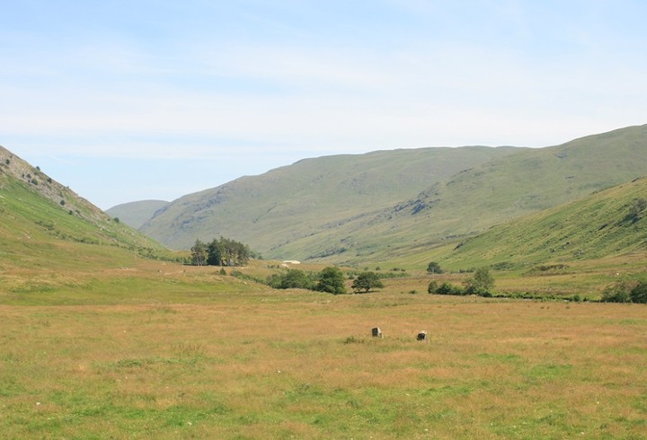
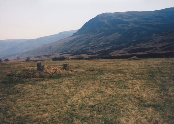
After passing the long chambered cairn and very ruined four poster, this second ruined four poster was easy to spot off to the left less than a hundred yards from the road. And I use the word road as loosely as I can, it is a several mile long bone shaking, head hurting, filling dislodging nightmare, "oh god when will it end".
Previous fieldnotes have described this as "Quite ruinous" and "sad remains" both statements are true, but I found it to be hugely enlightening and informative.
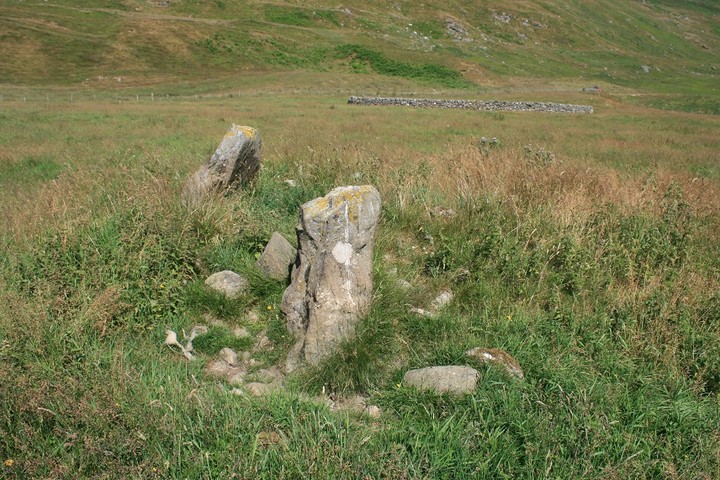
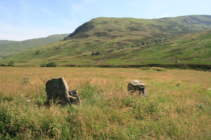
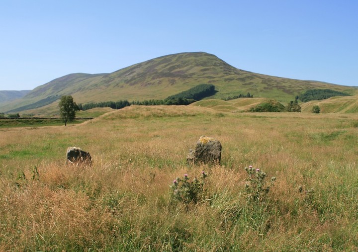
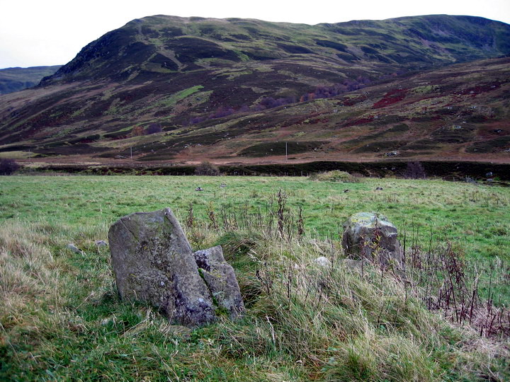
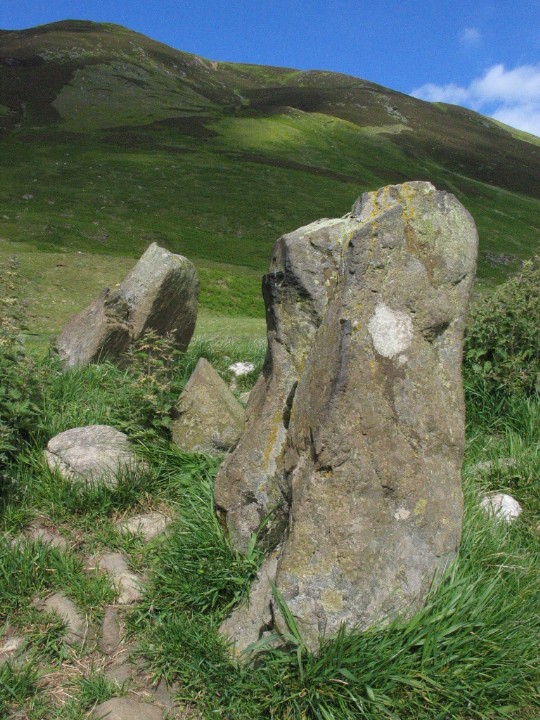
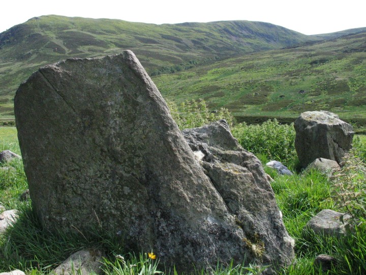
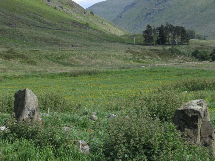
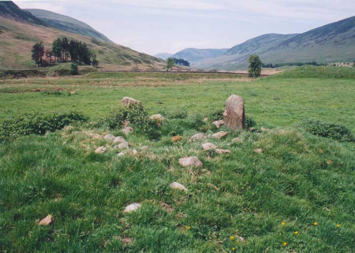
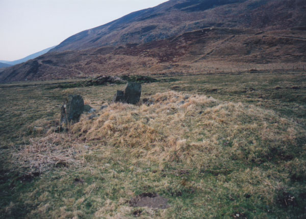
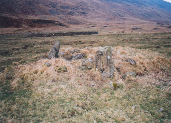
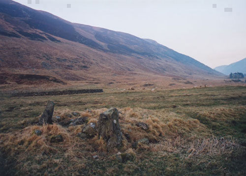
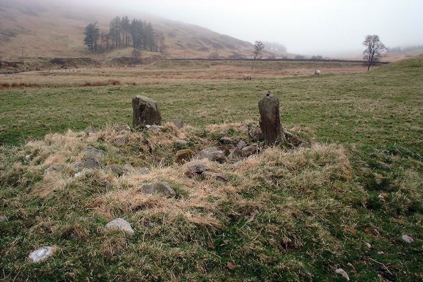
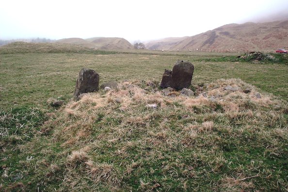
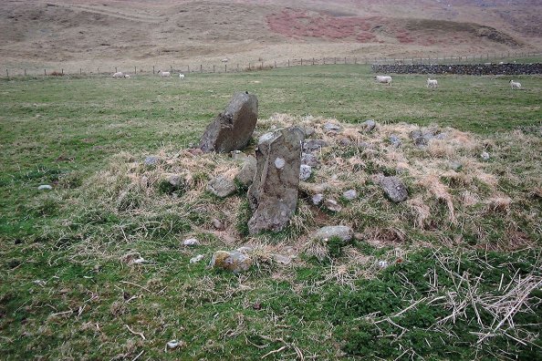
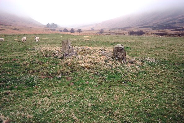
Yes, there are only two stones left of this stone circle, but they are poking out of what looks to be a small cairn, I did not know for sure that bona fide four posters are sometimes built into a cairn. Just the other day I was at Hafodygors wen, the only four poster in North Wales, but its position in a cairn casts some doubt over it for me. But now I know first hand that some four posters are in a cairn. But that is not all, both circles are near the meeting of mountain rivers, both sites are in the valley between big mountains.
It was a revelation.
And a good site too, even if you've never been anywhere near Conway.
Still see no reason to have your user name named after here though, no rock art, ruined stone circles, and a slightly less than impressive chambered cairn. Oh well who cares.
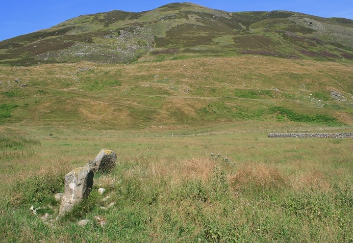
This circle is of the same type as its close neighbour Clach na Tiompan, but is in a better state of preservation (although still quite ruinous). Two stones remain standing, and a further two stoneholes have been identified. The stones protrude from cairn material, which spreads to a diameter of approximately 5.0m. The circle itself is nothing much to look at, but it's location, between the steep sides of Glen Almond, is stunning.
These are the sad remains of what was once a four-poster, which enclosed a cairn. Only two stones now remain, though excavation of the site in 1954 found the sockets for the other two. It was dated to approximately 1600 bc.
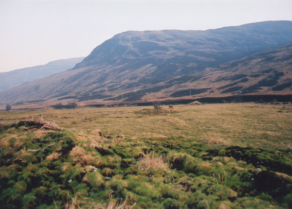
Directions - Head W from Perth on the A85 for Crieff. After approximately 22.0km, and having passed through the villages of Lochty and Methven, you will reach the village of Gilmerton (2.0km before Crieff). Drive into the village, and just before leaving it again, you will see a sign-post to the right for the A822 to Dunkeld & Aberfeldy. Take this road, which climbs steeply before taking you through the Sma' Glen. After approximately 10.0km, you will see a lay-by on the right side of the road, beside the river Almond, and just before the bridge which crosses it to the right. Park here, as the track to Clach na Tiompan is a private farm track and for farmers' vehicles only. Cross the bridge on foot, and take the track to the left after it (sign-posted as a footpath). Continue along this track, passing the farms of Craignavar and Conichan along the way. About 1.5km after Conichan (and approximately 6.0km after leaving the main road), the remaining stone of Clach na Tiompan stone circle is obvious on the left of the track, beside a track leading down towards the river, and the chambered cairn is on the right of the main track. Continue on the main track for approximately 0.5km further, and you will see a large, round stone sheep pen to your left. The River Almond circle is just beyond this, about 100m from the track, and can be accessed by a gate into the field.
This circle is listed by CANMORE as River Almond (also known as Auchnafree or Glenshervie Burn) to distinguish it from Clach na Tiompan stone circle across the track from the chambered cairn of the same name.

 Posted by postman
 Posted by BigSweetie
 Posted by nickbrand