The Modern Antiquarian
Log in
|
Register
Home
Latest Posts
Forums
Maps
Help
Browse Sites
News
Blog
Contributors
The Books
Select
-
Belgium
Denmark
Eire
France
Germany
Greece
Italy
The Netherlands
Norway
Portugal
Republic of Malta
Spain
Sweden
Switzerland
United Kingdom
Scotland
Argyll and Bute (Islands)
Mull
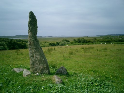
Pottie
Standing Stone / Menhir
Pottie (Standing Stone / Menhir) on The Modern Antiquarian, the UK & Ireland's most popular megalithic community website. 2 images, plus information on many more ancient sites nearby and across the UK & Ireland.
Image © notjamesbond
Nearest Town:
Tobermory (38km NNE)
OS Ref (GB):
NM325222 /
Sheet: 48
Latitude:
56° 18' 59.22" N
Longitude:
6° 19' 35.33" W
Added by
nickbrand
Images (2)
0 discussions
Start a topic
Show |
Hide
Web searches for Pottie
Flickr
Google
Google Images
MAGIC
The Megalithic Portal
Bing
Stone Pages
Streetmap.co.uk
Wikipedia
Show map
(inline Google Map)
- Sites within 20 km -
-
Fionnphort (1.55km WNW) (7 posts)
Fingal's Rock (2.76km W) (5 posts)
Tiraghoil (2.9km ENE) (15 posts)
Clach Brath (4.46km W) (3 posts)
Cladh an Diseirt (4.5km W) (9 posts)
Suidhe Barrow (4.59km E) (4 posts)
Suidhe (4.59km E) (9 posts)
Ardalanish (6.22km E) (10 posts)
Dun an Fheurain (6.27km E) (5 posts)
Uisken (7.12km E) (6 posts)
Taoslin (7.17km ENE) (8 posts)
Dun Bhuirg (10.44km ENE) (2 posts)
Dun a Gheard (13.58km ESE) (3 posts)
An Dun Torrens (16.22km ENE) (1 post)
Ulva 2 (18.47km NNE) (0 posts)
Ulva 1 (19.75km NNE) (2 posts)
- Add -
-
Add news
Add an image
Add fieldnotes
Add folklore
Add miscellaneous
Add a link
-
Add a site
Add a nearby facility
Add an alternative name/spelling
Images
(click to view fullsize)
Add an image
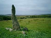 Image © notjamesbond