|
|

|
|
DaneburyHillfort
|
||||||||||||||||||||||||
|
|
|
News |
|
Mainly Danebury Exhibition @ Andover MuseumMainly Danebury; Paintings inspired by the Iron Age Hill Fort A collection of artwork by local artist Nat Lewis For many years I have been fascinated by Danebury, not only its history and the artefacts in the Museum, but also by the atmosphere inherent in the location..... continues... |
 Posted by goffik
4th March 2012ce |
Rampart Work Closes Iron Age FortFrom an article published on the BBC News web site on 11th December 2005: Parts of an Iron Age hillfort are to be closed to the public while essential repair work is carried out... continues... |
 Posted by Kammer
14th December 2005ce Edited 14th December 2005ce |
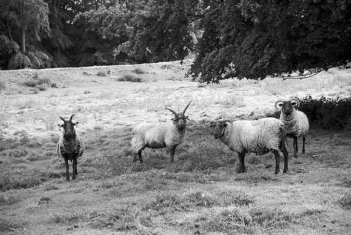
Rare sheep to conserve archaeology at DaneburyEdited from thisishampshire Danebury Hill is soon to welcome 80 sheep to graze back the rank grasses and scrub growth which threaten the fort's rare downland flowers, such as the burnt tip and frog orchids... continues... |
 Posted by Rhiannon
27th May 2004ce Edited 27th May 2004ce |
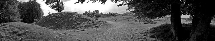
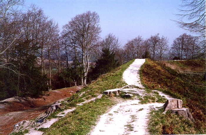
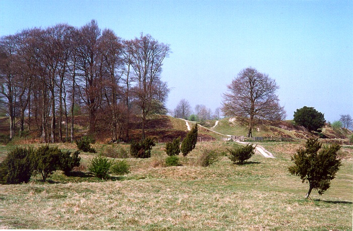
Images (click to view fullsize) |
|
Photographs: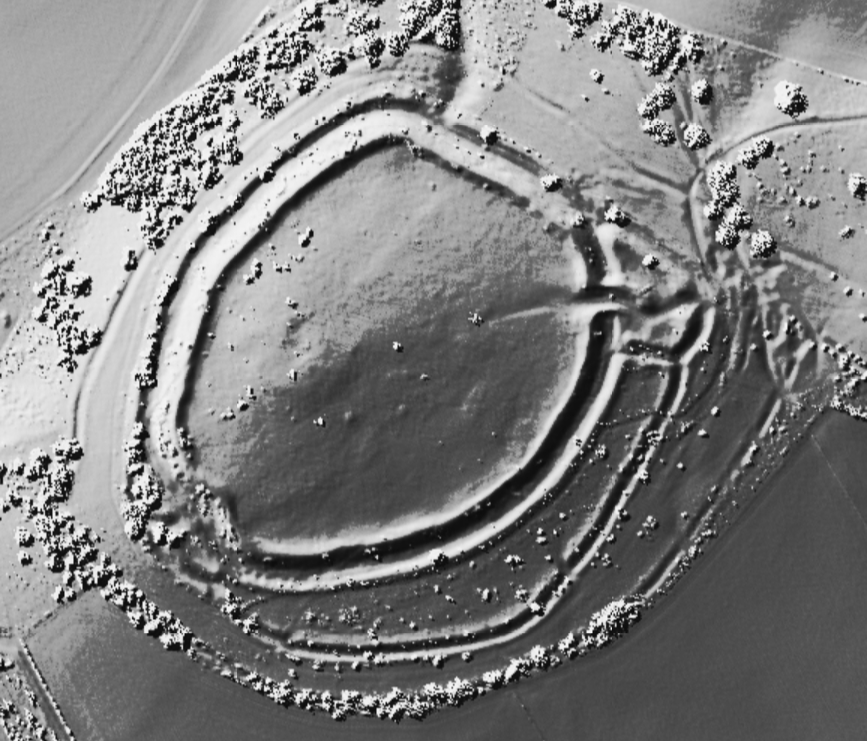

 Maps / Plans / Diagrams:
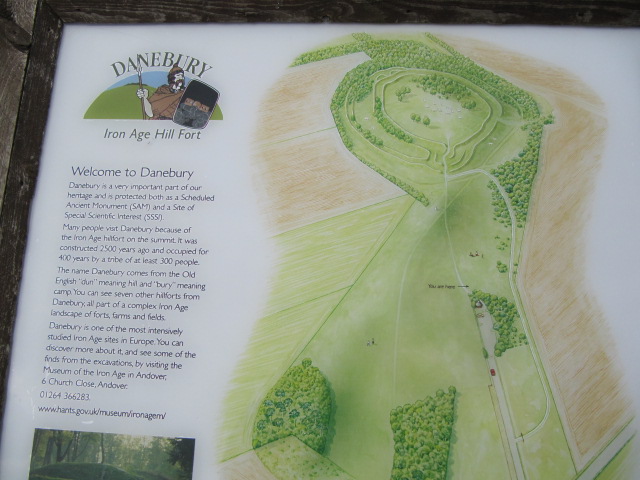
|
Fieldnotes |
|
|
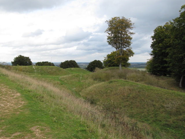
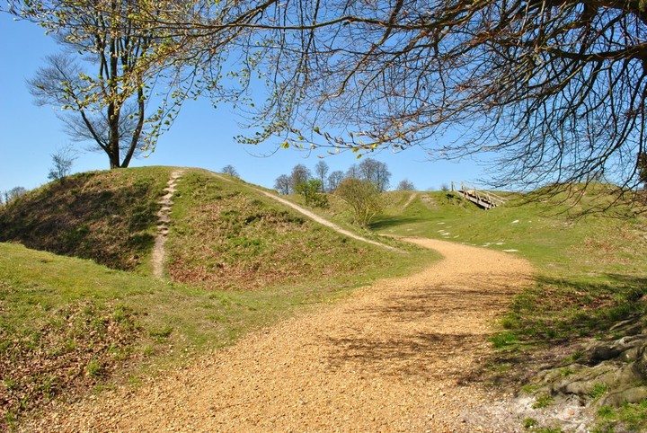
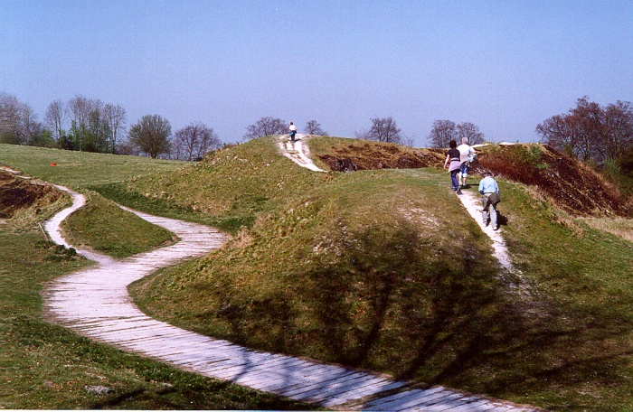
Visited 25.11.12 WOW – what a great place to visit! I had read a lot about Danebury and am pleased to report that it didn’t disappoint. The weather was menacing, with brooding black clouds all around. Although for now, thankfully, it remained dry. We parked at the first car park we came to not realising that you can drive up to the top of the hill into the main car park – where the toilets are (although they were shut due to the water levels in the reservoir?) Dafydd decided that he fancied a walk and donned his waterproofs while Karen stayed in the car with the sleeping Sophie. By the time we reached the main car park he was already flagging! It is only a short uphill walk across flat grass (much frequented by dog walkers) and you are soon at the entrance to the Hillfort. There is an information board with an artist’s impression of how the entrance would have looked which is pretty good. The info board stated that seven other Hillforts can be seen from Danebury. We walked up the wooden staircase and walked around the Hillfort in an anti-clockwise direction. By the time we got half way round Dafydd’s legs started to ‘hurt’ as they often do when walking any distance! The rain stayed away (despite the looming clouds) and it was clear to see that this site was in a dominant position within the landscape. As we completed the circuit (with me by now carrying Dafydd) the inevitable rain started to fall. We sheltered under the trees and I took one last look at the well preserved entrance and tried to imagine how impressive this site would have been when in use. We headed down the hill back to the car and past yet more dog walkers – they seem to like this place as much as I do! Time to head home. A great site to end my weekend ‘adventures’. If you are ever in the area this is a ‘must see’ site which is really easy to access – and signposted too! |
Posted by CARL 28th November 2012ce |
|
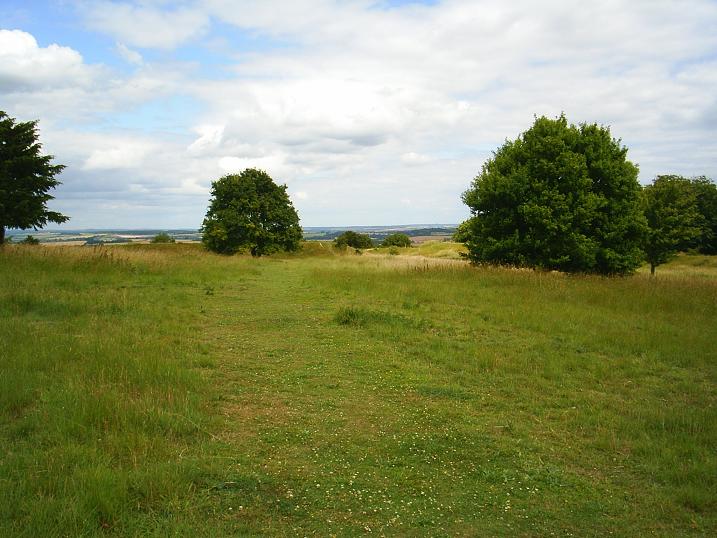
Second visit to this spectacular hill fort today. Incorporated it with a stop off in Andover to visit the superb Museum of the Iron Age based on the excavations at Danebury but which also attempts to give a general impression of life in the Iron Age. Well worth a visit - lots to see, lots to learn. It was a hot afternoon but the walk up to Danebury somehow felt breezy and just the right place to be. Wonderful views across the now golden grain fields of Hampshire. We had gone back specifically to see the wild flowers which seem to grow in such profusion at other hill forts like Barbury. The predominate wild flowers today were great stands of yellow ragwort - a wild flower I have reservations about as believe it is poisonous to horses and cattle. Lots of delicate harebells growing too. Butterflies galore ... which was a bit of a joy as its been a bad year for butterflies up till now. Saw my first red admiral of the summer, along with chalk blues, marbled whites and many more. Danebury had a little surprise for us - we found a small wooded area to take shade and stop for a drink. Three brown ponies (possibly Exmoors) appeared and calmly walked past unperturbed by our presence. I was particularly surprised to see them as there was so much ragwort around. I guess they just know not to eat it. |
 Posted by tjj
26th July 2012ce Edited 26th July 2012ce |
|
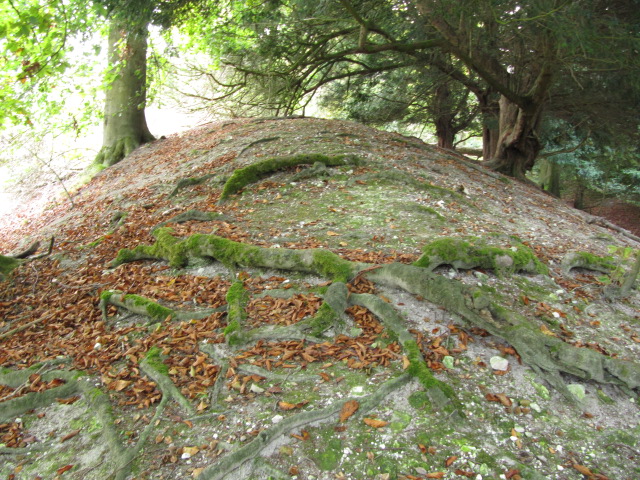
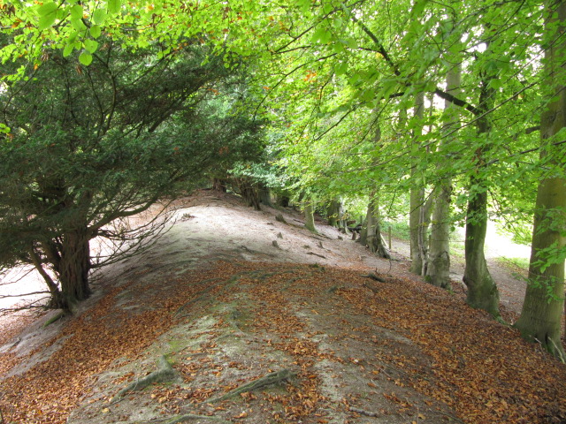
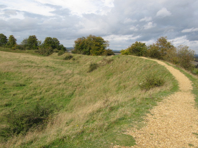
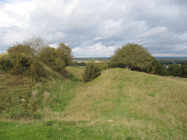
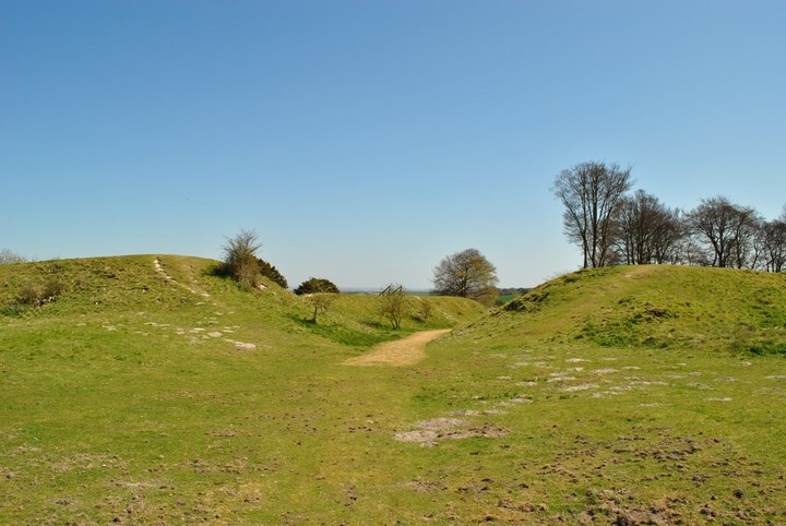
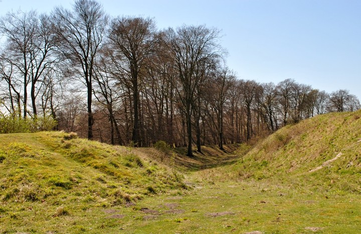
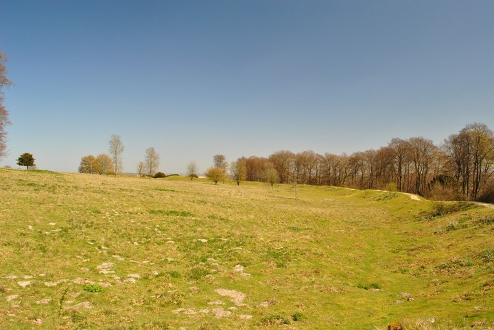
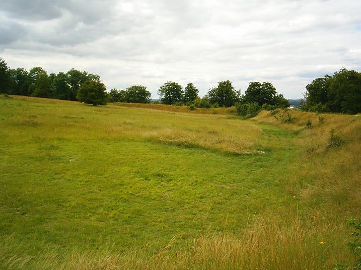
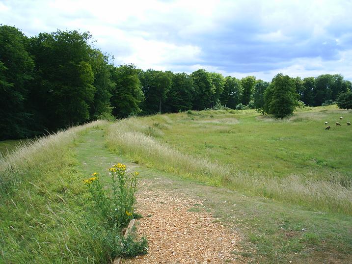
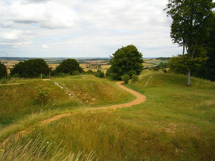
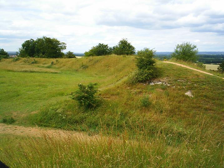
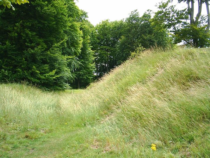
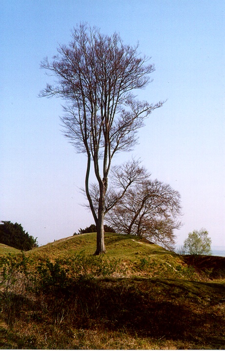
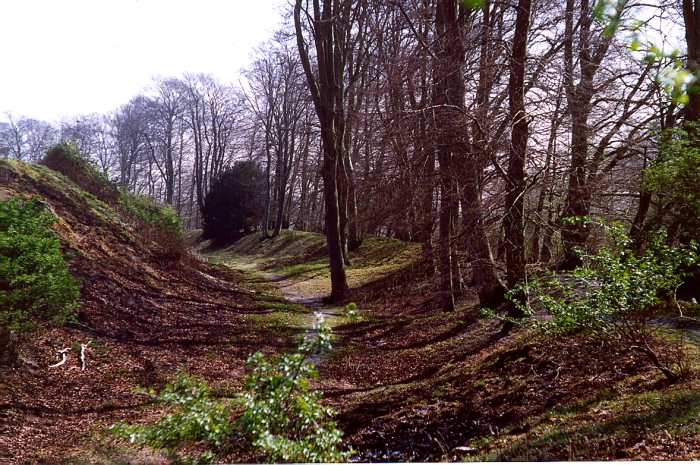
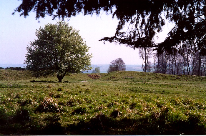
This hill fort has been on my list to visit for some time. Today I received the opportunity via a friend who wanted to make an autumnal visit to the New Forest - Danebury was on the way. Surprisingly easy to find as well sign-posted from Andover - we left the car in the first parking area at the bottom of the hill, although there was another one further up the hill next to a small discreet roundhouse-style toilet building (with information boards). Its a relatively gentle walk up to the hill fort where there is yet another information board explaining that the eastern entrance once had a timber gate which had been destroyed and rebuilt several times. Originally the fort had two entrances but the west gate was filled in and only the east gate used. It appears to be a trivallate fort, at least in parts; 2500 years old and occupied for 500 years until the Romans arrived. Excavations by Professor Barry Cunliffe of Oxford between 1969-1988 found evidence of 73 roundhouses and 500 rectangular buildings - roundhouses for the people and the rectangular store houses and pits probably for grain. 180,000 pieces of pottery and 240,000 bits of animal bone and stone objects such as querns and bone implements for weaving were found. There are still dips in the ground where grain stores used to be and a high spot in the centre which is thought to have been a focal point for religious gatherings and important meetings. Its a massive and impressive hill fort, the lower ramparts now quite densely wooded in places with beech and yew trees. The paths have had sand gravel, rather than chalk laid down, which slightly detracts from the ambience, as do the wooden steps up one of the higher ramparts. Both these measures protect the hill fort from erosion so no complaints from me. The wild flowers which appear to grow in profusion have gone with the onset of autumn; a 'must go back in the summer' sort of place with panoramic views over Hampshire and towards Wiltshire. |
Posted by tjj 17th October 2011ce Edited 18th October 2011ce |
|
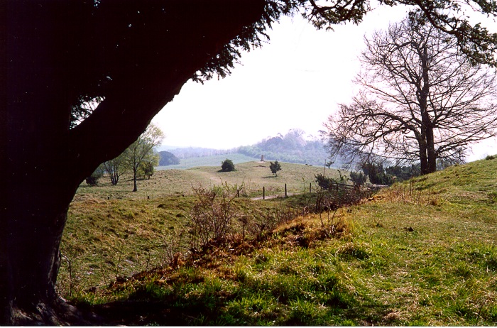
Visite 09/07/09. Flamin' Hell, this is a big, impressive site, with banks and ditches of almost Avebury proportions. Obviously it's been tamed, and spruced-up a tad, with a modern, slightly-pisses-me-off entrance. But, did I want an overgrown site, which was hard to see and interpret, and an entrance which was overgrown and hard to find? Yes, and no. Can't have both, can I? So, it's the modern take, and the huge, cleared centre. It's definitely easy to appreciate how massive this place is, and the info boards are full of info, as you'd expect, even directing you to the archaeologist who dug the site, which is helpful, 'cos so many lay-people who visit the lesser-known sites don't always know where to find more knowledge. The area is massive, once housing up to 1,000 people, and it just has to be seen to be believed. The views from the bank are superb, south across the flatlands of Hampshire, and with the various hills in other directions. It's a very quiet spot, and the wind rustles gently through the surrounding trees. On my visit I had the place to myself, and it was one of the most peaceful places I have ever been, with an atmosphere reeking of the past. |
 Posted by The Eternal
23rd August 2009ce |
|
On a really bizarre day for the weather, 25C+ in April, I visited this site for the first time for at least 15 years. Slightly put off by all the notices in the car park warning of thieves. Walked up to the Trig Point by the entrance and was struck by the fact that, although it is the highest point in the immediate neighbourhood, if it was meant to dominate the crossing of the River Test it doesn't as it is too far away. Mind you the other hills nearer the river are more conical in shape and were probably too small to support a hill town of any size. The earthworks on the SE side outside the main ramparts are very confusing and it's difficult to see, to my untrained eye, how they could have been cattle enclosures. Inside the E. entrance, which is a bit "managed" with a wooden walkway, I was struck by the difference from my last visit. The inner bank and much of the interior used to be quite thickly wooded, now apart from a small group of cherries and an isolated tree the centre and inner bank are mostly empty. The trees were felled as they were diseased although the ones on the perimeter seem to be fine. The clearance did, of course, make the extensive excavations possible. Although the site is on high downland and is managed grazed, the flora has yet to completely recover and compared to Woolbury it is a bit of a desert. The clumps of brambles on the banks seen to have been cleared by flame throwers, unfortunately this has also killed the grass holding the topsoil and there was much evidence of slippage of the surface. There was more erosion on the tops of the banks caused by walkers. What does one do? I am as guilty as most but do you keep to the worn bits or do you tread elsewhere and spread the problem? It's still a pretty grand site though and it's easy to imagine the thousand or so people that lived here for about 500 years leading a mostly settled and prosperous existence. Disabled: Long slope up from carpark on grass. |
 Posted by jimit
19th April 2003ce Edited 8th December 2003ce |
Folklore |
|
|
Someone's pan-icky experiences at Danebury recounted at the Fortean Times website: http://www.forteantimes.com/forum/showthread.php?s=&threadid=9310 |
Posted by Rhiannon 27th May 2003ce |
Miscellaneous |
|
|
Details of site on Pastscape Iron Age hillfort, with multiple phases of occupation and development from the 7th to 1st century BC with evidence of Bronze Age and pre Bronze Age activity. Finds of a Roman coin and a few sherds of pottery suggest only sporadic visits in the Roman period. The last ditch recutting is of unknown date. It is possibly late Iron Age, but equally possible that it could have been done in the sub Roman period. Unstratified sherds of 5th or 6th century pottery have been found. Later the site was probably used for a rural fair, and a charter for such a fair was granted in the 16th century. The site was also used as a rabbit warren with resident warrener. Disused by the 17th century the ground was then subject to 'improvment'. Danebury has been the subject of a major research project and excavation. |
 Posted by Chance
7th June 2014ce |
|
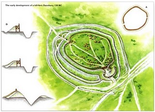
There is a cluster of hill forts in this part of Hampshire of which Danebury is the largest. Baulkesbury, more or less destroyed, Bury Hill and to the E. of the Test Valley, Tidsbury, Norsebury and Woolbury . Danebury is interesting for the fact that it started as a sacred site, developed into a fortified hill then became a thriving hill town until the Romans came. A circle of large posts was erected in Bronze Age times then in the 6C BCE the hill seems to have been lightly fortified with a single ditch and bank, a timber revetment and outer earthworks used as cattle enclosures while the people lived in a scatter of round huts. In the 4C BCE the pattern of occupation changed, the fortifications were strenghtened by elaborate diversions at the E. entrance, a second line of ramparts was erected, watch towers were built and large stocks of sling stones were kept. The town itself was more planned with maintained tracks and the houses were often rectangular. Trade thrived, probably in cattle and twenty or so iron currency bars have been found. The death customs were curious for the time as bodies just seem to have been thrown out with the rubbish or chucked unceremoniously into pits. From the number and size of the grain storage pits excavated it is suggested that the town comfortably supported a population of at least a thousand people. After 100 BCE the town was deserted and Danebury reverted to being a refuge in dangerous times. |
Posted by jimit 20th April 2003ce Edited 21st March 2007ce |
Links |
|
The Museum of the Iron Age, AndoverVisited this museum in Andover on a return visit to Danebury. Excellent and atmospheric museum, constructed as a round house inside (though in a conventional building). A great place for a family outing with lots to learn. One display focuses on the animals and plantlife that were around at the time. I learnt that the cockeral, goose and hare were held as sacred and never eaten. The raven was a symbol of darkness and death though also associated with foretelling the future. Also - something I've never seen before, a hologram of the Lindow Man. Very realistic. |
Posted by tjj 26th July 2012ce |
Hantsweb |
Posted by tjj 17th October 2011ce Edited 18th October 2011ce |
British Museum - CompassA decorated weaving comb from the Iron Age, made from an antler, and found at Danebury. |
Posted by Rhiannon 3rd January 2006ce Edited 20th November 2006ce |
Archaeology Data ServiceDanebury Excavations Digital Archive: extensive on-line excavation reports, including many illustrations. |
Posted by Rhiannon 5th December 2003ce |