The Modern Antiquarian
Log in
|
Register
Home
Latest Posts
Forums
Maps
Help
Browse Sites
News
Blog
Contributors
The Books
Select
-
Belgium
Denmark
Eire
France
Germany
Greece
Italy
The Netherlands
Norway
Portugal
Republic of Malta
Spain
Sweden
Switzerland
United Kingdom
County Cork
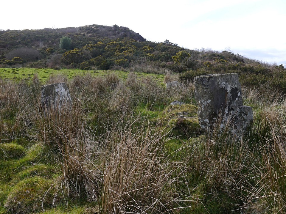
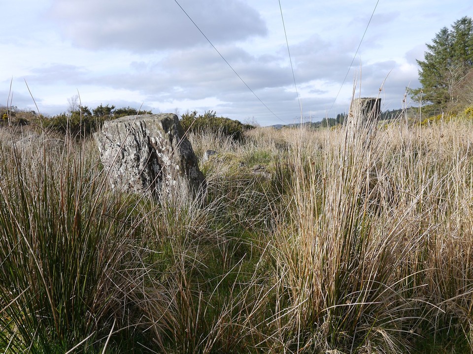
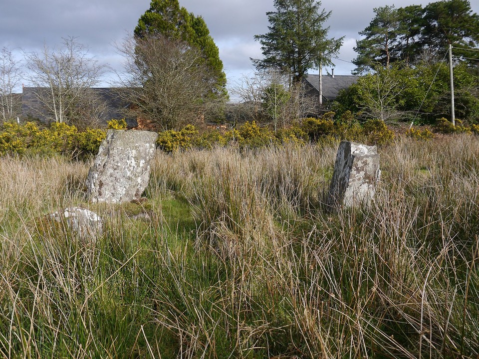
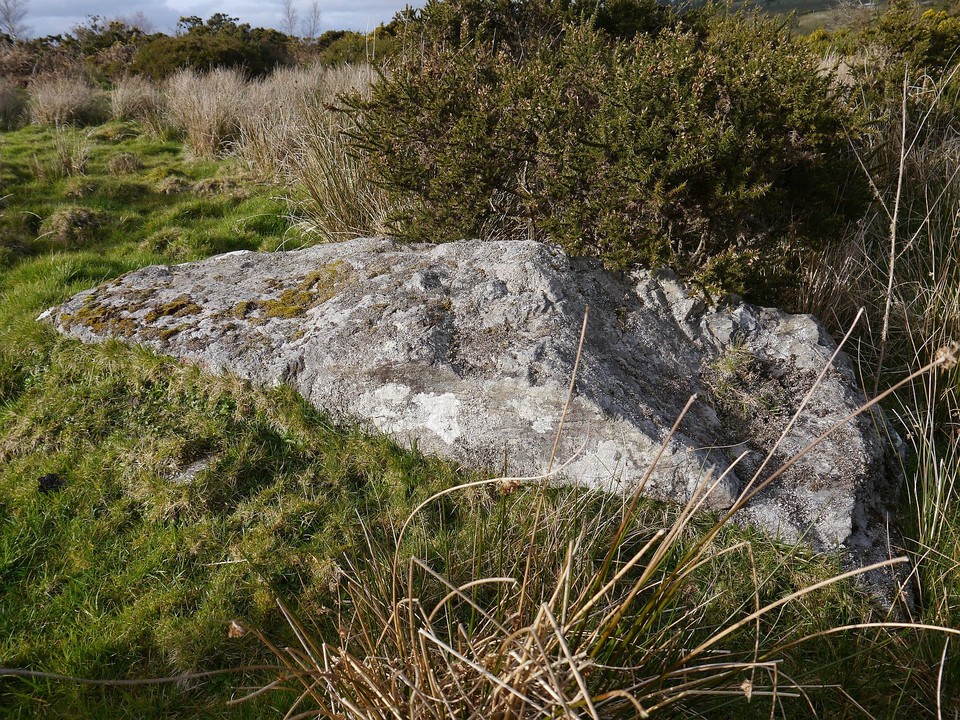
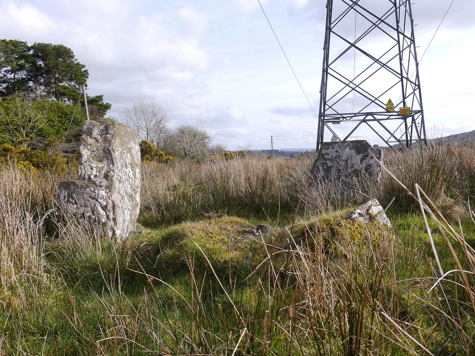
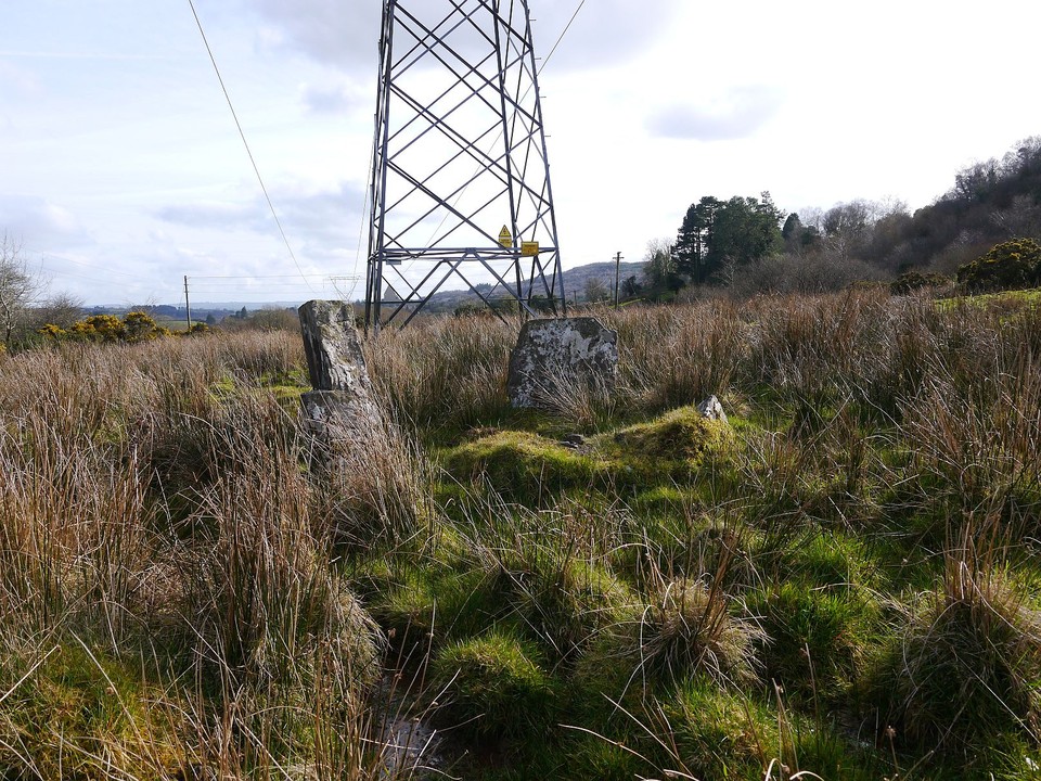
Carrigonirtane
Stone Circle
Carrigonirtane (Stone Circle) on The Modern Antiquarian, the UK & Ireland's most popular megalithic community website. 6 images, plus information on many more ancient sites nearby and across the UK & Ireland.
Image © Michael Mitchell
Nearest Town:
Cookstown (21km SE)
OS Ref (IE):
W285806 /
Sheet: 79
Latitude:
51° 58' 22.91" N
Longitude:
9° 2' 26.09" W
Added by
FourWinds
Images (6)
0 discussions
Start a topic
Show |
Hide
Web searches for Carrigonirtane
Flickr
Google
Google Images
The Megalithic Portal
Bing
Stone Pages
Wikipedia
Show map
(inline Google Map)
- Sites within 20 km -
-
Knocknakilla (1km ENE) (0 posts)
Cabragh (1.06km SW) (4 posts)
Cabragh N (1.06km SW) (6 posts)
Carrigonirtane (1.34km SW) (4 posts)
Cabragh (1.43km SSW) (4 posts)
Knockraheen (1.84km E) (19 posts)
Clashmaguire (2.16km S) (2 posts)
Carriganimmy (2.24km NNE) (15 posts)
Glantane South (2.5km NW) (8 posts)
Glantane East S (2.82km NNW) (16 posts)
Clashmaguire (3.11km S) (1 post)
Glantane East N (3.4km NNW) (5 posts)
Glantane East N (3.4km NNW) (14 posts)
Lackaduv (3.41km E) (5 posts)
Scrahanard (3.44km E) (15 posts)
Gortnalicky (3.6km S) (1 post)
Glantane East (3.68km NNW) (7 posts)
Knocknakilla (3.88km NNE) (24 posts)
Cloghboola Beg (5.01km NNE) (12 posts)
Lissacresig (5.53km SSW) (3 posts)
Lissacresig 1 (5.65km S) (4 posts)
Lissacresig 3 (5.66km S) (4 posts)
Lissacresig 2 (5.66km S) (5 posts)
Knockagappul 2 (5.99km ENE) (6 posts)
Kilboultragh (6.07km ESE) (1 post)
Knocknagappul (6.21km NE) (2 posts)
Cloghboola Beg (6.36km NNW) (0 posts)
Cloghboola More (6.36km NNW) (0 posts)
Knocknagappul (6.44km ENE) (5 posts)
Knockagappul 1 (6.52km ENE) (5 posts)
Stone Row, partially ruined (6.52km ENE) (5 posts)
Knocknagappul (6.97km ENE) (3 posts)
Knocknagappul (7.02km ENE) (3 posts)
Inchinlinane (7.12km S) (5 posts)
Carrigaphooca (7.15km SSE) (7 posts)
Caherbaroul (8.1km E) (7 posts)
Ballymakeery (8.31km WSW) (5 posts)
Cools (8.39km SSW) (3 posts)
Kilmeedy E (8.75km NW) (0 posts)
Claragh E (8.75km NW) (2 posts)
Shanacloon (8.83km WSW) (5 posts)
St Abban's Grave (8.83km WSW) (1 post)
St Abban's Grave (8.83km WSW) (4 posts)
Carrigagulla NE (8.87km ENE) (10 posts)
Carrigagulla (8.92km ENE) (20 posts)
Kilmeedy W (8.92km WNW) (0 posts)
Ballyvoge 1 (8.94km SSW) (6 posts)
Kylefinchin (8.95km S) (1 post)
Carrigagulla (8.97km ENE) (7 posts)
Kylefinchin 2 (8.97km S) (5 posts)
Carrigagulla NE (9.24km ENE) (17 posts)
Claragh W (9.27km WNW) (2 posts)
Kilberrihert large wedge tomb damaged (9.37km E) (2 posts)
Gortyleahy (9.4km SE) (4 posts)
Gortanimill (10.05km SW) (16 posts)
Bealick (10.1km ESE) (0 posts)
Bealick (10.13km ESE) (3 posts)
Gortnatubbrid (10.3km WSW) (4 posts)
Gortnatubbrid (10.3km WSW) (13 posts)
Glenleigh (10.32km NNE) (3 posts)
Oughtihery W (10.67km ENE) (9 posts)
Maulmore (10.88km ENE) (8 posts)
Teergay (11.2km SSE) (8 posts)
Reananarree (11.22km SW) (3 posts)
Reananerree (11.22km SW) (11 posts)
Deelish (11.42km E) (4 posts)
Laharankeal (11.47km E) (1 post)
Laharankeal (11.6km E) (4 posts)
Derryfineen (12.57km SW) (6 posts)
Derryfineen (12.64km SW) (5 posts)
Lack More (12.84km SW) (9 posts)
Oughtihery E (12.96km E) (9 posts)
Rosnascalp (13.75km ESE) (4 posts)
Shanralagh (14.94km NNW) (3 posts)
Lumnagh More (15.15km WSW) (0 posts)
Rylane (15.26km ENE) (5 posts)
Rossnakilla (15.38km SE) (0 posts)
Rossnakilla (15.38km SE) (9 posts)
Rylane (15.56km ENE) (3 posts)
Eastern Pap (15.85km W) (6 posts)
The Paps of Anu (16.39km W) (7 posts)
City of Shrone (16.54km W) (15 posts)
City of Shrone (16.54km W) (2 posts)
Kilmartin Lower (16.62km ENE) (1 post)
Knockane (16.67km SE) (8 posts)
Coolaclevane (16.68km SSE) (3 posts)
Knockaunnagorp (16.88km SSE) (0 posts)
Coolaclevane (16.88km SSE) (3 posts)
Turnaspidogy (16.94km SW) (8 posts)
Barnadivane (17.11km SE) (0 posts)
Clearagh (17.23km SE) (2 posts)
Knocknashannagh (17.29km NW) (1 post)
Knockavullig NE (17.57km ESE) (2 posts)
Knockavullig SW (17.62km ESE) (4 posts)
Gorteennakilla (18.1km SW) (6 posts)
Reanacaheragh (18.18km SSE) (0 posts)
Knockanereagh (18.18km S) (8 posts)
Currahy (18.59km SW) (4 posts)
Knocknaneirk NE (19.33km SE) (13 posts)
Keamcorravooly (19.51km SW) (4 posts)
Keamcorravooly (19.58km SW) (11 posts)
Hornhill (19.82km SE) (8 posts)
Knocknaneirk SW (19.82km SE) (17 posts)
Garranereagh (19.95km SE) (4 posts)
- Add -
-
Add news
Add an image
Add fieldnotes
Add folklore
Add miscellaneous
Add a link
-
Add a site
Add a nearby facility
Add an alternative name/spelling
Images
(click to view fullsize)
Add an image
 Image © Michael Mitchell