|
|

|
|
St David's Head
|
|||||||||||||
|
|
|
Sites in this group:
|
1 post
Carn Llidi Bychan |
38 posts
Carn Llidi Tombs Chambered Tomb |
7 posts
Clegyr Boia Ancient Village / Settlement / Misc. Earthwork |
|
48 posts
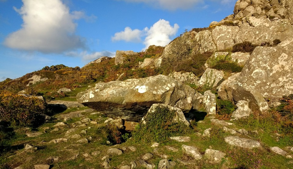
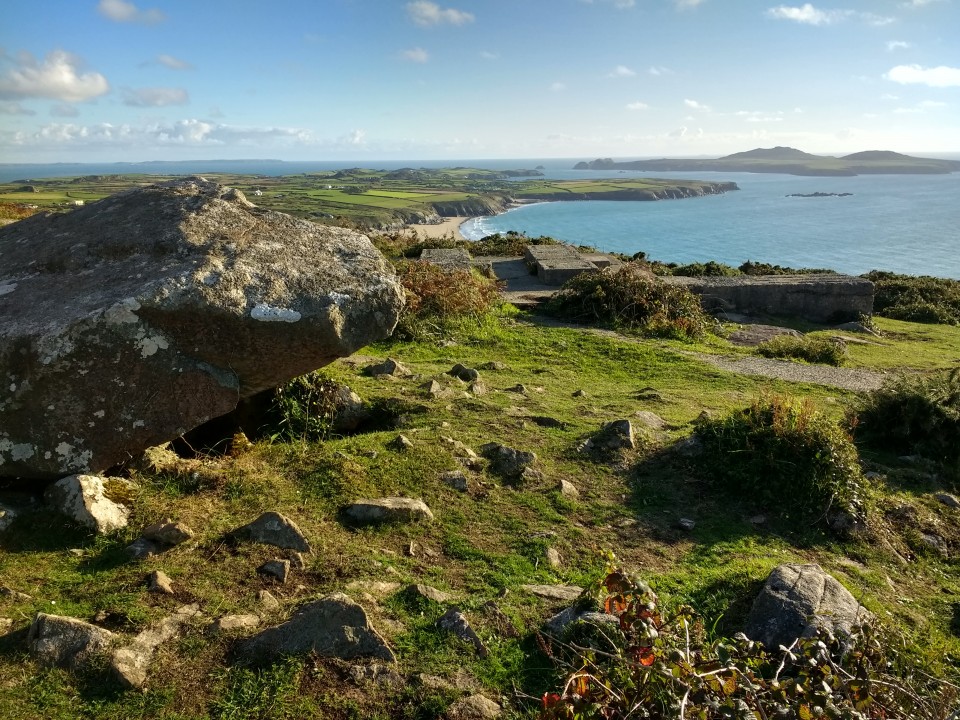
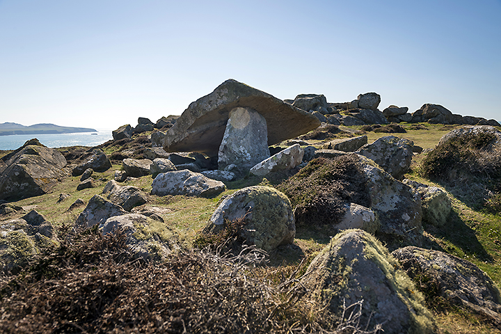
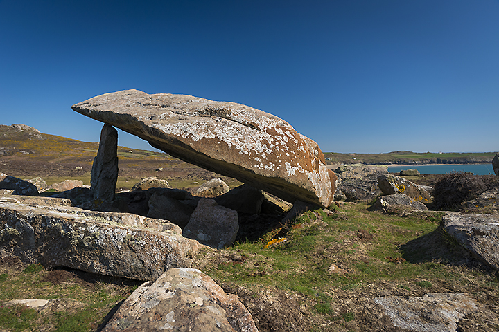
Coetan Arthur Chambered Tomb |
1 post
Lower Tregennis Burial Chamber |
31 posts
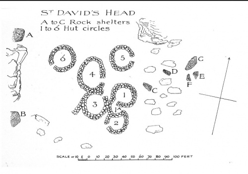
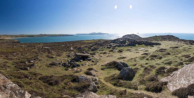
St David's Head Camp Cliff Fort |
Images (click to view fullsize) |
|

|
Miscellaneous |
|
It may not be man-made but it's certainly 'megalithic', and (like in Cornwall??) may well be related to the siting of tombs like the nearby Coetan Arthur?:The Rocking Stone (we give it a title of courtesy which has survived its peculiar property) stands on the western slope of Carn Llidi, at a short distance from the cliff, and from the road leading to St. David's Head. Its height is five feet, its extreme length and breadth each six feet six inches; and it narrows somewhat towards the bottom. A little to the east there is a point of rock which may have acted formerly as the fulcrum.From p24 of 'The History and Antiquities of Saint David's' by WB Jones and EA Freeman (1856). Browne Willis was an antiquary who wrote many books in the first half of the 18th century. You can read Jones and Freeman's book online at Google Books. It's got lots of information about the location of destroyed sites in the area, which I'm sure will be of interest to those that know the area well. |
 Posted by Rhiannon
6th October 2007ce Edited 6th October 2007ce |
| Carn Llidi is the highest point on the St David's Peninsular, and home to various forts and settlements. Two burial chambers here have pits cut into the rocks. |
Posted by Rhiannon 21st June 2002ce Edited 25th March 2003ce |
Links |
|
CAMBRIA Archaeology: Penmaen DewiA page about St David's Head (Penmaen Dewi) including an aerial photograph, and quite a bit of blurb about the prehistoric sites on the peninsular. |
 Posted by Kammer
8th April 2003ce |
Multimap Aerial PhotoAn aerial photograph of St David's Head. From this page you can overlay the Ordnance Survey map by clicking on the Overlay Map link on the left hand side of the screen (this is a slow process though). |
Posted by Kammer 25th March 2003ce |
Latest posts for St David's Head |
Showing 1-10 of 126 posts. Most recent first | Next 10 
Coetan Arthur (Chambered Tomb) — Images (click to view fullsize) |
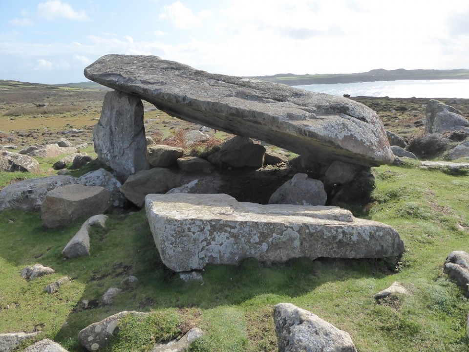 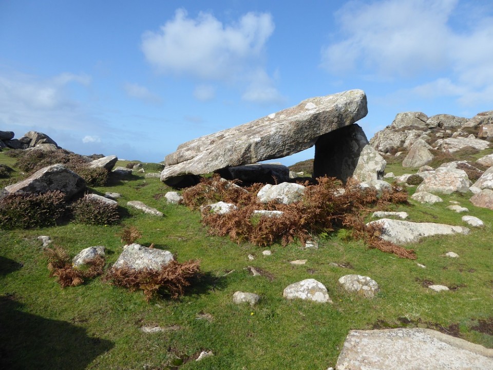 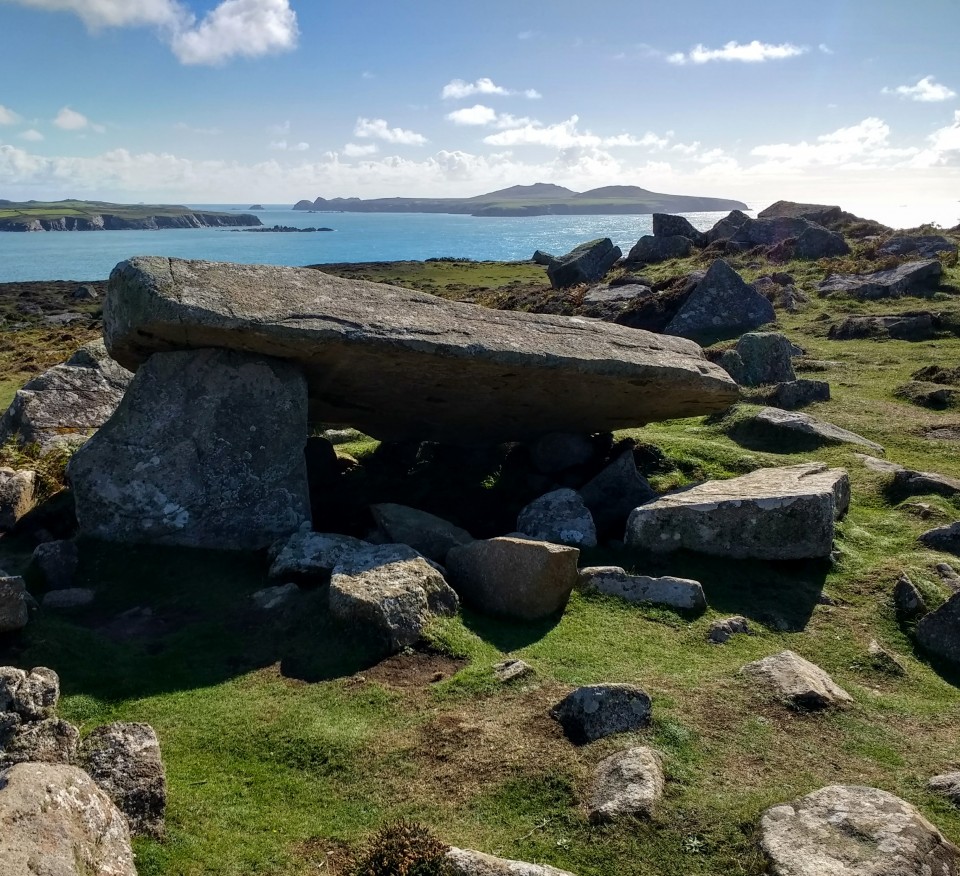
|
9th January 2019ce |
St David's Head Camp (Cliff Fort) — Images |
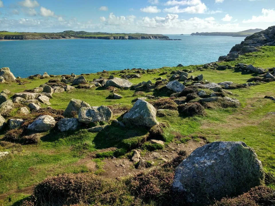 
|
 Posted by moss
28th September 2018ce |
Carn Llidi Tombs (Chambered Tomb) — Images |
|
23rd September 2018ce |
Coetan Arthur (Chambered Tomb) — Images |
|
 Posted by A R Cane
6th May 2015ce |
Showing 1-10 of 126 posts. Most recent first | Next 10