The rampart gets a bit of a helping hand from Mother Nature......
Image credit: Robert Gladstone
The rampart gets a bit of a helping hand from Mother Nature......


Eastern flank.. not a great deal of artificial defence required, to be fair.


Difficult to be specific upon such a massive hillfort, but approx north-western flank, I think.

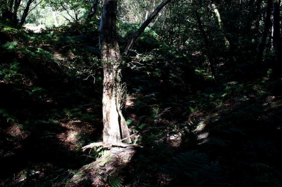
The hill fort’s defences are seen to best advantage to the west....

South-east, I believe.

To the west.... substantial defences.


The south-eastern defences.... the bank – to left – is generally more denuded here, but no less beautiful.


Oldbury Hill Fort – 25.8.2003 – the rampart /ditch on the west side

Rampart ‘ditch’ on the west side, just up from the car park.

The South East entrance which literally towered above you. Not that visible but it was cobbled...

Damaged & crumbling wall to the South East entrance...
Oldbury Hill Fort – 25.8.2003
An enormous hill fort, measuring 1,350m north-south, and 700m east-west, with an interior covering 49 hectares (about 125 acres)! So with only about half of it open access (National Trust land) it’s still an enormous place to mooch about in.
The woodland car park at TQ578558 is an obvious place, and is signposted (not that well) from the main road – the A25. A footpath directly opposite the end of the car park takes you up to the most impressive part of the ramparts (the west side). There are various paths all over the hill fort area, or as Juamei suggests a walk around the ramparts is nice, although the A25 does follow the ramparts on the south-east side making you feel really close the road despite the oppressive trees.
Excavated evidence suggests that the site as rapidly constructed on a huge scale but never occupied on a permanent basis. Short-lived settlement was discovered in the southern half of the hillfort, possibly relating to the construction period.
I later found the Mesolithic oldbury Rock Shelters (I think), the northern one of which does offer rare (and beautiful) views off to the east of the hillfort.
[visited circa 16/3/3] Finally I made it back here during the day & it was well worth the visit. A fairly large fort on top of a heavily wooded hill, the single bank-ditch combo is clearly visible and a well trodden path is available either at the top of the bank or the bottom. The trees (whilst nice for hugging et al) did iritate slightly as I’d have liked to have actually seen the view, but other than that they added very nicely to the general ambience.
Half of the fort is under cultivation, seemingly with apple orchards, but ‘apparently’ the farmer doesn’t mind people walking on it. I didn’t try this out however!
Park in the main car park & follow the hillfort bank counter-clockwise to get to the mesolithic Rock Shelters.
[actually written & added 27/11/02] This is another hillfort covered in trees & especially at night, there isn’t that much to see. Apparently the east side of the fort is precipitous but we didn’t make it that far, preferring instead to stop at the west embankments and wonder what the sounds were emanating from the trees.
Probably a better place to visit during the day, unless you know where you are going and (possibly) have a torch...
Oldbury hillfort was built by Iron Age people (who obviously had some run-ins with other tribes or the romans, as the NE timber gate was burnt down at some point, and caches (if I may use that word) of sling stones have also been found)
– But the hill was also the site of activity in the Old Stone Age. On the east side of the hillfort and 400m south of the NE fort entrance are two sandstone hollows (probably covered in vegetation) which were ‘workshops’ for tool makers – 40 hand axes and hundreds of flakes and other tools were found here (and are now in the Maidstone museum).