|
|

|
|
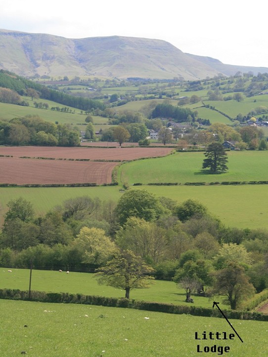
Little LodgeLong Barrow
|
||||||||||||||||||||||||
|
|
|
Images (click to view fullsize) |
|

|
Fieldnotes |
|
|
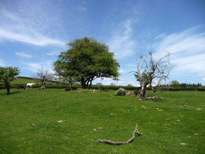
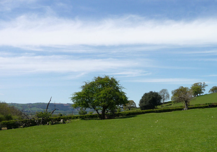
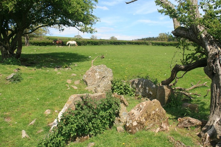
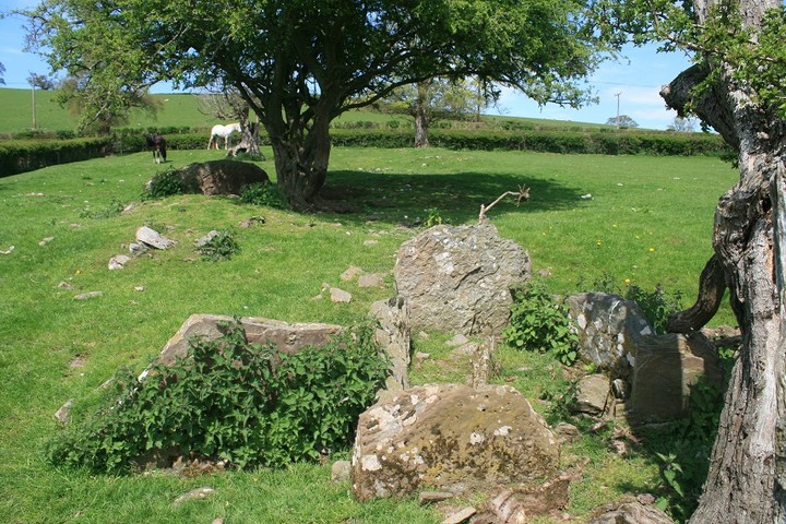
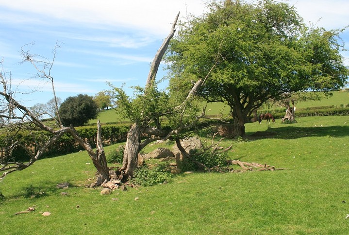
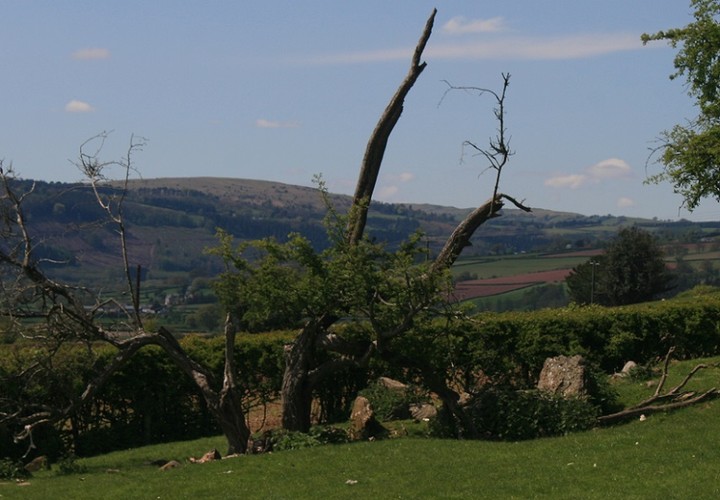
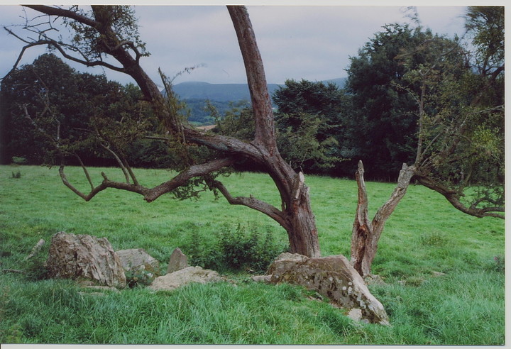
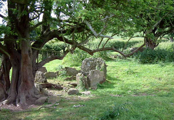
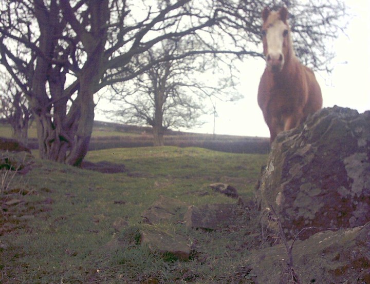
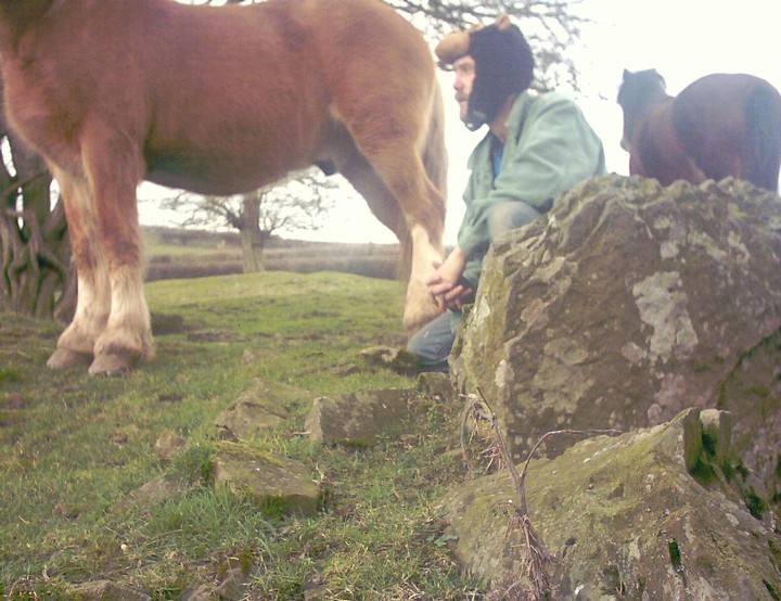
A lovely place is this. The sun was shining, the birds were singing, the horses ignored us, and with not one stone hunting buddy but two, this was getting to be a good day out. We parked at Little Lodge farm and strolled over to the long cairn unhindered by livestock or their human captors. More Hawthorn trees, with Mistletoe, never seen mistletoe before, except at parties, and that could have been plastic. It was a bit of an anti climax, as we'd just been to the sleeping giant of Penyrwrlod, and the two corkers at Ffostyll, today was a day of Black Mountain long cairns, six in all, this one was number four. Even though Little Lodge is not as big or as cool as the last two it does have some charm, and enough interesting features to keep one occupied for at least a couple of hours. The chamber at the south end is still complete, minus it's capstone. There is a large long stone under the Hawthorn tree, it could be a blocking stone. Just twenty yards further south and the ground falls steeply down to a wee brook that is fed by at least two nearby springs. Across the road and up the hill is a fairly good round barrow called Coed-y-Polyn (nice one Alken) it has good views of the surrounding fields and of the high hills of the Black Mountains and with Little Lodge Long cairn in it's place among it all |
 Posted by postman
23rd May 2013ce |
|
Visited 4.4.10. Just to add to Elderford's directions: As you drive up the lane towards the farm house (on your right), there is a gate about 50 metres before the gate which gives you access to the field via a public right of way. The barrow is only about 20 metres from this first gate – directly in front of you. If you don't want to trespass / ask permission, the barrow is easily seen from this gate. As an aside I noticed lots of mistletoe growing from the hawthorn trees – must come back at Christmas! |
Posted by CARL 6th April 2010ce Edited 6th April 2010ce |
|
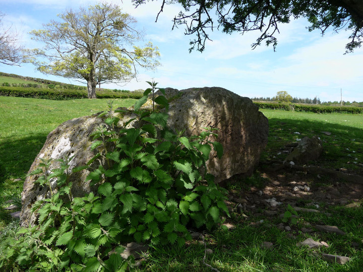
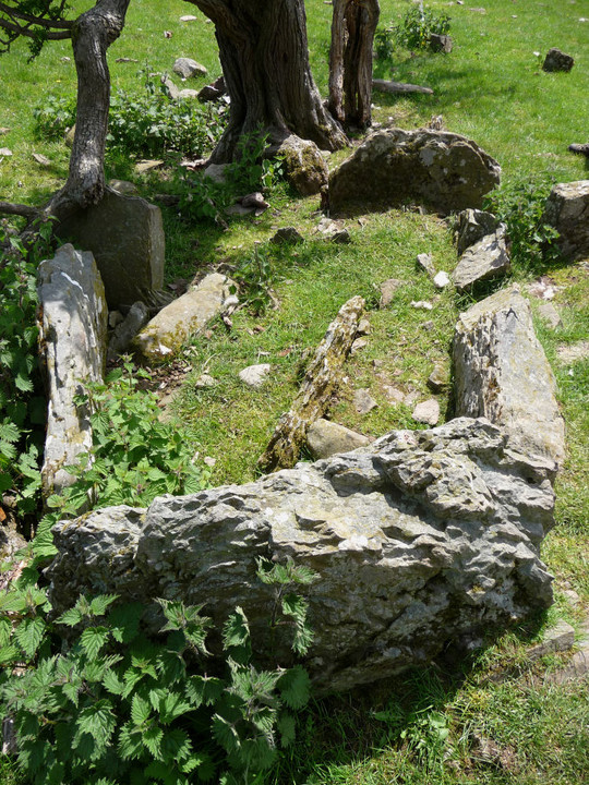
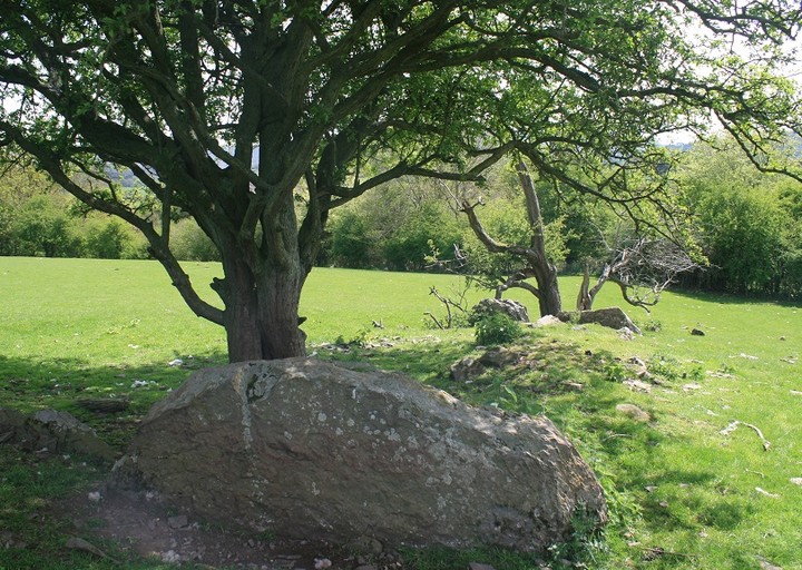
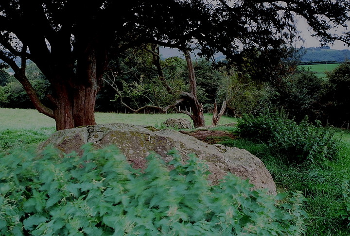
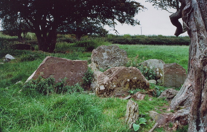
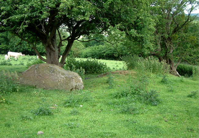
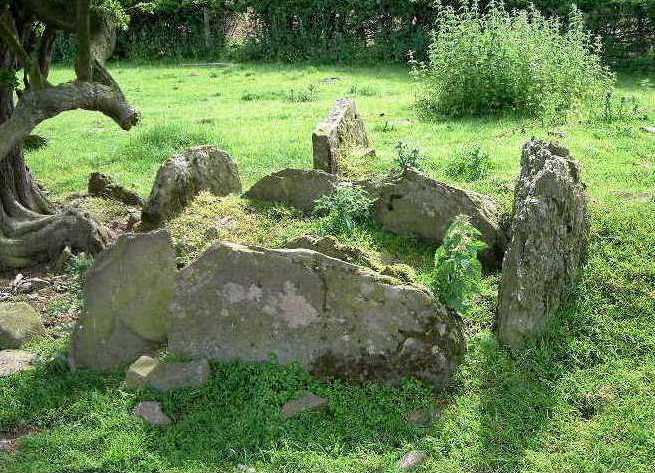
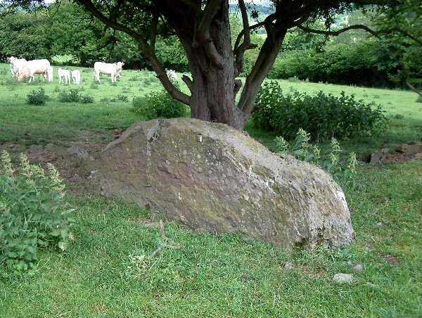
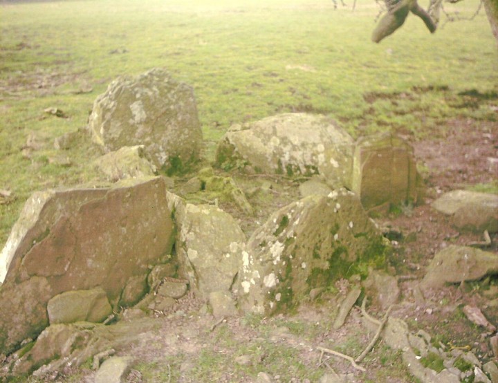
Chambered Long Barrow Part of the Black Mountains Group of Tombs OS map required Permission to visit required from Little Lodge farm. Although a public right of way does cross the field. A438 from Brecon. At Three Cocks take turning on right just beyond hotel signposted: Velindre. Less than 1km later at the crossroads continue ahead do not turn right for Velindre. Around 1km later (the first building you reach) is the Little Lodge farm on the right. The barrow is in the field before the farmhouse (on the right). Set back against the field boundary on the side of the field furthest from the house. The barrow sits between two trees and is easy to locate. This was the first of two long barrows I visited that day where hawthorn trees have been allowed to take root on the barrows causing extensive root damage. Excavated in 1929. Orientated north-south. The mound is in a cultivated field and is badly damaged. Many small cairn stones lie around the site. Measurements are given as 55.5m by 22m. There is a chamber at the southern end (no capstone). Wedge box shaped, that is to say, narrower at one end and broader at the other. About 2m by 1.4m, consisting of five stones, all less than 1m in height. At the southern end, one either side up against the outside the chamber are two stones aligned west-east. I guessed at it being a forecourt of some kind, but according to the plan the one on the right is the remaining upright of another chamber which would have stood next to the remaining one, or in English: two contiguous chambers with one common side. To the west of the chamber are three stones just breaking the surface. Archaeologists are unsure of their function. The largest stone there, is a huge traverse slab towards the northern end, supposedly from the main chamber. It is almost 3m long, 1m high and 0.45m wide. To its east is a broken stump of a stone also arranged transversely. Further towards the northern end (covered in nettles) is another low slab, which according to the plan is the eastern side of a chamber. Apparently kerbing is visible at the northern end, but my summer visit co-incided with the height of nettle growth so I didn’t see it. Well ruined, but enough remains to keep a visitor occupied, I like the guidebook which says ‘possibly a typical Severn-Cotswold type’. |
Posted by elderford 14th August 2003ce |
|
Chumbawala may have encountered horses here, but I had to watch out for the feisty cattle protecting their calves. At Three Cocks, on the A438, take the minor road heading east signposted to Llanigon. After just less than a mile, the barrow is in a field to the south of the road. The site is dominated by two old trees which hampered the excavation carried out here in 1929ad. The remains of five males were found. On approaching, I first saw a large blocking stone(?), followed by a small mound, then the remains of the burial chamber. GPS: SO 18226 38060 |
 Posted by baza
7th August 2003ce Edited 8th August 2003ce |