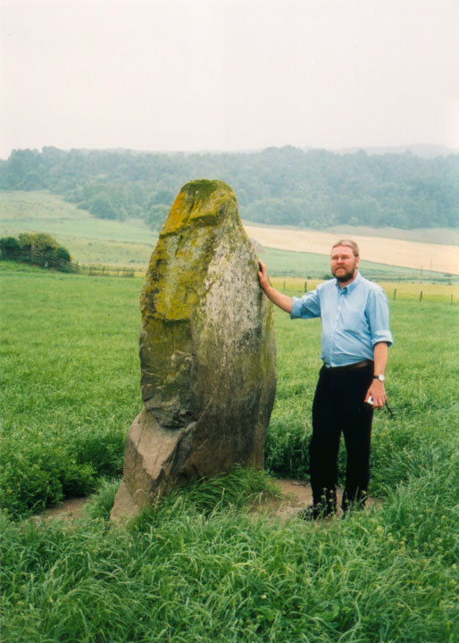
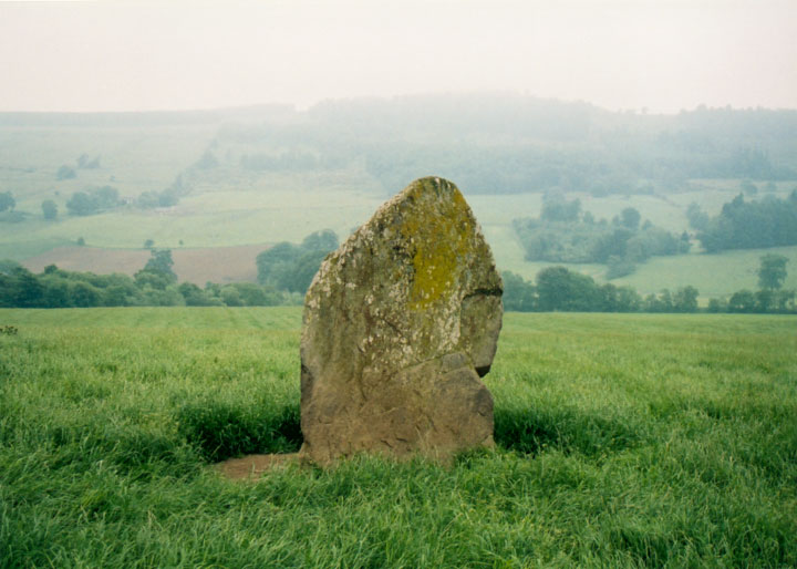
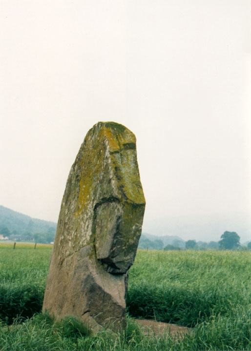
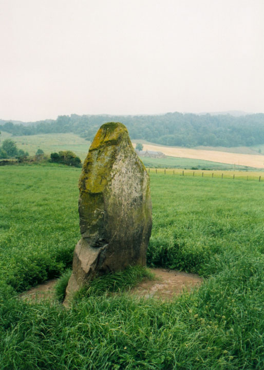
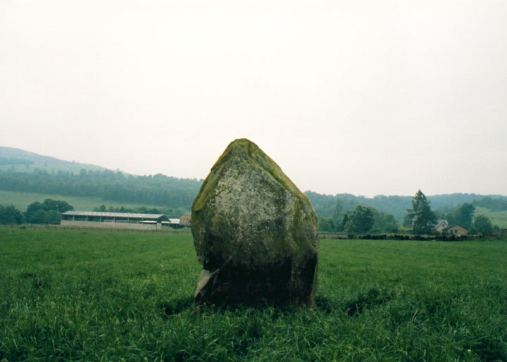
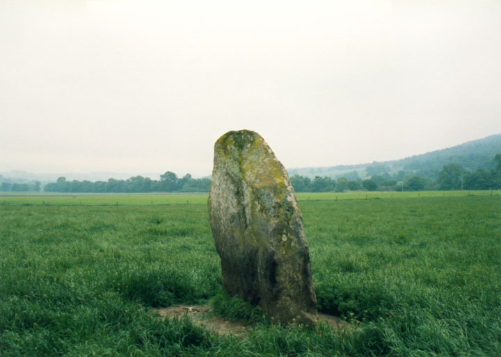
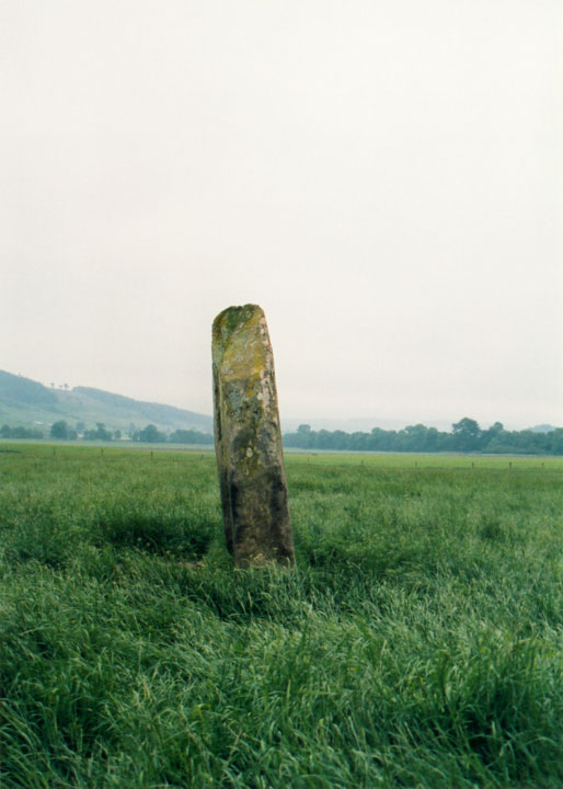
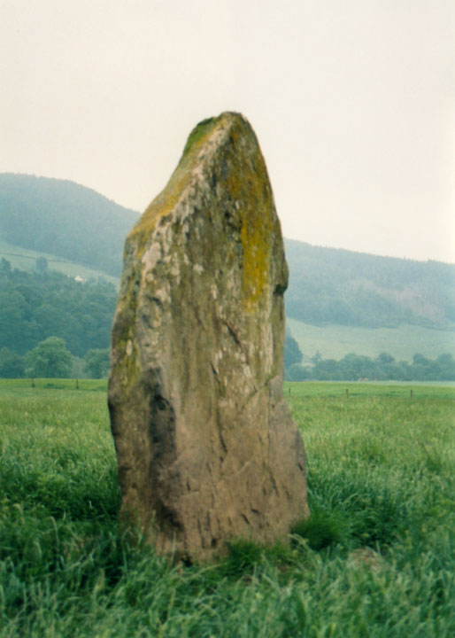
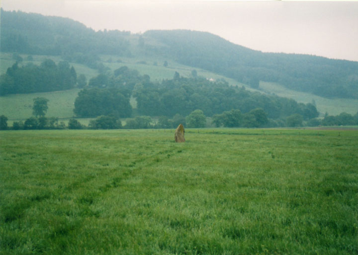
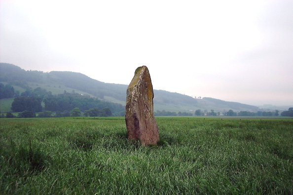
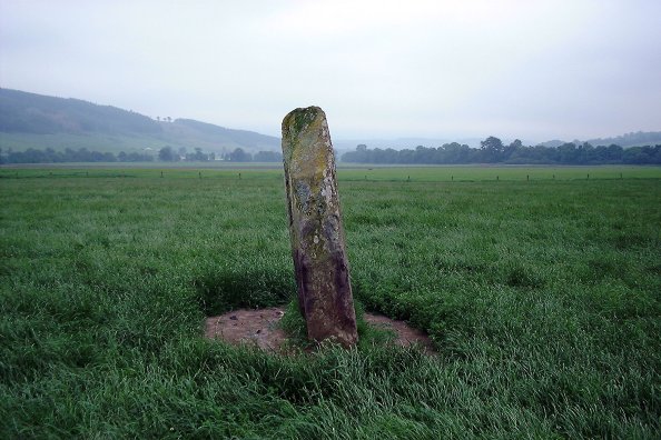
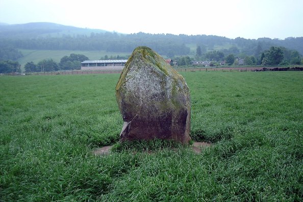
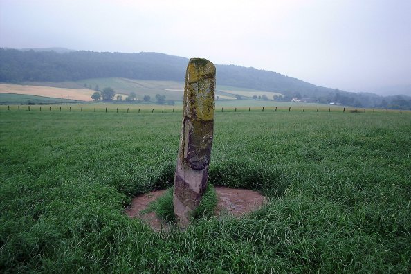
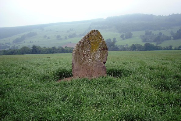
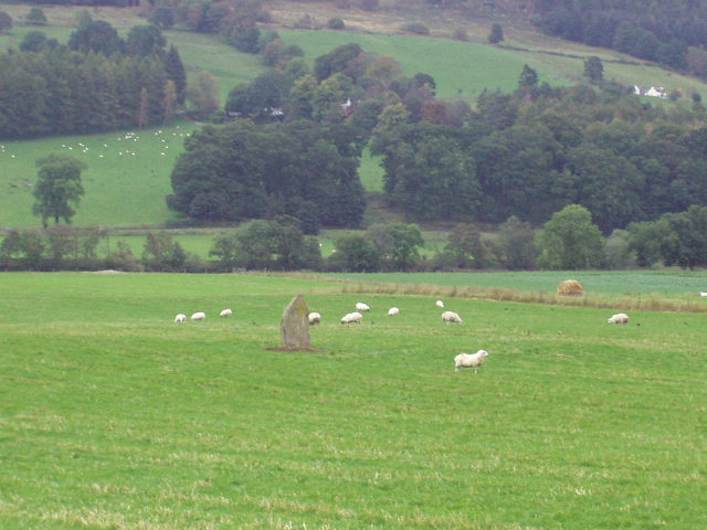
The field was empty of stock, radioactive sheep or otherwise, when Big Sweetie and I passed on our way back from the dig at Dull church. So we wandered in to have a look. This is one solid chunk of rock, a good 7-1/2 feet tall and four feet wide. No cupmarks visible, though on an earlier excavation I believe seven were found, about a foot below ground. This sits in a fine open plain, and if the rest of the reputed circle were the size of this remaining one, it must have been a pretty impressive sight!
Above ground, this site appears to be a solitary standing stone, albeit an impressively large one. However, a combination of ploughing and excavation in the late 1960s and early 1970s revealed this to be the visible remains of an archaeologically interesting area. Two further stones lie buried to the E of the standing stone, at distances of 7.80m and 12.15m, aligned E-W. Close to the eastern boundary of the field, again buried, are three further stones arranged in an arc that would suggest a circle of around 9.0m in diameter, just to the S of the E-W alignment.
Around 1887, a cist was uncovered near the standing stone, and was found to contain a food vessel, which made its way to the museum at Blair Castle. Coles described it as being "found in a cist in the haugh near Tom-na-Croiche, which is the name of the ground at the standing stone." In 1969, John McBeth, the farmer at Balnaguard, found a short cist while ploughing 12.0m to the NW of the stone, at the highest point of a slight rise. Upon excavation, the cist was found to have a partially-cobbled floor. Several finds, including an upturned beaker sitting on sand in one corner, are now in the National Museum. The cist was filled in, and the cover stone now lies at the edge of the field (NN 9455 5205).
In 1971, further excavations took place. The earth around the base of the standing stone was removed to a depth of 0.25m, revealing 7 cup-marks on the S face. Another cup-mark was found on the prostrate stone closest to the upright one. The three buried stones in an arc at the field boundary (NN 9468 5209) were found to be set amongst apparent cairn material of fist-sized smooth stones, covering an area of 6.10m by 3.65m. This was under a layer of 0.25m of plough soil, and was itself 0.3m deep, resting on the sandy subsoil of the field. Under the NE section of these stones the subsoil was found to have dark stains, and produced some cremated bone, carbonised wood, and a small rim sherd possibly from a food vessel. Further S from this area, a thin flat slab of 2.3m length was also found. No socket was found, so it is possible this may have been a cist cover.
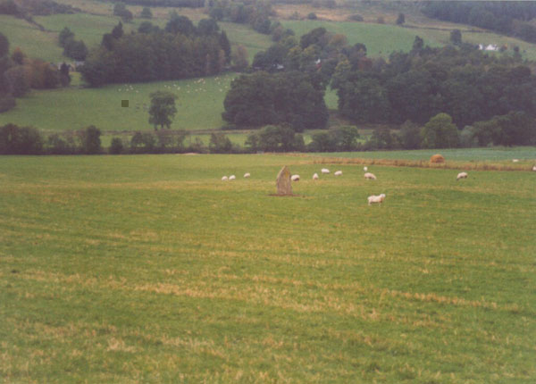
We visited this stone back in oct 02 as part of a Scottish megarak sunday jaunt. It's reached via a path from the village that leads to an old railway bridge. The stone stands 7ft tall in the field on the other side of the bridge. On this visit we opted to stay at the bridge for two good reasons.
1. A couple of locals looking less that friendly at the fact we were ' Stangers round these parts'
and
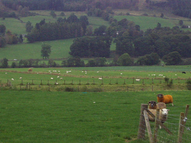
2.More scarey looking than the locals was the possible radio active offspring of dolly the sheep in the next field.
Next time we visit will be under cover of darkness and clad in a radiation suit. A good reason for a return visit would be the eight cup marks at the base of the stone.
Directions - Head N from Perth on the A9. After approximately 35.0km, take the road to the right for Aberfeldy at the Ballinluig junction. The road (A827) curves round and back over the A9. Continue through Logierait, and after approximately 5.0km you will cross a bridge over the Tay, and come to a junction. Turn left at the junction on to the B898, and after about 2.0km you will come to Balnaguard. There is space to park at the side of the road in the village. On foot, look for a grassy track to your left (the N side of the village) over an old railway bridge (there is a sign on the wall here with "Balna LMS Stop" on one side, and Guard Platform on the other). From here you will be able to see Clach na Croiche in the field below.


 Posted by nickbrand
 Posted by BigSweetie