|
|

|
|
CarfuryStanding Stone / Menhir
|
||||||||||||||||||||||||
|
|
|
Images (click to view fullsize) |
|
|
Fieldnotes |
|
|
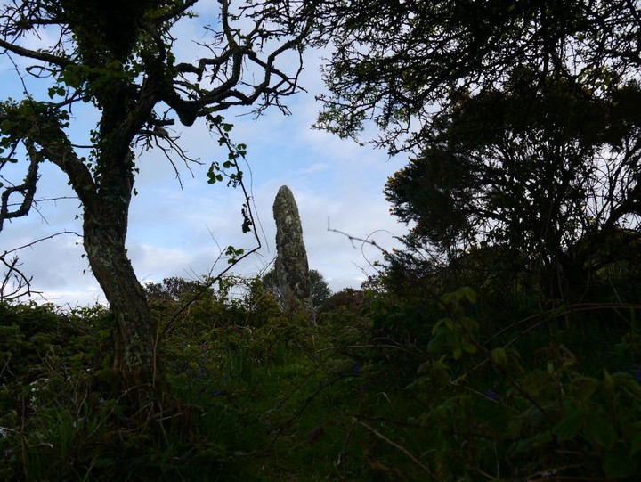
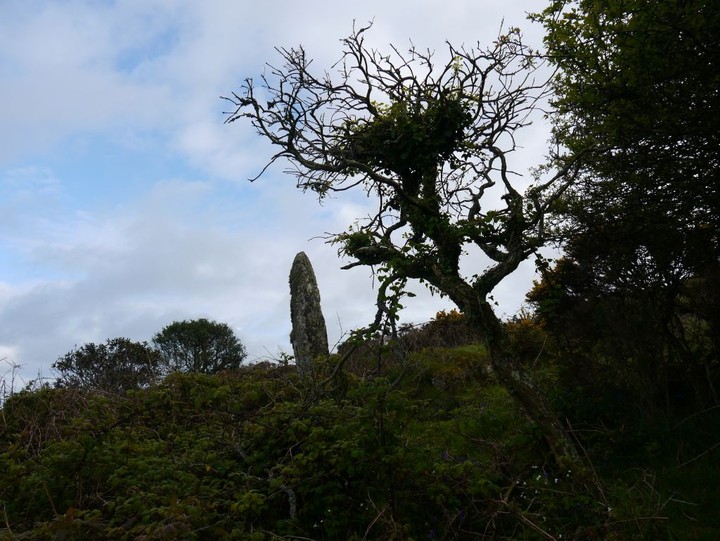
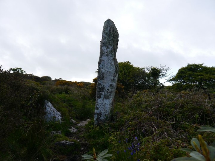
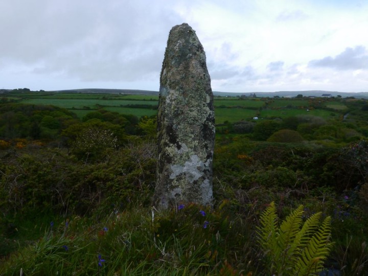
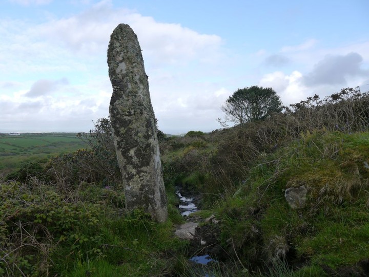
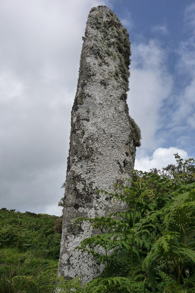
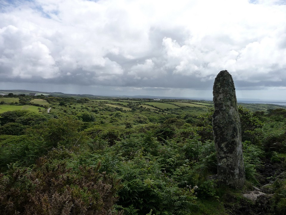
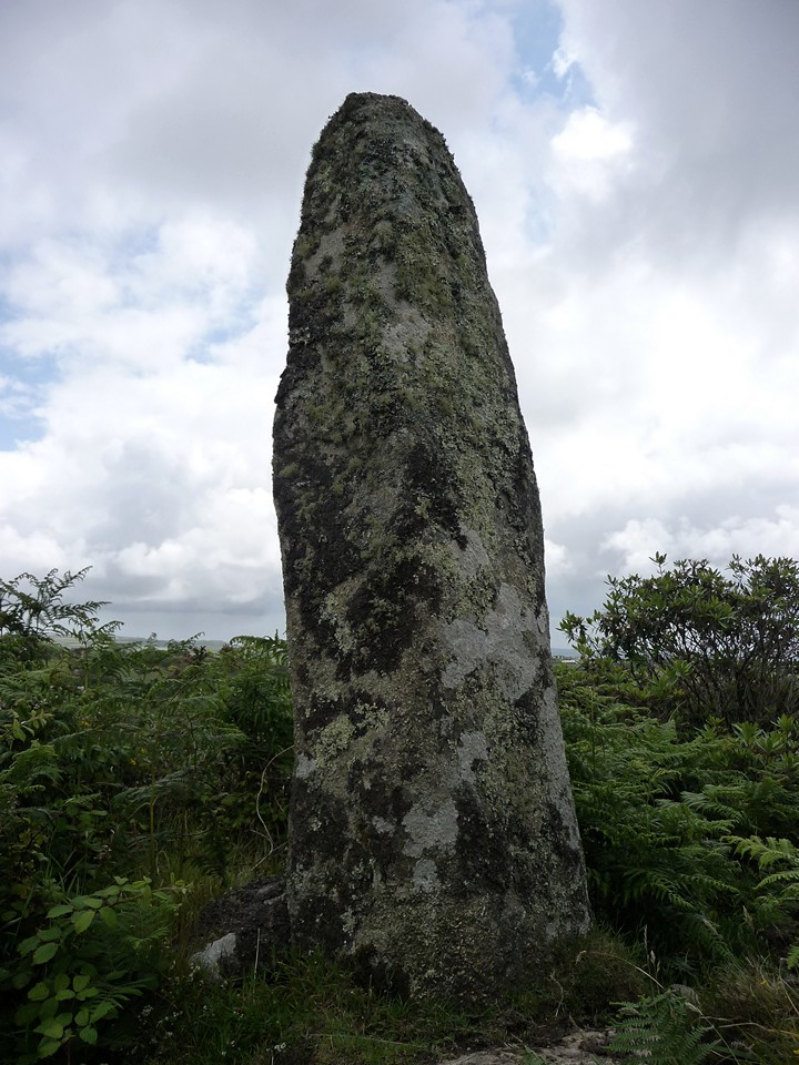
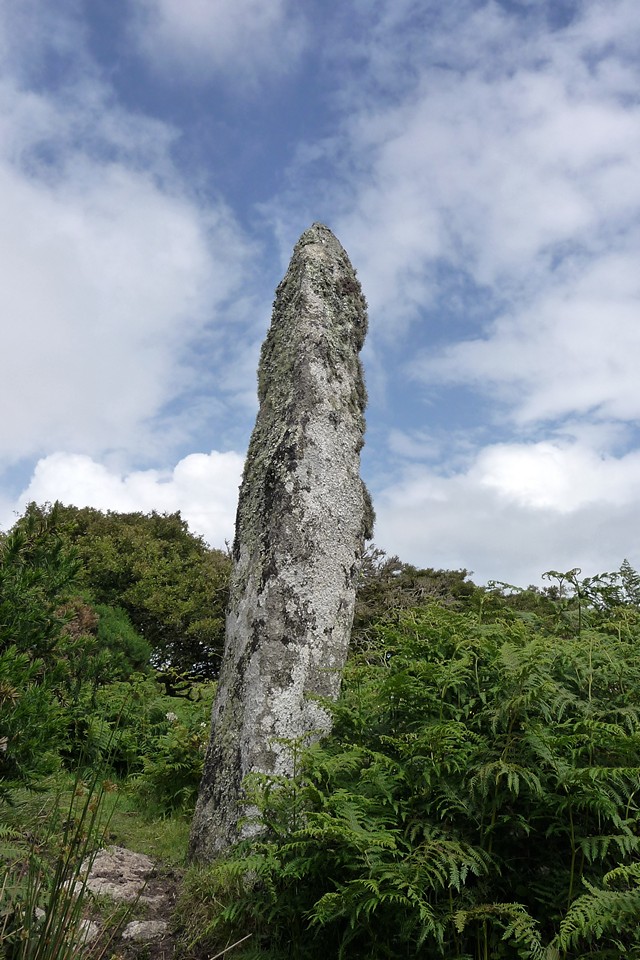
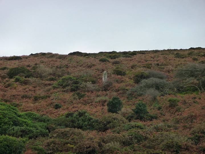
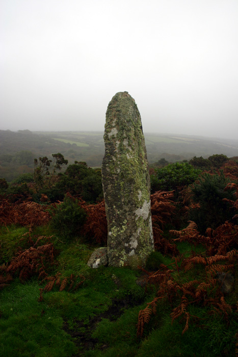
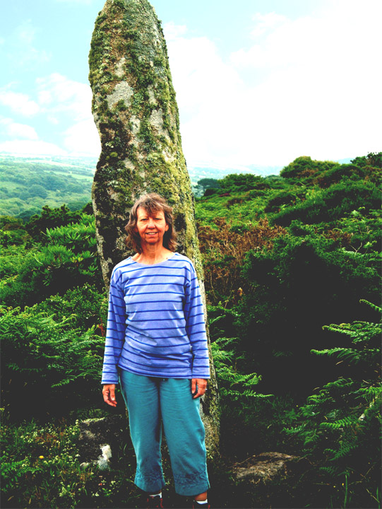
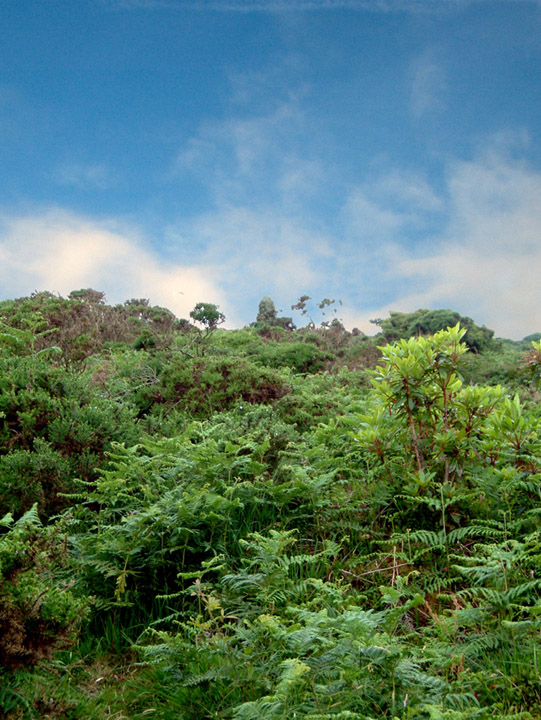
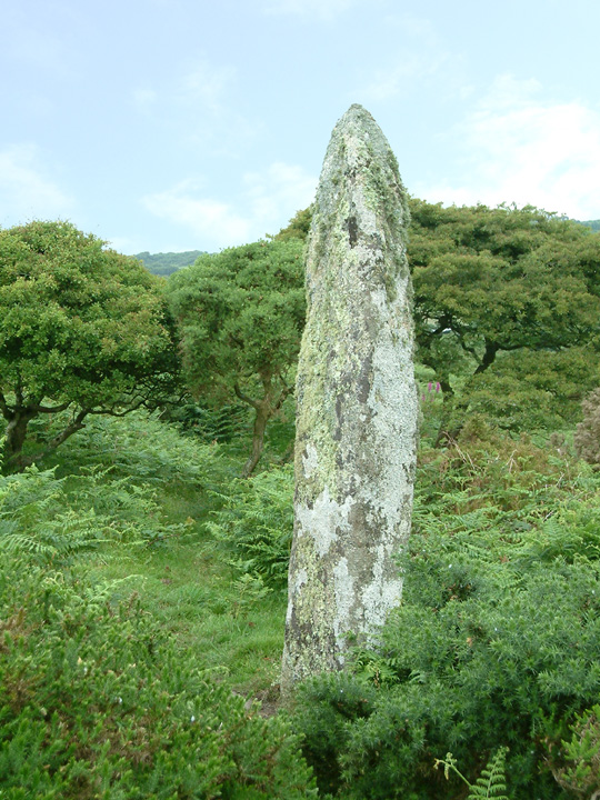
Carfury menhir is one I've intended to visit for years, but somehow never quite made it. It's not on any footpaths and its location is a bit obscure. I have seen it, across the valley from the southeast, where it stood out grey and stately against the brown autumn bracken. But my only attempt to actually visit it before was from the west, after a trip to Nine Maidens some years ago. That was a summer walk and progress down a vegetation-choked track ground to a halt after not much distance. I am more confident of the approach from the valley, particularly as, once again, I spy the stone surrounded by vegetation from across the valley. How hard can this be? At this point I don't really know where the stone is in relation to the features on the OS Explorer map, so I'm looking for clues from this initial vantage point. As seen across the valley, a line through the vegetation runs up the hillside behind the stone, which I remember stands in a low wall. I take this feature to be the narrow track shown on the map as running NE-SW, assuming then that the wall in the description is the southern boundary of the track itself. Boy, would that turn out to be wrong… I follow the minor road past Carfury itself, where it drops down gently into the valley, cutting off any further views of the stone. The road bends round to the east at a wide gateway and at the point, almost hidden, the narrow track I'm looking for heads off southwest. I follow it, almost immediately entering a green, leafy world with the sun creating dappled patterns on the soft surface beneath the trees. After a while, the path reaches a blockage of vegetation and wire, where a gate on the left leads out onto the hillside. Because I'm thinking the stone is to the left (or south) of the track, I happily take this, thinking the stone will be close by alongside the track. I emerge into an area of narrow stock tracks surrounded by thick bracken and other vegetation. I head uphill, following parallel with the track. No stone. I head into an area of very dense vegetation, trees and bushes snagging my backpack and sleeves. I come back out near to Mount Whistle, by now thoroughly confused and starting to get a bit irritated with myself. This thing's nine feet tall for goodness sake! I've already seen it! But none of that helps very much. A heavy shower comes winging in, forcing me to take cover once more in the dense vegetation and I realise I must be back "inside" the track again. I wander around the area in ever-decreasing circles for a while, but still no stone. Eventually I start to despair and decide to head back down the hill. At this point, just before giving up, it occurs to me that perhaps the stone is on the other side of the track… So I head back to the track, looking for an opening to the north. Lo and behold, a muddy cattle run leads off the lane, into the bracken-covered hillside on that side. It leads upwards for a while and suddenly, looming out of the bracken ahead of me, there it is! I've never been so happy to find a stone in all my wanderings. I've wasted the best part of an hour in completely the wrong place, but this was worth it. Tall and slender, the stone stands with its base in the remains of a low granite wall – which of course I now realise was the linear feature I saw, not the track at all. Doh! Castle-an-Dinas with its hillfort can be seen across the valley to the east, as can more distant Castle Pencaire on the way to the Lizard. I spend a while here, dodging a further rain shower under nearby hawthorn bushes. Although I'm now running late for the other sites I hope to visit, I'm not going to rush off after all the efforts of finding this bloody stone. Eventually I head off, back the way I came down to the track. It'll be easier next time… This post appears as part of the weblog entry A Crack In The Clouds (3) – Carfury to Gurnard's Head 23 June 2011
|
 Posted by thesweetcheat
17th July 2011ce Edited 18th July 2011ce |
|
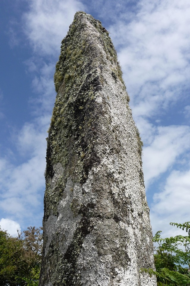
Thanks to Mr Hamhead's instructions below, I finally found this at the third time of trying! All I'd add is that the wall on the right is located just after the stream on the left (which tends to make the pathway extremely muddy), and there's a minor barbed wire fence to navigate at the top of the wall. Once in the clearing of the field, just follow the pathway up the hill. A massive stone, covered in that hairy lichen. Due to the weather I didn't tarry long, or look for the other nearby stones. Another day maybe, now I know how to get here! |
23rd October 2005ce |
|
A bit of a swine to find...... Take the road from Heamoor up Bone Valley then go straight ahead at the crossroads (signposted Carfury). The road descends into the valley winding past an abandoned quarry on the right. Just as you reach the bootom of the valley a path/track goes off on the left. There is room to park a car here. Walk down the track ( I would guess it is muddy after rain) and when you reach the bottom there is a wall goes off on the right. If you are agile enough you can scramble carefully up the tumbled boulders here and get into the upper field. Walk out into the clearing and look up to your left. You should be able to see the stone standing proud above the vegitation. From here you can continue up through the field. If you have decided to stay on the track then continue up to a gate. Go through the gate and then wind your way through the gorse, bracken, brambles and rhododendrons arcing around to the right but always climbing. At some point the stone will come into sight...but it is not easy to find this way. The stone itself is a stunner..it stands about 10 ft tall, built into the ancient wall. From it Mulfra Quoit can be seen as can the sea to the south. I did not find the other stones that are supposed to lay in the area, due to lack of time....and a rumbling belly. |
29th June 2005ce |
Miscellaneous |
|
|
There are 2 more stones near to the Carfury menhir. A 5m recumbent stone lies in the same boundary wall close to the menhir, first noted in the 1980's by J.Barnatt. And an upright 3"6' stone at SW437341 |
11th January 2003ce |
|
Carfury menhir SW440340 - I didn't have chance to visit this but it's mentioned in both Ian McNeil Cooke's 'Standing Stones of the Land's End' (1998 - Men-an-Tol Studio) and Craig Weatherhill's 'Belerion: Ancient Sites of Land's End' (Cornwall Books - 1981) as a little known and apparently superb 3m tall menhir standing on a steep rough hillside with its base embedded in a low and ancient wall. The ground around its foot was excavated in 1958 by Vivien Russell and Peter Pool but nothing was found. Formerly known as the Cuckoo Rock. |
 Posted by pure joy
11th January 2003ce |