|
|

|
|
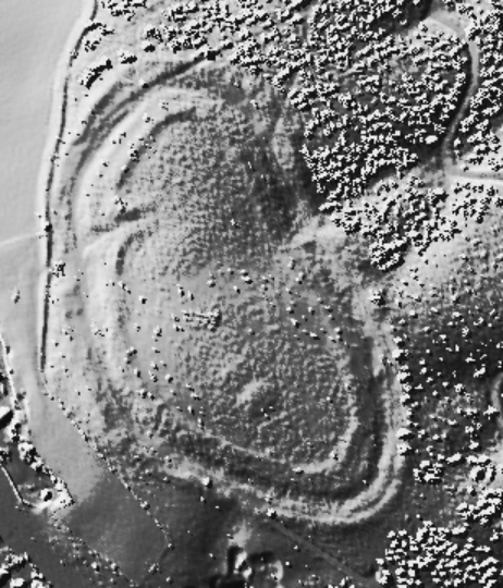
Bury BankHillfort
|
||||||||||||||||||||||||
|
|
|
Images (click to view fullsize) |
|
|
Folklore |
|
|
This webpage by Brian Billington http://www.sisyphus.demon.co.uk/POTOC/png/2000-03.potter.TC.html says that an 1899 map calls the fort 'Wulferecester' - Wulfere's town. There's a mound inside the southern part of the enclosure, which is said to be the site of the palace of Wulfere, the Saxon King of Mercia. |
 Posted by Rhiannon
3rd November 2006ce |
Links |
|
PastscapeExtensive description of the fort. There are also two probable BA round barrows within the fort. http://www.pastscape.org.uk/hob.aspx?hob_id=75653&sort=2&rational=m&recordsperpage=10&maplat=52.92052239&maplong=-2.17329336&mapisa=1000&mapist=os&mapilo=-2.1733&mapila=52.9205&mapiloe=w&mapilan=n&mapios=SJ883359&mapigrn=335950&mapigre=388350&mapipc=#aRt |
 Posted by thesweetcheat
9th September 2011ce Edited 9th September 2011ce |