The Modern Antiquarian
Log in
|
Register
Home
Latest Posts
Forums
Maps
Help
Browse Sites
News
Blog
Contributors
The Books
Select
-
Belgium
Denmark
Eire
France
Germany
Greece
Italy
The Netherlands
Norway
Portugal
Republic of Malta
Spain
Sweden
Switzerland
United Kingdom
County Kerry
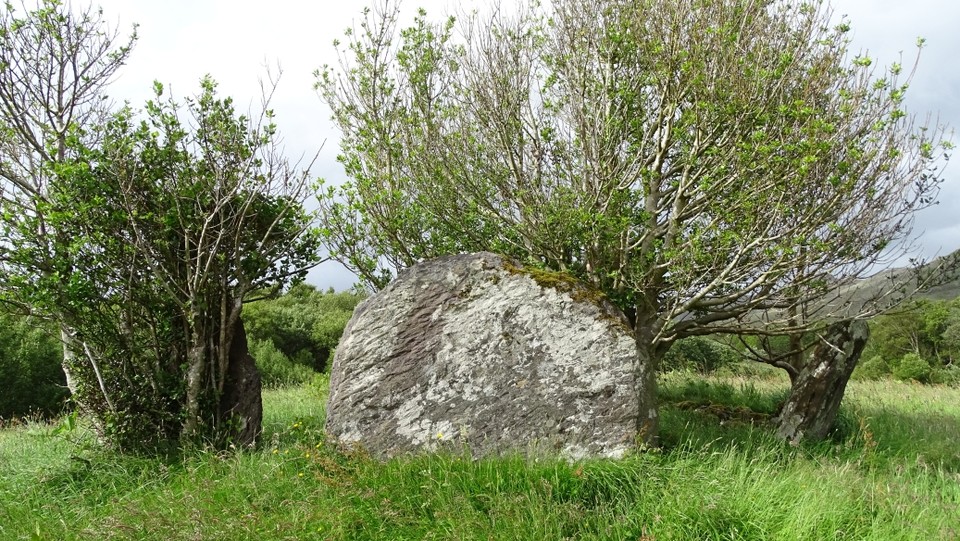
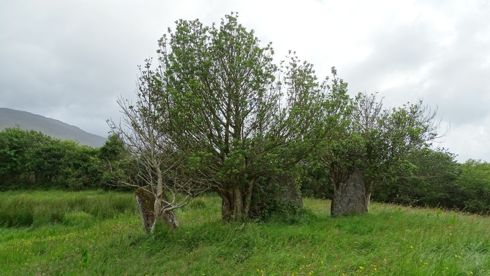
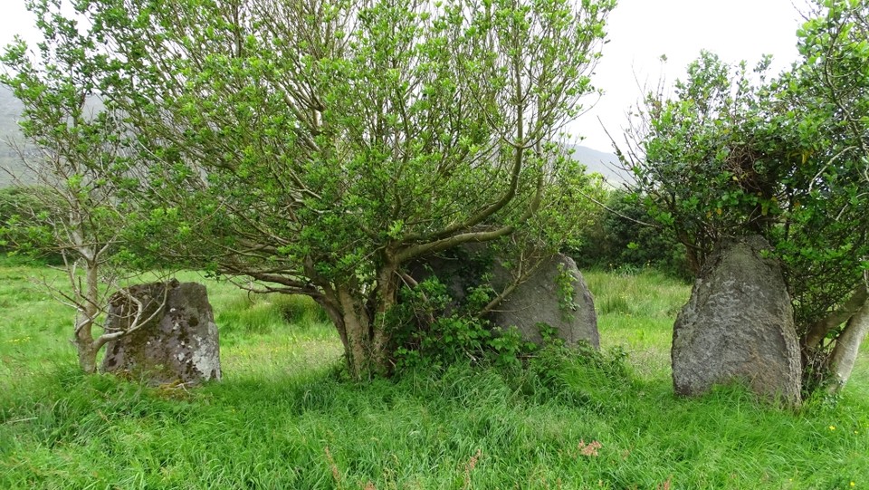
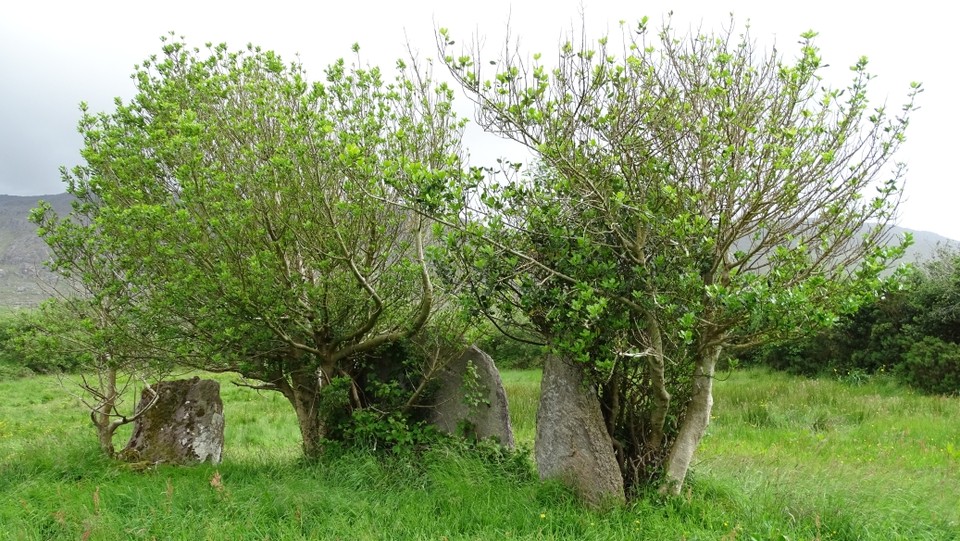
Glashananinnaun
Stone Circle
Glashananinnaun (Ardgroom Outward NE) (Stone Circle) on The Modern Antiquarian, the UK & Ireland's most popular megalithic community website. 5 images, plus information on many more ancient sites nearby and across the UK & Ireland.
Image © Uwe Häberle 06/2014
Also known as:
Ardgroom Outward NE
Nearest Town:
Sneem (11km NNW)
OS Ref (IE):
V719565 /
Sheet: 84
Latitude:
51° 44' 46.94" N
Longitude:
9° 51' 18.07" W
Added by
FourWinds
Images (5)
0 discussions
Start a topic
Show |
Hide
Web searches for Glashananinnaun
Flickr
Google
Google Images
The Megalithic Portal
Bing
Stone Pages
Wikipedia
Show map
(inline Google Map)
- Sites within 20 km -
-
Ardgroom Outward (1.69km SW) (34 posts)
Cashelkeelty NW (3km ENE) (12 posts)
Cashelkeelty SE (3.13km ENE) (13 posts)
Shronebirrane (3.65km E) (22 posts)
Reenkilla (5.03km ENE) (5 posts)
Clogherane (6.72km E) (3 posts)
Clogherane (6.83km E) (3 posts)
Ballycrovane (7.15km WSW) (18 posts)
Lehid (7.25km ENE) (2 posts)
Lehid (7.8km NE) (3 posts)
Lehid (7.97km ENE) (1 post)
Cloontreem (7.99km SSW) (15 posts)
Kilmackowen (8km SSW) (9 posts)
Kilmackowen (8.04km SSW) (17 posts)
Rodeen 1 (8.05km SSW) (3 posts)
Drombohilly Wedge Tomb (8.17km ENE) (2 posts)
Drombohilly (8.27km ENE) (32 posts)
Rodeen 3 (8.46km SSW) (4 posts)
Rodeen 2 (8.57km S) (5 posts)
Hag of Beara (8.81km WSW) (9 posts)
Coomgira (9.54km ESE) (6 posts)
Derrymihin West (10.27km S) (3 posts)
Kilcaskan (10.72km E) (5 posts)
Coulagh (10.83km SW) (1 post)
Coulagh (11.32km SW) (5 posts)
Derreenataggart West (11.34km SSW) (31 posts)
Kildromalive (11.72km E) (5 posts)
Derreenataggart Middle (11.72km SSW) (2 posts)
Cappaleigh North (11.88km E) (4 posts)
Drumlave (12.07km E) (11 posts)
Ardacluggin (12.34km SW) (4 posts)
Staigue Bridge (12.34km W) (13 posts)
Staigue (12.39km W) (0 posts)
Uragh West (12.39km ENE) (12 posts)
Ardacluggin (12.69km SW) (1 post)
Staigue Cashel (12.72km W) (21 posts)
Teernahillane (12.84km SW) (4 posts)
Teernahillane (12.96km SW) (9 posts)
Uragh (13.2km ENE) (38 posts)
Teernahillane (13.27km SW) (3 posts)
Teernahillane (13.27km SW) (1 post)
Ballynahowen (13.28km E) (15 posts)
Fanahy (13.41km SSW) (4 posts)
Uragh North (13.62km ENE) (14 posts)
Urhin (13.72km SW) (5 posts)
Leitrim Beg (14.01km E) (21 posts)
Tullakeel (14.35km NNW) (4 posts)
Dromtine (14.65km NW) (4 posts)
Knockoura (14.69km SW) (2 posts)
Killenough (14.95km E) (5 posts)
Gour (15.09km SW) (10 posts)
Kealoge (15.18km SW) (6 posts)
Derryleagh (15.53km NNW) (3 posts)
Kealoge (16.59km SW) (3 posts)
Coomnahorna East (16.79km W) (0 posts)
Caherdaniel (17.64km W) (4 posts)
Darrynane More (18.48km W) (8 posts)
Dromroe (18.57km ENE) (24 posts)
Cahermore (19.26km SW) (5 posts)
Peakeen (19.6km SE) (6 posts)
Cahernageeha (19.72km W) (5 posts)
- Add -
-
Add news
Add an image
Add fieldnotes
Add folklore
Add miscellaneous
Add a link
-
Add a site
Add a nearby facility
Add an alternative name/spelling
Images
(click to view fullsize)
Add an image
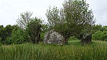 Image © Uwe Häberle 06/2014