The Modern Antiquarian
Log in
|
Register
Home
Latest Posts
Forums
Maps
Help
Browse Sites
News
Blog
Contributors
The Books
Select
-
Belgium
Denmark
Eire
France
Germany
Greece
Italy
The Netherlands
Norway
Portugal
Republic of Malta
Spain
Sweden
Switzerland
United Kingdom
Northern Ireland
County Tyrone
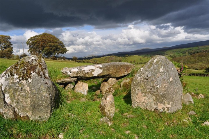
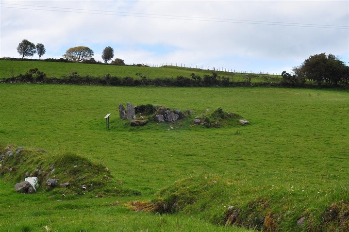
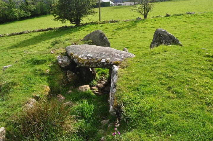
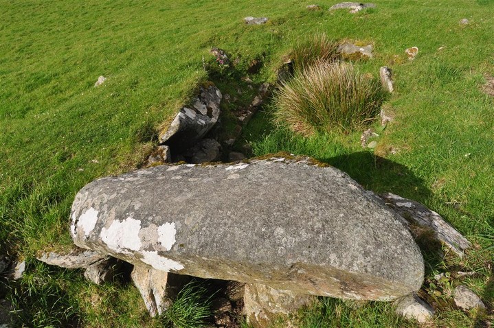
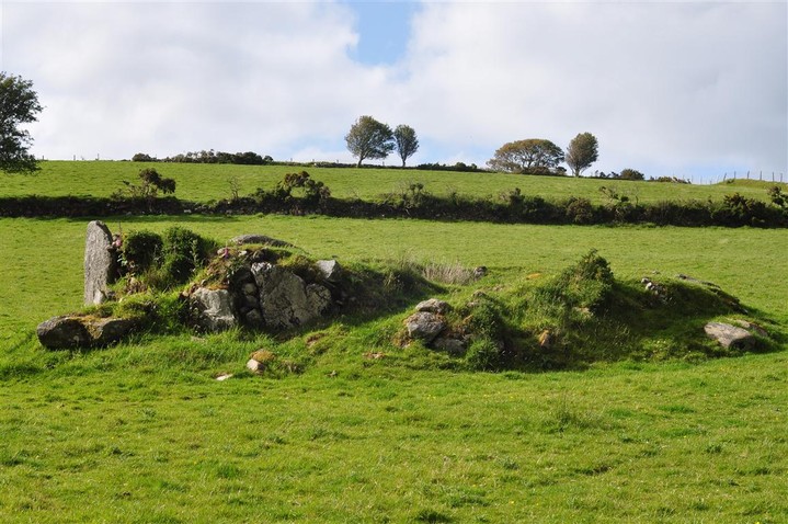
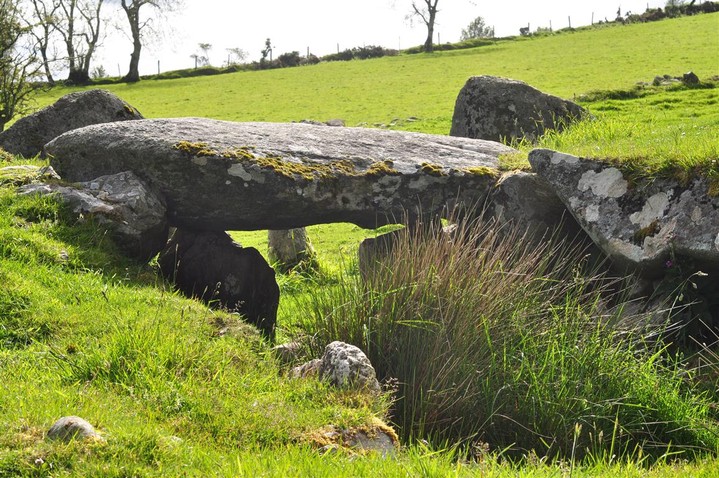
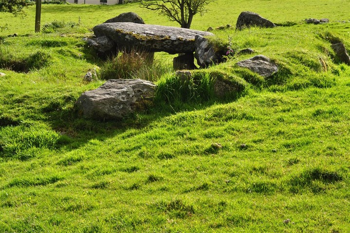
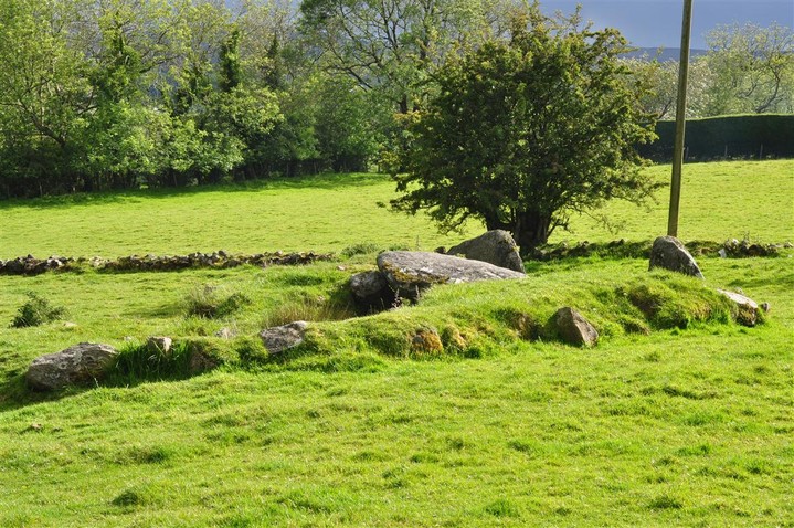
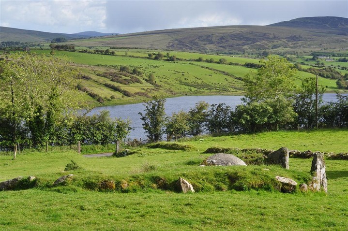
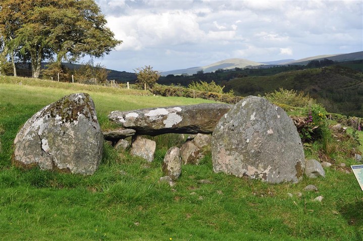
Loughash
Wedge Tomb
Loughash (The Giants Grave) (Wedge Tomb) on The Modern Antiquarian, the UK & Ireland's most popular megalithic community website. 10 images, plus information on many more ancient sites nearby and across the UK & Ireland.
Image © Charles Coughlan
Also known as:
The Giants Grave
OS Ref (GB):
C483008 /
Sheet: 7
Latitude:
54° 51' 9.23" N
Longitude:
7° 14' 52.5" W
Added by
FourWinds
Images (10)
0 discussions
Start a topic
Show |
Hide
Web searches for Loughash
Flickr
Google
Google Images
Megalithomania
Bing
Stone Pages
Streetmap.co.uk
Wikipedia
Show map
(inline Google Map)
- Sites within 20 km -
-
Cashelbane (3.42km ENE) (9 posts)
Clogherny (6.06km SSE) (0 posts)
Clogherny (6.21km SSE) (18 posts)
Knocknahorna (7.53km WSW) (4 posts)
Ballycumber (8.26km NE) (0 posts)
Cumber (8.26km NE) (0 posts)
Cregg (8.56km NE) (0 posts)
Killynaght (9.17km W) (0 posts)
Castledamph (9.2km SE) (7 posts)
Castledamph (9.27km SE) (3 posts)
Tireighter (10.82km ENE) (0 posts)
Gortmonly (11.22km WNW) (3 posts)
Glenroan (11.34km ESE) (7 posts)
Glenroan (11.39km ESE) (3 posts)
Ervey (12.25km NNE) (7 posts)
Aghnaglarig (12.32km SSW) (2 posts)
Ballygroll Prehistoric Complex (13.75km NNE) (5 posts)
Crosh (14.46km SSW) (17 posts)
Glenknock or Cloghogle (14.68km SSW) (7 posts)
Glenknock/Crosh (14.69km SSW) (3 posts)
Beltany (19.32km SSW) (10 posts)
Goles (19.47km E) (7 posts)
- Add -
-
Add news
Add an image
Add fieldnotes
Add folklore
Add miscellaneous
Add a link
-
Add a site
Add a nearby facility
Add an alternative name/spelling
Images
(click to view fullsize)
Add an image
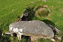 Image © Charles Coughlan