|
|

|
|
Cùl a'ChleitStanding Stones
|
||||||||||||||||||||||||
|
|
|
Images (click to view fullsize) |
|
|
Fieldnotes |
|
|
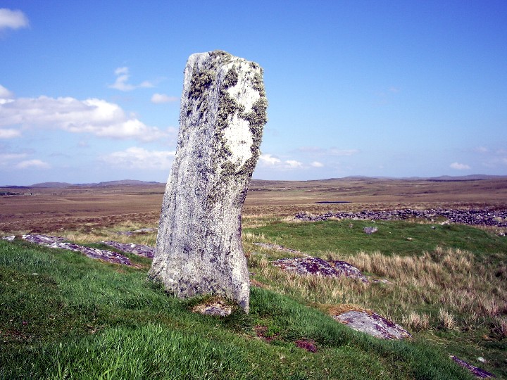
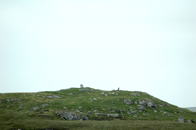
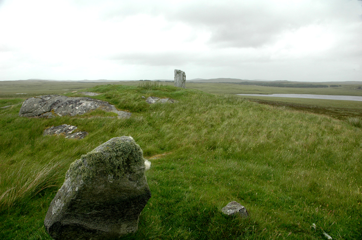
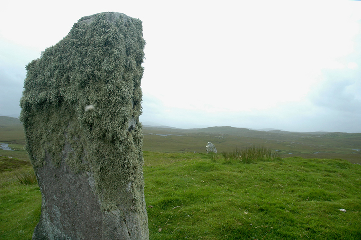
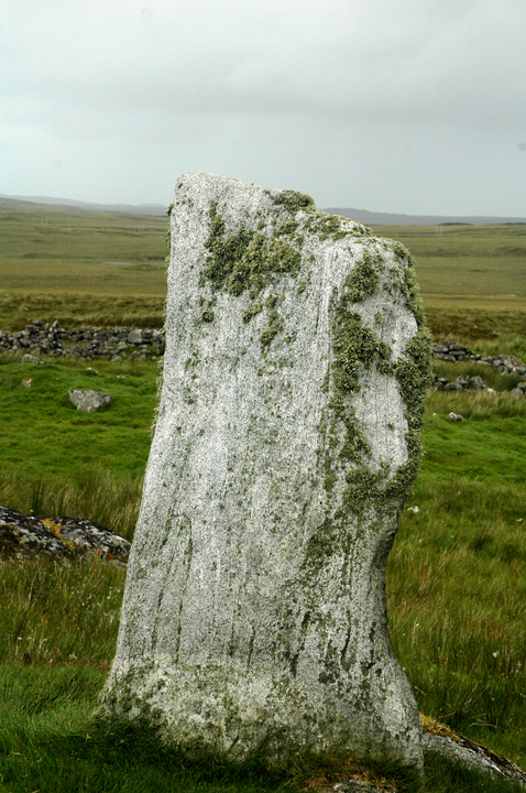
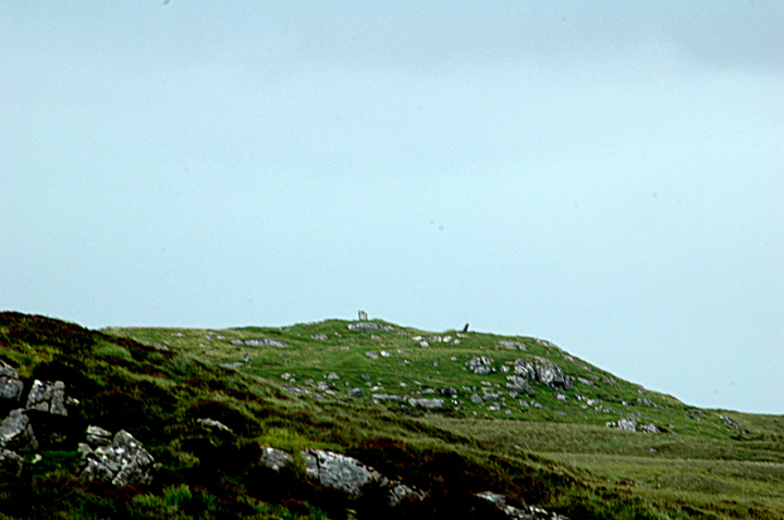
Access From Callanish V. Quite tough! Involves reasonable length yomp that took us around 45 mins to an hour I guess, across undulating, boggy & slippery ground. And I'd say the weather had been only averagely wet for Lewis (at most) when Juamei & I visited.... If memory serves, I think you can make out the standing stones on their hillock/crag from Callanish V itself. If not, you can certainly see them (probably most of the time) on the way towards them. You also lose sight of them at times. There may be a better way than this, but it's the best we could find! Starting from Callanish V, head east north east down the hill to a bridge at approx NB238301. Cross and follow the stream/river east. There are tributory burns to cross, some of which have plank bridges but some don't. Some may be almost impossible to cross if the weather's been particularly wet.... Warning! We found that trying to strike out for the stones are can be a waste of time. Even from spots where the stones are clearly visible, you can come to hidden burns running down to the main river. At around NB245300, at a distinct bend in the river (on the map, at least - the whole thing is bends 'on the ground'!), we set off more or less NE heading up the hillock/crag that the 2 standing stones are clearly visible on. We still had to leap across at least one inconveniently placed burn.... The last bit of the walk is steep - but that'll be pretty obvious when you see it! Wednesday 12 July 2006 Brilliant! What a lonely spot, especially on a wet & misty day. What a lovely spot it could be on a sunny day though! On Lewis it's easy to feel like you are miles from anywhere, but here it seemed particularly easy - perhaps because it's a bit of a walk (and awkward) to get here. If fact, it's not really all that far from 2 roads (which seems ironically close to civilisation by Lewis standards!) As mentioned by Kammer in his miscellaneous post, this seems unlikely to be a circle. To me, it also seemed unlikely to be a pair of standing stones - not least because they are too far apart and don't 'feel' interlinked in that kind of way. I can see that they may however, be part of the same structure that would have taken up most of the top of the craggy hillock. At the very least, the northernmost stone is a very nice chunky standing stone. According to Gerald Ponting, the stones are now thought most likely to be the remnants of a chambered cairn. It seems possible, and there are many stones and fragments around that could once have been part of it - especially in the nearby sheepfanks etc. It seems unlikely to me that they are anything to do with the signs of more modern settlement, such as the sheepfank. I can't think what the stones could be part of if associated with the more modern remains, particularly because of the way whatever it was would have been perched on top of the hillock. To be honest, about the only thing that 'bothers' me slightly about this theory is the general lack of chambered cairns in the area. So, not one of Lewis's most essential attractions unless you're a completist, but well worth a visit if you have the time and inclination. Or if you are a completist…! |
23rd May 2007ce Edited 23rd May 2007ce |
Miscellaneous |
|
|
I've not visited these standing stones, but I understand that most of this site is a relatively recently abandoned settlement. The two stones may be part of the settlement, or they may predate it. One theory is that they may represent the remains of a cairn. The name Cùl a'Chleit means rocky cliff at the back in Gaelic. The title of this page should have an accent of the 'u' of Cul, but for technical reasons it doesn't. |
 Posted by Kammer
3rd December 2002ce Edited 15th January 2004ce |