|
|

|
|
Scamridge DykesDyke
|
|
|
|
Images (click to view fullsize) |
|
|
Fieldnotes |
|
|
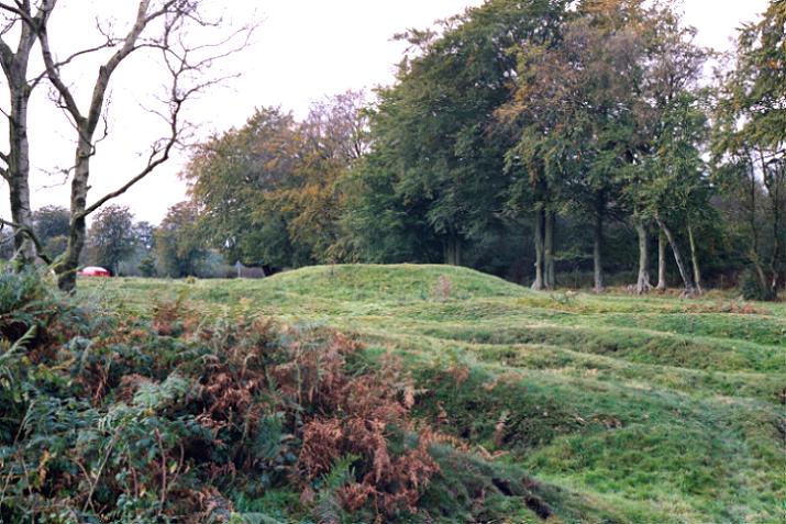
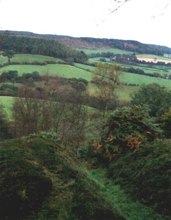
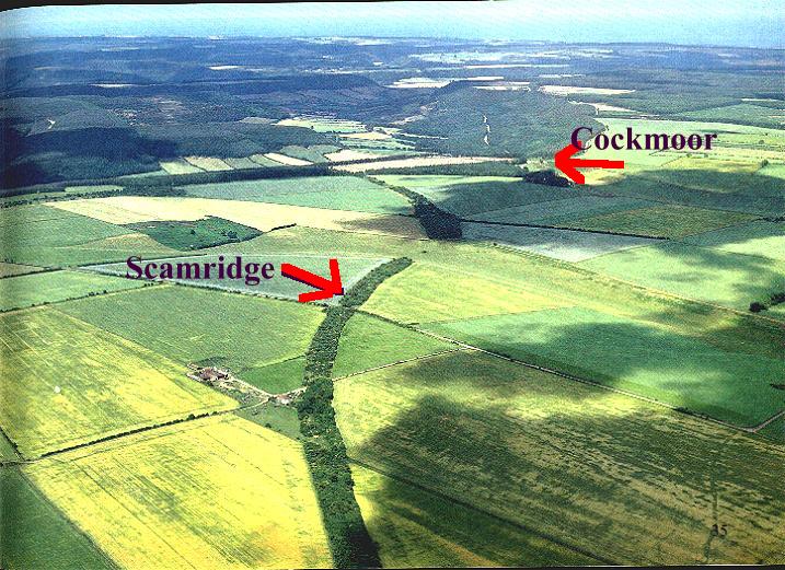
Brigantesnation and myself set out to check out these multiple dykes that so dramatically cross the landscape of the tabular hills . Our first target was the multiple dikes of the Cockmore system. We drove to Snaiton and the turned right along Nettledale lane. As we moved into the dry valley of Wydale we became aware of the dyke running along the ridge to our right. Most of the time it was signified by an unploughed zone running along the ridge, but where the plough had got through a soil or crop mark was left to indicate that the dyke was still running true to line. The valley peters out just beyond Cockmore Hall, this is the really interesting zone. The valley is funneled into a gap between the hills and drops away dramatically into Troutsdale. As for The dyke, as the ridge flattens out towards the head of the valley, the dykes become more numerous until you have 20 or so parallel dykes runing towards the head of the valley and then dropping over the brow into Troutsdale gradually petering out about 10 meters over the brow. There is also a lovely round barrow that appears to be associated with the system, it is either part of the system or older because the dyke deviates around it . The traceable length of the dyke is about 3km. Next we move on to the the Scamridge Dyke. We followed an extremely muddy path into the woodland. the dyke bisects the path about 500km into the wood. The dyke at this point is about 30 metres across and is made up of four dikes and ditches. Again this dike runs across the landscape and terminates at Troutsdale brow. If you continue along this path you will come out at thew Oxmoor Dykes, which again are multiple dykes and can be seen on the landscape as a large unploughed coppice area running across the landscape. As for the purpose of the dykes, who knows? They are probably not 'kingdom' boundaries as there are too many of them and they make no sense as military structures. The best Brigantesnation and I can come up with is that they served a 'none-functional' role. Personally I think it may be significant the the valley below the terminations of the dykes, Troutsdale, has a number of springs, two of them have names, Magerick keld and Jenny Thrush. This is limestone country so water appears and disappears as dictated by the geology. |
 Posted by fitzcoraldo
21st October 2002ce |
Folklore |
|
This hilly district, so near the limits between Deira and Bernicia, is very likely to have been the scene of the contest*: and it is worthy of remark, that the entrenchments on Scamridge, near Ebberston, have from time immemorial been known by the name of Oswy's Dikes, probably because Oswy's army encamped there, before engaging with the forces of his rebellious son.*This is confusingly written, it could mean between King Alfred (or his brother?) and his father. Possibly. It's on p38 of 'A History of Whitby, and Streoneshalh Abbey' by George Young (1817). It's on Google Books. |
 Posted by Rhiannon
12th June 2007ce |
Miscellaneous |
|
|
"The Scamridge dyke system in the tabular hills consists of Red Dyke, Gibbendale Dyke, Moor Dyke, the Oxmore Dykes, the Cockmoor Dykes as well as the Scamridge Dyke. Many of the dykes in the Scamridge system run for 2 or 3 miles: sometimes they are single and sometimes several run abreast. The Cockmoor Dykes are the most extraordinary of them all with no less than 20 ditches and banks of various sizes. Some of the banks are believed to be mediaeval and may have been constructed for rabbit warrening, but most archaeologists believe that the earliest dykes were elaborate boundary markers." Richard Crossthwaite Ancient Cleveland from the Air Tees Towing Co. 1986 |
Posted by fitzcoraldo 21st October 2002ce |