The Modern Antiquarian
Log in
|
Register
Home
Latest Posts
Forums
Maps
Help
Browse Sites
News
Blog
Contributors
The Books
Select
-
Belgium
Denmark
Eire
France
Germany
Greece
Italy
The Netherlands
Norway
Portugal
Republic of Malta
Spain
Sweden
Switzerland
United Kingdom
England
Northern England
North Yorkshire
Castle Steads, Coverham
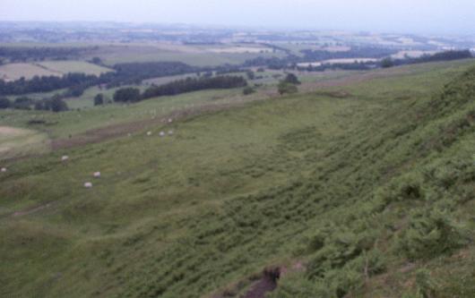
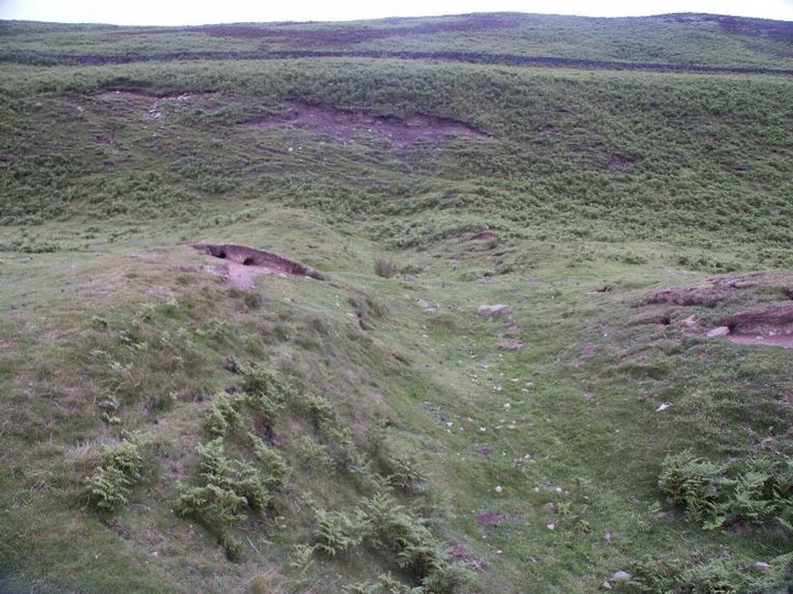
Hillfort
Castle Steads, Coverham (Hillfort) on The Modern Antiquarian, the UK & Ireland's most popular megalithic community website. 2 images, 1 weblink, plus information on many more ancient sites nearby and across the UK & Ireland.
Image © BrigantesNation
Nearest Town:
Richmond Yorks (17km N)
OS Ref (GB):
SE105852 /
Sheet: 99
Latitude:
54° 15' 43.54" N
Longitude:
1° 50' 19.63" W
Added by
BrigantesNation
Images (2)
Links (1)
0 discussions
Start a topic
Show |
Hide
Web searches for Castle Steads, Coverham
Flickr
Google
Google Images
MAGIC
The Megalithic Portal
Bing
Stone Pages
Streetmap.co.uk
Wikipedia
Show map
(inline Google Map)
- Sites within 20 km -
-
Flamstone Pin (0.41km SE) (1 post)
Braithwaite Wood Hillfort (1.41km ENE) (5 posts)
Diana's Well (2.1km ENE) (2 posts)
West Agra (5.08km ESE) (17 posts)
Burton Moor (7.53km W) (2 posts)
Fearby Standing Stones (9.28km E) (2 posts)
Gospel Hill (12.3km ENE) (0 posts)
Castle Dykes, Wensleydale (12.44km W) (18 posts)
Carperby B (12.54km W) (3 posts)
Carperby (12.58km W) (12 posts)
How Hill Swaledale (12.79km N) (1 post)
Haw Beck Burnt Mounds (12.99km W) (4 posts)
Thackwaite Beck (13.02km W) (1 post)
Cowling Lane Round Barrow (13.3km ENE) (4 posts)
Downholme (13.75km N) (3 posts)
Dove Stones (14.04km W) (1 post)
Fortress Dyke Camp (14.07km ESE) (3 posts)
Harkerside Moor Circle (14.21km NW) (18 posts)
Great Crakehall Round Barrow (14.25km ENE) (2 posts)
Grinton Round Barrow (14.82km NW) (2 posts)
Cock Howe (15.11km NNW) (1 post)
Tor Dike (15.33km SW) (2 posts)
Maiden Castle (Grinton) (15.34km WNW) (32 posts)
Stony Raise (Addlebrough) (15.44km W) (7 posts)
Binsoe Artificial Mound (15.48km E) (3 posts)
Addlebrough (16.2km W) (5 posts)
Devil's Stone (Addlebrough) (16.29km W) (1 post)
Well (16.44km E) (3 posts)
How Hill, Low Whita (16.63km WNW) (4 posts)
Reeth Strip Lynchets (16.66km WNW) (3 posts)
Calverside Moor Neolithic Enclosure (16.95km NW) (1 post)
Phlashetts Stone (17.02km E) (4 posts)
Whitcliffe Scar (17.02km N) (2 posts)
Low Sides Bronze Age burial (17.08km E) (1 post)
Castle, Nr Reeth (17.37km NW) (7 posts)
Nosterfield Mixed Period Barrow Cemetary (17.67km E) (2 posts)
Yeadon Crag Rock Shelter (17.69km SE) (0 posts)
Bainbridge Camp (17.94km W) (3 posts)
Catterick Henge (18.21km NE) (3 posts)
Thornborough Henge North (18.26km E) (31 posts)
Low Feldom Farm (18.29km N) (0 posts)
Northern Henge Cursus (18.36km E) (2 posts)
Three Hills (18.65km E) (5 posts)
Green Lane Barrow (18.75km E) (1 post)
Thornborough Henge Central (18.82km E) (45 posts)
Thornborough Central Cursus (18.85km E) (3 posts)
Aske Moor (18.98km N) (0 posts)
Aske Moor (Silver Hill) (18.98km N) (1 post)
Booze (19.11km NW) (4 posts)
Southern Henge Barrow (19.23km E) (2 posts)
Centre Hill Barrow (19.26km E) (3 posts)
Thornborough Henge South (19.42km E) (21 posts)
Holgate (19.7km NNW) (3 posts)
Rush Wood Post Alignment (19.73km E) (3 posts)
East Tanfield Barrow (19.77km E) (1 post)
Rush Wood Round Barrow (19.83km E) (10 posts)
Rush Wood Hall Barrow (19.9km E) (1 post)
- Add -
-
Add news
Add an image
Add fieldnotes
Add folklore
Add miscellaneous
Add a link
-
Add a site
Add a nearby facility
Add an alternative name/spelling
Images
(click to view fullsize)
Add an image
Links
Add a link
BrigantesNation - Castle Steads Page
Here's my page.
Comments (0)
|
Add a comment
|
Permalink
Posted by
BrigantesNation
22nd April 2003ce