|
|

|
|
Harry's WallsStanding Stone / Menhir
|
|
|
|
Images (click to view fullsize) |
|
|
Fieldnotes |
|
|
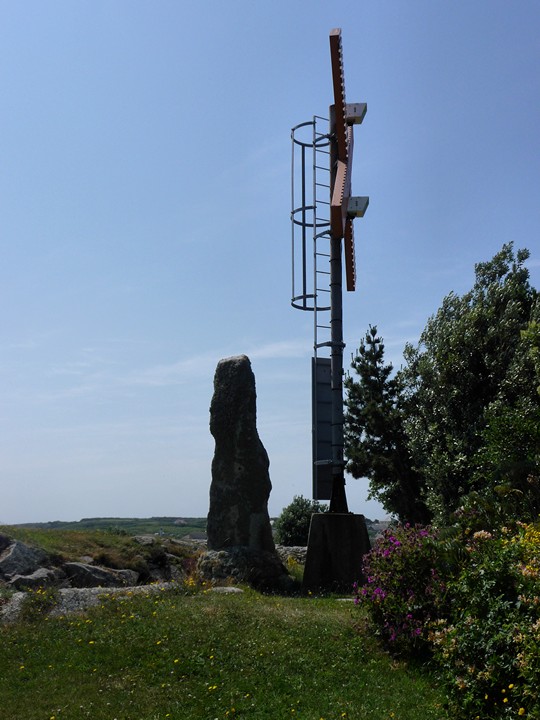
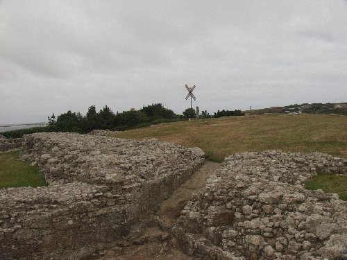
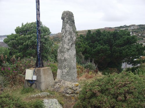
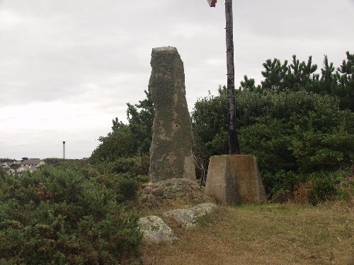
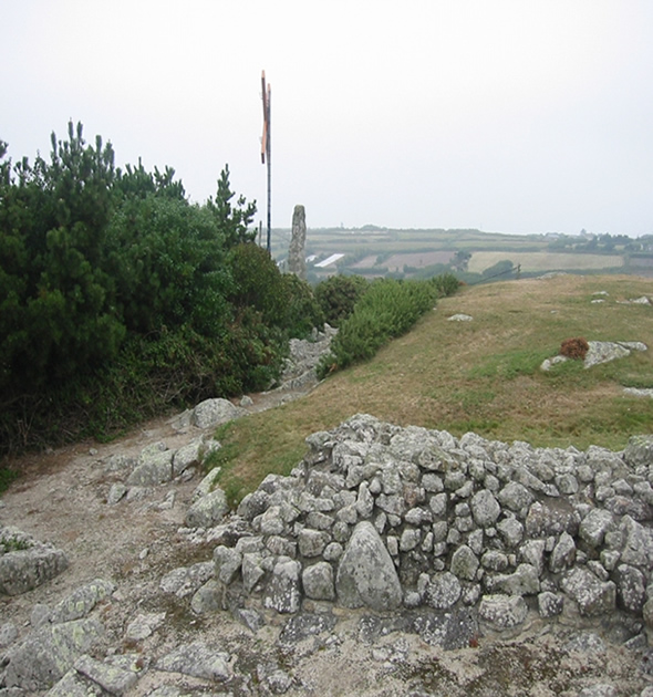
Our first trip to the Isles of Scilly (24.6.09) - we decided to come by ferry, rather than helicopter as it was a load cheaper, so we only had a limited time on the island (about 4hrs). Knowing that time was short, we decided to limit ourselves to the sites in Craig Weatherhill's "Cornovia". We had perfect weather and St Mary's basked in midsummer sun. After leaving the harbour through the town, we went north along the road, before coming to a path off to the left marked "Harry's Walls" - how easy is this? A short walk later, we emerged out onto the open area of the fort, and our first Scillonian prehistoric site. The standing stone is cemented in place and rather overshadowed by the daymark next to it. However it's still an impressive stone, in a good situation overlooking the harbour and the islands to the south west. After a short stop here, it's back to the coast path to Bant's Carn. |
 Posted by thesweetcheat
26th July 2009ce |
|
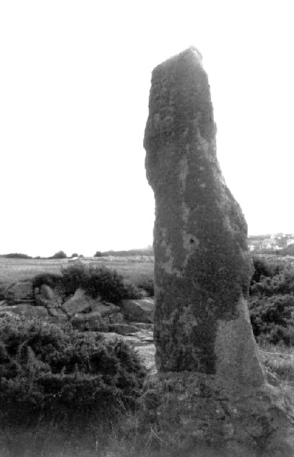
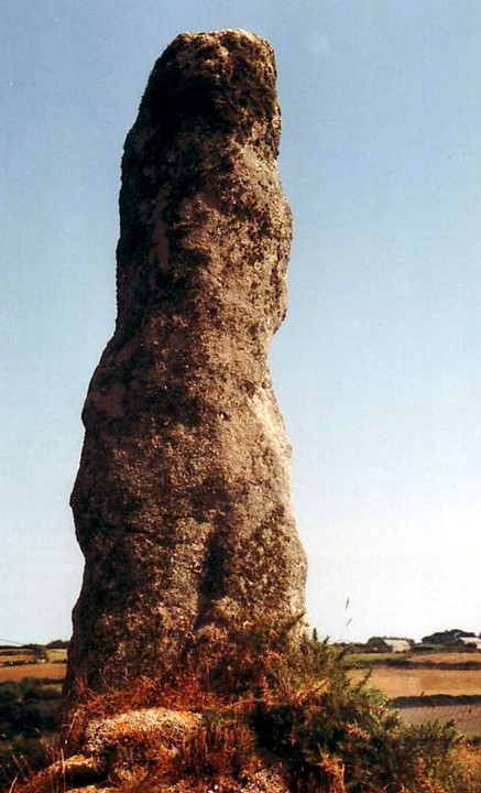
Harry's Walls Menhir - St.Mary's, Isles of Scilly - 3rd October 2003 Given that just by getting to St.Mary's, and presumably having a map, you have show a lot of initiative and commitment, I won't try to describe the minutiae of getting to sites on the island (but might just make a few comments). Most major sites are signposted, but I was disappointed (in general) at the poor signposting of paths, especially given that I have read others say that Scilly sites are well signposted, and the general fact that tourism is the main economy of the islands. This is obviously a strange one because of its location right next to an X shaped daymark (within an unfinished Tudor fort) and it being cemented in place, but seems to be recognised as a menhir. It was first recorded by Borlase in 1756 as sitting on a mound. Stones litter the immediate area possibly suggesting a previous cairn? Give all the above I felt the menhir was in a rather 'cold' place. Couldn't get much feeling of ancient history! This post appears as part of the weblog entry Kernow again - Part 2 - Land of the Giants
|
 Posted by pure joy
7th October 2003ce Edited 7th October 2003ce |
Folklore |
|
|
As the EH Schedule says: "The failure of the workers on the artillery castle to topple this standing stone for use in their structure demonstrates a respect for such antiquities that has sometimes persisted in the folklore of recent communities. The stone's survival is also considered to reflect its useful siting as a navigational aid for seamen entering St Mary's Pool, a role now superseded by the modern marker adjacent to the standing stone." |
 Posted by Rhiannon
6th August 2003ce Edited 6th August 2003ce |
Miscellaneous |
|
|
Harry's Walls is a 16th century (unfinished) artillery castle on the summit of Mount Flagon, overlooking St Mary's Pool. The castle is to the south east of a standing stone. (Do you like that? I thought I'd put it deliberately that way round. After all, the Stone Was There First). Seven standing stones are known on the Isles of Scilly, all of which are considered by EH to be 'of national importance.' The following information is taken from the MAGIC.gov website: The prehistoric standing stone is situated near the summit of the hill, just half a metre beyond the castle's rock cut ditch. It's a granite slab 2.75m high, set in concreted rubble. It's 80cm by 30cm at the bottom, tapering to about half that at the top. It's heavily weathered and each face bears a little pit, the relatively recent result of an attempt to perforate the slab. The stone is situated on a slight rise, which EH's schedule calls a 'sub-circular cairn' - it's believed to be artificial. A modern navigation post also stands on the cairn to the NW of the standing stone. The stone's situation on a small cairn is rare and the antiquity of this association receives unusually early confirmation in its mention by the antiquary Borlase in 1756, as `on a little tumulus near Harry's Battery'. |
Posted by Rhiannon 6th August 2003ce Edited 6th August 2003ce |