The Modern Antiquarian
Log in
|
Register
Home
Latest Posts
Forums
Maps
Help
Browse Sites
News
Blog
Contributors
The Books
Select
-
Belgium
Denmark
Eire
France
Germany
Greece
Italy
The Netherlands
Norway
Portugal
Republic of Malta
Spain
Sweden
Switzerland
United Kingdom
County Louth
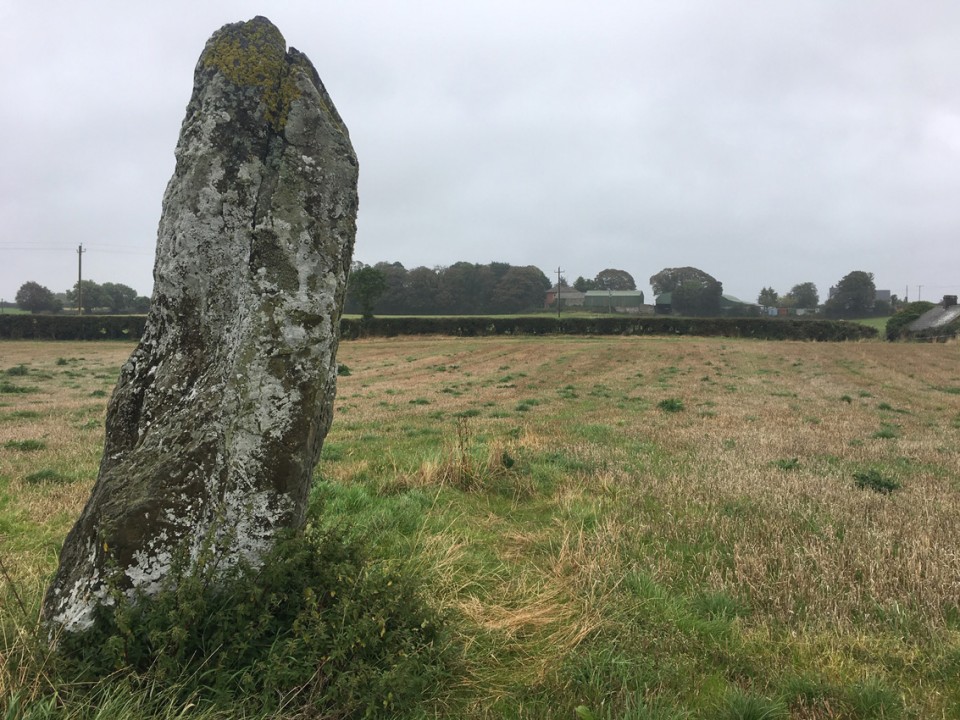
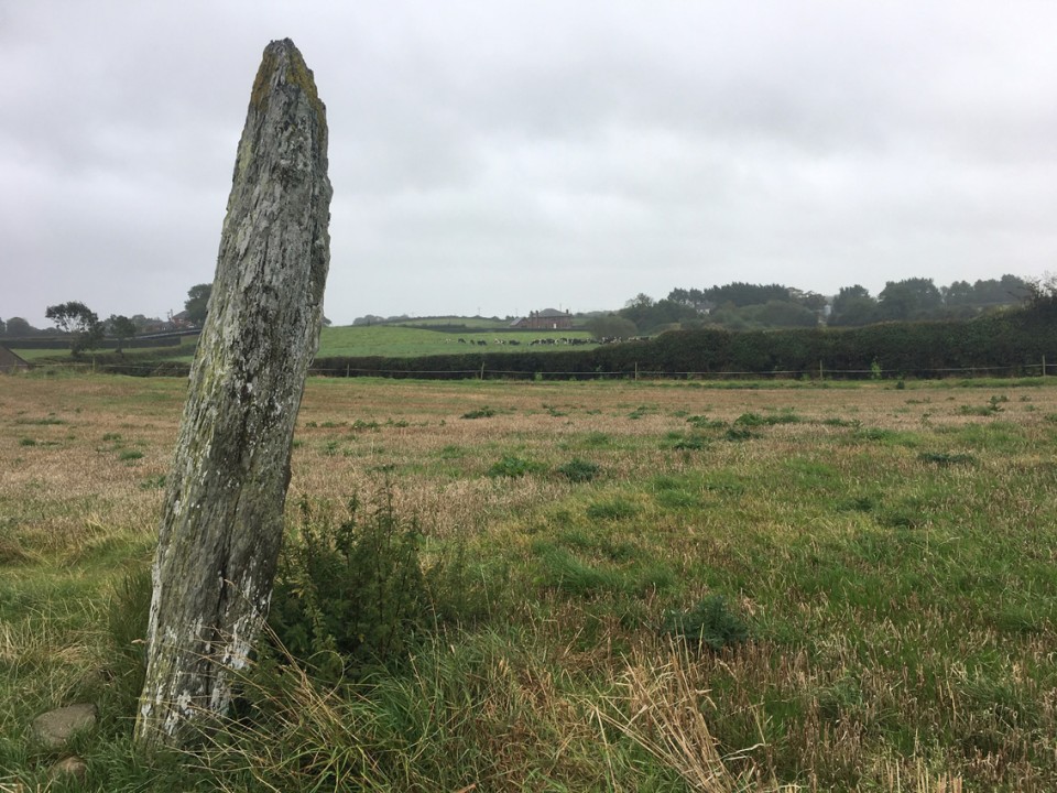
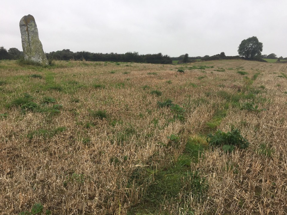
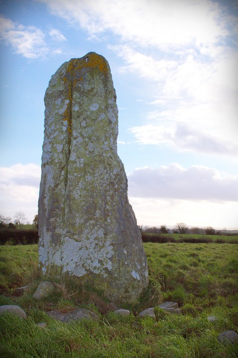
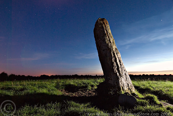
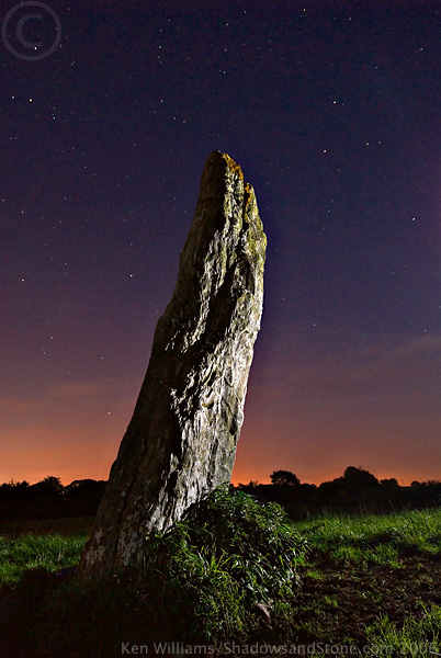
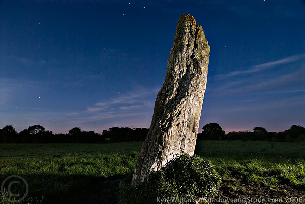
Cuchulains Stone (Rathiddy)
Standing Stone / Menhir
Cuchulains Stone (Rathiddy) (Cloch an Fhir Mhóir) (Standing Stone / Menhir) on The Modern Antiquarian, the UK & Ireland's most popular megalithic community website. 7 images, 1 weblink, plus information on many more ancient sites nearby and across the UK & Ireland.
Image © tmulraney
Also known as:
Cloch an Fhir Mhóir
Nearest Town:
Dundalk (5km NE)
OS Ref (IE):
J007039 /
Sheet: 36
Latitude:
53° 58' 28.23" N
Longitude:
6° 27' 54.37" W
Added by
FourWinds
Images (7)
Links (1)
0 discussions
Start a topic
Show |
Hide
Web searches for Cuchulains Stone (Rathiddy)
Flickr
Google
Google Images
The Megalithic Portal
Bing
Stone Pages
Wikipedia
Show map
(inline Google Map)
- Sites within 20 km -
-
Cortial (3.19km NW) (5 posts)
Castletown (4.91km NNE) (0 posts)
Castletown - Souterrain (4.91km NNE) (0 posts)
Drumgonnelly (4.98km W) (3 posts)
Castletown - Standing Stone (5.04km NNE) (4 posts)
Ballinloughan (5.61km NE) (1 post)
Tullagee (5.61km W) (1 post)
Drumsinnot (6.15km WNW) (8 posts)
Standing Stone (6.2km SE) (0 posts)
Killin (6.3km N) (0 posts)
Drumcah (6.57km W) (3 posts)
Crannog (6.86km ESE) (0 posts)
Drumirril (6.92km W) (6 posts)
Carn Beg (6.97km NNE) (5 posts)
Balriggan (7.74km NNE) (1 post)
Lurgankeel (7.87km N) (0 posts)
Lurgankeel (7.93km N) (4 posts)
Faughart (9.77km NNE) (6 posts)
Proleek (10.37km NE) (31 posts)
Proleek (10.37km NE) (12 posts)
Miskish More (10.85km W) (1 post)
Drumnasillagh (11.73km NE) (7 posts)
Ballymakellet (11.77km NE) (3 posts)
The Well of The White Cow (11.78km SW) (3 posts)
Ballymakellet Standing Stone (11.83km NE) (1 post)
Aghnaskeagh Chambered Cairn (11.9km NE) (3 posts)
Aghnaskeagh (11.98km NE) (2 posts)
Kilnasaggart (12.26km NNE) (0 posts)
Rockmarshall (12.44km ENE) (7 posts)
Monalty Lough (14.29km WSW) (0 posts)
Carnawaddy (14.46km NE) (5 posts)
North Stone (14.48km S) (0 posts)
The Meadow (14.53km NE) (0 posts)
Barnaveddoge Mound (14.58km S) (0 posts)
South Stone (14.68km S) (2 posts)
Clermont Cairn (14.86km NE) (0 posts)
Ravensdale Park (15km NE) (10 posts)
Mullameelan (15.44km SSW) (0 posts)
Tullyallen Lough (15.45km WSW) (0 posts)
Roestown (15.52km S) (0 posts)
Drummond Otra (15.55km WSW) (0 posts)
Knockdinnin (15.69km SSE) (0 posts)
Lisanisk (15.74km WSW) (0 posts)
Riverstown (15.82km ENE) (0 posts)
Callaigh Berra's Lough (16.14km N) (6 posts)
Tullynavall (16.43km NW) (4 posts)
Callaigh Berra's House (16.47km N) (39 posts)
Corrakit (16.66km NE) (0 posts)
Blakestown (16.74km SSW) (0 posts)
Clonlum South (17.12km NNE) (9 posts)
Annaghmare (17.2km WNW) (27 posts)
Slieve Gullion - North Cairn (17.33km N) (10 posts)
Hurlstone (17.57km SSW) (6 posts)
Purcellstown (17.58km SSW) (0 posts)
Latbirget (17.76km NNW) (5 posts)
Skeaghmore (17.8km SE) (0 posts)
Clonlum (17.85km N) (3 posts)
Clontygora - Court Tomb (17.9km NE) (38 posts)
Ballykeel (17.91km NNW) (24 posts)
Grange Irish (Court Tomb) (18.15km ENE) (0 posts)
Rahans Lough (18.15km WSW) (0 posts)
Grange Irish (Ruined Tomb) (18.29km ENE) (0 posts)
Commons (18.37km ENE) (4 posts)
Lough Fea (18.43km WSW) (0 posts)
Souterrain (18.57km ENE) (0 posts)
Corracon (18.79km SSW) (0 posts)
Carranmore (19.13km ENE) (0 posts)
Grange Irish cairn (19.13km ENE) (3 posts)
Grange Irish bullaun (19.28km ENE) (4 posts)
Mullaghash (19.3km S) (2 posts)
Mullaghash (19.3km S) (3 posts)
Grange (19.38km ENE) (0 posts)
The Ballard Longstone (19.49km N) (7 posts)
The Dorsey Entrenchment (19.5km NNW) (7 posts)
White Mountain (19.52km SSW) (0 posts)
Dunany Point (19.53km ESE) (1 post)
- Add -
-
Add news
Add an image
Add fieldnotes
Add folklore
Add miscellaneous
Add a link
-
Add a site
Add a nearby facility
Add an alternative name/spelling
Images
(click to view fullsize)
Add an image
Links
Add a link
The Stone of the Big Man
The folklore behind this stone is probably connected with the High Man, a giant warrior figure, thought to be Cúchulainn, in the landscape of Co. Louth.
http://www.thehighman.com
http://www.mythicalireland.com/highman/
Comments (0)
|
Add a comment
|
Permalink
Posted by
mythicalireland
19th March 2004ce
Edited 3rd August 2009ce