|
|

|
|
Four Stones HillStanding Stones
|
||||||||||||||||||||||||
|
|
|
Images (click to view fullsize) |
|


|
Fieldnotes |
|
|
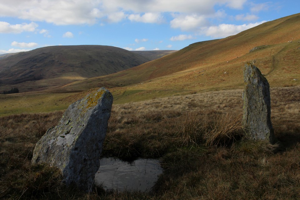
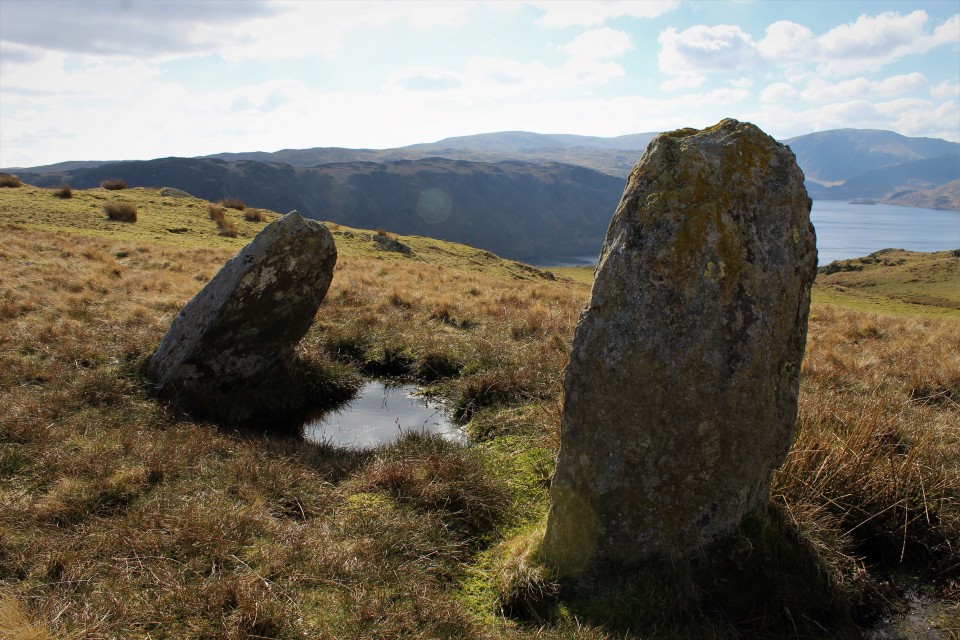
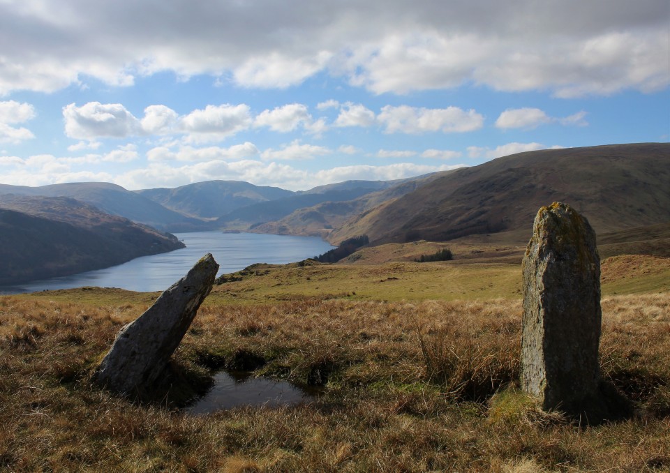
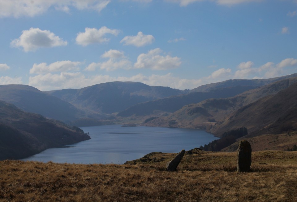
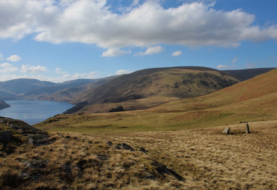
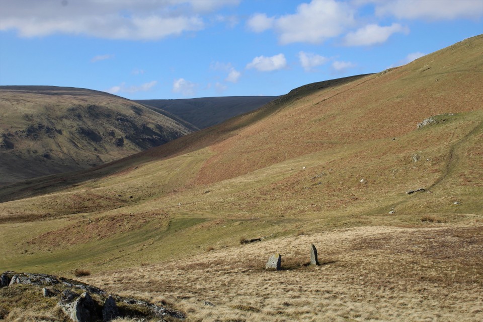
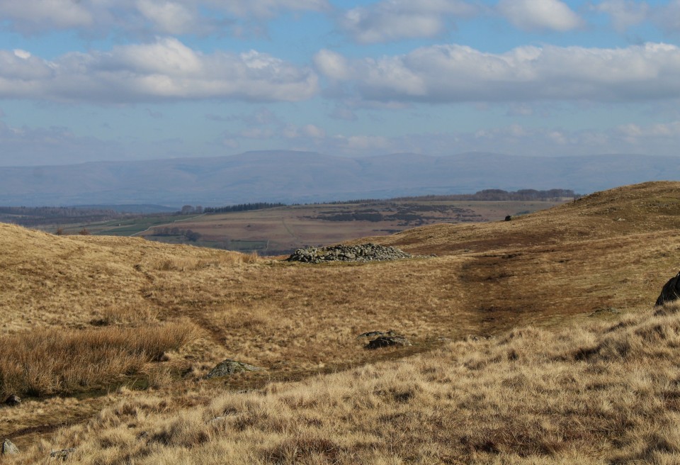
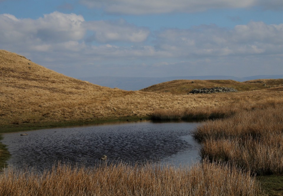
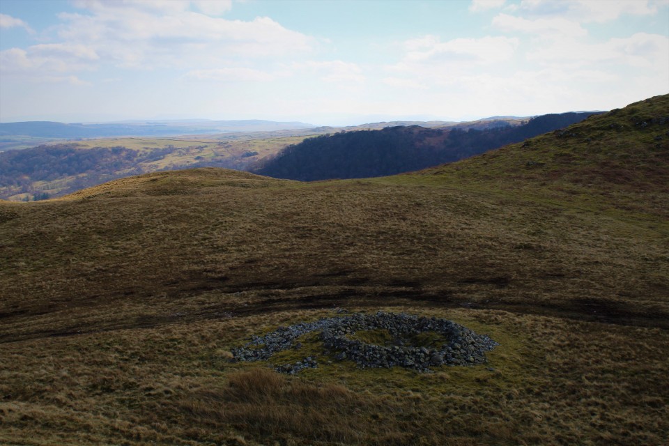
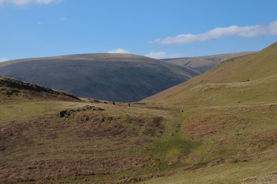
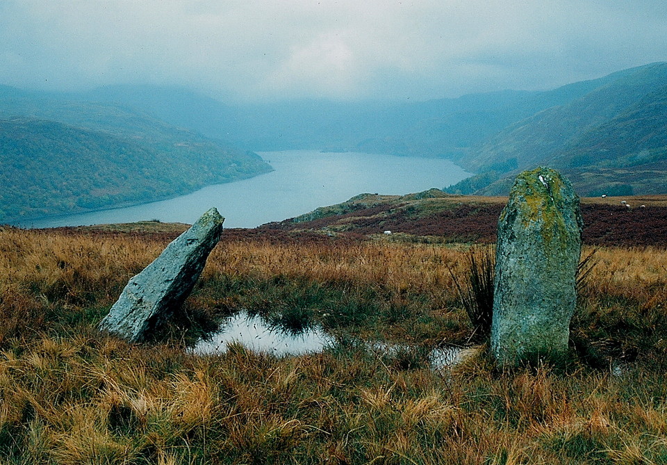
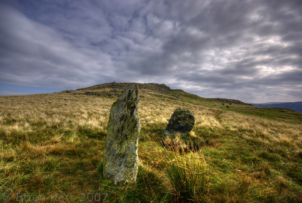
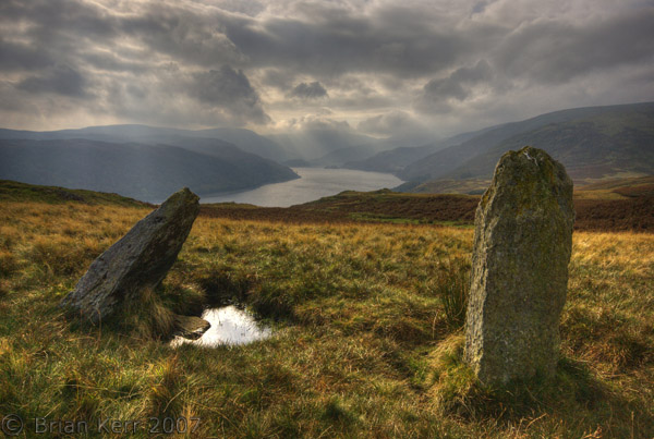
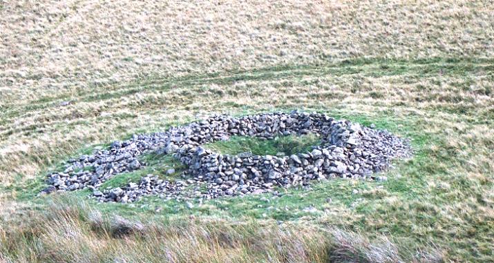
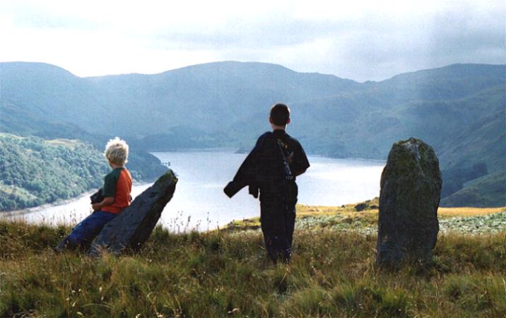
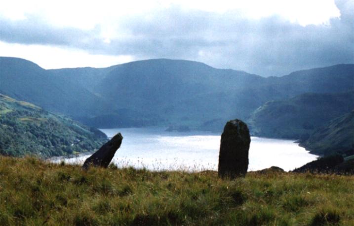
All previous posts have no positive words on getting there, so I put it off for years and went elsewhere, until today, its the spring equinox today, and after a successful sunrise at Elvaplain stone circle I felt today was the day to go. I did what the previous posts seemed to suggest and approached from Drybarrows farm. I couldn't park near the farm because of all the signs written forbidding me from doing so, so I had to squeeze the car in on the little east to west road north of Winder hill. It was precariously parked, but with what looks like a long walk (just over a mile)to the stones I wanted to get as close as I could. Walking through the farm was the worst bit, trying to get by without bumping into angry farmer (they're all angry, they may not always show it, but they're all angry on the inside) all those negative signs on the road made me feel unwanted. But got through the farm I did, and out onto the open moor. There are lots of paths going this way and that, trying to stay on the one that would take me to the stones proved impossible. It wasn't long before I was well off the right path and climbing Little Birkhouse hill, the view over Haweswater was pretty good, and I was sure I hadn't passed the stones yet so I carried on, up Great Birkhouse hill, from there I skirted round the south side of Fourstones hill, and there they were, to me they were in profile and looked like one stone, so I still wasn't convinced I was there until I was right upon them. Standing at the stone pair the view is joyous, on the nice scale it stands somewhere between very nice and I need to sit down. The reservoir is an imposition on the landscape, there would have been a river down there in the past, it's just a lot bigger now. The way the sunlight speeds across the countryside, lighting up the distant hill sides, I sat down. So what happened to the other two stones? Was this a four poster? or a four stone row? Or were the four stones the remains of a bigger circle? Answers on a postcard to....... The stones are quite different, the smaller one sits in it's eternal pool and is kind of triangular and leans towards it's partner, the taller one is a long robust pillar. From the stones about 100 meters north east is the cairn, the two are not intervisible. I get back up and start circling the stones, after many many photos, I go for a little walk about, get some height and perspective change. I drop back down right onto the cairn, it's quite a good one, large and stony and with a shallow scooped interior. Its time to go, with my car parked where it is I've spent too long here. On the way back I follow the footpath more correctly and miss the farm out altogether passing by to its south and east by several hundred meters, I wish I'd gone this way first. If you intend to see all of the lake districts ancient remains (A list) the two stones at Fourstones hill are a definite must see, the view will astound and the stones will confound. But getting there is still a pain in the...... |
 Posted by postman
22nd March 2022ce |
|
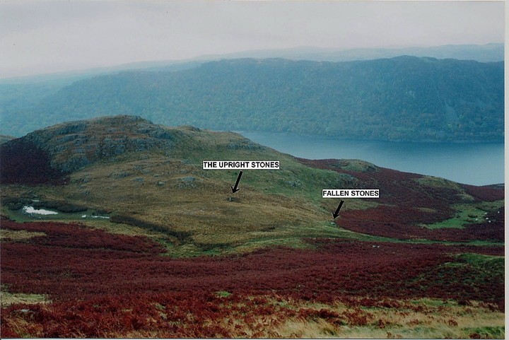
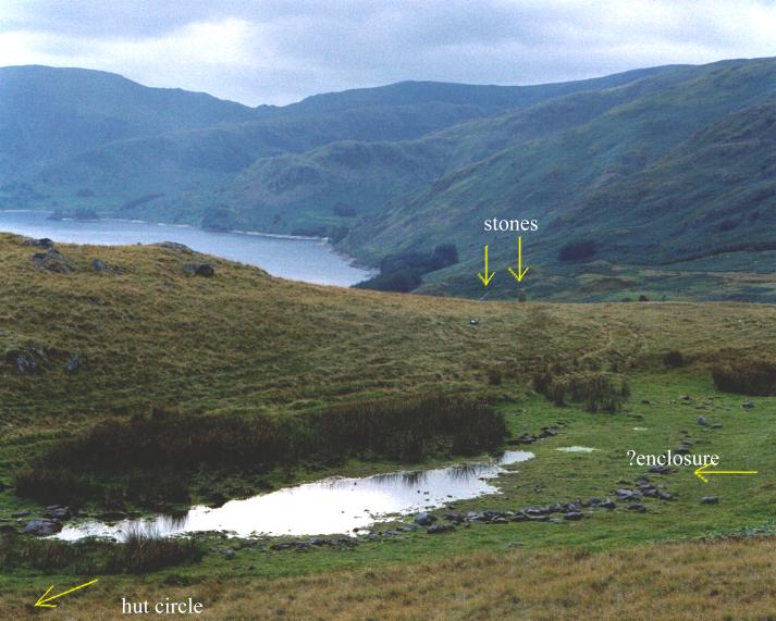
Well.......... I eventually mentioned to get to this excellent site, albeit in a somewhat, er, roundabout way...... and was not disappointed. I arrive at the tiny, model settlement of Burnbanks, at the eastern end of Haweswater, in pouring rain - as per usual - taking the stony bridleway, which climbs above and along the northern shore of the reservoir. A mini range of craggy hills rise above, but I'm put off the direct approach to Four Stones Hill by the waist-high fern cover (seriously, just try walking through it, particularly with concealed brambles to catch the unwary), so carry on to take a look at the roaring 'The Forces' waterfalls. Impressive in their raw, unbridled power in spate. A footpath climbs the left hand (west) bank to arrive at a footbridge over the stream and it's here the fun begins. Hmm. The mist has come right down so I a take a compass bearing on Four Stones Hill on my map and .... doesn't seem quite right, so have another go. Anyway, climb as indicated and, breaking free of cloud, find myself upon Low Kop....... damn, but while I'm here may as well have a wander to take in this magnificent Lakeland scenery.Well, it'd be rude not to. Upon returning, I head for Four Stones Hill and am duly engulfed in cloud once again. Suddenly the vapour peels away and there are the two stones below to the south, the position highlighted by the tiny tarn, the cairn also visible. Two further fallen stones lie a little way to the west of the uprights, down the broad, green track. Of course, the whole vista is now dominated by the reservoir, a modern intrusion into the scene altering the whole landscape context of the monument. But then again none can deny that it does look bloody magnificent as a backdrop. Much rather this than some power station. Awesome, in fact. The ground around the stones is seriously waterlogged, although the pool between the upright stones is, judging by previous photo posts, a permanent fixture. My compass says the reservoir lies to the north (!!) so duly goes in the bin upon getting back to the campsite. Luckily it didn't stop me reaching these fantastic stones set in glorious scenery. |
 Posted by GLADMAN
31st October 2009ce Edited 1st November 2009ce |
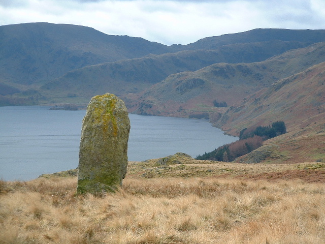
| The photo I've posted is of the most upright of the two stones still standing on four stones hill. The view over Haweswater on a seemingly beautiful February morning only lasted a few moments before a heavy downpour crept over the hills and greyed the whole thing out. Part of a well worthwhile circular walk along the north shore of Haweswater and then up the hillside by the side of a waterfall, along the tops to the standing stones site and then back down to Burnhead where we started. |
Posted by ledlegz 24th February 2005ce Edited 24th February 2005ce |
|
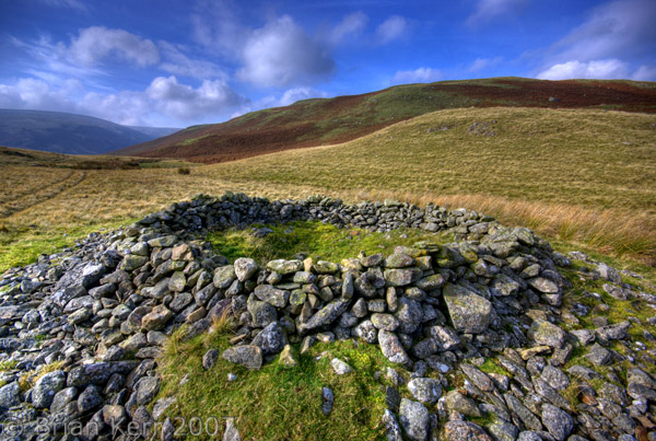
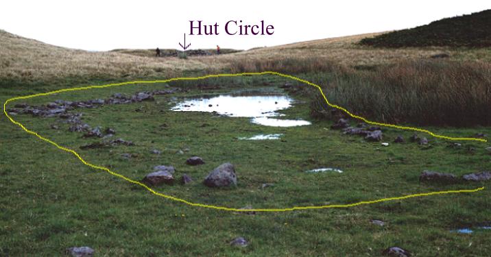
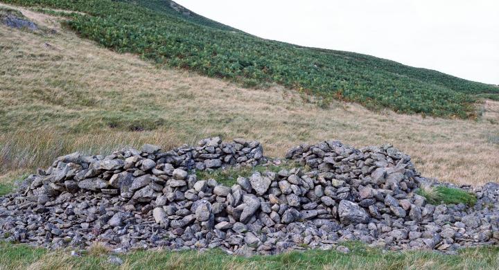
This is a fantastic site although I would not advise anyone to approach it by the route we took. Myself and my two dodmen apprentices took the road to Burnbanks at the head of Hawswater and parked up. We then walked along the well made path until we reached Mile Craggs and the took the uphill route following the beck (no footpath). My apprentices had a hard time of it but remained uncomplaining as they sank into bogs and were totally lost in a forest of bracken. I was trying to show them how to follow the sheep paths but failed miserably as even sheep are not daft enough to take this route up the fell. We eventually made it to the top and were rewarded with fabulous views across Haweswater to Hare Shaw in the east and High Rise and Long Stile in the south. The site itself is nestled in a lovely sheltered high vale. You are first aware of the two stones on the horizon, as you walk up to them they seem to get smaller. One stone is upright the other is leaning. They look out over the southern flank. As you move into the site you come across a small pond (about 30M long, very shallow) that is bizzarly flanked by a lowline of stones ( ?an ancient wall structure), slightly up the rise to the North east is a lovely hut circle about 10M across. The combination of these three features coupled with the views and absolute isolation of this site make it a wonderful place to visit. As we sat and admired the views we watched a storm move towards us, helpless to escape it we got soaked, when the storm moved on it left a beautiful rainbow across the fell. Out of interest I'm sure this site used to be called the Giants Grave or graves but cannot find a reference to back me up. I also wonder what happened to the other two stones of Four Stones Hill. Any info? My lad collected a mean set of sheeps bones on the way down! " look dad , some of 'em still have the skin on!" His mum was well impressed when he took them home to show her. If you visit this site, I would advise the safer less strenuous route from Drybarrows. Or walk along the lakeside to the Forces and follow the footpath past the waterfall. |
 Posted by fitzcoraldo
8th September 2002ce |