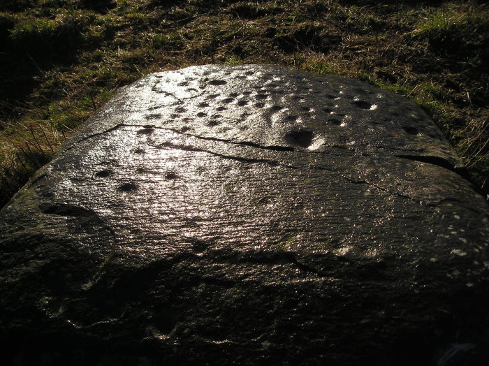
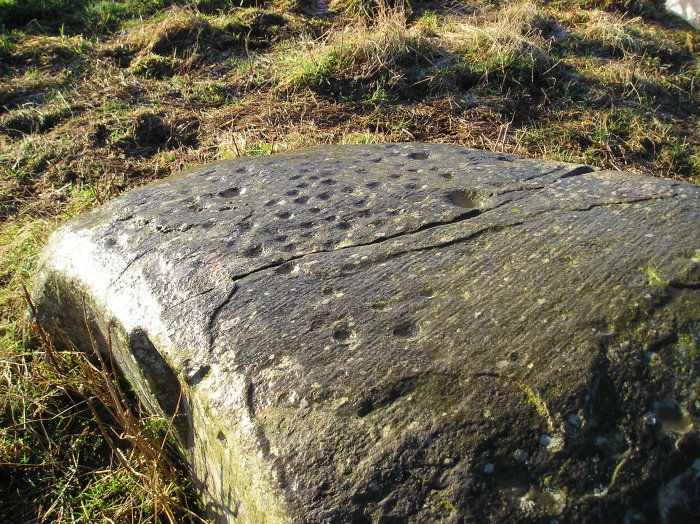
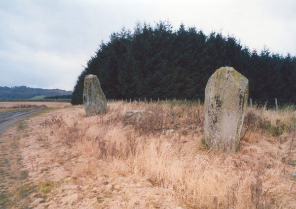
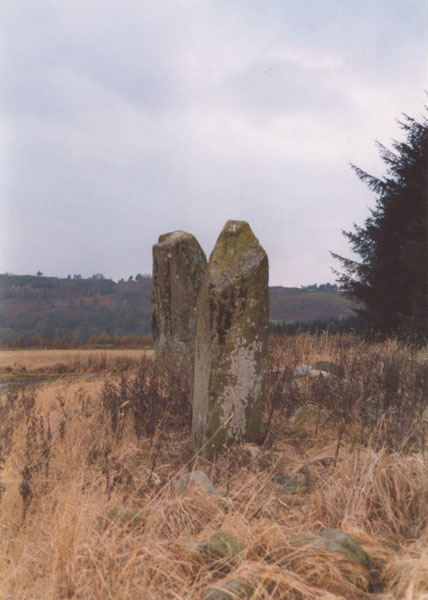
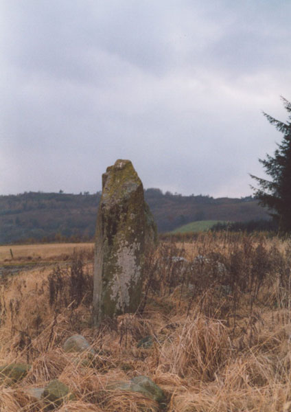
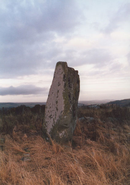
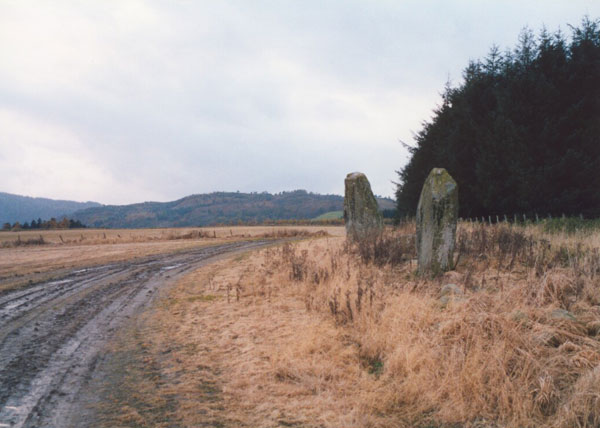
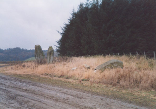
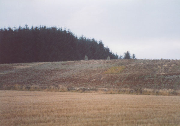
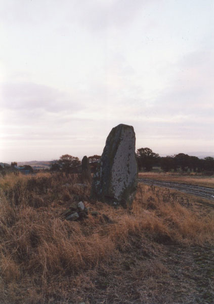
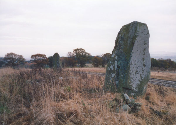
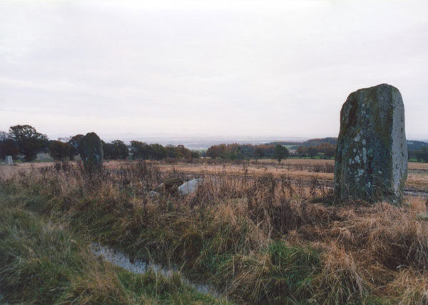
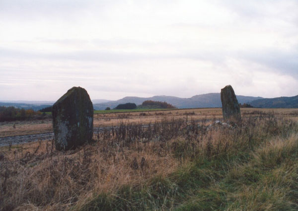
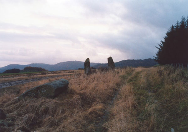
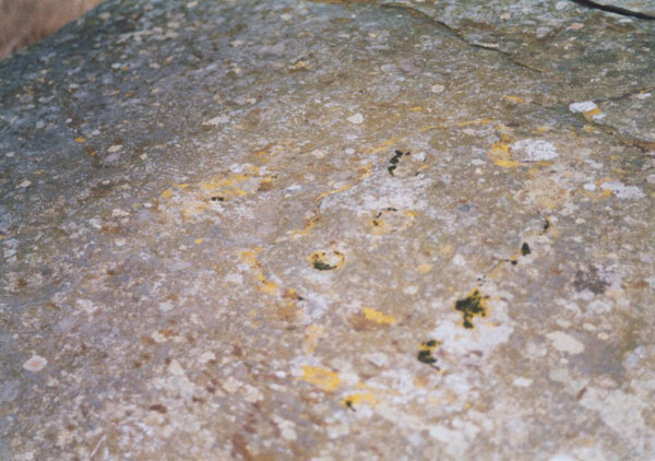
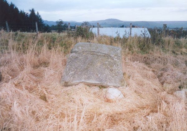
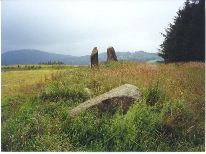
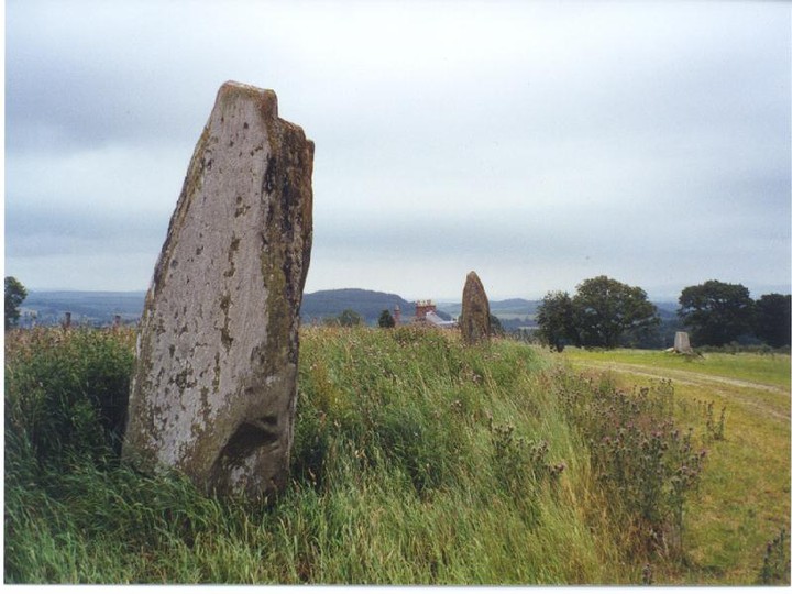
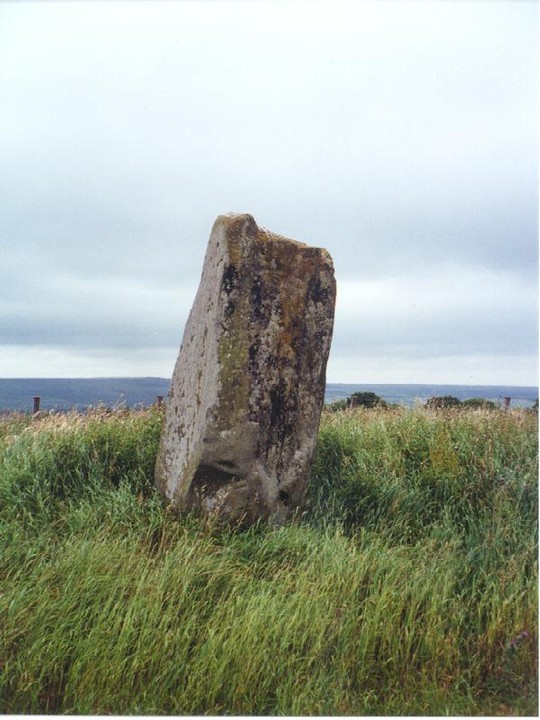
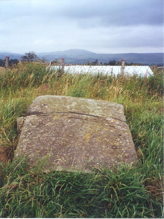
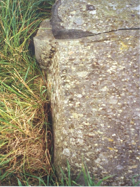
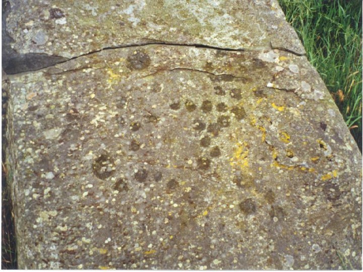
The East Cult stones stand proud on a high ridge above the River Tay that extends E from Dunkeld. Aligned E-W, the two huge standing stones are approximately 9.0m apart, while a similar distance to the E is a third prostrate stone, profusely decorated with cup-marks. In 1986 the RCAHMS counted some 130 cup-marks and a dumb-bell on the upper face, and a further 3 cup-marks on the E face. However, weathering has taken its toll since, and it's difficult to make out so many today. Field clearance or possibly cairn material is scattered around the stones.
The prostrate stone may originally have stood upright, and if it did, Coles suggests that the stones may have been part of a circle with a diameter of 78' (24m). But considering their E-W alignment, I believe the stones are unlikely to have ever formed part of a circle. However, in the Old Statistical Account, and repeated in the New, the site is described like this:
"About a mile and a half north-west from the church, in a very elevated situation, there is a small Druidical circle. Beside it are two large stones, deeply sunk in the ground; the top of the lowest is artificially formed into an inclined plane, facing the south, and contains a number of small cavities; which may have been used by the Druids in the performance of religious rites."
This makes me think that perhaps the cairn mentioned by the RCAHMS as being 185m S of the standing stones (NO 0724 4198), and which was removed before 1865 for building material, could in fact have been the site of the "small Druidical circle." If the Statistical Accounts are accurate, then one of the three stones now at East Cult may have been moved from its original position as part of the circle, and the remaining two been outliers for the circle to the S.
East Cult Standing Stones
27/7/02
A ridge rises out of the fertile plains of Eastern Perthshire to a height of 204 metres. The views stretch from the Sidlaws to the hills around Dunkeld and Birnam and up to Glenshee and the Grampians. Atop this ridge are the three stones of East Cult. They are aligned E/W and graded in height towards the west. This massive stone stands at 2.15 m with a circumference of over 4 m. Approximately 9 m to the east the next stone rises to a height of 1.8 m. A rounded side facing south, a flat northern side catches my gaze and points in the direction of a dip in the Dunkeld Hills over towards the Two-Poster at Newtyle and the cup and ring marked rocks of Birnam Hill. The third and final stone is the most interesting. This is a cup marked recumbent which is another beautiful viewfinder and interpreter. There are over 130 markings on this stone- it points my gaze to the north and aligns perfectly with Benachally Hill about 7 km away. This interpreter measures 1.25 m wide by 1.9 m long and slopes up from the ground to the south to a height of 0.9 m at it’s northern edge. The cups measure from approximately 3 cm to 12 cm in diameter. Along the western edge is a line of 11 cup marks all of which are about 3 cm in diameter. The black clouds to the west hang heavy in the sky, the sun almost breaks overhead. Whilst taking pictures I hear something coming towards me through the undergrowth- I look up to see a stoat looking up at me. It slowly checks me out, then heads back towards the middle stone. Wild roe deer are also sniffing amongst the thistles just to the south. The stones then draw my view to the dark clouds and black mass of Birnam Hill- the rain. Time to go. I stand and try to take it all in one more time- this is a hugely impressive site- in fact one of the most spectacular I have yet visited in this part of the land.
Directions - Take the A9 N from Perth (sign-posted Inverness), turning off at Luncarty onto the B9099. Follow this road through Luncarty, Stanley, then Murthly, crossing the Tay before entering Caputh. Continue on through Caputh until you reach the T-junction with the A984. Turn right onto this road, and after about 1.5km turn left opposite Glendelvine Primary School for Clunie.
Approximately 2km up this road is a farm track to the left (no sign), opposite the drive for Craigend farm on the right side of the road, and approximately 200m before the drive for Snaigow House. Turn onto the track, which is quite rough and can be muddy, but should be suitable for most cars, following the line of trees on your right.
After a short-distance you will find another farm track joining with a T-junction. Turn left, and follow the track for approximately 1.5km, where there is the first road up to the right. This is the road up to East Cult farm, which is surfaced in places, but please park sensibly at the bottom and walk up to the farm to ask permission. Approaching the farm, you will see the stones to your left. There is a track which passes the farmhouse and runs along the edge of a field to the stones.


 Posted by BigSweetie