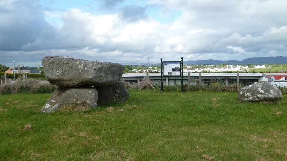
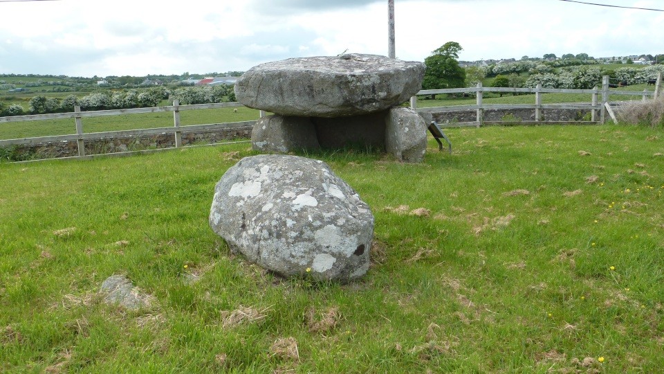
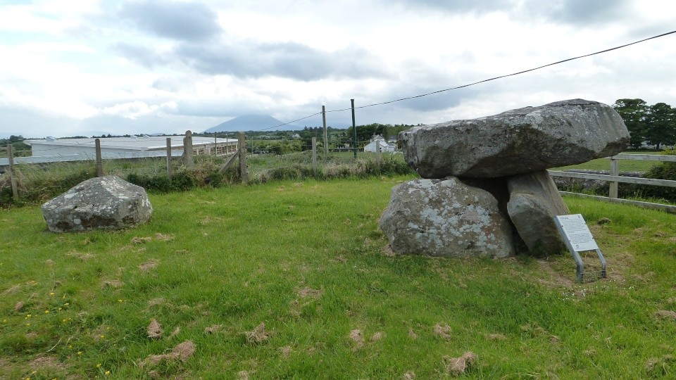
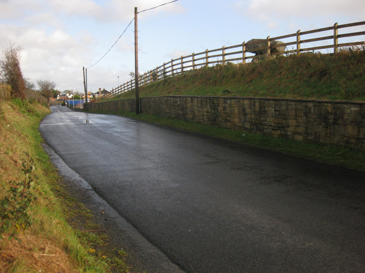
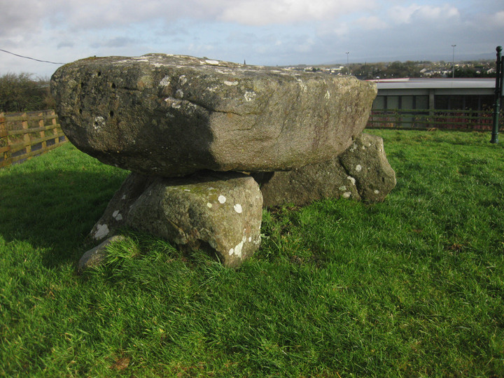
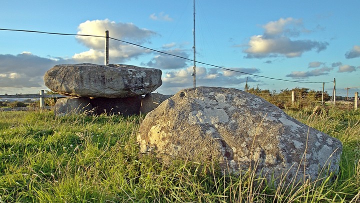
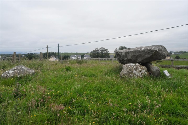
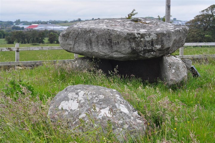
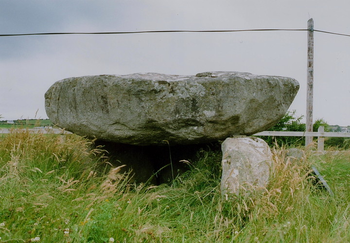
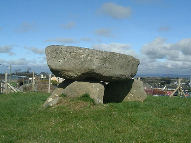
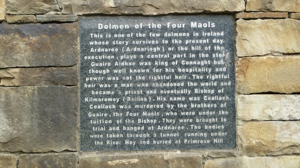
Log in
|
Register
Home
Latest Posts
Forums
Maps
Help
Browse Sites
News
Blog
Contributors
The Books
Select
-
Belgium
Denmark
Eire
France
Greece
Italy
The Netherlands
Norway
Portugal
Republic of Malta
Spain
Sweden
Switzerland
United Kingdom
County Mayo
Ballina
Dolmen / Quoit / Cromlech
Ballina (Dolmen of the Four Maols) (Dolmen / Quoit / Cromlech) on The Modern Antiquarian, the UK & Ireland's most popular megalithic community website. 5 images, plus information on many more ancient sites nearby and across the UK & Ireland.
Image © Robert Gladstone
Also known as:
Dolmen of the Four Maols
Nearest Town:
Ballina (2km N)
OS Ref (IE):
G238182 /
Sheet: 24
Latitude:
54° 6' 25.75" N
Longitude:
9° 9' 54.53" W
Added by
FourWinds
Images (5)
0 discussions
Start a topic
Show |
Hide
Web searches for Ballina
Flash Earth
Flickr
Google
Google Images
The Megalithic Portal
Bing
Stone Pages
Wikipedia
Show map
(inline Google Map)
- Sites within 20 km -
-
Carrowcastle (5.75km E) (3 posts)
Corrower (6.88km E) (6 posts)
Carrowcrom (7.95km E) (6 posts)
Bunnafinglas (8.81km SE) (0 posts)
Carrowleagh (12.86km ENE) (12 posts)
Carbad Mor (15.46km NW) (6 posts)
Carrowkilleen (15.5km WSW) (5 posts)
Carrowreagh (15.65km E) (0 posts)
Belladooan (15.88km WNW) (2 posts)
Rathfran - Stone Circle (15.95km NW) (5 posts)
Caltragh (16.12km ENE) (5 posts)
Rathfran Wedge Tomb (16.19km NW) (9 posts)
Breastagh (16.51km NW) (6 posts)
Breastagh (16.79km NW) (9 posts)
Cashel (16.88km NNW) (4 posts)
Banagher (18.72km NNW) (7 posts)
Carrowtrasna (18.84km NW) (8 posts)
Tawnatruffaun (18.98km ENE) (9 posts)
Kilcummin Holy Well (19.23km NNW) (5 posts)
- Add -
-
Add news
Add an image
Add fieldnotes
Add folklore
Add miscellaneous
Add a link
-
Add a site
Add a nearby facility
Add an alternative name/spelling
Images
(click to view fullsize)
Add an image