We parked at the farm and noticed a hand made sign stating that the Broch was a 1km walk up a track. Karen stayed in the car while I, Dafydd and Sophie headed towards our goal. Sophie enjoyed herself splashing in the puddles and chasing the sheep whilst Dafydd was taking notice of the various items of farm machinery.
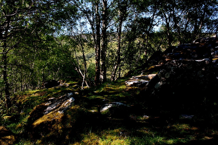
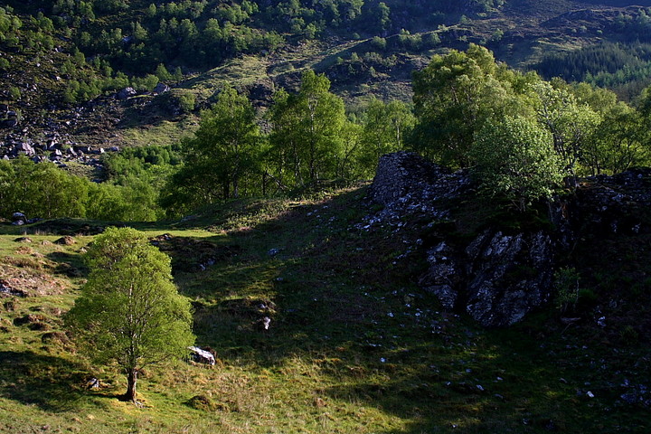
The track was fairly level but a bit rough. Low clouds hung over the mountains in this picturesque valley. The river gurgled away making its way to the sea in Glenelg Bay.
It was a very atmospheric walk, something Scotland excels in – no wonder I love this country so much.
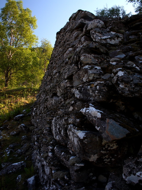
As has been said, the Broch is in not as good condition as its more famous counterparts but is still worth the small amount of effort required.
Nowhere near as ruinous as I'd anticipated, Dun Grugaig is - in my opinion - the most rewarding of the trio of ancient defensive structures to be found within the wondrous confines of Glen Beag.
Tearing myself away from the magnetic attraction of the excellent Balvraid chambered cairn, I venture once again into the merciless glare of the sun. The broch is signposted, a DIY placard indicating the route to be taken along the rough track heading approach south-east beside the Abhaim a' Ghlinne Bhig. It is not far, a 1/4 mile or so from the buildings at Balvraid, I guess... look for the birch covered crag, above and to the right (south) upon fording the stream which flows towards the aforementioned river from the Coire nan Caorach.
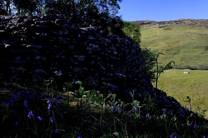
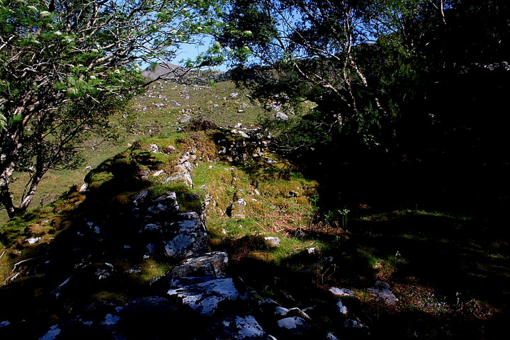
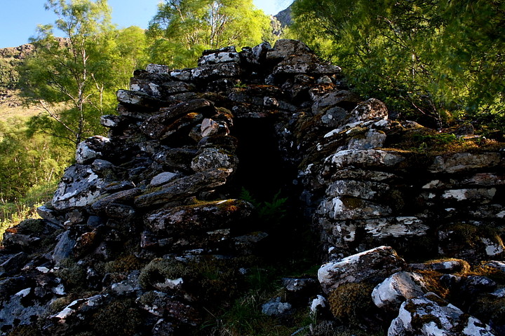
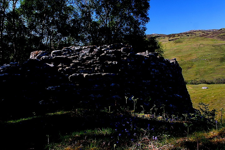
Not a true broch, Dun Grugaig possesses a semi-circular ground plan, therefore differing from its much more famous, distinctly circular neighbours (Dun Telve and Dun Troddan), utilising a steep ravine falling to the river for its western defence. Truly, no more was needed.... that much is obvious as I teeter upon the edge, the presence of gurgling water just discernable far below. Consequently the setting of the enclosure is far more dramatic than either of the other two sites, thus engendering a far superior vibe. The archaeology is substantial, too, the drystone walling rising to an impressive height, particularly facing the original approach to the approx south-east, where I reckon additional, outer defences remain in situ beyond. What's more a gallery can still be seen within the inner and outer walls of the defences. Always a good thing.
The proximity to water does have its drawbacks, however. Yeah, the ancient defenders may now be long gone from Dun Grugaig.... but not so the terrible midge which begins to demand evasive action from the visitor. However the fort occupies such an idyllic position within this landscape that such discomforts must surely be bourne in good heart?

 Posted by GLADMAN