|
|

|
|
Windmill TumpLong Barrow
|
||||||||||||||||||||||||
|
|
|
Images (click to view fullsize) |
|
Photographs: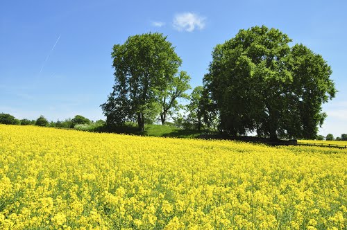
 Maps / Plans / Diagrams:
 Artistic / Interpretive:
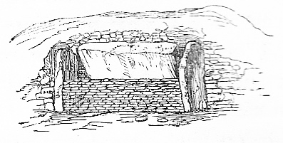
|
Fieldnotes |
|
|
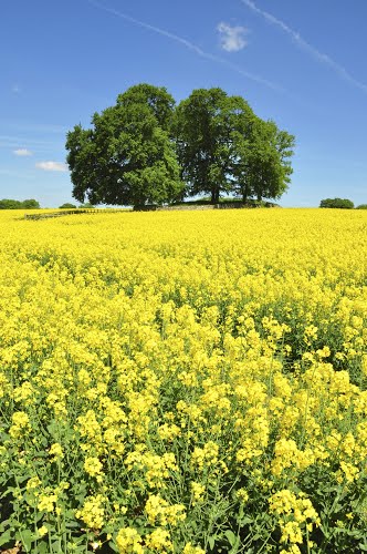
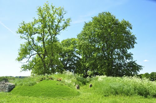
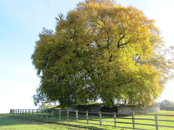
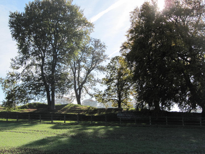
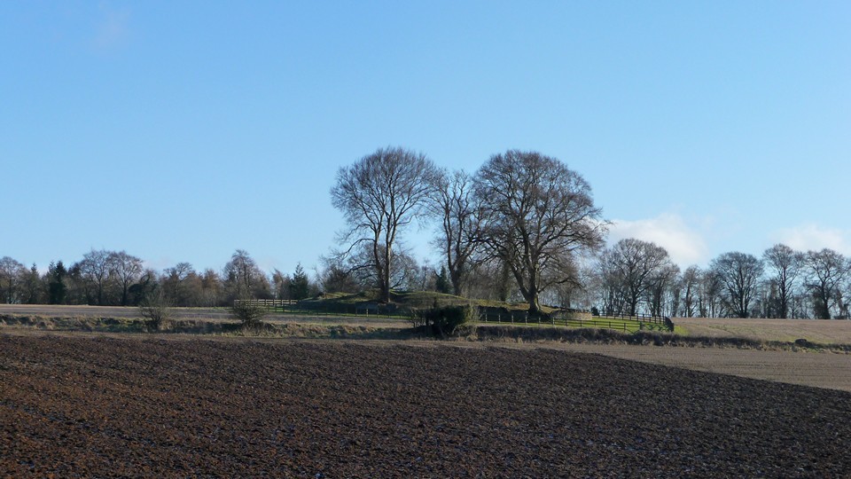
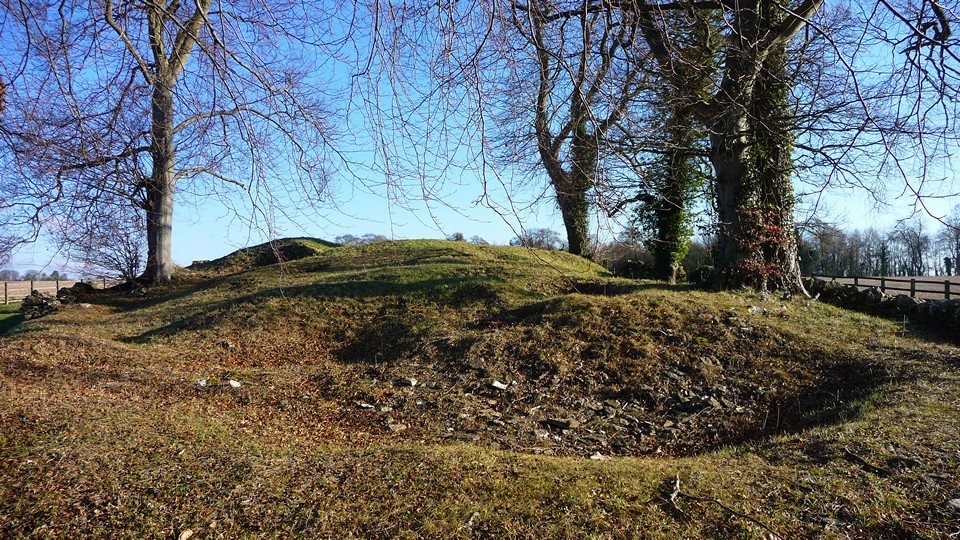
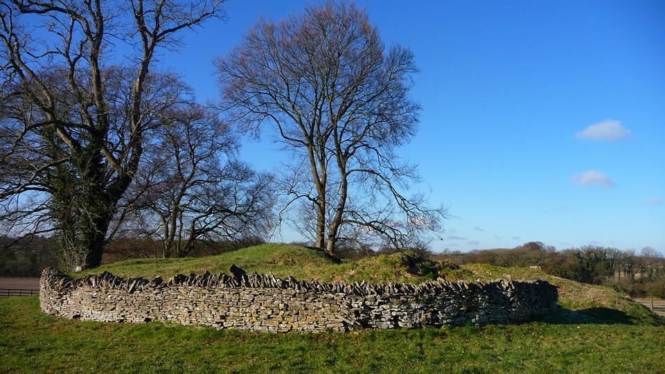
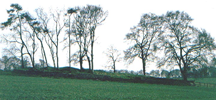
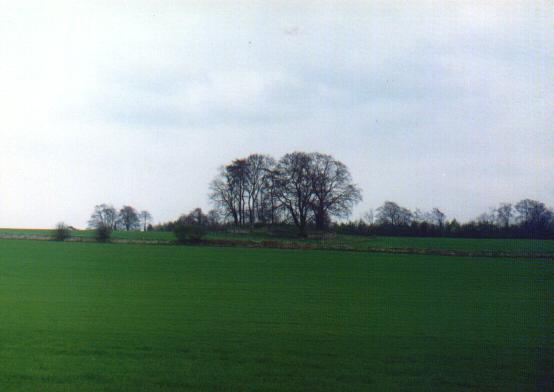
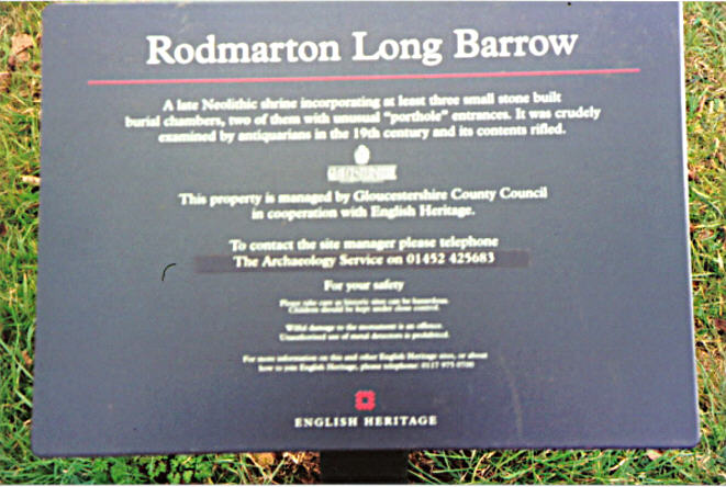
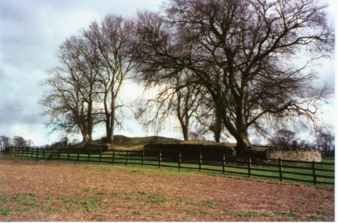
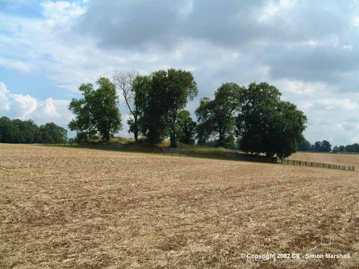
A free day - and golden autumn sunshine beckoned … We stopped at Rodmarton long barrow,aka Windmill Tump, on our way to a Cotswold walk around Oakridge and Bisley . The plan was to walk to three different OS marked long barrows in an attempt to see what remained of them. Before this, however, my friend, now something of a Cotswold long barrow enthusiast, had identified Rodmarton as one not yet visited. Rodmarton was a wonderful way to kick off – the sun still low in the sky and frost on the grass when we took the turning to Trull not far from Cirencester. The barrow's position, like most long barrows, was a joy – with views of the open farmland all around. Quite a few large trees growing on the around the edges of the barrow (a golden Beech, Oak and Ash) and evidence of some large tree stumps on the barrow. The three burial chambers are easy to identify though sadly they have collapsed in on themselves now (quite possibly due tree root damage) – just two entrance stones remain visible. The English Heritage information board says: "A late Neolithic shrine incorporating at least three stone 'porthole' entrances. It was crudely excavated by antiquarians in the 19th century and its contents rifled". As we drove away,we were reminded we were in 'horsey' country when we encountered a hunt about to set off; being an ex-townie this was a first for me so I sat quietly on my emotions and observed this privileged group of people doing what they felt was their god-given right. It was gratifying to see a large deer run across the field behind them, unseen - away and free. The walk later was golden and crisp – we passed Money Tump near Bisley; visited Seven Wells in the village of Bisley; and walked to Giant's Stone (overgrown and unidentifiable as a long barrow) before heading back late afternoon. Just in case they read this, a very big thank you to my friend for the transport and enthusiasm - without which this lovely day would not have happened. |
 Posted by tjj
25th October 2010ce Edited 25th October 2010ce |
| When I visited in the early Spring of 2009 the field had just been ploughed and was very, very muddy despite sticking as much as possible to the edge of the field - the rain didn't help!Anyway, I did squelch my way across to the barrow and found it to be quite overgrown with fairly high grass - lots of places where it looded as though it had been dug in the past. All in all I found this to be a little disappointing although it is in a lovely setting - on a nice day! |
Posted by CARL 28th May 2010ce |
|
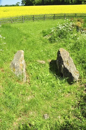
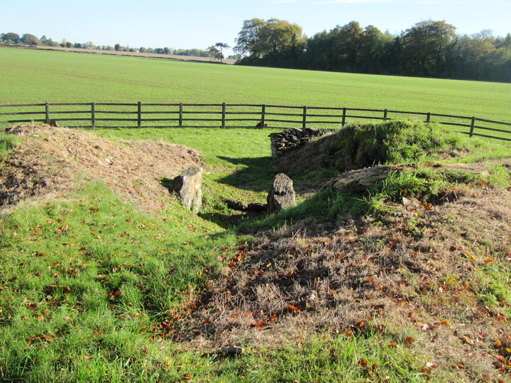
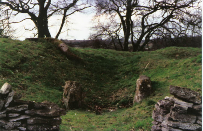
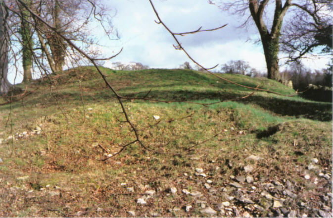
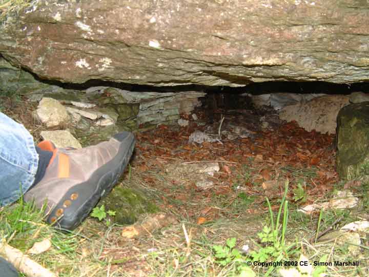
Visited on a lovely, frosty winter's day (3.1.2010). The barrow is a easy stroll along quiet country lanes from Kemble railway station (about 3 miles). It's a brilliant site, quite low lying for a Cotswold long barrow but easily visible from the roads on the north and west sides. The barrow itself has suffered very badly at the hands of antiquarian excavators, the back is a hotch-potch of craters and pits. The remains of the orthostated chamber at the east end shows two large visible megaliths, but the capstone has disappeared. The "portholed" chamber on the north side is only partially visible. The capstone can be seen, and the highest part of the chamber beneath, which shows internal drystone walling. On either side are what appear to be the tops of two upright orthostats, perhaps part of the porthole stones? The NW chamber has been turfed over as far as I can tell, it only came to light in 1987 as a result of a falling tree and has presumably been recovered. The barrow clearly had many more trees on its top at one point, judging by the number of stumps. It's a lovely place to spend some time. I was here about half an hour and no-one else came, despite the glorious day. A light plane (possibly from the Kemble airfield) flew over the barrow at least four times while I was there, perhaps hoping to get a stone-obsessive-free aerial photo. Temperatures never reached much above freezing point today and eventually I started to get cold and decided it was time to leave. A wonderful site with a great atmosphere. [Some additional access notes - Rodmarton is served by the Cirencester - Tetbury 881 bus service Monday - Saturday, which runs to within a mile of the barrow.] |
 Posted by thesweetcheat
3rd January 2010ce |
|
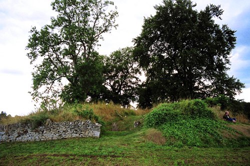
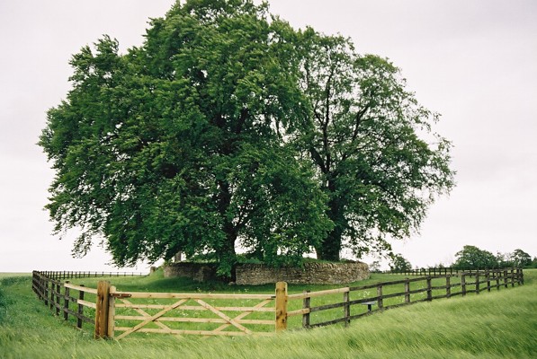
I unexpectedly found myself near Windmill Tump today, so popped in for a visit. It's quite different at this time of year, without leaves on the trees, and without the tangles of vegetation beneath, and all the lumps and bumps are exposed, making it much easier to understand what you're looking at. Crunching through the beechmast I expected to see more stones around the side chambers, but everything was mossy or covered by a carpet of short grass and other plants. I did some sketches, but the length of the barrow kept squashing itself up on the page. I tried to draw the stones with some pastels, but the colours eluded me. Never mind, the process of drawing gave me that curious 'attentive / relaxed' meditative state, and I felt peaceful.. apart from the racket that was coming from somewhere nearby, out of sight.. something agricultural maybe. It would have been a blissful picnic spot there today but for that noise. A word on access - there's a steep bit up from the road (a few feet) and you can either step through a little squeezy bit at the side, or I did notice the big farm gate is unlocked, so you could open that. The 200m(?) to the barrow is a nice flat wide path (with loads of daisies), and then it's a short flat nip across the oil-seed rape (look out for all the bright blue speedwell in between) to the barrow (the wide gate here was propped open). So I'd say it was pretty accessible now (compared to when Kammer visited), assuming you can make the distance from the road. I did notice on the barrow that there were patches of violets, strawberry, dogs mercury, arum, and something decidedly oniony looking which I assume will be in flower soon, along with the patches of bluebells. So, I heartily recommend it for a spring visit soon. |
 Posted by Rhiannon
31st March 2008ce Edited 31st March 2008ce |
|
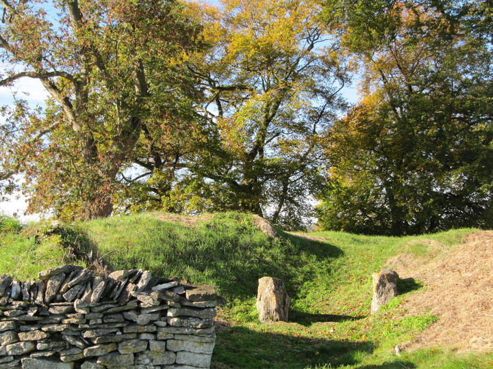
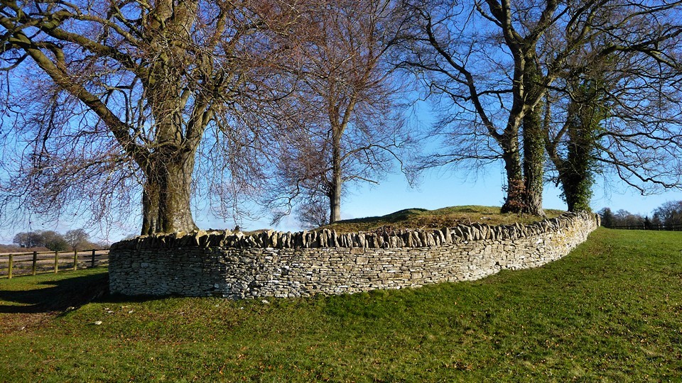
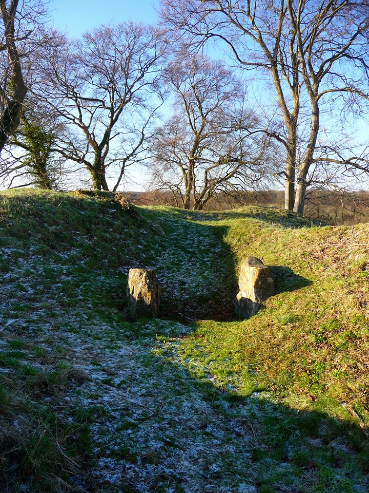
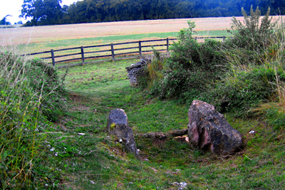
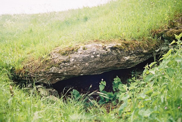
Windmill Tump is marked on my road atlas and I got here without an OS map. Since Kammer's visit a smart brown sign has gone up at the gate. It's a small one on a stick like a footpath sign, but it clearly shows the English Heritage symbol and the barrow's name, so if you're looking for it it's enough to make you swerve into the layby. Well, this is a strange place. It's partly so neat that you wonder what's real - the enclosing drystone wall echoes Stoney Littleton's, but it ends neatly and abruptly every time a tree appears on the margin. On the other hand, the barrow's untidy and rather bumpy and muddley on top - partly the fault of the big beech, ash and oak trees on top, and partly, no doubt, from past excavations. My favourite bit was the chamber (of which Kammer has taken a photo). It's ever so low and you can see more drystone walling inside. It was spookily thrilling to think of it stuffed with bones. However, it was weird - it was so high up on the mound. I imagined it would be low down like the side chambers at Belas Knap, but no. Weren't bones shuffled about and periodically added to at long barrows? So it couldn't have been just a sealed cist accessed from above? Was it just the end of a once longer passage? I dunno. I do know I kneeled squarely on a nettle when bending down for a look though. But in this position spotted that there are several lovely fossilised cockle-type shells on the rock: a deliberate choice or just local geology? There's also the two stones at the far end from the gate. I couldn't tell if this was a 'false entrance' like Belas Knap, or another chamber positioned at the back end of the barrow instead (some research required). They were interestingly (naturally) striated and one of them had an excellent pink lichen on its inner face. It was more draughty sat here though, and the noise of the wind in the trees occasionally sounded like voices. As the rain set in it felt like quite a bleak and lonely place. But in sunshine it's probably an ideal picnic spot really. The barrow is pretty overgrown at the moment - apart from round the chamber and the end pair of stones, which has short turf. There are nettles, brambles, wild strawberry, and pretty but poisonous woody nightshade. There are lots of lovely stripey snail shells in yellow and in pink to look out for, too. Scrambling over all this I got to the end of the barrow nearest the gate, where it was quite clear and there were lots of flat stones like the ones in the walls. But - hang on a minute - I couldn't believe my eyes. Someone had carefully constructed a cross with them, flat on the ground, about 3 or 4 feet across! It was really carefully done, with the occasional straight edges of the stones deliberately chosen to form the edges of the symbol. It made me really angry - firstly that someone should be moving the stones (even if they had fallen out of a wall, or whatever), but secondly because I instantly presumed the symbol was made by someone trying to christianise this patently unchristian monument. Perhaps they weren't. Perhaps it wasn't even christian in intent. But that's what it looked like and I just set about demolishing their handiwork. Some people have some funny ideas. Not least pretty much illegally interfering with ancient monuments. But also, if that's what it was, trying to confer some kind of christian 'benefit' on people who lived at least 4000 years before christianity was even invented. In comparison with this, the roughly made plaited cornstalk ring I saw left at the entrance was a respectful and undamaging addition to the site. Pfah. Anyway it was raining in big sheets now sweeping across the field and I had to leave. When I arrived I thought it was a strange location - there's no view at all. But on leaving it occurred to me that maybe that's the point - the barrow totally dominates the area which it is in, a constant reminder of the ancestors of the local inhabitants. |
Posted by Rhiannon 13th August 2006ce Edited 13th August 2006ce |
| I was pottering about in the Cotswolds and saw this on the horizon, decided to have a look and was very pleasantly surprised.The site is clean and easy to access. I can't add any more than Kammer but it is a must to visit. |
 Posted by hamish
7th April 2003ce Edited 8th April 2003ce |
|
Visited 4th August 2002: Windmill Tump (aka Rodmaron Long Barrow) isn't sign-posted, so you'll probably need an Ordnance Survey Map to find it. This Neolithic long barrow is south of road between Rodmarton and Cherington. You can park in a lay-by near the gate (ST934975), then you'll have to climb over the gate or squeeze through the gap (if you're thin) to get into the field. From the road there is no signage, but I've checked this out with Gloucestershire County Council, and according to them there is public access to the site. You can clearly see the barrow from the gate, with it's own fence surrounding it in the field. The path along the side of the field is very well kept and follows the hedge (unmarked on the Landranger) almost all the way to the barrow. There's one more gate (this time not locked) then you're there. Apparently the barrow was crudely excavated in the 19th Century, and the remains of 10 adults and 3 children were found. You can still see the exploratory ditches that were dug. The barrow has a false entrance and two unusual porthole entrances. I could only find one of these portholes on the north side [or at least that's what I thought it was], presumably because most of the grass on the barrow is uncut. From photos I've seen of the other porthole, it's quite small. The chamber that I found is really obvious, and here you can peer in under a very low capstone. My three year old son William could probably have got into the chamber, but I was worried we might not get him out! The barrow feels remarkably secluded, even though the walk to the road is less than half a mile. Having gone there expecting nothing very special, I was pleasantly surprised. Well worth a visit! |
 Posted by Kammer
5th August 2002ce Edited 22nd December 2003ce |
Folklore |
|
|
Leslie Grinsell collected a couple of stories about the barrow. Mrs Clifford, who excavated the site, heard there was a tradition of an underground passage here extending for some distance from the Tump. He also spoke to a Mr Rymer of Cherington in 1960, who told him of the belief that a golden coffin lay buried inside. ('Gloucestershire Barrows' - Proc Brist Glos Arch Soc 1960.) |
Posted by Rhiannon 4th April 2005ce |
Miscellaneous |
|
|
Well here's another story from Mrs.Clifford, Rhiannon, she could do sums as well.. She estimated that the Rodmarton l/b contained at least 5000 tons and writes "The stones in the body of the cairn are placed with some care, not thrown in haphazardly. Not more than 20 men could do this at one time. This would employ 20 men placing, 20 men carrying, 40 men digging, and 20 directors (you can see its all male) and those engaged on ancillary activities - a total of 100. The 40 men digging won half a ton of stone a day,250 working days would be needed to provide 5000 tons, or one year with stoppages for weather, festivals, rest etc, and another year for preparation of site and erection of megaliths which would involve continuous employment of 100 men for two years"..... not sure how she worked that one out, but the Glyn Daniels book I have taken it from," Megalithic Builders of Western Europe", shows Rodmarton as a Portal tomb, I suppose she is the one to blame for the destruction of the portal opening. Avening down the road was also a portal tomb. Its a stylistic difference - two opposing vaguely K shaped stones making the entrance.... |
 Posted by moss
25th February 2006ce Edited 26th February 2006ce |
I found this curious paragraph about Rodmarton barrow in 'The Long Barrows of the Cotswolds' by Glyn Daniel (Trans Brist Glouc Arch Soc 82, p14 (1963):We have, at least so far, never found any geometrical art in the Cotswolds. There are no spirals or lozenges, but Mrs Clifford has often drawn attention to one stone at Rodmarton which, viewed in certain lights, could be thought to display the stylized features of the goddess so well represented in unmistakeable form on tombs in France and objects buried with the dead in collective tombs in Iberia.It makes you wonder what the 'unmistakeable form' alludes to (or is that just me). Mrs Clifford was the woman he excavated Rodmarton with, so you imagine she was quite a sober sort and not given to imagining goddesses all over the place? Daniel does let his serious face slip a bit when he says of Rodmarton: "I shall myself never forget the excitement when we found the blocked porthole." |
Posted by Rhiannon 25th February 2006ce |
Links |
|
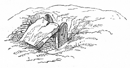
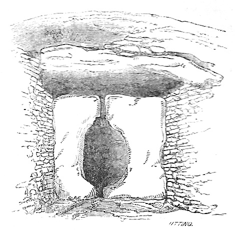
Google Books'Our British Ancestors: Who and what were they?' by the Rev. Samuel Lysons. MA, FSA, and Rector of Rodmarton he may have been, but he did write a considerable amount of guff which you will have to wade through. I suppose it's not his fault, but for some reason he thinks the Ancient Britons spoke Hebrew (or something similar), so all his theories are peppered with it. Anyway, overlooking this, he owned the land on which the long barrow stands. He had been 'discouraged' by his father and uncle in his youth, but in May 1863 (when no doubt they were dead and couldn't complain) he thought he'd have it dug up a bit. What is so interesting are the illustrations - it seems that the two stones at the East end are very big (8ft 6" - can this be true?) and they had a low wall between them, and another large stone resting on them at an angle. There are also diagrams of the N and S chambers, with their huge covering stones. On page 160 ther's a great drawing of the 'porthole' style chamber entrance. He disturbs the 13 peaceful occupants and their 'finely wrought' flints yet has the nerve to talk about earlier barrow diggers as ransackers and riflers; having been there today it makes me feel a bit sad. |
Posted by Rhiannon 31st March 2008ce |
George Eastman House ArchivePhotos taken by Alvin Langdon Coburn, apparently during excavations: http://www.geh.org/ar/strip27/htmlsrc/m197926660003_ful.html#topofimage http://www.geh.org/ar/strip27/htmlsrc/m197926660004_ful.html#topofimage |
Posted by Rhiannon 20th January 2007ce |