|
|

|
|
Harkerside Moor CircleStone Circle
|
|
|
|
Images (click to view fullsize) |
|
|
Fieldnotes |
|
|
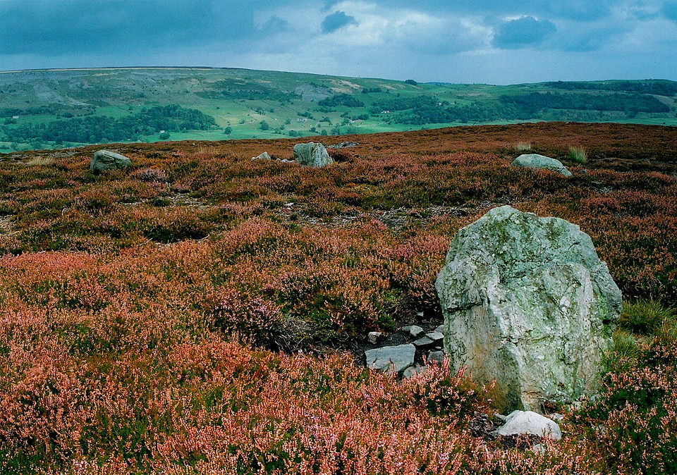
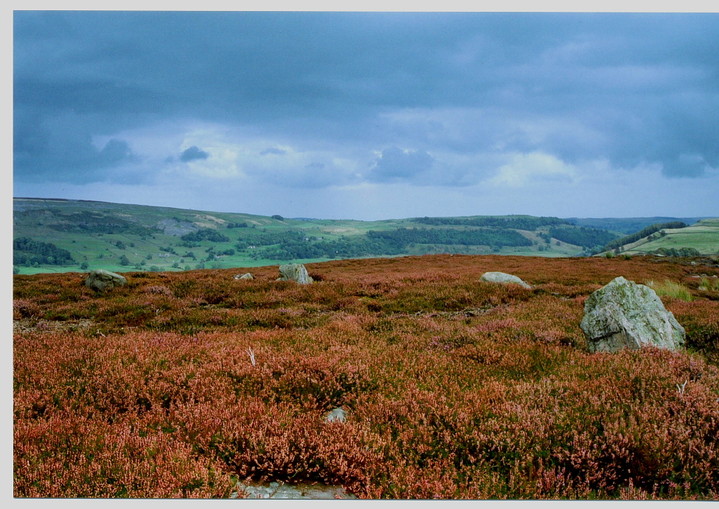
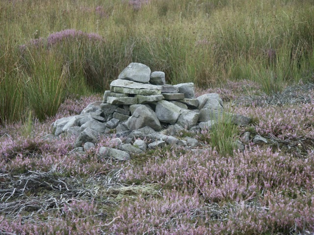
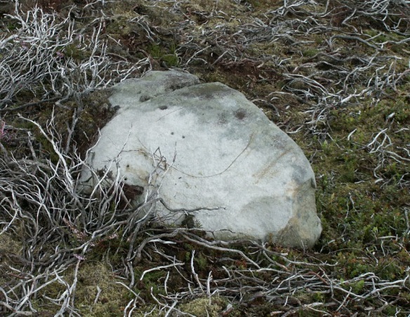
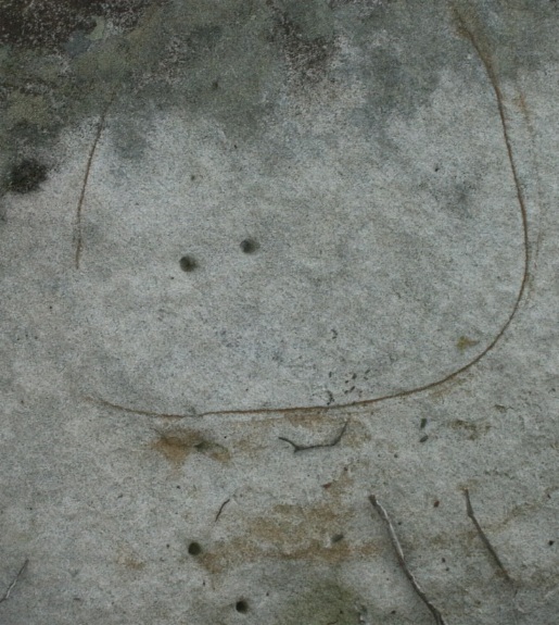
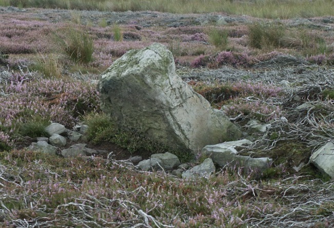
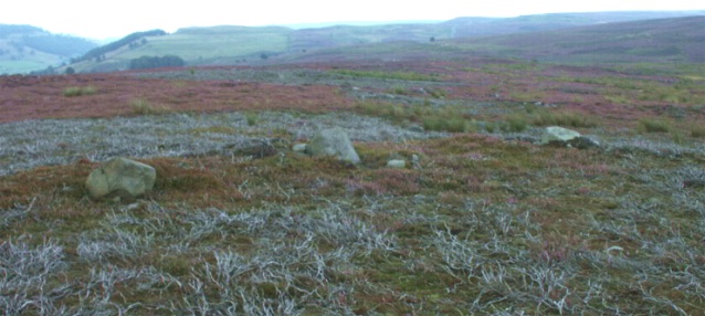
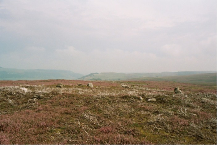
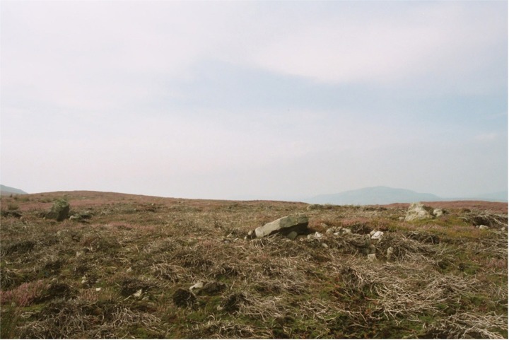
I went to see what I could see today and saw a stone circle. I can see why there is confusion, since I also found several hut circles, and squares and other shapes all located broadly in the same area identified as a hut circle on the OS - a clear understatement of what is going on here! This stone circle sits in a place of prominance in the middle of an apparent pre-historic settlement, that includes a number of huts, field enclosures and other signs of human activity. Including a cairn not too far away. The circle is small - 10m across and appears to be a nine stone - circle with several stones missing. The embankment that it sits on is approx. 11m in diameter. Most of the stones appear to have slipped from their original position and a few seem to be missing altogether. The stones themselves are small - the largest is less than a metre high. This is not surprising as the strata of the local rocks means they are subject to easy fracture and these stones appear to have done well to stay so large. Interestingly, two different types of stones were used to create this circle. The majority of stones were limestone but at least two were sandstone. One of the sand stones appeared to have human-made drill holes which were very shallow - perhaps 5mm deep. |
Posted by BrigantesNation 17th August 2003ce |
|
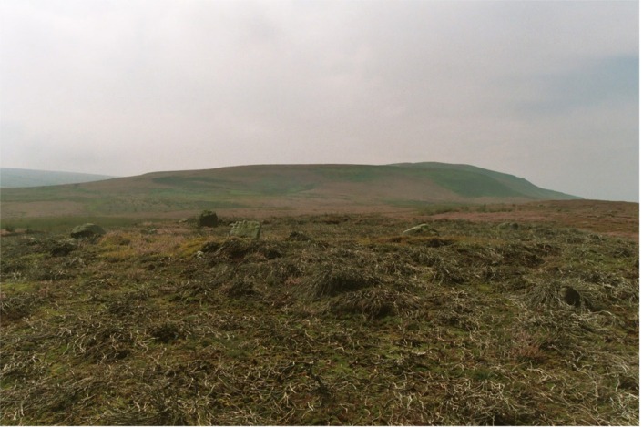
10 August 2003 I went up to this one following Fitzcoraldo's comments... and am in WHOLEHEARTED agreement. Just my opinion, but if this really is what the OS has marked as a hut circle, all I can say is "is it HELL a hut circle "! We all know the OS are flawed on this sort of thing – stone circles marked as cairns (Druid's Altar to name but one), cairns marked as stone circles, you name it…. I was accompanied by my mate John, a man not easily impressed with 'alleged sites', having like most of us here, seen plenty of stones. He thought it was a stone circle too. That's 2 more necks out with yours Fitz! The circle stands on a slight platform and is much wider than any hut circle I've ever seen or heard of. It shows no signs of ever having been even vaguely contiguous, which for me pretty much says it isn't a cairn circle either. Some of the stones aren't firmly seated and may possibly not be in their proper positions, but some have what looked like very clear packing rubble and stones around them. Looks pretty damn authentic to me. As well as the impressive 'earthwork' nearby, there are also what we thought looked like a few ruined cairns on the way to the circle. To find the circle, we approached from Leyburn, heading for Grinton. Descending towards Grinton, we took a left turn signposted (I believe) to Redmire, a short distance after passing Grinton Lodge on the right. This road goes gently uphill and pretty soon there is a sharpish bend left at approximately SE044974, by a barrier gate onto the moor. We parked here. A track heads WSW onto the moor. We found that the simplest thing to do was to follow this until it crosses a small stream called Grovebeck Gill just after passing a fence leading off to the right. Cross the stream and leave the path to the right and follow the fence, leading just about north. You will soon come to a very clear and quite spectacular earthwork ditch and bank. Follow the earthwork left (WNW) and where it peters out, continue straight on, along a projected line from the earthwork. On the nearest crest almost exactly in front of you should immediately or soon see the outline of some small rocks. That is the circle. Oh, and by the way, try not to jump out of your skin when the grouse shoot out of the undergrowth! I reckon I lost a good few minutes off my life…. This post appears as part of the weblog entry A dash round the dales
|
14th August 2003ce Edited 14th August 2003ce |
|
The OS calls this a Hut Circle, I'm going to stick my neck out and call it a stone circle possibly a cairn circle (oh no I'm introducing seeds of doubt!). No! stone circle it is. Its a neat little circle 18m X 18m with six irregulary place stones, the largest being 1.5m tall. The largest stone has some lovely fossils on its surface. The stones are the local stone. It has an embankment and no obvious entrance. It resembles many of the other dales circles. It is neat, small and intimate. |
 Posted by fitzcoraldo
8th June 2002ce |
Miscellaneous |
|
| "Most of the stone circles in the area are small and have no obvious astronomical significance. It is likely that many originally had a burial function. One such is the embanked stone circle on Harkerside Moor" The Yorkshire Dales, Robert White. |
Posted by BrigantesNation 6th August 2003ce |